- Ōtsuki, Kōchi
-
- This entry refers to the town in Kōchi prefecture. For the city in Yamanashi prefecture, see Ōtsuki, Yamanashi
Ōtsuki
大月町— Town — A view of Otsuki's windmills from the top of Fureai Park Location of Ōtsuki in Kōchi
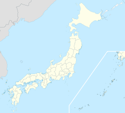
 Ōtsuki
Coordinates: 32°49′N 132°43′E / 32.817°N 132.717°ECoordinates: 32°49′N 132°43′E / 32.817°N 132.717°E Country Japan Region Shikoku Prefecture Kōchi District Hata Government – Mayor Kunio Shibaoka Area – Total 103.06 km2 (39.8 sq mi) Population (April 30, 2009) – Total 6,379 – Density 61.9/km2 (160.3/sq mi) Time zone Japan Standard Time (UTC+9) City symbols - Tree Ubamegashi (Quercus phillyraeoides) - Flower Crinum (Crinum asiaticum) - Bird Omizunagidori (Calonectris leucomelas) Phone number 0880-73-1111 Address 2298-8 Hiromi, Ōtsuki-chō, Hata-gun, Kōchi-ken
788-0302Website http://www.town.otsuki.kochi.jp/ Ōtsuki (大月町 Ōtsuki-chō) is a town in the Hata District, Kōchi Prefecture, Japan. It is located approximately 184 km away from downtown Kōchi in the southwestern corner of the prefecture. [1]
Having a mild climate, Ōtsuki has developed through the promotion of its agriculture, forestry and fishing industries. The town has invested in 12 wind-powered generators. Approximately 70% of the town's area comprises heavily wooded mountain forests. Its neighbors are Tosashimizu to the east and Sukumo to the north.[2]
Contents
Demography
 A graph of Ōtsuki's gender distribution by age (Basic Resident Registration results from October 1, 2006). [3]
Although the town had a population of 13,688 people back in 1960, Ōtsuki has seen a steady decline with each year. [3] A growing problem for Japan, there has been an increasing trend for younger workers and their families to leave rural areas and find work in the cities, as well as a tendency for couples to produce fewer children. As can be seen in the graph provided, the majority of residents in Ōtsuki are between 45 to 84 years of age.
As of July 2011 Otsuki contained 2,881 households, with a ratio of 2,889 males to 3,227 females, with an overall estimated population of 6,116. On average 59.34 reside in each square kilometer.[4] .
History
The region came to be known as Ōtsuki on February 11, 1957 after the union of Ōuchi (大内町 Ōuchi-chō) and Tsukinada (月灘村 Tsukinada-son).
Transportaion
- Railway Lines
- The nearest station is Sukumo Station in Sukumo
- Roads
- Route 321 is the main road that that connects Ōtsuki to Tosashimizu to the east and Sukumo to the north.
- Ōtsuki Fureai Park
Sights of Interest
- Kashiwajima Island
- Tourists come to this island to scuba dive. Around 1,000 different kinds of fish, both temperate and tropical, can be found in the waters around Kashiwajima. The island is even said to have one of the world's largest concentrations of reef-building corals. To date, 123 different types of coral have been confirmed within Ōtsuki. [5]
- Kannon Rock
- A rock that stands 30 meters high above the deep blue ocean and resembles the image of the goddess Kannon. In 1638, during the revolt of Shimabara, it is said that a man named Amenomori Kudayu was sent to quell the uprest but was injured in battle and retreated with his men by ship. His condition deteriorated, and while there were no lighthouses at the time, it is said that the crew headed towards a light that was coming from Kashiwajima. When the ship approached Kannon Rock, Kudayu died from his wounds, and at that moment a beam of light radiated from Kannon Rock. Since then, the rock has been thought to be sacred. [6]
- Oman's Waterfall
- Along the same hiking trail that passes by Kannon Rock is a cliff called Oman Taki. Despite being called a waterfall, there is no running water; locals use the word "taki" (滝, literally "waterfall") to mean "cliff". There once was a beautiful blind woman named Oman who fell in love with a man whose job it was to protect the island (most likely a samurai of higher social class). Oman thought of this man's job as an important role and somewhat became obsessed with him, but when she realized this love could never be, she decided to throw herself from the edge of this cliff and plummeted to her death approximately 120 m to the ocean below. The exact date is unknown, but eventually the cliff came to be known as Oman's Waterfall in memory of this tragic story.[7][8]
- Tsukiyama Shrine
- Tsukiyama Shrine, which has a thousand years of history, is located on Mt. Moritsuki. It is believed to have been a shrine where Kūkai performed ascetic practices. As a former center of Shugendō training, and as one of the 88 temples of the Shikoku Pilgrimage, it is visited by a great number of people from all over the country. The coastal area near a temple called "Ōtsukinada" used to be famous for pink corals, and it is believed to be the first place where corals were gathered for living. In recent years parties of pilgrims have been using well-paved roads. However, the local people founded a group called the Association for the Preservation of the Pilgrimage Route to restore such routes to their original state for the first time in 40 years. The routes run through mountains and seacoasts.[9]
References
- ^ 大月町史編纂委員会 (March 28, 1995), p.3
- ^ Town of Ōtsuki (June 22, 2009)
- ^ a b Ōtsuki — Clear Serenity: The 50th Anniversary of Ōtsuki, Ōtsuki Town Handbook 2007, February 2007, p. 30
- ^ 男女別行政区別人口統計表. July 29, 2011.
- ^ "Otsuki — Clear Serenity: The 50th Anniversary of Ōtsuki" Ōtsuki Town Handbook 2007, February 2007, p. 2
- ^ Town of Ōtsuki — Kannon Rock (June 17, 2009).
- ^ 高知県大月町 柏島・大堂海岸の紹介 (July 1, 2009).
- ^ "~ようこそ!黒潮踊る大月町~" 大月町役場産業振興課 - 観光情報の請求があって送信した原稿、(直)0880-73-1115.
- ^ "Otsuki — Clear Serenity: The 50th Anniversary of Ōtsuki" Ōtsuki Town Handbook 2007, February 2007, p. 15
External links

This Kōchi Prefecture location article is a stub. You can help Wikipedia by expanding it.


