- Cranbrook, British Columbia
-
Cranbrook — City — City of Cranbrook, British Columbia Downtown Cranbrook

FlagMotto: Mountains of Opportunity Location of Cranbrook in British Columbia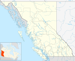
 Cranbrook
Coordinates: 49°30′49″N 115°46′7″W / 49.51361°N 115.76861°WCoordinates: 49°30′49″N 115°46′7″W / 49.51361°N 115.76861°W Country  Canada
Province  British Columbia
Regional District East Kootenay Established 1898 Incorporation 1905 Government - Mayor Scott Manjak - Governing body Cranbrook City Council - MP David Wilks (politician) - MLA Bill Bennett Area - City 25.14 km2 (9.7 sq mi) Elevation 921 m (3,021 ft) Population (2006) - City 18,267 - Density 726.5/km2 (1,881.6/sq mi) - Metro 24,138 - Demonym Cranbrookian Time zone Mountain Standard (MST) (UTC-7) - Summer (DST) Mountain Daylight (MDT) (UTC-6) Postal code span V1C Area code(s) 250, 778 Telephone Exchanges 250-417, 250-420, 250-421, 250-426, 250-464, 250-489, 250-581, 250-919, 778-261, 778-517, 778-520, 778-963 NTS Map 082G05 GNBC Code JAIQY Website City of Cranbrook Cranbrook, British Columbia is a city in southeast British Columbia, located on the west side of the Kootenay River at its confluence with the St. Mary's River,[1] It is the largest urban centre in the region known as the East Kootenay. As of 2006, Cranbrook's population is 18,267, and the metropolitan population is 24,138. It is the location of the headquarters of the Regional District of East Kootenay and also the location of regional headquarters of various provincial ministries and agencies, notably the Rocky Mountain Forest District.
Cranbrook is home to the Canadian Museum of Rail Travel which presents static exhibits of passenger rail cars built in the 1920s for the CPR and in the 1900s for the Spokane International Railway. It is also the home of the Kootenay Ice, a WHL hockey team. Cranbrook is also home to many NHL players to where it has won 11 Stanley Cup Championships within 13 years. (1994-95 to 2006-07).
Contents
History
Originally inhabited by Ktunaxa peoples, the land that Cranbrook now occupies was bought by European settlers, notably Colonel James Baker who named his newly acquired land Cranbrook after his home in Cranbrook, Kent, England.
In 1898 Baker had successfully convinced Canadian Pacific Railway to establish their Crowsnest Pass line through Cranbrook rather than nearby Gold Rush Boom Town Fort Steele. With that accomplishment Cranbrook became the major centre of the region, while Fort Steele declined; however, the latter is today a preserved heritage town.
On November 1, 1905, Cranbrook was incorporated as a city.
Public schools and colleges
Schools
- Amy Woodland Elementary
- Gordon Terrace Elementary
- Highlands Elementary School
- Kootenay Orchards Elementary School
- Laurie Middle School
- Mount Baker Secondary School
- Parkland Middle School
- Pinewood Elementary School
- Steeples Elementary School
- T M Roberts Elementary School
- Kootenay Christian Academy
Colleges
Geography
While much of the city is relatively flat, Cranbrook is surrounded by many rising hills where many residential homes are located [2]. In addition Cranbrook faces the Purcell Mountains to the west and the Rocky Mountains to the north and east.
Climate
Environment Canada reports Cranbrook as having the most sunshine hours of any BC city at approximately 2228.6 hours annually. Because of that it is a fairly dry city throughout the year, and when precipitation does fall a good percentage of it will be in the form of snow. Environment Canada also states that the city experiences some of the lightest wind speeds year-round, has few foggy days, and has among the highest average barometric pressure of any Canadian city.[2] Frost-free days average 110 days, typically occurring between May 26 to September 14. Mean daily temperatures range from −8.3 °C (17.1 °F) to 18.2 °C (64.8 °F). However, temperatures can range from −30 °C (−22.0 °F) in the winter to 35 °C (95.0 °F) in the summer months.
Climate data for Cranbrook Month Jan Feb Mar Apr May Jun Jul Aug Sep Oct Nov Dec Year Record high °C (°F) 10
(50)14
(57)19
(66)28
(82)33
(91)35
(95)36
(97)35.5
(95.9)34
(93)28.5
(83.3)17.5
(63.5)11.5
(52.7)36
(97)Average high °C (°F) −2
(28)1.8
(35.2)8
(46)13.5
(56.3)18.3
(64.9)21.9
(71.4)25.9
(78.6)25.7
(78.3)20
(68)12.1
(53.8)2.5
(36.5)−3.1
(26.4)12.1 Average low °C (°F) −9.7
(14.5)−7.6
(18.3)−3.2
(26.2)0.5
(32.9)4.6
(40.3)8.1
(46.6)10.3
(50.5)9.5
(49.1)4.8
(40.6)0.3
(32.5)−4.8
(23.4)−9.9
(14.2)0.2 Record low °C (°F) −33
(−27)−31.5
(−24.7)−24
(−11)−10
(14)−3.5
(25.7)−0.5
(31.1)2.5
(36.5)−1
(30)−6
(21)−15
(5)−30
(−22)−35
(−31)−35
(−31)Precipitation mm (inches) 33.3
(1.311)24.2
(0.953)19.9
(0.783)26.5
(1.043)44.2
(1.74)52.5
(2.067)35.6
(1.402)28.5
(1.122)28.9
(1.138)21.8
(0.858)39.7
(1.563)46
(1.81)429.7
(16.917)Sunshine hours 69.1 106.1 164.5 216.2 254.2 273.9 318.3 292.1 217 162 74.6 57.3 2,205.3 Source no. 1: Environment Canada[3] Source no. 2: Environment Canada[4] Education
Cranbrook is home to the main campus of the College of the Rockies, which has over 2500 full and part-time students from over 21 countries.[5]
Public schools are run by School District 5 Southeast Kootenay, consisting of seven elementary schools and two middle schools that feed into the city's only high school: Mount Baker Secondary School, home to approximately 1500 students. Prior to 2004 the middle schools were referred to as junior high schools housing grades 8-10 rather than the current 7-9. However, due to declining enrollment the school district adopted the new system.
There is also a local home-school network.
Transportation
Cranbrook is home to a major Canadian Pacific Railway yard, which serves as a key gateway for trains arriving from and departing to the United States.
Cranbrook is at the junction of major highways 3 and 93/95, and due to its close proximity to the borders of Alberta and the United States it is an important transportation hub.
The McFee Bridge also known as the St. Mary's Bridge rises high above the St. Marys River and is near the Canadian Rockies International Airport and the Shadow Mountain Golf Community and supports thousands of people to travel to Kimberley from Cranbrook and Kimberley to Cranbrook, the bridge is on highway 93/95.
Approximately 9 km north is the Canadian Rockies International Airport, which has recently completed its 12.5 million dollar expansion including the lengthening of its runway from 6000 to 8000 feet in order to accommodate a limited number of international flights and an expansion to the Terminal for more passengers. The airport is served by Air Canada Jazz to Vancouver and Calgary, Pacific Coastal Airlines to Vancouver, and Integra Air to Edmonton.
Cranbrook also has a public transit system, operating buses on seven different routes.
On February 11, 1978, Pacific Western Airlines Flight 314, a Boeing 737-200, crashed in Cranbrook, killing 44 of the 50 people on board.
Notable residents
The following notable people come from or were born in Cranbrook:
- Ray Allison, retired NHL player
- Greg Andrusak, retired NHL player
- Brent Carver, Professional stage actor
- Glen Cochrane, retired NHL player
- Jim Hiller, retired NHL player
- Juggernaut, professional wrestler
- Jon Klemm, NHL player
- Brad Lukowich, NHL player
- Donald C. MacDonald, politician
- Jason Marshall, NHL player
- Bob McAneeley, retired WHA player
- Ted McAneeley, retired NHL and WHA player
- Bob Murdoch and Don Murdoch, retired NHL players
- Rob Niedermayer and Scott Niedermayer, NHL players
- Kate Pullinger, author
- Tom Renney, NHL coach
- Ben Rutledge, Olympic Gold Medal Rower, Mens 8 Canadian National Team, Beijing Summer Olympics 2008
- Joel Savage, retired NHL player
- Corey Spring, retired NHL player
- Steve Yzerman, retired NHL player, current General Manager of the Tampa Bay Lightning
- Lillix, pop rock band
Local media
Newspapers
- Cranbrook Daily Townsman - Daily paper
- Kootenay Advertiser - Weekly paper , Monday and Friday
Radio stations
- 101.3 FM - CBRR-FM, CBC Radio One (repeats CBTK-FM, Kelowna)
- 102.9 FM - CHDR-FM, Rock
- 104.7 FM - CHBZ-FM, Country
- 106.5 FM - VF2497, Christian (repeats VOAR, Mount Pearl, Newfoundland and Labrador)
Off-Air Television repeaters
- Channel 5: CFCN-TV-9, CTV (repeats CFCN-TV Calgary)
- Channel 10: CBUBT-TV-7, CBC (repeats CBUT Vancouver)
Local television
Sister cities
Cranbrook is twinned with
 USA - Coeur d'Alene, Idaho (United States)
References
- ^ BCGNIS entry "Cranbrook (city)"
- ^ [1]
- ^ Environment Canada—Canadian Climate Normals 1971–2000, accessed 10 July 2009
- ^ Environment Canada—Canadian Climate Normals 1971–2000. Retrieved 1 January 2011.
- ^ College of the Rockies website
External links
- City of Cranbrook
- Cranbrook Community Nutshell
- Cranbrook, British Columbia, Canada 2006 Census Community Profile
Subdivisions of British ColumbiaSubdivisions Regions · Regional districts · Forest Regions and Forest Districts · School districts · Land DistrictsSettlements Urban centres Cities Abbotsford · Armstrong · Burnaby · Campbell River · Castlegar · Chilliwack · Colwood · Coquitlam · Courtenay · Cranbrook · Dawson Creek · Duncan · Enderby · Fernie · Fort St. John · Grand Forks · Greenwood · Kamloops · Kelowna · Kimberley · Kitimat · Langford · Langley · Merritt · Nanaimo · Nelson · New Westminster · North Vancouver · Parksville · Penticton · Pitt Meadows · Port Alberni · Port Coquitlam · Port Moody · Powell River · Prince George · Prince Rupert · Quesnel · Revelstoke · Richmond · Rossland · Salmon Arm · Surrey · Terrace · Trail · Vancouver · Vernon · Victoria · White Rock · Williams LakeCategories:


Wikimedia Foundation. 2010.