- Melmerby, Cumbria
-
Coordinates: 54°43′52″N 2°35′58″W / 54.73100°N 2.59937°W
Melmerby 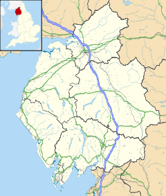
 Melmerby
Melmerby shown within CumbriaOS grid reference NY615375 Parish Ousby District Eden Shire county Cumbria Region North West Country England Sovereign state United Kingdom Post town PENRITH Postcode district CA10 Police Cumbria Fire Cumbria Ambulance North West EU Parliament North West England UK Parliament Penrith and The Border List of places: UK • England • Cumbria Melmerby is a village in Cumbria, England. It is a small village with a population of around 200.[citation needed] It is relatively quiet because the area is not as popular with tourists as other parts of Cumbria. The River Eden is bridged about 4 miles (6.4 km) away at Langwathby, and Long Meg and Her Daughters, the 3,500 year old stone circle—the second largest in the country—is nearby at Little Salkeld.
For the purposes of local government Melmerby is within the civil parish of Ousby, informally known as Ousby and Melmerby, in the District of Eden.
Contents
History
Melmerby is supposed to have taken its name from the residence of Melmor, a Dane who lived nearby in the 9th century. The most significant historic buildings surviving in the village today are the 13th century church of St John the Baptist and the Grade II Listed Melmerby Hall, begun as a defensive structure in the early 14th century. A Petition received by Edward II between 1320 and 1326 reads:
- "John le Denum petitions the King that whereas he has a castle in Cumberland called Melmerby Tower, which could be kept by a dozen men at arms, he has kept it until now and has often been assailed by the Scots to their great loss, and John's lands are so devastated there and elsewhere that he can no longer bear the expense. He craves help in the form of wages or otherwise until times change, because all the country around would suffer great loss peril and loss if it were taken through lack of garrison."[1]
The Hall, built from the local red sandstone, was extended in the 17th century and again in the 18th century in a Georgian style. The 20-acre (81,000 m2) grounds include an archery lawn, walled vegetable gardens, a Victorian castle folly and wooded areas. Features inside include a priest hole and a large inglenook fireplace.
Modern Melmerby
Melmerby has one Egon Ronay Guide-listed eatery: the popular Village Bakery[2], famous for breads and cakes made with organic, stoneground flour. Village residents formed a consumer co-operative and opened a village shop in 2005, that featured on the BBC's Working Lunch.[3]. The shop closed in 2008.
In June, during the Appleby Horse Fair, Irish Travellers camp on the village green. The staff in the village pub said that between 150 and 200 caravans camped on the village green for two weeks during the 2005 fair, and caused very little trouble.
The area is popular with ramblers. Melmerby Fell is very close and Cross Fell, the highest part of the Pennines, is only three or four miles (6 km) away.
The A686 road passes through the village, and was described in AA Magazine by travel journalist Phil Llewellin:
- "England's great wilderness sprawls across the northern Pennines, where the mountains have fascinating names such as Fiend's Fell and Wildboar Fell. Penrith merits a visit after leaving the M6, and memories of the motorway fade as the A686 crosses the River Eden valley. The mood changes dramatically in Melmerby, where the road starts its long climb to the cafe at the top of Hartside pass, 1,904 feet (580 m) above sea level, with stunning views of the Solway Firth and Scotland.
- The road leads to Alston, which claims to be England's highest market town, a charming little place with cobbled streets and quaint buildings. The A686 beyond Alston crosses another breathtaking expanse of windswept upland before running down to the River Allen's beautiful wooded gorge."
The Hartside Fell is a prominent feature of the area.
External links
Notes
- ^ Northern petitions illustrative of life in Berwick, Cumbria and Durham in the fourteenth century. Ed. C. M. Fraser (Surtees Society vol. 194, 1981)
- ^ The Village Bakery, Organic Bread, Cakes and Bars
- ^ "Melmerby & Fellside Village Shop Ltd". Village Retail Services Association. http://www.virsa.org/index.cfm/villageshop/Directory.Details/shop_id/177. Retrieved 2008-05-14.
Categories:- Villages in Cumbria

Wikimedia Foundation. 2010.