- Kansas Turnpike
Infobox_road
marker_
highway_name=Kansas Turnpike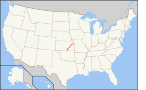
maint=Kansas Turnpike Authority
maint_abbrev=KTA
length_mi=236
length_ref=cite web |url= http://www.ksturnpike.com/history.shtml |title= History of the Kansas Turnpike | accessdaymonth=28 February |accessyear=2008|publisher= Kansas Turnpike Authority]
length_round=
direction_a=South
starting_terminus=
junction=
direction_b=East
ending_terminus=
established=October 1956
commons=galleryThe Kansas Turnpike is a 236-mile (380-km)
freeway -standardtoll road that lies entirely within theU.S. state ofKansas . It runs in a general southwest-northeast direction from theOklahoma border, and passes through several major Kansas cities, including Wichita, Topeka, Lawrence and Kansas City. The turnpike is owned and maintained by theKansas Turnpike Authority (KTA), headquartered in Wichita.The Kansas Turnpike was built from 1954 to 1956, predating the
Interstate Highway System . While not part of the system's early plans, the turnpike was eventually incorporated into the Interstate system in late 1956, and is designated today as four different interstate highway routes: I-35, I-335, I-470, and I-70. The turnpike also carries a piece of U.S. Route 40 in Kansas City.Because it predates the Interstate Highway System, the road is not engineered to current Interstate highway standards, and notably lacks a regulation-width median. To attain the reduced risks of head-on collisions which were designed into Interstate-standard roadways, the Kansas Turnpike now has continuous, permanent
Jersey barrier s in the median over its entire length. On opening, there was no fixed speed limit on the highway; drivers were merely asked to keep to a "reasonable and proper" limit.Around 120,000 drivers use the turnpike daily. The road features numerous services, including a travel radio station and six service areas. One of these service areas is notable for the presence of a memorial to
University of Notre Dame football coachKnute Rockne , who died near the current highway's route.The turnpike is self-sustaining, deriving its entire revenue from the tolls collected and requiring no tax money for maintenance or administration.
History
Early history
Early federal plans for a nationwide system of "Interregional Highways" did not include a route along or near the present Turnpike, instead connecting Oklahoma City and Kansas City via southeastern Kansas and
U.S. Route 69 . [, ca. 1943]However, the Interstate Highway System was not funded until the passage of the
Federal-Aid Highway Act of 1956 . Prior to this, the state of Kansas wished to build a freeway system but was having issues with funding. Thus, they turned totoll road s, which were gaining in popularity as ways of raising funds for new freeways.cite book
last = Lamb
first = Sherry
coauthors = Dr. Theodore A. Wilson
title = Milestones: A History of the Kansas Highway Commission and the Department of Transportation
publisher =Kansas Department of Transportation
year = 1986
pages = pp. 4-19 to 4-20
month = December ] The Kansas Turnpike Act, defining a turnpike from Oklahoma to Kansas City, became effectiveApril 7 ,1953 .Given
Oklahoma 's plans to build a turnpike north from Oklahoma City to the Kansas state line, a preliminary route was chosen via Wichita and Topeka. After considering a number of different alignments, including one bypassing Topeka via the present route of I-35, the state decided on an "airline" route between Wichita and Topeka. From Wichita south, the turnpike was to parallel U.S. Route 81, continuing into Oklahoma; the interchange with U.S. Route 166 at South Haven was included to provide an outlet if Oklahoma lagged in its construction. At the Kansas City end, the turnpike was to parallel U.S. Route 40 from Topeka. The Kansas City end was set at 18th Street and Muncie Boulevard, which was to be extended and upgraded to a freeway (the Muncie Expressway) to the Intercity Viaduct by the state. From Park Drive (exit 419) east to 18th Street (exit 420), the turnpike was built on top of Muncie Boulevard.Ground was broken on
December 31 ,1954 at theKansas River bridge near Lawrence. After almost 22 months of construction, funded by private investors, the road was opened for a day of free travel onOctober 20 ,1956 between 6 a.m. and 2pm.cite news
title = KTA Officials Say Traffic Heavy on Pike This Morning
publisher = Lawrence Daily Journal-World
date =1956-10-20 ] An estimated 12,000 to 15,000 cars traveled on the turnpike. Many of those motorists traveled to Lawrence for a football game between the Universities of Kansas and Oklahoma.cite news
title = Over 12,000 Cars on Turnpike For Special Opening Saturday
publisher = Lawrence Daily Journal-World
date =1956-10-22 ] Official opening ceremonies were held at interchanges in each of the three major cities on October 25. The Kansas City celebration includedGene Autry jumping his horse through a large paper map of the Turnpike.John Masefield , the BritishPoet Laureate , wrote a tribute to commemorate the occasion. On the first day after the official opening, 7,197 vehicles traveled the turnpike, with 81 toll collectors and 50 maintenance workers on duty.cite web |url= http://ksturnpike.com/history/Chapter%202%20A%20Vision%20Builds.pdf|title=Chapter 2 - A Vision Builds |accessdate=2007-03-12 |format=PDF|work= Driven by Vision: The Story of the Kansas Turnpike|publisher=Kansas Turnpike Authority] The turnpike originally had 14 interchanges; as of 2006, there are 27 interchanges.The southern terminus
Oklahoma's plans for a connecting turnpike fell through, as they had not performed a traffic study and their
credit rating was not good enough to obtain loans. Therefore, the Kansas Turnpike ended at the state line, at anat-grade intersection with E0010 Road. [TheNational Bridge Inventory lists the bridge at the state line (CO RD 3604C) as 1958, which matches the other two bridges in Oklahoma north ofU.S. Route 177 , while the nearby bridges in Kansas are all from 1956. The bridges at and immediately south of US 177 are from 1959. From the database compiled by theUnited States Department of Transportation Federal Highway Administration , available at www.nationalbridges.com. Accessed2007-03-30 .] [ [http://cjonline.com/photo_pages/012206/35265.shtml Cover photo] , "Life",1956-06-04 . Available from The Topeka Capital Journal online, Retrieved on2007-03-30 ] Just across the state line was an oat field, into which many inattentive motorists crashed. This abrupt end became nationally famous afterWyoming governorMilward L. Simpson and his wife crashed in mid-1957. The oat farmer plowed the field to provide a safer landing, and the KTA was persuaded to install a huge wooden barrier at the end of the highway. However, within a day, three more drivers had crashed and destroyed the barrier, so the KTA closed the Turnpike south of the South Haven interchange.Although Oklahoma's plans to construct a toll road from the southern end of the Kansas Turnpike at the state line to Oklahoma City did not materialize, the surveyed route was turned over to the Oklahoma Department of Highways (since renamed the
Oklahoma Department of Transportation ) to be developed as a free expressway following the passage of the Interstate Highway Act in 1956 and later designated as Interstate 35, along with the southernmost convert|127|mi|km of the turnpike.Extensions studied
While the initial Turnpike was still being built, the KTA authorized four feasibility studies in October 1954. Three of them — a spur to Leavenworth and St. Joseph,
Missouri , a spur from Wichita to Hutchinson, Great Bend and Hays, and a new Intercity Viaduct to Kansas City,Missouri — did not go anywhere. But the fourth proposal, atoll bridge on 18th Street in Kansas City, was pushed through, and the KTA agreed to build the turnpike in early 1956. The18th Street Expressway , running south from the Turnpike's east end over theKansas River , opened in 1959, improving access to northeast Johnson County.As part of the Interstate system
In June 1956, the
Federal-Aid Highway Act of 1956 was signed into law, granting funding to the nationwideInterstate Highway System . Without its Oklahoma link, the Kansas Turnpike was in danger of being bypassed by the Interstate System entirely. However, at the end of 1956, theBureau of Public Roads and the state of Kansas agreed to route I-35 along the Turnpike south of Emporia and I-70 along the piece east of Topeka. The state insisted on a separate Emporia-Kansas City alignment, and the mileage that would have been used to build I-35 from Wichita to Emporia via Newton was instead used for Interstate 35W (now Interstate 135) from Wichita via Newton to Salina.The Interstate Highway Act also facilitated the connection in Oklahoma. The state's first piece of
Interstate 35 , from the state line to U.S. Highway 177 at Braman, openedApril 22 ,1958 . [The PDFlink| [http://www.odot.org/hqdiv/p-r-div/maps/state-maps/pdfs/1958.pdf 1958 Oklahoma State Highway Map] |2.26 MiB , the first to show the Turnpike, shows the freeway ending at US 177. The PDFlink| [http://www.odot.org/hqdiv/p-r-div/maps/state-maps/pdfs/1959.pdf 1959 map] |2.22 MiB is the first to place anI-35 shield on the road. Retrieved on2007-03-30 ]Tolls
As of
July 1 ,2007 , the passenger or passengers of two-axle vehicles (such as cars and motorcycles) pay a total of $9.25 USD to travel the entire length of the Turnpike. Tolls are calculated based on the length of the route traveled, and the toll is as little as 25¢ for motorists driving only a short distance (3 mi or 5 km, for example) on the Turnpike. [cite web | url=http://www.ksturnpike.com/tolls/class%202.pdf | title= Class 2 Vehicle Toll Schedule | accessdate=2008-02-28 |publisher= Kansas Turnpike Authority] Drivers in vehicles with more than two axles, such as truckers, pay higher tolls.The Turnpike runs on a ticket-based collection system. When entering the turnpike, either at one of the termini or at an interchange, a driver is issued a ticket which indicates the toll plaza at which they entered. When leaving the turnpike, this ticket is collected and used to determine the amount of the toll.cite web | last= Stuve |first= Eric | url= http://www.okroads.com/guides/ks/i35.html |title= Kansas Highway Guides - Interstate 35 | publisher = okroads.com | accessdate=2006-01-25 ]
As an alternative to using tickets, motorists can purchase a transponder, known as a "K-Tag". K-Tag customers can proceed slowly through the toll plaza without stopping and collecting a ticket or paying toll. The toll is instead paid through one of two payment plans. "K-Tag I", intended for frequent turnpike users, requires the customer to maintain a prepaid account, which funds are drawn from as needed. The plan intended for intermittent users, "K-Tag II", keeps track of the tolls accrued by the customer, and a bill is automatically sent out when $10.00 of tolls is accumulated. K-Tag I accounts are subject to a $1 monthly fee per tag, while K-Tag II account holder pay a $5 annual fee per tag. K-Tag I users also receive a 10 percent discount on tolls. [cite web |publisher= Kansas Turnpike Authority |url=http://ksturnpike.com/ktag.shtml|title= K-Tag|accessdate=2008-02-28] K-Tag was introduced in 1995. [cite news| publisher= Kansas City Business Journal | url= http://www.bizjournals.com/kansascity/stories/2002/02/04/focus2.html | title= Toll tags speed traffic through booths and maybe drive-through lanes, too | accessdate=2008-03-15]
The Kansas Turnpike is completely self-sustaining. All costs are paid for by the tolls collected; no tax money is used for construction, maintenance, or administration. KTA estimates that 120,000 drivers use the turnpike each day. ["Kansas Turnpike Authority" (KTA pamphlet).]
Route description
The Kansas Turnpike is convert|236|mi long. The first convert|127|mi of the highway, between its southern terminus four miles (6 km) north of the
Oklahoma border and Emporia,Kansas , are designated as Interstate 35. The turnpike runs due north and south between its southern terminus and Wichita. After passing Wichita, the highway turns northeast toward El Dorado and Emporia. After passing through El Dorado, it crossesEl Dorado Lake . This marks the turnpike's entry into theFlint Hills , a band of hills in eastern Kansas. The turnpike does not leave this region completely until it reaches Topeka.From Emporia to Topeka, the turnpike is signed as
Interstate 335 . This highway exists entirely as a part of the Kansas Turnpike. In fact, until 1987, this stretch of the Turnpike was designated solely as the Kansas Turnpike without an Interstate number. It was only after a change in theNational Maximum Speed Law , when state legislators were given the authority to raise the speed limits on rural Interstate Highways to convert|65|mi/h|km/h|abbr=on, that this segment of the Kansas Turnpike was given the I-335 designation so that it could fall under the new law.cite news
title = Kansans Can Drive at 65 on 680 miles
publisher = Lawrence Daily Journal-World
date =1987-05-14 ] I-335 has only one interchange (with U.S. Route 56) along its section of the turnpike other than the two end junctions.Interstate 470 forms a bypass loop around the southern side of Topeka. The eastern five miles (8 km) of this loop are part of the Kansas Turnpike, although it has no interchanges other than at I-335 and I-70.
Interstate 70 makes up the remainder of the turnpike, running from Topeka to Lawrence and the turnpike's eastern terminus in Kansas City. This east-west section is the route between the state capital in Topeka, the
University of Kansas in Lawrence, and the industrial center of Kansas City,Kansas .Design
Because the Kansas Turnpike was built before the Interstate Highway System, it is not engineered to current
Interstate Highway standards . Notably, the Turnpike was built without a convert|36|ft|adj=on median. When it opened, the central reservation was a convert|20|ft|adj=on depressed median. Starting in 1985,cite web | url= http://ksturnpike.com/history/Chapter%204%20The%20Road%20Grows%20Smoother.pdf | title=Chapter 4 - The Road Grows Smoother |accessdate=2007-03-12 | format=PDF |work= Driven by Vision: The Story of the Kansas Turnpike | publisher= Kansas Turnpike Authority]Jersey barrier s were installed along its entire length.cite web| publisher= Kansas Turnpike Authority | url= http://ksturnpike.com/history.shtml | title= The Story of the Kansas Turnpike | format=SWF| accessdate=2007-03-11] This is similar to what thePennsylvania Turnpike did in the 1970s, as that highway has an even narrower median. In both cases, as with all other toll roads that predated the Interstate Highway System, the highway is grandfathered from Interstate standards.Kansas Turnpike
milepost s are continuous along the entire length of the turnpike. Mile markers begin at the point where I-35 enters Kansas at the southern border. These numbers are continued along the other three interstates that make up the turnpike, rather than numbering each interstate individually, leading to discontinuous numbering on I-70—the exit numbers east of Topeka are much lower than those west of the city.The majority of the turnpike, from the Oklahoma state line to Topeka, was constructed with convert|4|in|adj=on asphalt. The convert|55|mi from Topeka to Kansas City was built with
Portland cement concrete . Curves along the turnpike are limited to 3° and grades limited to 3%. When built, it was designed to allow convert|18000|lb|0|adj=on axle loads. Minimum sight distances were kept at convert|725|ft.Like many interstates, the entire length of the turnpike has a 70 mph (110 km/h) maximum
speed limit ; the minimum speed is convert|40|mi/h|km/h|abbr=on. [cite web| publisher= Kansas Highway Patrol | url= http://www.kansashighwaypatrol.org/faqs/violations.html#speed | title= Facts & FAQ's - Traffic Violations | accessdate=2007-03-30] Originally, the Turnpike had a "reasonable and proper" speed rule (i.e., no numerical speed limit), with early reports saying that curves were designed to accommodate speeds of 70 to 75 mph. However, a speed limit was soon fixed at convert|80|mi/h|km/h|abbr=on. [cite web
publisher = Kennedy, Richie.
url= http://www.route56.com/gallery/photo/KTA1
title = KTA1
accessdate= 2008-02-29 ] Eventually, the speed limit was lowered to convert|70|mi/h|km/h|abbr=on. No other convert|80|mph|km/h|abbr=on speed limit appeared anywhere else in the United States until 2006, whenTexas posted convert|80|mi/h|km/h|abbr=on speed limits on remote, western parts ofInterstate 10 andInterstate 20 .ervices
The Kansas Turnpike Authority provides a number of services to help motorists and provide incentives for using the Turnpike. KTA broadcasts a travel radio station at 1610 AM from Wellington, Wichita, El Dorado, Cassoday, Emporia, Admire, East Topeka, and West Lawrence. Law enforcement is provided by a separate Turnpike Division of the Kansas Highway Patrol. Motorists needing assistance can use a roadside assistance hotline by dialing
*KTA(*582) on amobile phone . Statewide weather and traffic conditions can be accessed by dialing511. KTA also provides weather and traffic information on their website.There are six
service area s located along the highway at various locations. Four of these service areas, Belle Plaine (mile 26), Towanda (mile 65), Matfield Green (mile 97), and Emporia (mile 132), provide aPhillips 66 gas station and aMcDonald's restaurant to motorists needing those services. The service area at Matfield Green also contains a convert|175|sqft|m2cite news|author=Kansas Turnpike Authority|title=Rockne Memorial reopens at Matfield Green Service Area|work=Turnpike Times|date=Spring 2004] memorial to legendary Notre Dame football coachKnute Rockne , who died in a 1931 plane crash a few miles north of the service area. The Topeka service area (mile 188) provides aConoco gas station, multiple restaurants including Bresler's Ice Cream, Cinnamon Street Bakery and Coffee Company,Hardee's , Hot Stuff Pizza, andTaco Bueno . The Lawrence service area (mile 209) provides an EZ-Go gas station and aMcDonald's restaurant. There are also gift shops at the Belle Plaine and Topeka service areas, and a Kansas travel information center at Belle Plaine.Interchanges
The Turnpike currently has 27 interchanges and two barrier
toll plaza s. Many of the interchanges are designed astrumpet interchange s with a connector road to the crossroad, for easy placement of a single toll plaza on the connector.Exit number s were originallysequential but are assigned today by mileage from south to east, the same numbering system used by the majority of U.S. states for their interstate highways as well. After passing the Bonner Springs interchange, exit numbers change to match the mileage of Interstate 70 east from theColorado border.Oklahoma to Wichita
The southernmost interchange on the Turnpike is exit 4 (South Havencite web | url= http://www.terraserver-usa.com/image.aspx?T=2&S=12&Z=14&X=809&Y=5127&W=3&qs=%7csouth+haven%7cks%7c | title= 1976 USGS topographic map | publisher = TerraServerUSA | accessdate=2007-03-14] ), which serves U.S. Route 166. US-166 heads east to Arkansas City and west to U.S. Route 81 at South Haven. This interchange is a four-ramp
folded diamond with ramps in the southeast and northwest quadrants. It has no toll plazas, as it lies south of the southern barrier toll. Northbound traffic must exit at US-166 to avoid paying a toll. Initially the interchange provided only a southbound exit and northbound entrance, [PDFlink| [http://www.ksdot.org/burtransplan/maps/PastPublishedCounty/sumner1968.pdf 1968 General Highway Map, Sumner County, Kansas] |2.18 MiB Kansas Department of Transportation. Retrieved on2007-03-30 ] forcing drivers who did not wish to pay a toll to leave I-35 in Oklahoma. By 1976 the other two ramps had been added.Exit 19 (Wellington [cite web|url=http://www.terraserver-usa.com/image.aspx?T=2&S=12&Z=14&X=809&Y=5158&W=3&qs=%7csouth+haven%7cks%7c|title=1981 USGS topographic map | publisher = TerraServerUSA | accessdate=2007-03-14] ) serves U.S. Route 160, which heads west to Wellington and east to Winfield. It is the first of many
trumpet interchange s, serving the surface road via a connector road with a toll plaza. Until spring 2003, when it was moved south to mile 17, the "Southern Terminal" barrier toll (marked as exit 4 on toll tickets) was located under the US-160 bridge. When the Turnpike first opened, the US-160 interchange was a reversed diamond with four loop ramps, so that all traffic using the interchange had to pass under the bridge and thus through the toll plaza. [cite web|url=http://www.terraserver-usa.com/image.aspx?T=2&S=12&Z=14&X=809&Y=5158&W=3&qs=%7csouth+haven%7cks%7c|title=1981 USGS topographic map | publisher = TerraServerUSA |accessdate=2007-03-14] [ [http://www.terraserver-usa.com/image.aspx?T=1&S=11&Z=14&X=1617&Y=10316&W=3&qs=%7csouth+haven%7cks%7c 1996 USGS aerial photo] , showing the new configuration and scars from the old ramps. TerraServerUSA, Retrieved on2007-03-30 ] The new configuration was built ca. 1988.National Bridge Inventory , a database compiled by theUnited States Department of Transportation Federal Highway Administration , available at www.nationalbridges.com. Accessed2007-03-30 .]In the median at mile 26cite web |publisher=Kansas Turnpike Authority |url=http://ksturnpike.com/services.html |archiveurl=http://web.archive.org/web/20070811064142/http://www.ksturnpike.com/services.html |archivedate=2007-08-11 |title=KTA Services |accessdate=2007-03-13] is the Belle Plaine Service Area. The
service area opened in May 1998, burned down onApril 6 ,2002 , due to a grease fire in the Hardee's restaurant, and was later rebuilt. It contains a Kansas Travel Information Center. There is currently no fuel service available at the Belle Plaine Service area until at least late June 2008, as the fueling areas are undergoing expansion and replacement of pumps. [cite web |publisher=Kansas Turnpike Authority |url=http://www.ksturnpike.org/belle%20plaine.pdf |archiveurl=http://web.archive.org/web/20060725110913/http://www.ksturnpike.org/belle+plaine.pdf |archivedate=2006-07-25 |title=Belle Plaine Service Area - Travel Information Center|format=PDF |accessdate=2006-07-02]Exit 33 (Mulvanecite web |url=http://www.ksdot.org/burtransplan/maps/InterchangeSK.asp | title= KDOT Interchange Sketches | publisher= Kansas Department of Transportation | accessdate=2007-03-14] ) connects to K-53 via a trumpet ramp, just east of the west end of K-53 at U.S. Route 81. The interchange was built ca. 1985.
Exit 39 (Haysville) is a
diamond interchange with a connector road to Grand Avenue. Grand Avenue runs west to U.S. Route 81 and Haysville and east to Derby. It was built ca. 1989.The next interchange is exit 42 (South Wichita [cite web |url= http://www.terraserver-usa.com/image.aspx?T=2&S=12&Z=14&X=810&Y=5203&W=3&qs=%7cwichita%7cks%7c | title= 1982 USGS topographic map | publisher = TerraServerUSA |accessdate=2007-03-14] ), which is the south end of Interstate 135. I-135 heads north through Wichita towards Salina; U.S. Route 81 joins at the first interchange and Interstate 235 begins at the second. The interchange is a simple trumpet with I-135, and opened in 1956 with the Turnpike, but the connector ended at 47th Street (now US-81) until ca. 1961.
Exit 45 (K-15 Wichita [PDFlink| [http://www.ksdot.org/burtransplan/maps/PastPublishedCounty/sedgwick1960.pdf 1960 General Highway Map, Sedgwick County, Kansas] |2.13 MiB Kansas Department of Transportation. Retrieved on
2007-03-30 ] ) is a trumpet connection to K-15 in southern Wichita. It opened in 1956 as one of the original interchanges.Wichita to Topeka
Exit 50 (East Wichita) is a double-trumpet connection to the parallel Kellogg Avenue, which carries U.S. Route 54 and U.S. Route 400. It is one of the original 1956 interchanges.
Exit 53, the final Wichita exit, is a trumpet connection to the K-96
freeway . The connector road junctions K-96 at a four-ramppartial cloverleaf interchange and ends at 127th Street East. The interchange opened ca. 1994 along with the nearby piece of K-96.Exit 57 (Andover) connects to Southwest 70th Street northeast of downtown Andover. The Turnpike uses a
diamond interchange with the connector road to 70th Street. This interchange opened ca. 1985.The Towanda Service Area is located in the median at mile 65.
Exit 71 (El Doradocite web |url= http://www.terraserver-usa.com/image.aspx?T=2&S=12&Z=14&X=855&Y=5234&W=3&qs=%7ctowanda%7cks%7c |title= 1979 USGS topographic map | publisher=TerraServer USA | accessdate=2007-03-14] ) is a trumpet connection to K-254 just east of its junction with K-196. The connector originally directly intersected K-254, but it now ends at West 6th Avenue just north of K-254. Exit 71 opened with the original Turnpike in 1956.
Exit 76 (El Dorado NorthKennedy, Richie. http://www.route56.com/photobrowse.cgi?photo=10112.
24 March 2000 . Retrieved12 November 2006 .] ) connects to U.S. Route 77 via a trumpet ramp. It opened ca. 1986.Exit 92 (Cassodaycite web |url= http://www.terraserver-usa.com/image.aspx?T=2&S=12&Z=14&X=883&Y=5266&W=3&qs=%7ccassoday%7cks%7c | title= 1967 USGS topographic map | publisher=TerraServer USA | accessdate=2007-03-14] ) is a
diamond interchange with a connector to K-177. The interchange was not present when the Turnpike opened in 1956,Gilchrist, Judy. . E-mail to .18 January 2007 .] Verify source|date=July 2007 but was built soon after as an east-facingfolded diamond with two separate toll plazas. The present configuration was built ca. 1995.In the median at mile 97 is the Matfield Green Service Area. It contains a memorial to football coach
Knute Rockne , who died in a plane crash near Bazaar,Kansas . [cite web |url=http://ksturnpike.com/files/03annrep.pdf |title= Kansas Turnpike Authority 2003 ANNUAL REPORT, pp 7|accessdate=2008-03-15 | publisher= Kansas Turnpike Authority]Exit 127 (Emporiacite web |url= http://www.terraserver-usa.com/image.aspx?T=2&S=12&Z=14&X=926&Y=5318&W=3&qs=%7cemporia%7cks%7c | title= 1979 USGS topographic map | publisher= TerraServer USA | accessdate=2007-03-14] ) is a trumpet connection to a complicated partial interchange between Interstate 35 and U.S. Route 50. It is the south end of Interstate 335, as I-35 leaves the Turnpike there to head northeast on its own to Kansas City via Ottawa. The interchange, as opened in 1956 with the original Turnpike, connected directly to US-50 at Overlander Street; the present configuration opened ca. 1966 along with the connecting piece of I-35. In 2005, the KTA approved reconstruction of the Emporia interchange to improve connections to US-50, I-35, and the city of Emporia. This project, funded by the Turnpike, the
Kansas Department of Transportation , and the city of Emporia, is scheduled to be completed in 2008.cite web |url= http://ksturnpike.com/ConstUpdates.shtml| title= Construction Updates | publisher= Kansas Turnpike Authority | accessdate=2008-03-15]The Emporia Service Area is in the median at mile 132.
Exit 147 (Admire [cite web | url= http://www.terraserver-usa.com/image.aspx?T=2&S=12&Z=14&X=948&Y=5352&W=3&qs=%7cadmire%7cks%7c | title=1971 USGS topographic map | publisher = TerraServer USA | accessdate=2007-03-14] ) is a trumpet connection to U.S. Route 56, which heads west to Council Grove and east to Osage City. It was one of the original 1956 interchanges.
Exit 177 (South Topeka) is a trumpet interchange at the north end of Interstate 335, where Interstate 470 joins the Turnpike to the east and heads west on its own to junctions with U.S. Route 75 and Interstate 70. A trumpet connection just north of the toll plaza runs east to Topeka Boulevard, formerly intersecting it at another trumpet built with the Turnpike in 1956. [ [http://cjonline.com/photo_pages/012206/35264.shtml Aerial photo] , "Topeka State Journal",
October 25 ,1956 Available from the Topeka Capital Journal Online, Retrieved on2007-03-30 ] [cite web |url= http://www.terraserver-usa.com/image.aspx?T=2&S=12&Z=15&X=333&Y=5398&W=3&qs=%7ctopeka%7cks%7c | title=1990 USGS topographic map | publisher = TerraServer USA | accessdate=2007-03-14] The interchange originally connected only to Topeka Blvd (then US-75); I-470 was added ca. 1960.Topeka to Kansas City
Exit 182 (East Topeka) is the west half of the junction between Interstate 70 and Interstate 470, where I-470 ends and I-70 joins the Turnpike. It consists of an offramp from the eastbound Turnpike that splits with ramps to U.S. Route 40 east/K-4 east and I-70 west towards Salina (which is also US-40 and K-4 west), and a similar westbound onramp. Toll plazas are located along the ramps next to the Turnpike.
At its opening with the Turnpike in 1956,Verify source|date=July 2007 Exit 182 was originally a full trumpet. It initially served a connector road that interchanged with 21st Street, crossed 10th Street and ended at Deer Creek Parkway south of US-40. [cite web |url= http://www.terraserver-usa.com/image.aspx?T=2&S=12&Z=15&X=340&Y=5404&W=3&qs=%7ctopeka%7cks%7c |title= 1991 USGS topographic map | publisher= TerraServer USA | accessdate=2007-03-14] A partial junction with I-70 was added ca. 1965, when that road was built west through Topeka. The new interchange was built ca. 2001.
A service area was formerly located in the median between exits 182 and 183. It closed in May 2002 when the present Topeka Service Area opened. [cite web
url=http://www.ksdot.org/burtransplan/maps/HistoricStateMaps/2001-02Mapside.pdf
publisher=Kansas Department of Transportation
format=PDF
title=2001–2002 Official State Transportation Map
accessdate=2007-03-30] [cite web
url=http://www.ksdot.org/burtransplan/maps/HistoricStateMaps/2003-04Mapside.pdf
title=2003–2004 Official State Transportation Map.
format=PDF
publisher=Kansas Department of Transportation
accessdate=2007-03-30]Exit 183 (East Topeka) is the merge between Interstate 70 and Interstate 470. The toll plaza is located on I-70 west of the merge, east of its junction with U.S. Route 40, K-4, and the exit 182 ramps. It opened
August 1 ,2001 to replace the old exit 182. [cite press release
url = http://www.ksdot.org/offtransinfo/News01/01-096.asp
publisher = Kansas Department of Transportation
date = 2001-08-01
title = New interchange will benefit northeast Kansas
accessdate = 2007-03-26]The Topeka Service Area is on the north side of the Turnpike, accessed via right-side ramps in both directions, at mile 188. It opened in May 2002 to replace the former service area between exits 182 and 183, and includes a full
food court .Exit 197 (Lecompton [cite press release |url= http://ksturnpike.com/press_releases/press_releases2.html |archiveurl= http://web.archive.org/web/20070810201137/http://www.ksturnpike.com/press_releases/press_releases2.html |archivedate=2007-08-10 | title= K-10 closed Friday, May 12 due to cycling race|accessdate=2007-03-26 | publisher=Kansas Turnpike Authority] ) is a
folded diamond at the west end of K-10, with two separate toll booths, one in the southwest quadrant and one to the northeast. The road that takes K-10 to the Turnpike continues north to end at North 1800 Road. In addition to Lecompton, K-10 serves the west and south parts of Lawrence. The interchange openedNovember 7 ,1996 .cite news
last = Toplikar
first = Dave
title = New Exit an Opening for Town
publisher = Lawrence Journal-World
date =1996-11-08
url = http://www2.ljworld.com/news/1996/nov/08/new_exit_an_opening/
accessdate = 2007-03-14]Exit 202 (West Lawrence [cite web |url= http://www.terraserver-usa.com/image.aspx?T=2&S=12&Z=15&X=380&Y=5395&W=3&qs=%7clawrence%7cks%7c |title= 1994 USGS topographic map | publisher=TerraServer USA | accessdate=2007-03-14] ) is a trumpet connection to the south/west split of U.S. Route 40 and U.S. Route 59. The connector - McDonald Drive - intersects 2nd Street and 4th Street at-grade before interchanging with US-40 and US-59. The interchange was one of the original junctions in 1956.
Exit 204 (East Lawrence [cite web |url= http://www.terraserver-usa.com/image.aspx?T=2&S=12&Z=15&X=383&Y=5397&W=3&qs=%7clawrence%7cks%7c |title= 1978 USGS topographic map | publisher= TerraServer USA | accessdate=2007-03-14] ) connects to the concurrent U.S. Route 40 and U.S. Route 59 via a trumpet ramp. Just to the north on US-40/US-59 is a junction with U.S. Route 24. The interchange opened in 1956 along with the Turnpike.
The Lawrence Service Area is located in the median at mile 209.
Exit 212 [cite press release | url = http://ksturnpike.com/press_releases/press_releases2.html | archiveurl = http://web.archive.org/web/20070810201137/http://www.ksturnpike.com/press_releases/press_releases2.html | archivedate=2007-08-10 | title = KTA to build new interchange near Tonganoxie | publisher = Kansas Turnpike Authority | date =
February 24 ,2006 | accessdate = 2007-03-30] is a planned interchange with Leavenworth County Road 1 (222nd Street) near Tonganoxie. In late March 2006, the Leavenworth County Commission debated whether the interchange should be built since funds could not be established to rebuild of the southern portion of the county road. Reconstruction of the northern portion is funded and awaiting a start date. [cite news
last = Marusarz
first = Mike
title = Turnpike Proposal Problems
publisher = WIBW-TV Topeka
date =2006-03-24
url = http://www.wibw.com/kansasfeeds/headlines/2515861.html
accessdate = 2008-04-29 ] . The interchange will be fully automated, with payment machines to take coins, bills, or credit cards, as well as the ability to contact a turnpike representative remotely.cite news
last = Fagan
first = Mark
title = Turnpike toll plazas will be automated
publisher = Lawrence Journal-World
date =2008-09-24
url = http://www2.ljworld.com/news/2008/sep/24/turnpike_toll_plazas_will_be_automated/
accessdate = 2008-09-24]The "Eastern Terminal" barrier toll is the east end of the toll system, at approximately mile marker 217. It replaced the old Eastern Toll Plaza at mile marker 224 in October 2000 for the construction of
Kansas Speedway .Citation
last = Robert A.
first = Cronkleton
title = Toll plaza opens in anticipation of Kansas racetrack
newspaper = Kansas City Star
year = 2000
date = 2000-10-07
url = http://nl.newsbank.com/nl-search/we/Archives?p_product=KC&p_theme=kc&p_action=search&p_maxdocs=200&p_topdoc=1&p_text_direct-0=0EAF48C3E6E78B79&p_field_direct-0=document_id&p_perpage=10&p_sort=YMD_date:D&s_trackval=GooglePM ] cite web
title = Bonner Spring
publisher = KTA
year = 2000
url = http://web.archive.org/web/20001018013746/http://www.ksturnpike.com/bonproj/leftface.html
accessdate = 2007-08-13 ] All travel east of the toll plaza is free.Exit 224,cite map |publisher= KDOT |title= Official Kansas Highway Map 2003–2004 |url= http://www.ksdot.org/burtransplan/maps/HistoricStateMaps/2003-04Insetside.pdf |edition= 2003–2004 |section= Inset Side |accessdate= 2007-08-13 ] [http://maps.google.com/?ie=UTF8&ll=39.09523,-94.880762&spn=0.036504,0.068836&z=14&om=1 Google Maps Exit 224 Interchange] ,
August 13 ,2007 . Google Maps, Retrieved on2007-08-13 ] [ [http://www.okroads.com/080903/i70ksexit224.jpgI-70 west at exit 224] ,August 9 ,2003 . okroads.com, Retrieved on2007-03-30 ] old Exit 223cite map |publisher= Rand McNally |title= Greater Kansas City |edition= 2000 |section= Bonner Springs Inset Map ] cite map |publisher= KDOT |title= Official Kansas Highway Map 2001–2002 |url= http://www.ksdot.org/burtransplan/maps/HistoricStateMaps/2001-02Mapside.pdf |edition= 2001–2002 |section= Inset Side |accessdate= 2007-08-13 ] (Bonner Springs)cite web |url= http://www.terraserver-usa.com/image.aspx?T=2&S=12&Z=15&X=421&Y=5411&W=3&qs=%7clawrence%7cks%7c |title= 1988 USGS topographic map | publisher= TerraServer USA | accessdate=2007-03-14] is a trumpet connection to K-7. In addition to heading south to Bonner Springs, K-7 runs north, mostly with U.S. Route 73, to Leavenworth. The interchange opened in 1956 with the Turnpike, and had a toll plaza on the trumpet connector until the present barrier toll was built in 2000. The "Eastern Terminal" toll plaza was located just east of exit 223 until 2000. However, in the mid 1990s the KTA stopped charging a toll for traffic driving between the Eastern Terminal and the Bonner Springs exit. A special lane was added for westbound I-70 traffic to exit to K-7, bypassing the toll plaza. The traffic entering I-70 was directed by a sign to stop for a ticket if westbound, but proceed through if eastbound. Prior to this change, drivers going between the Eastern Terminal and the K-7 interchange (less than a quarter mile) were required to get a ticket and pay a toll. Construction of the Kansas Speedway increased traffic and caused large lines to back up on both freeways. This resulted in the cessation of toll charges and eventually the relocation of the Eastern Terminal altogether. There is still a virtual KTAG toll plaza on this ramp that is just a sign bridge with KTAG readers. KTAG customers entering or exiting at this interchange can still get a discounted toll, as if the East Terminal was still at the old location. This was done to prevent a toll increase for Bonner Springs customers.Kansas City area
Exit 410 is the first interchange for which traffic entering westbound does not have to pay a toll and the first to match the Interstate 70 mileposts. It is a
diamond interchange with 110th Street, just south of theKansas Speedway , and opened ca. 1996.Exit 411 (split into 411A south and 411B north) opened in the early 1980s to serve the newly-built Interstate 435. It is a cloverleaf with one directional ramp, from I-435 south to the Turnpike east.
Collector/distributor road s eliminate weaving with the next interchange to the north on I-435 (U.S. Route 24, U.S. Route 40 and U.S. Route 73). This exit provides access toKansas City International Airport from points in Kansas along the Turnpike, particularly Topeka, which is without major commercial service.Exit 414 is a simple diamond interchange at 78th Street. It was built ca. 1984. [It does not appear on the 1984 Official Transportation Map but is on the 1987 Official Transportation Map.]
Exit 415 serves
Turner Diagonal , which carries U.S. Route 40 north from the Turnpike to State Avenue (U.S. Route 24). To the south, Turner Diagonal is unnumbered; US-40 uses the Turnpike east of exit 415. The interchange is composed of a half-cloverleaf for the west-pointing ramps (split into 415A south and 415B north), and a Y connection for the east-pointing ramps, junctioning Turner Diagonal at a trumpet north of the Turnpike.Exit 417 is a
diamond interchange with 57th Street, opened ca. 1986.Exit 418 (split into 418A south and 418B north eastbound) is a fully directional interchange with Interstate 635. Westbound, as it shares an exit ramp with Park Drive, it is designated exit 419. The interchange opened ca. 1975.
Exit 419 is an east-facing
folded diamond with Park Drive. The interchange has been around for a while, but it was rebuilt in its present form circa 1974 as part of the I-635 construction.Exit 420 (split into 420A south and 420B north) is a
cloverleaf interchange with the north end of the18th Street Expressway , which carries U.S. Route 69 to the south. (To the north, US-69 joins I-70 and US-40 east.) It was built in 1956 as the east end of the Turnpike.In fiction
The Kansas Turnpike is part of the Path of the Beam in an alternative version of the
USA inStephen King 's The Dark Tower.References
ee also
* Interstate 35
*Interstate 335
* Interstate 470
* Interstate 70External links
* [http://ksturnpike.com/ Kansas Turnpike Authority]

Wikimedia Foundation. 2010.