Crag Hill (Yorkshire)

Crag Hill (Yorkshire)
Crag Hill

The summit triangulation point with Mickle Fell in the background
Elevation 682 m (2,238 ft)
Location
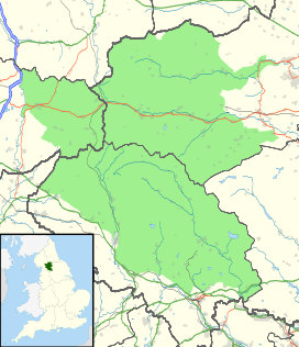
Crag Hill is located in Yorkshire Dales
Crag Hill
Yorkshire Dales/Cumbria,  England
Coordinates 54°14′40″N 2°28′27″W / 54.24446°N 2.47413°W / 54.24446; -2.47413Coordinates: 54°14′40″N 2°28′27″W / 54.24446°N 2.47413°W / 54.24446; -2.47413
Topo map OS Landranger 98
OS grid SD692833

Crag Hill is on the western edge of the Yorkshire Dales in northern England, not to be confused with the higher Crag Hill elsewhere in the county of Cumbria. It lies on the boundary of the Yorkshire Dales national park, but its summit is in Cumbria. It is part of a ridge including the neighbouring fells of Great Coum and Gragareth. The summit of Crag Hill is about 1 kilometre away from the top of Great Coum, the latter being the highest point on the ridge at 687 m.

All three hills may be included in a single circular walk from High Moss near Whernside on the Ingleton to Dent road. The views are extensive, with panoramas of the Yorkshire Dales, Howgill Fells, the Pennines and the Lake District beyond.


Wikimedia Foundation. 2010.

Игры ⚽ Нужна курсовая?

Look at other dictionaries:

  • Crag Hill — Crag Hill …   Wikipedia

  • List of hill forts in England — This List of hill forts in England is a list of links to any hill fort in England, UK.Berkshire*Alfred s Castle, Badbury Hill, Cherbury Camp, Hardwell Castle *Segsbury Camp, Uffington Castle, Walbury Hill, Wittenham ClumpsBristol*Kingsweston… …   Wikipedia

  • Dodd Fell Hill — Elevation 668 m (2,192 ft) …   Wikipedia

  • List of Sites of Special Scientific Interest in North Yorkshire — This is a list of the Sites of Special Scientific Interest (SSSIs) in North Yorkshire. Note that Natural England, the designating body for SSSIs in England, uses the 1974–1996 county system, and this list follows the same approach, rather than,… …   Wikipedia

  • Civil parishes in West Yorkshire — A map of West Yorkshire, showing the Metropolitan Boroughs: (1) Leeds; (2) Wakefield; (3) Kirklees; (4) Calderdale; and (5) Bradford. A civil parish is a subnational entity, forming the lowest unit of local government in England. There are 97… …   Wikipedia

  • Dale Head — seen from the neighbouring hill of High Spy Elevation 753 m (2,470 ft) …   Wikipedia

  • Dent — This unusual and interesting name is English. It has two possible origins. The first and most likely being a locational surname from either of the places called Dent in West Yorkshire and Cumberland. The places are recorded in circa 1200 as Denet …   Surnames reference

  • Parc national de Lake District — Parc national du Lake District Le Lake District est un parc national anglais qui fait partie de Cumbrie. On y trouve les montagnes les plus hautes d Angleterre, dont Scafell Pike, son point culminant. La région est connue pour être l inspiration… …   Wikipédia en Français

  • Parc national de lake district — Parc national du Lake District Le Lake District est un parc national anglais qui fait partie de Cumbrie. On y trouve les montagnes les plus hautes d Angleterre, dont Scafell Pike, son point culminant. La région est connue pour être l inspiration… …   Wikipédia en Français

  • Parc national du Lake District — Mouton de Herdwick près du lac Thirlmere Catégorie UICN V (paysage terrestre/marin protégé) Identifiant 959 …   Wikipédia en Français

Share the article and excerpts

Direct link
Do a right-click on the link above
and select “Copy Link”