- City of Greater Shepparton
-
City of Greater Shepparton
Victoria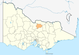
Location in VictoriaPopulation: 62,368(2009)[1] Mayor: Geoff Dobson State District: Shepparton Federal Division: Murray LGAs around City of Greater Shepparton: Moira Moira Moira Campaspe City of Greater Shepparton Benalla Campaspe Strathbogie Strathbogie The City of Greater Shepparton is a Local Government Area in Victoria, Australia. It is located in the northern part of the state. It has an area of 2,420 square kilometres, and in 2001 it had a population of 56,000. It was formed in 1994 from the merger of the City of Shepparton, Shire of Shepparton, and parts of the Shire of Rodney, Shire of Euroa, Shire of Goulburn, Shire of Tungamah, Shire of Violet Town and Shire of Waranga.
The Greater Shepparton City Council is composed of seven councillors elected to represent an unsubdivided municipality.[2]
See also
References
- ^ Australian Bureau of Statistics (30 March 2010). "Regional Population Growth, Australia, 2008–09". http://www.abs.gov.au/ausstats/abs@.nsf/Latestproducts/3218.0Main%20Features52008-09?opendocument&tabname=Summary&prodno=3218.0&issue=2008-09&num=&view=. Retrieved 3 June 2010.
- ^ Local Government Victoria. "Greater Shepparton City Council". http://www.localgovernment.vic.gov.au/web20/dvclgv.nsf/AllDocs/A949DE10B6DD5473CA25716100237311?OpenDocument. Retrieved 2008-10-30
External links
- Greater Shepparton City Council
- Metlink local public transport map
- Link to Land Victoria interactive maps
Towns in the City of Greater Shepparton Arcadia • Congupna • Dookie • Grahamvale • Katandra West • Kialla • Lancaster • Lemnos • Merrigum • Mooroopna • Murchison • Orrvale • Shepparton • Shepparton East • Tallygaroopna • Tatura • Toolamba • Undera •
Local Government Areas of Victoria Greater Melbourne Inner MelbourneMetropolitanBanyule · Bayside · Boroondara · Darebin · Glen Eira · Hobsons Bay · Kingston · Maribyrnong · Maroondah · Monash · Moonee Valley · Moreland · WhitehorseOuter MetropolitanBrimbank · Cardinia · Casey · Frankston · Greater Dandenong · Hume · Knox · Manningham · Melton · Mornington Peninsula · Nillumbik · Whittlesea · Wyndham · Yarra RangesSouthwest Central Highlands and Goldfields Goulburn Valley Northeast Gippsland Western District Wimmera The Mallee Coordinates: 36°23′00″S 145°24′00″E / 36.3833333°S 145.4°E
Categories:- Local Government Areas of Victoria (Australia)
- Victoria (Australia) geography stubs

Wikimedia Foundation. 2010.