- City of Wodonga
-
City of Wodonga
Victoria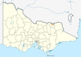
Wodonga within VictoriaPopulation: 35,733(2009)[1] • Density: 76.2/km² (197.4/sq mi) Established: 1876 Area: 433 km² (167.2 sq mi) Mayor: Cr Mark Byatt Council Seat: Wodonga Region: Northeast Victoria State District: Benambra Federal Division: Indi 
LGAs around City of Wodonga: Greater Hume (NSW) City of Albury (NSW) Greater Hume (NSW) Indigo City of Wodonga Towong Indigo Indigo Indigo  Council offices
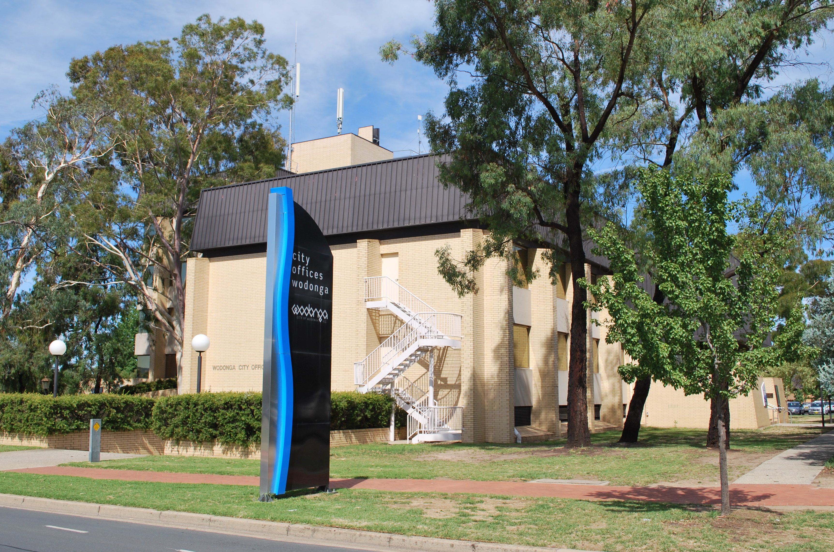
The City of Wodonga is a Local Government Area in Victoria, Australia, located in the north-eastern part of the state on the Murray River, which forms the border with New South Wales. It has an area of 433 square kilometres (167 sq mi) and at the 2006 census, it had a population of 33,010.[2] Its floral and fauna emblems are Pink heath and the Leadbeater's Possum respectively—the same as the state of Victoria's.
Its council, the Wodonga City Council, provides governance for the Victorian part of the Albury-Wodonga urban area.
Contents
History
Wodonga was first surveyed in 1852 and proclaimed the town of Belvoir in the same year. In 1876 the Victorian colonial government granted a request from the people of the area for their district to be severed from the Shire of Yackandandah to form a new municipality, and on 10 March 1876, the Shire of Wodonga was incorporated. On 12 April 1911 it annexed a further part of Yackandandah, and on 30 March 1973, Wodonga was proclaimed a Rural City by the Governor of Victoria, Sir Rohan Delacombe.[3][4]
The municipality survived widespread local government amalgamations in 1994, gaining the Baranduda and Barnawartha North districts from neighbouring shires.[5] However, the councillors were dismissed on 18 November 1994,[6] and replaced by commissioners Mel Read, a long-serving executive of the Albury-Wodonga Development Corporation, Des Kelly, a Shire of Tallangatta councillor from 1968 until 1994, and Mike Hansen, a retired army officer with management and logistics experience.[7] The commissioners decided in 1995 that, to give the city a fresh image, the term "rural" be dropped from use except when legally required.[4] It has since been officially renamed to the City of Wodonga. The elected council was reinstituted in 1997.
Wards and Structure
Prior to 1994, Wodonga was divided into four wards, each of which elected three councillors:
- Baranduda Ward
- Belvoir Ward
- Bonegilla Ward
- Greenhill Ward
The council was replaced with three commissioners on 18 November 1994, and at the 1997 inaugural elections of the new council, five councillors were elected to an unsubdivided municipality. Following the enactment of the Local Government (Democratic Reform) Act 2003 (Vic.), which amended the Local Government Act 1989, an independent review of Wodonga's internal structure was commissioned and advertised on 13 May 2004 by the Victorian Government. The final report by the Victorian Electoral Commission, issued on 27 September 2004, recommended that the council be increased in size to seven elected members, noting that at the time of the report, Wodonga was the only city council with fewer than seven, and that the task of representing the diversity and issues of a growing regional city was complex. It recommended leaving the City unsubdivided as it had a single, dominant centre and a small area.[8]
The council was restructured accordingly and elections held on 26 November 2005 returned seven councillors with Rodney Wangman as mayor and Brian Wicks as deputy mayor.[9] Elections in late November 2008 resulted in four of the sitting seven councillors losing their seats, and saw the City of Wodonga gain a new Mayor and Deputy-Mayor, in Crs. Mark Byatt and Angela Collins.
Geography
The City of Wodonga is dominated by the Wodonga urban area, which includes the suburb of West Wodonga and represents 37.1 square kilometres (14.3 sq mi), or 8.57%, of the City's area and at the 2006 census had a population of 29,710.[10]
Other towns within the City's area include:
- Bandiana
- Baranduda
- Barnawartha North
- Bonegilla
- Castle Creek
- Ebden
- Gateway Island
- Huon Creek
- Killara
- Leneva
- Staghorn Flat (shared with Indigo Shire)
Population
Year Population 1954 10,924 1958 12,520* 1961 12,968 1966 11,867 1971 13,074 1976 15,733 1981 19,208 1986 22,693 1991 26,389 1996 29,158 2001 30,921 2006 33,010 * Estimate in 1958 Victorian Year Book.
See also
References
- ^ Australian Bureau of Statistics (30 March 2010). "Regional Population Growth, Australia, 2008–09". http://www.abs.gov.au/ausstats/abs@.nsf/Latestproducts/3218.0Main%20Features52008-09?opendocument&tabname=Summary&prodno=3218.0&issue=2008-09&num=&view=. Retrieved 3 June 2010.
- ^ Australian Bureau of Statistics (25 October 2007). "Wodonga (RC) (Local Government Area)". 2006 Census QuickStats. http://www.censusdata.abs.gov.au/ABSNavigation/prenav/LocationSearch?collection=Census&period=2006&areacode=LGA27170&producttype=QuickStats&breadcrumb=PL&action=401. Retrieved 2008-01-05.
- ^ Victorian Municipal Directory. Brunswick: Arnall & Jackson. 1992. pp. 537–538. Accessed at State Library of Victoria, La Trobe Reading Room.
- ^ a b City of Wodonga (2 January 2008). "General history and what we do". http://www.wodonga.vic.gov.au/council/about/history/index.htm. Retrieved 2008-01-07.
- ^ Australian Bureau of Statistics (1 August 1995) (PDF). Victorian local government amalgamations 1994-1995: Changes to the Australian Standard Geographical Classification. Commonwealth of Australia. p. 12. ISBN 0-642-23117-6. http://www.ausstats.abs.gov.au/ausstats/free.nsf/0/76E601D6DB55E88ACA25722500049195/$File/12570_1994-95.pdf. Retrieved 2008-01-05.
- ^ Gettler, Leon (19 November 1994). "North-east Victoria councils cut from 37 to 12". The Age: p. 10.
- ^ Office of the Minister of Local Government (18 November 1994). "News Release - Twelve councils for north-east". Government of Victoria. Provisionally available at [1].
- ^ Victorian Electoral Commission (27 September 2004). "Final Report - Electoral Representation Review - City of Wodonga" (PDF). http://www.doi.vic.gov.au/doi/doielect.nsf/2a6bd98dee287482ca256915001cff0c/b7fc957ffa655680ca256f3e007aff31/$FILE/2004%20Wodonga.pdf.
- ^ City of Wodonga (19 December 2007). "Our councillors and senior staff". http://www.wodonga.vic.gov.au/council/about/councillors/index.htm. Retrieved 2008-01-07.
- ^ Australian Bureau of Statistics (25 October 2007). "Albury-Wodonga (Wodonga Part) (Urban Centre/Locality)". 2006 Census QuickStats. http://www.censusdata.abs.gov.au/ABSNavigation/prenav/LocationSearch?collection=Census&period=2006&areacode=UCL200400&producttype=QuickStats&breadcrumb=PL&action=401. Retrieved 2008-01-07. Map
External links
- City of Wodonga official website
- Metlink local public transport map
- Link to Land Victoria interactive maps
Towns in the City of Wodonga Bandiana · Baranduda · Barnawartha North · Bonegilla · Castle Creek Ebden Gateway Island · Huon Creek · Killara · Leneva · Staghorn Flat · West Wodonga · Wodonga ·
Local Government Areas of Victoria Greater Melbourne Inner MelbourneMetropolitanBanyule · Bayside · Boroondara · Darebin · Glen Eira · Hobsons Bay · Kingston · Maribyrnong · Maroondah · Monash · Moonee Valley · Moreland · WhitehorseOuter MetropolitanBrimbank · Cardinia · Casey · Frankston · Greater Dandenong · Hume · Knox · Manningham · Melton · Mornington Peninsula · Nillumbik · Whittlesea · Wyndham · Yarra RangesSouthwest Central Highlands and Goldfields Goulburn Valley Northeast Gippsland Western District Wimmera The Mallee Coordinates: 36°07′00″S 146°53′00″E / 36.1166667°S 146.8833333°E
Categories:- Populated places established in 1876
- 1876 establishments in Australia
- Local Government Areas of Victoria (Australia)

Wikimedia Foundation. 2010.