- Pennsylvania Route 3
-
"PA 3" redirects here. PA 3 may also refer to Pennsylvania's 3rd congressional district.This article is about the current route. For the PA Route 3 in the 1920s, see William Penn Highway.
PA Route 3
Route information Maintained by PennDOT Length: 24.33 mi[1] (39.16 km) Existed: 1936 – present Major junctions West end: 


 US 322 Bus. in West Chester
 US 202 / US 322 in West Chester
 I-476 in Broomall
 US 1 in Havertown
 US 13 in Philadelphia
 I-76 in Philadelphia
East end:  PA 611 in Philadelphia
Location Counties: Chester, Delaware, Philadelphia Highway system Roads in Pennsylvania
Interstate • US • State • Legislative←  PA 2
PA 2PA 4  →
→Pennsylvania Route 3 is a state highway located in the southeastern portion of Pennsylvania. The route connects West Chester with Philadelphia. The divided highway that comprises much of its route is the West Chester Pike, built as a turnpike by the Philadelphia and West Chester Turnpike Company. In the early 20th century, it comprised part of the Lakes-to-Sea Highway.
From 1898 to 1954, the route was paralleled by a streetcar line of the Philadelphia Suburban Transportation Company. However, the line was removed in order to facilitate a four-lane widening of the entire length of the highway in response to traffic and safety concerns. Today, SEPTA's Route 104 bus covers most of the length of the route, running from West Chester to 69th Street Terminal in Upper Darby.
Contents
Route description
PA 3 begins at an intersection with Business US 322 in West Chester, as a one-way pair of Market and Gay Streets. At the borough line, the route becomes West Chester Pike, a four-lane divided highway. The route interchanges with the US 202/US 322 bypass of West Chester, heading eastwards towards Goshen and the county line.
PA 3 continues eastward through Edgmont, passing by Ridley Creek State Park. It passes through Newtown Square and Broomall, interchanging with Interstate 476 near Havertown, where it also meets U.S. 1. In the Philadelphia inner suburb of Upper Darby, the West Chester Pike ends and the route continues as Market Street across the Philadelphia city limits.
PA 3 enters Philadelphia as Market Street, then immediately turns onto the Cobbs Creek Parkway and divides into Chestnut and Walnut Streets. In the University City neighborhood of Philadelphia, the route makes several turns including a short overlap with U.S. Route 13, with the westbound direction becoming J.F.K. Boulevard and the eastbound direction turning back onto Market Street, and across the Market Street Bridge. Both streets pass over I-76 and the Schuylkill River at 30th Street Station, and the westbound boulevard passes the Comcast Center, Pennsylvania's tallest skyscraper. The route then ends at Pennsylvania Route 611 in a massive traffic circle around Philadelphia City Hall.[2]
History
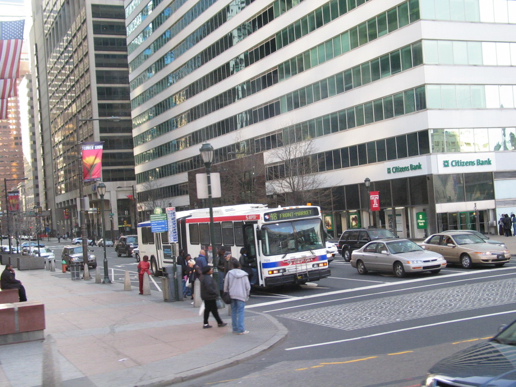
 Eastbound PA 3 (Market Street) approaching 15th Steeet, near the route's eastern terminus.
The Philadelphia and West Chester Turnpike Road Company was formed in 1848 to build a toll road between the two cities. The road was one of several built in Delaware County in the 1840s, as part of a plan to improve the farming and manufacturing business in the county. Rail was first used on the turnpike in 1858, when the Delaware County Passenger Rail Road Company built a 4-mile (6.4 km) line from 39th and Market streets in Philadelphia to Howard House.[3][4]
In 1924, PA 3 was first signed onto the William Penn Highway, from the West Virginia state line to the New Jersey state line. It was designated on what is today U.S. Route 22, from the West Virginia state line to Harrisburg; U.S. Route 322 from Harrisburg to Hershey; U.S. Route 422 from Hershey to Reading; U.S. Route 222 from Reading to Allentown; US 22 from Allentown to the New Jersey state line. The number was decommissioned in 1930, four years after AASHTO added the US 22 designation.[5]
In 1927, a portion of the Lakes-to-Sea Highway (PA 5) was signed to the West Chester Pike. By 1940, PA 3 was commissioned replacing the previous PA 5 designation.[5][6][7]
Major intersections
County Location Mile[1] Destinations Notes Chester West Chester 0.00
US 322 Bus. (High Street)West Goshen Township 1.36 US 202 / US 322Interchange Westtown Township 4.53  PA 352 north (Chester Road)
Western terminus of concurrency 4.66 PA 352 south (Chester Road)Eastern terminus of concurrency Willistown Township 6.35  PA 926 (Street Road)
Eastern terminus of PA 926 Delaware Newtown Township 11.32  PA 252 (Newtown Street Road)
Marple Township 13.46  PA 320 (Sproul Road)
14.59 I-476 (Blue Route)Exit 9 (I-476) Upper Darby Township 17.14 US 1 (Township Line Road)Philadelphia Philadelphia 22.46 US 13 south (38th Street)Western terminus of concurrency 22.57 US 13 north (38th Street)Eastern terminus of concurrency 24.33 PA 611 (Broad Street)1.000 mi = 1.609 km; 1.000 km = 0.621 mi
Concurrency terminus • Closed/Former • Incomplete access • UnopenedReferences
- ^ a b DeLorme Street Atlas USA (2007), Toggle Measure Tool. Retrieved on 2007 June.
- ^ PennDOT (2007). Pennsylvania Tourism and Transportation Map (Map). ftp://ftp.dot.state.pa.us/public/pdf/BPR_PDF_FILES/MAPS/Statewide/otm/2007/otm_2007.PDF. Retrieved 2007-12-20.
- ^ Trains. Kalmbach Publishing Company. 1954.
- ^ Smith, George (1862). History of Delaware County: From the discovery of the territory including within its limits to the present time. printed by H.B. Ashmead.
- ^ a b Gulf Oil (1926). Pennsylvania Highway Map (eastern side) (Map). http://www.mapsofpa.com/art5pics/251c.jpg. Retrieved 2007-12-26.
- ^ Pennsylvania Department of Highways (1927). Pennsylvania Highway Map (Map). http://www.mapsofpa.com/roadcart/1927_2043m.jpg. Retrieved 2007-12-26.
- ^ Pennsylvania Department of Highways (1940). Pennsylvania Highway Map (back side) (Map). ftp://ftp.dot.state.pa.us/public/pdf/BPR_pdf_files/Maps/Statewide/Historic_OTMs/1940bk.pdf. Retrieved 2007-12-26.
Road transportation infrastructure of the metro Philadelphia area Interstates U.S. Routes Pennsylvania Routes New Jersey Routes Delaware Routes Named roads/streets Benjamin Franklin Parkway · Broad Street · City Avenue · Front Street · Girard Avenue · Market Street · Roosevelt Boulevard · South Street · Chestnut Street · Walnut Street
Pennsylvania Turnpike · New Jersey Turnpike · Delaware Turnpike · Atlantic City Expressway · Schuylkill Expressway · Delaware Expressway · Blue Route · Vine St Expressway · North South Freeway · Lancaster Avenue · Bethlehem Pike · Baltimore Pike · Black Horse PikeBridges Delaware Memorial Bridge · Commodore Barry Bridge · Walt Whitman Bridge · Ben Franklin Bridge · Betsy Ross Bridge · Tacony–Palmyra Bridge · Burlington–Bristol Bridge · Delaware River – Turnpike Toll BridgeCategories:- State highways in Pennsylvania
- Pre-freeway turnpikes in the United States

Wikimedia Foundation. 2010.