- Sudbury District, Ontario
Infobox Settlement
official_name = Sudbury District
other_name =
native_name =
nickname =
settlement_type = District
motto =
imagesize =
image_caption = Mattagami First Nation
flag_size =
image_
seal_size =
image_shield =
shield_size =
city_logo =
citylogo_size =
flag_size =
image_
seal_size =
image_shield =
shield_size =
city_logo =
citylogo_size =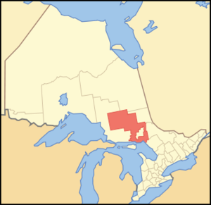
mapsize =
map_caption = Location of Sudbury District in Ontario
mapsize1 =
map_caption1 =
image_dot_
dot_mapsize =
dot_map_caption =
dot_x = |dot_y =
pushpin_
pushpin_label_position =
pushpin_map_caption =
pushpin_mapsize =
subdivision_type = Country
subdivision_name =Canada
subdivision_type1 = Province
subdivision_name1 =Ontario
subdivision_type2 = Region
subdivision_name2 =Northeastern Ontario
subdivision_type3 =
subdivision_name3 =
subdivision_type4 =
subdivision_name4 =
government_footnotes =
government_type =
leader_title = MPs
leader_name =Raymond Bonin ,Brent St. Denis
leader_title1 = MPPs
leader_name1 = Mike Brown,France Gélinas
leader_title2 =
leader_name2 =
leader_title3 =
leader_name3 =
leader_title4 =
leader_name4 =
established_title = Created
established_date = 1894
established_title2 =
established_date2 =
established_title3 =
established_date3 =
area_magnitude =
unit_pref =
area_footnotes =
area_total_km2 =
area_land_km2 =
area_water_km2 =
area_total_sq_mi =
area_land_sq_mi =
area_water_sq_mi =
area_water_percent =
area_urban_km2 =
area_urban_sq_mi =
area_metro_km2 =
area_metro_sq_mi =
population_as_of = 2006
population_footnotes =
population_note =Canada 2006 Census
population_total = 21392
population_density_km2 =
population_density_sq_mi =
population_metro =
population_density_metro_km2 =
population_density_metro_sq_mi =
population_urban =
population_density_urban_km2 =
population_density_urban_sq_mi =
population_blank1_title =
population_blank1 =
population_density_blank1_km2 =
population_density_blank1_sq_mi =
timezone = Eastern (EST)
utc_offset = -5
timezone_DST =
utc_offset_DST =
elevation_footnotes =
elevation_m =
elevation_ft =
postal_code_type = Postal code span
postal_code =
area_code = 705
blank_name = Seat
blank_info = Espanola
blank1_name =
blank1_info =
website =
footnotes = The Sudbury District is adistrict inNortheastern Ontario in theCanadian province ofOntario . It was created in 1894 from townships of eastern Algoma District and west Nipissing District.Geography
Although the Sudbury District takes its name from the city of
Greater Sudbury , and geographically encloses the city on all sides, the city is "not" politically part of the district. The city instead has comprised its own separate census division since 1973, when the Regional Municipality of Sudbury was created. The Regional Municipality of Sudbury was separated from the district so that its needs could not dominate the much smaller communities in the district.With the exception of Chapleau, all of the district's incorporated municipalities are found in the area immediately surrounding Greater Sudbury to the west, east and south. North of the Greater Sudbury area, the district is sparsely populated; between Sudbury and Chapleau, only unincorporated settlements,
ghost town s and smallFirst Nations reserves are found.Demographics
In 2006, the population of the Sudbury District was 21,392. Some sources may improperly include the city of Greater Sudbury in the district, thereby citing a population of approximately 180,000, although this is incorrect.
ubdivisions
Towns
* Espanola
* French River
* Killarney
* Markstay-Warren
* St. CharlesTownships
* Baldwin
* Chapleau
* Nairn and Hyman
* Sables-Spanish RiversUnorganized areas
*
Sudbury, Unorganized, North Part, Ontario .First Nations reserves
* Chapleau 74A
* Chapleau 75
* Duck Lake
* Mattagami
* Mountbatten
* Whitefish Lake
* Whitefish River (boundaries include parts of both Sudbury and Manitoulin Districts)Provincial Highways
The Sudbury District is served by
Trans-Canada Highway s 17, which leads from the community of Walford (Sables-Spanish Rivers) in the west to the community of Warren (Markstay-Warren) in the east, and 69, which enters the district at French River and exits at the southern boundary of Greater Sudbury.The Ontario government is converting Highway 69 to a freeway. Construction, and renumbering as Highway 400, are expected to be complete by
2017 .Other primary provincial highways in the district are:
* Highway 6, which extends from Highway 17 south to Whitefish Falls, where it enters the Manitoulin District,
* Highway 64, which runs from Highway 69 east and north through the Municipality of French River, and enters the Nipissing District atMashkinonje Provincial Park ,
* Highway 101, which extends from the boundary of Algoma District, west of Chapleau, to the boundary of Cochrane District, just outside ofTimmins, Ontario ,
* Highway 129, which runs from Highway 101 to the boundary of Algoma District south of Chapleau,
* Highway 144, which runs from the northwestern city limits of Greater Sudbury north to the boundary of Timiskaming District, just outside of Timmins.The Sudbury District also has a number of secondary provincial highways, which are the analogue in a district to county or municipal roads in Southern Ontario. They are important connections to the communities they serve, but are not significant routes for through traffic. The secondary highways are:
* Highway 528, connecting the community of Wolseley Bay (French River) to Highway 64,
* Highway 528A, which provides access to the south side of the water body at Wolseley Bay,
* Highway 535, connecting Highway 64 at Noëlville (French River) to Highway 17 at Hagar (St. Charles),
* Highway 553, extending north from the community of Massey (Sables-Spanish Rivers),
* Highway 560, which runs from Highway 144 to the boundary ofTimiskaming District , through Shining Tree,
* Highway 560A, which connects Westree to Highway 560,
* Highway 607, which runs from Bigwood (French River) to Highway 64,
* Highway 607A, which provides road access to the French River,
* Highway 637, which runs from Highway 69 to the community of Killarney,
* Highway 661, which connects the community of Gogama to Highway 144.See also
Sultan Industrial Road .Provincial Parks
* Biscotasi Lake
* Chapleau-Nemegosenda River
*Chutes Provincial Park
* Esker Provincial Park
* Five Mile Lake
*French River Provincial Park
*Halfway Lake Provincial Park
*Ivanhoe Lake Provincial Park
*Killarney Provincial Park
* La Cloche
* La Motte
*Lady Evelyn-Smoothwater Provincial Park
* Mashkinonje
*Missinaibi Provincial Park
* Mississagi River
*Obabika River Provincial Park
*Solace Provincial Park
*Sturgeon River Provincial Park
*The Shoals Provincial Park
*Wakami Lake Provincial Park
*Windy Lake Provincial Park
Wikimedia Foundation. 2010.