- Havre Boucher, Nova Scotia
-
Havre Boucher — Village — Location of Havre Boucher, Nova Scotia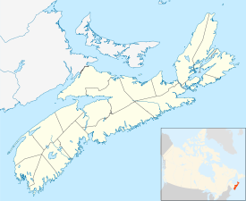
 Havre Boucher
Coordinates: 45°39′0″N 61°31′0″W / 45.65°N 61.516667°W Country  Canada
Province  Nova Scotia
Municipality Antigonish County Government – Village Chair Sylvester Landry – Village Committee Village of Havre Boucher Commission Area – Total 313.3 km2 (121 sq mi) Elevation 0-74 m (-243 ft) Population (2001) – Total 3,000 – Density 28.75/km2 (74.5/sq mi) Time zone AST (UTC−4) – Summer (DST) ADT (UTC−3) Canadian Postal Code B0H 1P0 Area code(s) 902 Telephone Exchange 234 NTS Map 011F12 GNBC Code CAPVL Website http://www.havreboucher.com Havre Boucher (
 /ˈhævər ˈbuːʃi/) is a Canadian village in Antigonish County, Nova Scotia.
The village takes its name from "Havre Boucher", a natural harbour that opens onto St. George's Bay to the north. The original community of Havre Boucher is situated to the west side of the harbour, although it now encompasses the communities of Auld's Cove, Cape Jack, East Havre Boucher, West Havre Boucher, Frankville and Linwood.
Havre Boucher is a rural area, largely dependent upon the fishing industry, as well as serving as a service centre for local communities.
The construction of the Canso Causeway, which opened in 1955, saw the Canadian National Railway mainline from Truro-Sydney diverted from Linwood north through Havre Boucher and Cape Jack, before following the Strait of Canso to the causeway. Before 1955, the railway ran from Linwood to Mulgrave where a ferry service operated to Point Tupper. Havre Boucher saw the construction of a large railway yard, which remains in operation today by the Cape Breton and Central Nova Scotia Railway.
Havre Boucher is one of Nova Scotia's 22 incorporated villages, offering its residents political control through an elected governing body known as a "village commission" which operates under the auspices of the Nova Scotia Municipal Services Act.
External links
Coordinates: 45°39′N 61°31′W / 45.65°N 61.517°W
The home of Dennis Bonvie.Categories:- Communities in Antigonish County, Nova Scotia
- Villages in Nova Scotia
- Designated places in Nova Scotia
- General Service Areas in Nova Scotia

Wikimedia Foundation. 2010.