- Sekong Province
-
Sekong Province Location of Sekong Province in Laos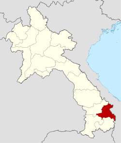
Country Laos Established Capital Sekong Area – Total 7,665 km2 (2,959.5 sq mi) Population (2004) – Total 83,600 – Density 10.9/km2 (28.2/sq mi) Time zone UTC+07 ISO 3166 code LA-XI Sekong (also sometimes Xekong, Lao ເຊກອງ) is a province of Laos, located in the south-east of the country.
Contents
Geography
Sekong was created in 1984, when it was split off from Salavan Province. It is bordered by Vietnam to the east, Attapeu Province to the south, Salavanh Province to the north, and Champasak Province to the west. Sekong is the second smallest province in Laos (7,665 km²); it also has the lowest population (about 83,000) and the lowest population density of any province. Sekong is split administratively into four districts: Thateng on the Bolaven Plateau, Lamam in the lowland plain, and Dakchung and Kaleum in the mountainous areas bordering Vietnam.
Administrative divisions
The province is made up of the following districts:
- Dakcheung (15-03)
- Kaleum (15-02)
- Lamam (15-01)
- Thateng (15-04)
Isolation
Sekong is among the most remote areas of Laos; even some of its largest villages are virtually inaccessible by road for at least half of the year. The eastern districts of Dakchung and Kaleum, in particular, are characterized by mostly mountainous terrain which is rugged and difficult to access. This isolation has meant that forest cover, biodiversity, and ethnic traditions have changed less in recent years than in other areas in Laos. However, the province has become much less isolated in recent years, with the upgrading of a major road up from the Mekong valley city of Pakse, plus two major road projects connecting Sekong to Vietnam to the east. Road infrastructure backed by the Vietnamese is part of a regional development strategy spearheaded by Hanoi called the Development Triangle Initiative, aiming to develop links between Vietnam and neighboring underdeveloped provinces in Cambodia and Laos.
Forest management
Remaining forest cover in Sekong Province is high. Government figures classify over 50% of the province’s land area as forest, the majority of it being mixed deciduous and semi-evergreen forest, but with pockets of dry dipterocarp forest along the Sekong river valley, and pine forest in the Dakchung highlands. Much of the natural forest in Sekong has never been subject to commercial logging, but this is changing fast. Commercial timber extraction has been expanding rapidly over the past decade in the province. There is tremendous and growing pressure on Sekong to log its forests – both from Vietnamese interests (where the wood furniture sector averaged 70% growth per year during 2000-2004) and from Lao companies (who face wood shortages because of dwindling stocks in lowland forests). Up to now, such commercial logging has not been planned and is unsustainable.
Ethnicity
Sekong is ethnically diverse. Only about 3% of the population is ethnic Lao. The vast majority (97%) come from one of at least 14 distinct ethnic minority groups. The Alak (21% of the provincial population), Katu (20%), Tarieng (19%) and Nge/Krieng (11%) are the main ethnic groups. The Lao government classifies them as “Lao Theung” (mid-slope Lao), but an ethno-linguistic categorization, based on language families, places them under the Austroasiatic family. Within this broad family, the ethnic groups of Sekong fall into two linguistic branches: the Katuic (including the Katu and the Nge/Krieng) and the Bahnaric (Alak and Tarieng).
These groups have always existed on the margins of society. Lowland groups – be it the Lao-Tai majority in Lao PDR, or the Vietnamese over the border – have traditionally viewed them as uncivilized, for several reasons. First, their agriculture is more focused on swidden cultivation than paddy rice cultivation, a powerful symbol of civilization for lowland societies. Second, since swidden is a form of forest management, and because forest products are so important in their livelihoods, they have always existed in close relation to the forest – a wild and unpredictable place full of spirits (good and bad) in the minds of lowlanders. Third, they do not practice Buddhism, another benchmark of civilization. Rather they practice ‘animism,’ or what can be translated as ‘spiritualism,’ and they are believed to wield powers (ethnic Lao people call it ‘black magic’) used to deal with the dangerous spirits resident in their villages and forests. Furthermore, they have no written language, another sign of civilization. Finally, they do not traditionally recognize political organization outside the village. Thus to lowland Lao these Austroasiatic groups have traditionally represented savagery, godlessness, witchcraft, illiteracy, and anarchy. However, these groups have always been given the place of honor in traditional ceremonies of the Lao state, because they are considered original owners of the land. They have always been represented in all major rituals, and even newly-built palaces of the Lao kings could not be occupied until the upland chiefs had ceremonially opened it.
These views – and the fear engendered as a result, the fear of peoples who have mastered the wild periphery – has in some ways worked to the advantage of the minorities. They have enjoyed relative autonomy over the centuries, as the power of great kingdoms of the lowlands (Cham, Khmer, Vietnamese, Lao) changed hands, and ebbed and flowed. Historically, their lands have been an important buffer zone between powerful and often warring lowland groups – alternatively a staging point or hideout for rebellions or retreats, with minorities acting as essential guides through the forests and mountains. Therefore, these groups have been a part of many of the great battles of mainland Southeast Asian history; but not until the French colonial takeover in the 1890s were their lands ever totally claimed by an outside power.
This is when the first substantial organizational push beyond the village level – including collaboration with lowland groups – occurred. Many rebellions against the French were organized from the time of French conquest in Laos. Ultimately, a great number of minorities joined the Pathet Lao communist movement during the resistance war against the French, and then later the American-backed Royal Lao Government forces. Though they were fighting for “independence,” in a very real way this was the beginning of the end of autonomy for Sekong’s ethnic groups. Many moved as a result of the heavy bombing in Sekong (the Ho Chi Minh trail runs through the province), and many remain today in the settlements made then.
Government policy towards ethnic groups
Because of their contribution to the liberation movement, the new communist government set out in 1975 to repay the debt by developing the remote mountainous areas. (In fact, the province of Xekong itself is something of a repayment – during the war, Kaysone Phomvihane, the revolutionary leader of the Pathet Lao and later President of the Lao People's Democratic Republic, from 1976 until his death in 1992, promised the minorities of what was then referred to as "East Salavanh" their own province. Phomvihane made good on this promise in 1984, creating Sekong Province.) The main Lao government strategy to develop remote areas has been to push for “economic integration.” This has translated into a policy of swidden agriculture eradication, which is commonly put forward as an important way to develop the uplands. Following the common government line, swidden is focused on producing a diversity of crops for subsistence, and this keeps ethnic minorities poor, especially where fallow cycles are being reduced. The solution is to teach them how to farm like lowland Lao people – to focus on a narrow range of crops in order to produce a surplus which will generate cash, increase market linkages, and uplift them out of poverty. Recognizing that many upland areas are unsuitable for paddy cultivation, and given the remoteness of so much of Sekong, at least a hundred villages (possibly 200) have been resettled over the past two decades (with varying levels of compliance and resistance from these groups).
The results have in many cases been disastrous. The actual move has rarely been assisted by government, and villages have had to leave behind their most important belongings – houses, tools, perennial crops, and sometimes livestock. Once they have moved to the new site, there is often no help for them to restart; whole villages have been uprooted and then told to build their own new houses for settlement, and clear new lands for paddy cultivation, with no assistance. The new villages often have no clean water available, no school, no clinic, and neighbors who resent the migrants being given lands that formerly belonged to them. Beyond this, since the new villages are usually on the lowland plain or along river valleys, ethnic minorities from the mountains are exposed to malaria and other illnesses less common in their ancestral lands. Not surprisingly, then, figures from numerous studies conducted in Lao show an increase in all the poverty indicators – including decreased food production and increased mortality rates – among new villages. Thus the policy has not only failed, but in many cases it has produced increased poverty, both material and cultural.
See also
- Mandala (Southeast Asian history)
- Zomia (geography)
Further reading
- Non-Timber Forest Products Project (Cambodia). Hydropower on the Sesan/Sekong River. Mekong factsheet, 1. Phnom Penh: NTFP Project, Ratanakiri Province, 1997.
- Saiyavong, Somphāvan. Phao Trīang: vithī sīvit kap sathāpattayakam = The life and house of the Tariang people. [Vīangchan]: Sathāban Khonkhwā Vatthanatham, Kasūang Thalǣng Khāo læ Vatthanatham, 2003.
- Thongkum, Theraphan L. Phāsā khō̜ng nānā chonphao nai khwǣng Sēkō̜ng Lāo Tai: khwāmrū phư̄nthān phư̄a kānwičhai læ phatthanā = Languages of the tribes in Xekong Province Southern Laos : a foundation for research and development. Krung Thēp: Samnakngān Kō̜ngthun Sanapsanun Kānwičhai, 2001. ISBN 9740301282
- United Nations Development Programme (Viangchan, Laos). Socio-Economic Profile of Sekong Province. Lao PDR: province profiles series, no. 3. Vientiane: United Nations Development Programme, 1997.
- Vythilingam, I., et al. "The prevalence of Anopheles (Diptera: Culicidae) mosquitoes in Sekong Province, Lao PDR in relation to malaria transmission." Tropical Medicine & International Health. 8.6 (2003): 525-535.
- Hodgdon, B.D. 2007. No Success Like Failure: Policy versus reality in the Lao forestry sector. Watershed Magazine 12(1): 37-46.[1]
- Hodgdon, B.D. 2008. Frontier Country: The political culture of logging and development on the periphery in Laos. Kyoto Journal 69: 58-65. [2]

Salavan Province Thua Thien-Huế province,  Vietnam
Quang Nam province, Vietnam Sekong Province

Champasak Province Attapeu Province Kon Tum province, VietnamProvinces of Laos Attapeu • Bokeo • Bolikhamxai • Champasak • Houaphan • Khammouan • Loung Namtha • Louangphabang • Oudomxai • Phongsali • Sainyabuli • Salavan • Savannakhet • Sekong • Vientiane • Xiangkhoang • Prefecture: Vientiane
 Categories:

Wikimedia Foundation. 2010.