- Thomas Stone National Historic Site
Infobox_nrhp2 | name =Habre-de-Venture; Thomas Stone National Historic Site
nhs = yes
nhl = yes
caption = Habre de Venture
location= 6655 Rose Hill Rd., near jct. with MD 225 and 6,Port Tobacco, Maryland
lat_degrees = 38
lat_minutes = 31
lat_seconds = 55
lat_direction = N
long_degrees = 77
long_minutes = 1
long_seconds = 53
long_direction = W
area =360 acres
built =1771
architect= Unknown
architecture= Georgian
designated_nhl =November 11 ,1971 cite web|url=http://tps.cr.nps.gov/nhl/detail.cfm?ResourceId=1106&ResourceType=Building
title=Habre-De-Venture |accessdate=2008-06-11|work=National Historic Landmark summary listing|publisher=National Park Service]
added =October 31 ,1972 cite web|url=http://www.nr.nps.gov/|title=National Register Information System|date=2008-04-15|work=National Register of Historic Places|publisher=National Park Service]
established_nhs =November 10 ,1978
visitation_num = 4,500
visitation_year =2005
governing_body =National Park Service
refnum=72001595Infobox Protected area
name = Thomas Stone National Historic Site
iucn_category =

caption =
locator_x = 245
locator_y = 83
location =Charles County, Maryland
nearest_city =St. Charles, Maryland
lat_degrees = 38
lat_minutes = 31
lat_seconds = 53
lat_direction = N
long_degrees = 77
long_minutes = 02
long_seconds = 10
long_direction = W
area = 328 acres (1.33 km²)
established =November 10 ,1978
visitation_num = 4,500
visitation_year =2005
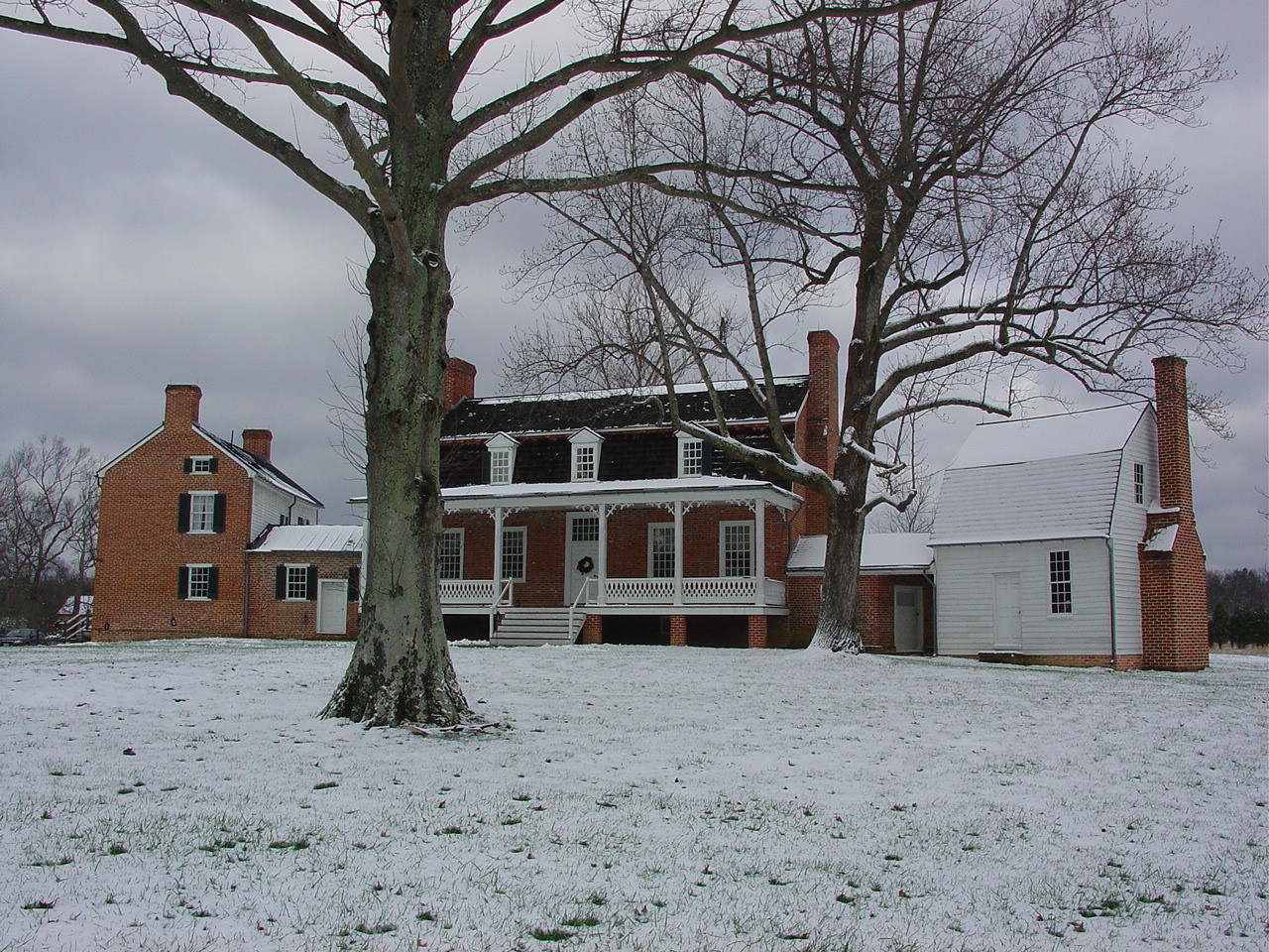
governing_body =National Park Service Thomas Stone National Historic Site, also known as Habre de Venture or Thomas Stone House, is a
United States National Historic Site located about 25 miles (40 kilometers) south ofWashington D.C. in southernMaryland . The site was established to protect the home and property ofThomas Stone , one of the 56 signers of theUnited States Declaration of Independence . His home and estate were owned by the Stone family until1936 .History
Stone purchased Habre de Venture in 1770 and began construction of a new home in 1771. Stone's original plan was to build a small, modest home for him, his wife, and their two daughters but before the house was completed, his father died and five of his younger brothers and sisters came to live with him at Habre de Venture creating the need for larger living quarters. During the 1780s, the Habre de Venture plantation probably supported about 25 to 35 people including a number of
slaves . By the time of Stone's death in 1787, Habre de Venture had increased in size from 442 acres (1.79 km²) to 1077 acres (4.36 km²). Stone was buried in the family cemetery adjacent to his home.Descendants of Thomas Stone continued to own Habre de Venture until 1936 when the land was sold.
It was declared a
National Historic Landmark in 1971.citation|title=PDFlink| [http://pdfhost.focus.nps.gov/docs/NHLS/Text/72001595.pdf National Register of Historic Places Inventory-Nomination: Habre-de-Venture (Thomas Stone House)] |32 KB|date=May 27, 1971 |author=Charles W. Snell |publisher=National Park Service and PDFlink| [http://pdfhost.focus.nps.gov/docs/NHLS/Photos/72001595.pdf "Accompanying photos, exterior and interior, from 19"] |32 KB]The property was privately owned until 1977 when a fire severely damaged the central section of the house. Habre de Venture was authorized as a National Historic Site a year later in 1978 and was purchased by the
National Park Service in 1981. Restoration efforts on the historic structures began at this time but the house was not opened to the public until 1997.Today, a
visitor center located at the site has exhibits on the Declaration of Independence and the life of Thomas Stone. Guided tours of Habre de Venture are also offered.References
External links
* [http://www.nps.gov/thst/index.htm National Park Service: Thomas Stone National Historic Site]
* [http://www.marylandhistoricaltrust.net/nr/NRDetail.aspx?HDID=105&FROM=NRNHLList.aspx Habre de Venture, Charles County] , including undated photo, at Maryland Historical Trust
* [http://hdl.loc.gov/loc.pnp/hhh.md0349 Habre de Venture, Rose Hill Road, La Plata vicinity, Charles County, MD: 14 drawings, 5 photos, 1 data page] , atHistoric American Building Survey
* [http://hdl.loc.gov/loc.pnp/hhh.md1068 Habre de Venture, Tenant House, Rose Hill Road, La Plata vicinity, Charles County, MD: 2 drawings, 1 data page] , atHistoric American Building Survey
* [http://hdl.loc.gov/loc.pnp/hhh.md1069 Habre de Venture, Wagon House, Rose Hill Road, La Plata vicinity, Charles County, MD: 1 drawing, 1 data page] , atHistoric American Building Survey
* [http://hdl.loc.gov/loc.pnp/hhh.md1066 Habre de Venture, Main Barn, Rose Hill Road, La Plata vicinity, Charles County, MD: 5 drawings, 1 data page] , atHistoric American Building Survey
* [http://hdl.loc.gov/loc.pnp/hhh.md1067 Habre de Venture, Corn Crib, Rose Hill Road, La Plata vicinity, Charles County, MD: 3 drawings, 1 data page] , atHistoric American Building Survey
Wikimedia Foundation. 2010.