- U.S. Route 50 in California
-
"CA 50" redirects here. For the congressional district, see California's 50th congressional district.This article is about the section of U.S. Route 50 in California. For the entire length of the highway, see U.S. Route 50.
U.S. Route 50
Route information Defined by S&HC § 350 Maintained by Caltrans Length: 108.624 mi[1] (174.813 km) Existed: 1926 – present Major junctions West end:  I-80 in West Sacramento

 I-80 Bus. / I-5 / SR 99 in Sacramento
 SR 49 in Placerville
 SR 89 in South Lake Tahoe
East end:  US 50 at Nevada state line
Highway system United States Numbered Highways
List • Bannered • Divided • ReplacedState highways in California(list • pre-1964)
History • Unconstructed • Deleted • Freeway • Scenic← SR 49SR 51  →
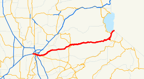
→In the U.S. state of California, U.S. Route 50 (US 50) runs east from I-80 in West Sacramento to the Nevada state line in South Lake Tahoe. Portions within Sacramento are known as the Capital City Freeway and El Dorado Freeway. The western half of the highway, from I-80 through Sacramento and Placerville to the canyon of the South Fork American River at Riverton, is a four-or-more-lane divided highway, mostly built to freeway standards. The remainder, passing through the canyon, over the Sierra Nevada at Echo Summit, and into the Lake Tahoe Basin, is a mainly two-lane road.
The US 50 corridor is a historic one, used by many 49ers who came to California during the Gold Rush as well as the Pony Express. In 1895, part of the present-day route was designated as California's first state highway, and it was later considered as a scenic alternate of the Lincoln Highway. Much of US 50 was constructed during the initial construction of the California state highway system. During the second half of the twentieth century, US 50 was gradually designated and converted into a modern highway.
Contents
Route description
US 50 has been added to the California Freeway and Expressway System by the state legislature. The highway east of SR 49 is eligible for the State Scenic Highway System, and has been recognized as such except within the South Lake Tahoe city limits.[2]
US 50 begins in West Sacramento, where I-80 leaves the West Sacramento Freeway onto a bypass of Sacramento. The old route of I-80 through Sacramento is signed as Business 80 (Capital City Freeway), which overlaps US 50 on the West Sacramento Freeway to the split with SR 275, then over the Sacramento River on the Pioneer Memorial Bridge and across I-5 to SR 99.
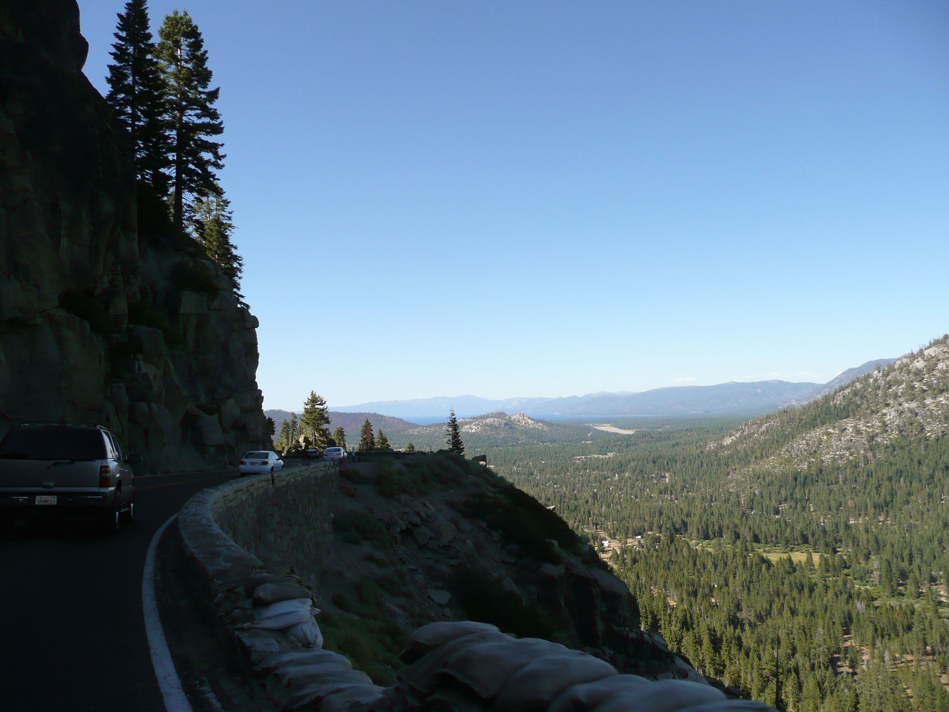
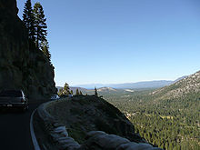 Descending eastbound into the Lake Tahoe Basin (this portion completed in 1940)[citation needed]
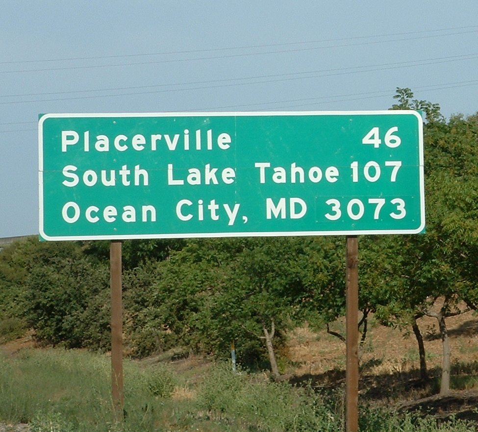
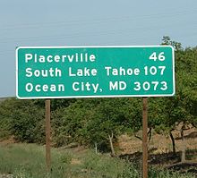 This sign at the west end indicates the distances to Placerville, South Lake Tahoe, and the east end of the route in Ocean City, Maryland
 Lake Tahoe Boulevard. Here the route leaves California and enters Nevada (Nevada territory would be at the bottom). A tiny portion of Lake Tahoe is visible in the upper right corner
 Highway 50 winds down
Echo SummitThere Business 80 splits to the north, SR 99 heads south, and US 50 continues east as the El Dorado Freeway. This freeway parallels Folsom Boulevard and the American River east-northeasterly through the suburb of Rancho Cordova to near Folsom. There US 50 turns east, running cross-country through the foothills of the Sierra Nevada via El Dorado Hills, Cameron Park, and Shingle Springs to downtown Placerville. The freeway temporarily ends, and US 50 has several at-grade intersections in Placerville, including SR 49.[3]
Leaving Placerville, the freeway restarts, only to end several miles later. The final section of freeway begins as a bypass of Camino, and then heads east-northeast through Pollock Pines to near the canyon of the South Fork American River. The four-lane cross section continues with intersections until the crossover bridge to the north side of the river at Riverton. From Riverton to the crest of the Sierras, US 50 is a steadily rising mostly two-lane road, staying just north of the river except for a 1995 cutoff that crosses the river twice in quick succession west of Kyburz, the boyhood home of ski racer Spider Sabich.
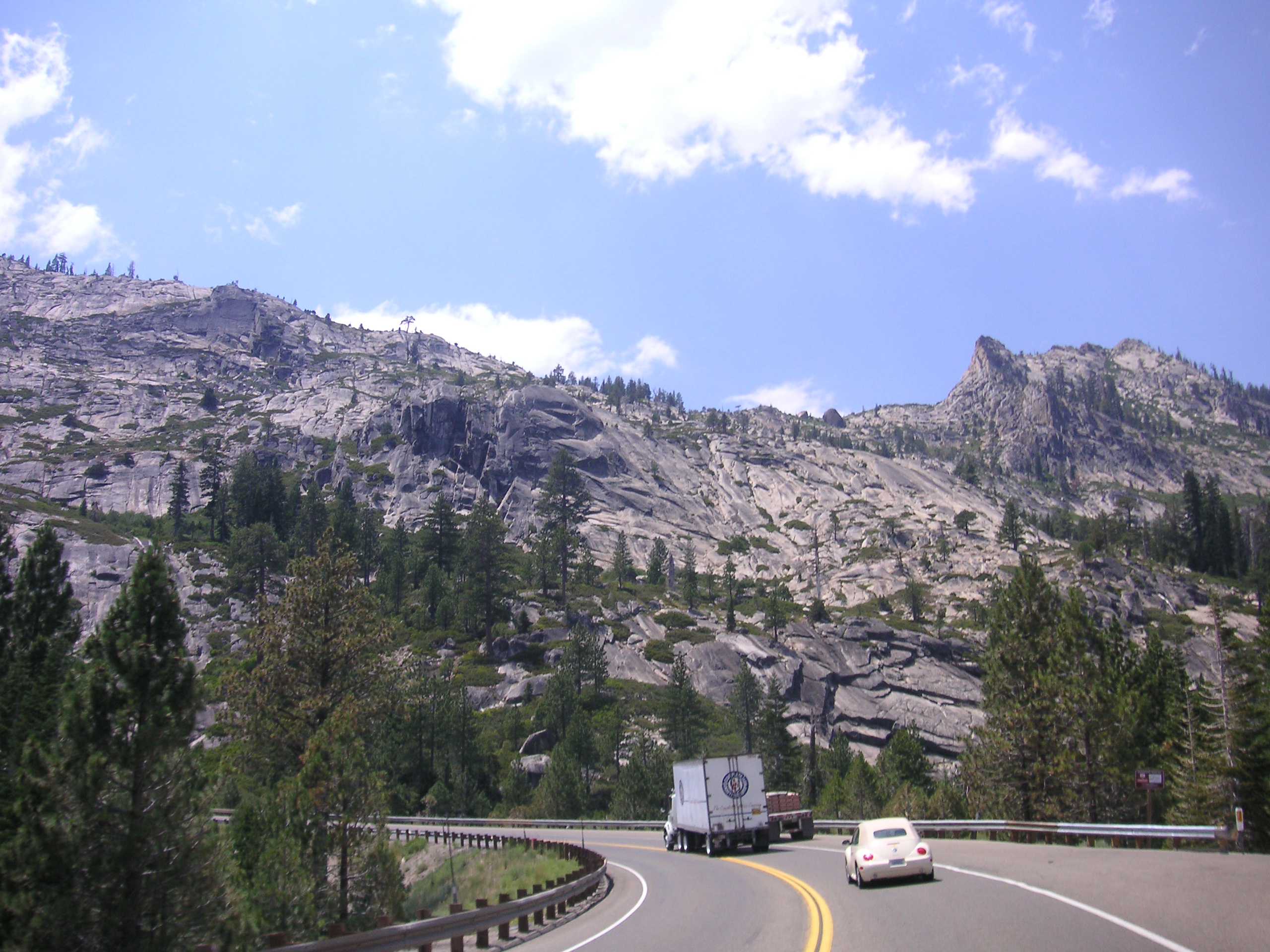
Several hairpin turns take the highway up a grade east of Strawberry, after which US 50 continues east alongside the river to its source at Echo Summit. Echo Summit is the highest elevation U.S. Route 50 reaches in California at 7,377 feet (2,249 m). From Echo Summit down to the Lake Tahoe Basin, the roadway slowly descends the side of a steep hill; it then curves northeast and meets SR 89, which heads south to Luther Pass and overlaps US 50 northeast into the city of South Lake Tahoe. Where US 50 and SR 89 split, at an intersection known as "The Y", the former turns east on the four-lane Lake Tahoe Boulevard, which it follows to and along the south shore of Lake Tahoe, then it enters the state of Nevada.
History
Emigrant trails and wagon roads
The earliest roads used by Europeans to cross the Sierra Nevada into California were branches of the California Trail. The first route near the present US 50 was the Carson Route, laid out in 1848 by an eastward Mormon party that wanted to avoid the Truckee Route and its deep crossings of the Truckee River. The group left Pleasant Valley, southeast of Placerville, on July 3, following Iron Mountain Ridge up to the crest of the Sierra at Carson Pass and then descending through Carson Canyon into the Carson Valley. Along the Humboldt River in Nevada, the Mormons met Joseph B. Chiles, who was leading a westward wagon train to California, and told him of their new trail. Although this new Carson Route crossed two summits — Carson Pass over the crest of the Sierra and West Pass over the Carson Spur just to the west, these crossings were easier than Donner Pass on the Truckee Route, and only three fords of the Carson River were required. The route became the primary westward route into California at the start of the Gold Rush. Through California, the general alignment of the Carson Route, in terms of today's highways, was State Route 88 over Carson Pass and Mormon Emigrant Trail and Sly Park Road to Pleasant Valley.[4]
John Calhoun Johnson of Placerville surveyed and cleared a shorter, lower (and thus less snow-covered) trail east from that town in 1852, completing the work by the summer. Rather than following the ridge to the Sierra's crest as the Mormons had, Johnson headed eastward to the South Fork American River, crossing to its north side near the present Pacific Ranger Station in order to follow Peavine Ridge around a rocky stretch of the river. Returning to the river between Kyburz and Strawberry, he then continued alongside it to the crest at Johnson Pass, where a steep slope descended to Lake Tahoe. Within Nevada, his route generally followed the lake to Glenbrook, where it turned inland and crossed the Carson Range over Spooner Summit into the Carson Valley near Carson City. This trail, known as Johnson's Cut-off, generally followed the present US 50, with notable deviations only just east of Placerville (via Carson Road), over Peavine Ridge (roughly following Peavine Ridge Road, some trails, and Wrights Lake Road), just east of Strawberry (via Slippery Ford Road), over the crest of the Sierra (via Johnson Pass Road and Meyers Road), south of Lake Tahoe (via Pioneer Trail), east of Lake Tahoe (via Genoa Peak Road[5]), and from Spooner Summit into the Carson Valley (via Kings Canyon Road). By 1854, Bartlett's Bridge had been built at the trail's westernmost crossing of the American River, allowing wagons to follow the cutoff;[6] it was soon washed away by a freshet on March 7, 1855, and replaced by Brockliss Bridge, several miles to the east.[7] Due to an improvement of the road through Carson Canyon on the old Carson Route, most travelers ended up turning southeast from Johnson Pass over Luther Pass (present SR 89) to join the older route northeast of Carson Pass rather than following the cutoff along Lake Tahoe.[8][9]
Johnson's Cut-off was the only trail that could be used year-round, but it still had problems, as it had been built without use of earth-moving equipment, and thus did not always take the optimal route. The state adopted a survey by Sherman Day in September 1855, but failed to make use of it. Two years later, the counties of Yolo, Sacramento, and El Dorado, all of which would be benefited by further improvements, began planning and carrying out work. The state legislature created a "Board of Wagon Commissioners" on March 8, 1858, and it completed the improvements by the end of that year. This new route had better grades than the old cutoff, deviating from it in several places: it followed the present Smith Flat Road rather than Carson Road east of Placerville, traversed Peavine Ridge much further down the slope, returning to the river west of Kyburz (roughly via the present White Meadows Road, Ice House Road, and Weber Mill Road to US 50 at Granite Springs Road), and crossed into Carson Valley via Luther Pass. By 1860, the immense traffic over the road and lack of maintenance had worsened it to the point that it could no longer be used by stagecoaches.[9][10]
To provide for better maintenance, improvements funded by tolls were authorized. The first of these was built and operated by Kingsbury and McDonald, who improved the old Johnson's Cut-off between Johnson Pass and Stateline, where they turned east over Daggett Pass (now SR 207) in Nevada, connecting Lake Tahoe to the Carson Valley via a shorter route than that over Luther Pass. Two other competing toll roads soon opened across the Carson Range: one built by Rufus Walton from Spooner Summit down Clear Creek to the valley (now part of US 50), and an 1863 improvement of the original Johnson's Cut-Off along the lake, across Spooner Summit, and through Kings Canyon to Carson City.[11] West of Johnson Pass, the Slippery Ford Grade down to Strawberry was rebuilt by George W. Swan. The first toll-supported bypass of Peavine Ridge was built by Oglesby and opened in 1861, leaving the old road from Placerville at Pollock Pines, following the ridgetops and slopes south of the South Fork American River, crossing the river east of White Hall, and then following US 50 along the north bank to the 1858 county road west of Kyburz. Johnson began work on a lower-grade replacement on the north side of the river in 1864, but stopped when Pearson and McDonald opened a road over the present alignment of US 50, leaving the pre-1861 main road southwest of Brockliss Bridge and following US 50, across the river at Riverton, to Oglesby's road east of White Hall. Toll collection ended in California in 1886, when El Dorado County bought the privately-improved sections and made them public roads.[9][12]
West of Placerville, the wagon road headed south to Diamond Springs, where it turned west along the original Carson Route over relatively gentle terrain to Sacramento, generally following the present US 50 on parallel surface roads, such as Pleasant Valley Road and White Rock Road.[6][13] The Pony Express used this route from its beginning in April 1860 until July 1, when its western terminus became Folsom on the Sacramento Valley Railroad. (The route was further cut back to Placerville, where messages were passed to the telegraph, from July 1861 to its discontinuance in October.)[14] The Placerville and Sacramento Valley Railroad reached Latrobe in 1864,[6] Shingle Springs (on the old Carson Route west of Placerville) in 1865, and was finally completed to Placerville in 1888.[15] As the railroad extended east, the western terminus of the stage lines followed;[16] the completion of the First Transcontinental Railroad in 1869 took most of the traffic off the Placerville wagon road.[9]
State maintenance and reconstruction
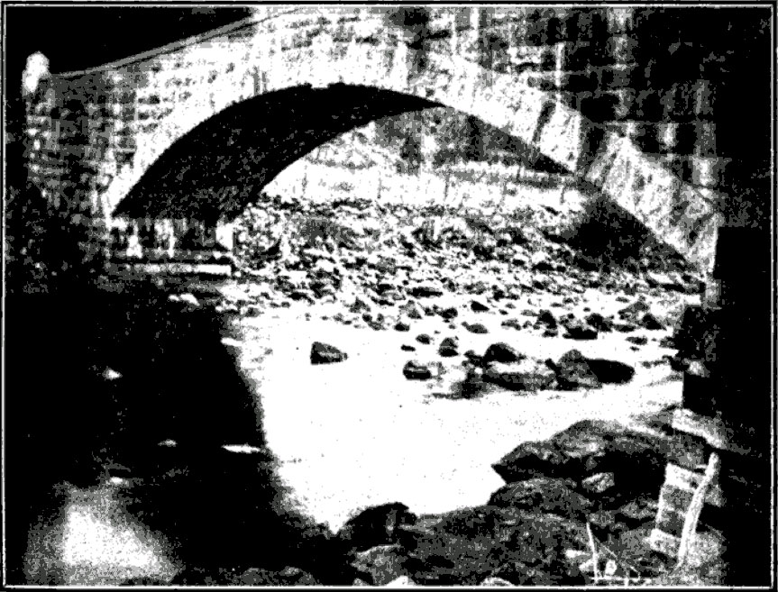
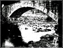 The 1901 bridge at Riverton
At the dawn of the automobile era, the state legislature authorized California's first state road on March 26, 1895 by creating the post of "Lake Tahoe Wagon Road Commissioner" to maintain the road from Newtown Road near Smith Flat (just east of Placerville) to Nevada.[17] The county deeded the 58-mile[18] (93 km) road to the state on February 28, 1896. Funding was only enough for minimal improvements, including a new stone bridge over the South Fork American River at Riverton in 1901. The Department of Engineering took over its maintenance in 1907, immediately completed a survey and posted granite milestones that marked the distance from Placerville, and in 1910 started sprinkling the dirt road with water in summer to keep down dust (as had been done in the 1860s). A 1915 law added the short distance from Smith Flat west to the east limits of Placerville to the state road.[9][19][20][21][22]
With the passage of the first state highway bond issue in 1910, the Department of Engineering was directed to lay out and construct a system connecting all county seats. Placerville, seat of El Dorado County, was connected to Sacramento by the 46.5-mile (74.8 km) Route 11, which followed Folsom Boulevard from Sacramento to Folsom, Bidwell Street and Placerville Road to White Rock, the old Carson Route to El Dorado, and Forni Road and Placerville Drive to Placerville.[23] Between El Dorado and Placerville, the state had two routes to choose from, including one via Diamond Springs (present SR 49), where it decided improving a cut would be too expensive. Instead, it chose the "O'Keefe grade" (Forni Road), following the old road for about 4 miles (6 km) and then building a cutoff (now part of Placerville Drive) to the Green Valley road.[24] In 1917 the mileage that had been added by special laws, rather than as part of bond issues, was consolidated with the rest of the system, and Route 11 was extended east to the state line.[25] (The route was extended farther, from Sacramento southwest to Antioch via present SR 160, in 1933.[26][27]) The third bond issue, passed in 1919, included funds for the improvement of 10 miles (16 km) from Placerville east to Sportsman's Hall, by which time paving was complete west of Placerville.[20][28]
 Westbound at the bottom of the 1947 grade to Echo Summit
The Lincoln Highway, one of the earliest marked highways across the country, split in two over the Sierra Nevada. The main route followed the present I-80 alignment over Donner Pass, but an alternate "Pioneer Branch", designated as part of the initial routing in 1913, turned south at Reno, Nevada to Carson City and then crossed the Sierras via Johnson Pass and the Placerville route. Contrary to the Lincoln Highway Association's policy of marking the most direct route, this deviation was explained simply as "for those tourists desiring to see Lake Tahoe". However, it actually became shorter in 1921, when the Fallon Cut-off opened from Carson City directly east to the main route near Fallon, bypassing Reno.[29] The U.S. Highway system was created in 1926, and this route (along with the main Lincoln Highway east of the cutoff) became part of U.S. Route 50. (The Donner Pass route was U.S. Route 40, crossing Nevada on the Victory Highway.) US 50 initially ended in Sacramento, where motorists could follow US 40 (Victory Highway) southwest to the San Francisco Bay Area or turn south over US 99 to Stockton and take US 48 (Lincoln Highway) west over Altamont Pass. Originally, US 48 was a road connecting the San Francisco Bay area with the San Joaquin Valley, traveling from San Jose to near Modesto, largely following the future routing of US 50, which replaced US 48. Its western terminus was located near the present location of the Interstate 238/Interstate 880 interchange. It generally followed the route of current Interstate 580 to the Interstate 205 junction. From here, US 48 continued east on Interstate 205, then followed Old Highway 50 (present I-205 Bus.) through Tracy, thence to Interstate 5. It then followed Interstate 5 to SR 120, where US 48 followed SR 120 to the old location of the SR 99/SR 120 interchange (present day intersection of Main and Yosemite in Manteca), the location of its eastern terminus. [30][31] At this time, US 50 was improved but unpaved east of Placerville.[32] As part of the state project to pave this portion, the old road was bypassed in several areas, completing the final two-lane alignment. These realignments included Broadway, bypassing Smith Flat Road, at Smith Flat (1932), a new route around Slippery Ford Grade east of Strawberry (1931), and a new route through South Lake Tahoe, leaving behind Pioneer Trail (1931). The crossing of the Sierra crest at Johnson Pass was bypassed in 1940 by a better-quality route over Echo Summit; the lower part of the current road east of the summit opened in 1947, bypassing Meyers Road.[9] West of Placerville, several major two-lane relocations were built. A bypass (now Mother Lode Drive) around El Dorado and the winding Forni Road was completed in 1938, and the improvement was extended west to Shingle Springs in 1947. A short relocation north of White Rock, between Bidwell Street and Bass Lake Road, opened in 1940, and was extended west beyond Hazel Avenue, bypassing Folsom, in 1949.[33][34][35]
Extension to San Francisco
Main article: Interstate 580 (California)By the early 1930s, US 50 had been extended to San Francisco via the former US 48 by overlapping US 99 from Sacramento to Stockton and replacing US 48 over Altamont Pass to US 101E (Foothill Boulevard at Castro Valley Boulevard) near Hayward.[36][37] It was extended over the new Bay Bridge at the time of its opening in 1936, replacing US 101E on Foothill Boulevard and the present MacArthur Boulevard to the Bay Bridge Distribution Structure in Oakland.[38][39] As the new MacArthur Freeway (now I-580) was constructed, US 50 was moved to it.[40] This extension was officially eliminated in the 1964 renumbering,[41] but it remained on maps and signs for several more years[42][43][44] before being replaced I-80 over the Bay Bridge, I-580 over Altamont Pass, I-205 business route through Tracy, I-5 to Stockton, SR 4 and SR 26 (Charter Way) through Stockton, and SR 99 to Sacramento.
Freeway and expressway upgrades
When the California Freeway and Expressway System was created in 1959, it included US 50 from Sacramento to Nevada. (The Oakland-Sacramento portion was also included, mostly as part of the Interstate Highway System.)[45] Two segments had already been upgraded to freeway or expressway standards — an expressway through Placerville, completed in 1955, and a freeway bypass of Camino with an expressway continuing west to Five Mile Terrace, completed in 1957.[35] From Pollock Pines east to the bridge at Riverton, the road was widened to four lanes in about 1960.[46] The next decade saw the improvement of every remaining two-lane section between Rancho Cordova (near Sunrise Boulevard) and Riverton, with the final section, connecting Bass Lake Road and Shingle Springs, opening in July 1970.[47][48] The freeway was completed west to I-80 (now Business 80) and SR 99 in early 1973, bypassing the mostly four-lane Folsom Boulevard.[49] US 50 was extended west along former I-80 to the new I-80 bypass in 1981, when the old I-80 became Business 80. (Since Business 80 was not a valid legislative designation, the remainder became State Route 51.)[50]
For many years, the four lanes from Sacramento stopped at Riverton, where the original two-lane road continued through the canyon and over Echo Summit.[51][52] The state rejected a proposed $133 million total realignment between Riverton and Kyburz in 1985, instead opting for a less expensive program of spot improvements including new bridges and passing lanes.[53] Portions of the work were completed by 1987, including a four-lane bridge at Riverton (though two lanes are used by traffic turning at Ice House Road at the east end of the bridge).[54] Between White Hall and Kyburz, a pair of four-lane bridges over the South Fork American River, carrying a realignment across a bend in the river, were dedicated on May 31, 1995 as the El Dorado County Veterans Bridges.[55]
The route through the South Fork American River Canyon remains vulnerable to mudslides and other storm damage. One particularly bad slide closed the highway east of Riverton for 28 days from January 24 to February 21, 1997, only a week after a similar 17-day closure caused by flooding on January 1. A project to make more permanent repairs and prevent future closures began on July 31, and from September 2 to October 24 the highway was closed during the week to allow for more efficient reconstruction. The state signed the detour, which followed Sly Park Road, Mormon Emigrant Trail (the old ridgetop Carson Route), SR 88, and SR 89 (over Luther Pass), as Alternate U.S. Route 50,[56] a designation not approved by the American Association of State Highway and Transportation Officials, which generally assigns new bannered U.S. Highways.[57] After the work was complete, signs were left along the route.[58]
Major intersections
Note: Except where prefixed with a letter, postmiles were measured on the road as it was in 1964, and do not necessarily reflect current mileage. The numbers reset at county lines; the start and end postmiles in each county are given in the county column.
County Location Postmile
[1][48][59]Exit
[60]Destinations Notes Yolo
YOL 0.00–3.16West Sacramento 0.00 I-80 west – San FranciscoWestbound exit and eastbound entrance; west end of I-80 Bus. overlap 0.00 1A I-80 east – RenoWestbound exit and eastbound entrance; former I-880 east 1.20 1B Harbor Boulevard Signed as exit 1 eastbound 2.50 3 Jefferson Boulevard (SR 84) – Downtown Sacramento (SR 275), West Sacramento SR 275 was former US 40 east / US 99W south 2.92 3 South River Road Westbound exit and eastbound entrance Sacramento
SAC L0.00–L2.48
R0.00–23.14Sacramento L0.35 4A I-5 to SR 99 north – Redding, Los Angeles4B 5th Street – Downtown Sacramento Eastbound exit and westbound entrance; former SR 99 L0.96 4B 10th Street – Downtown Sacramento Westbound exit and eastbound entrance L1.37 5 15th Street, 16th Street Former US 99W[61] / SR 160 L2.20 6A 26th Street Westbound exit and eastbound entrance L2.48
R0.006B SR 99 south – FresnoL2.48
R0.006C I-80 Bus. east (Capital City Freeway) – RenoEast end of I-80 Bus. overlap; no exit number eastbound; former I-80 east 7 34th Street Eastbound exit only R0.60 7 Stockton Boulevard No eastbound exit R2.13 8A 59th Street Eastbound exit and westbound entrance R2.63 8B 65th Street Signed as exit 8 westbound R3.47 9 Cal State University Sacramento Eastbound exit and westbound entrance R3.67 9  SR 16 east (Howe Avenue) / Power Inn Road – Jackson
R5.34 11 Watt Avenue Rancho Cordova R7.75 13 Bradshaw Road 15 Mather Field, Rancho Cordova (Mather Field Road) R10.92 17 Zinfandel Drive – Rancho Cordova 12.50 18 Sunrise Boulevard (CR E2) – Fair Oaks 15.76 21 Hazel Avenue (CR E3) 16.10 22 Aerojet Road Eastbound exit only Folsom 17.01 23 Folsom Boulevard Former US 50 19.23 25 Prairie City Road 21.50 27 East Bidwell Street, Scott Road El Dorado
ED 0.00–80.44El Dorado Hills 0.86 30 Latrobe Road, El Dorado Hills Boulevard Signed as exits 30A (Latrobe Road) and 30B (El Dorado Hills Boulevard) eastbound R3.23 32 Bass Lake Road Cameron Park 4.96 34 Cambridge Road – Cameron Park 6.57 35 Cameron Park Drive Shingle Springs R8.56 37 Ponderosa Road R10.30 39 Shingle Springs Drive 40 Red Hawk Parkway R12.19 41 Greenstone Road R14.01 43 El Dorado Road R15.06 44A Missouri Flat Road – Diamond Springs Placerville 15.83 44B Forni Road, Placerville Drive 16.99 46 Placerville Drive Westbound exit and eastbound entrance 17.42 46 Central Placerville, Diamond Springs (Main Street) Closed; former eastbound exit East end of freeway 17.67 SR 49 (Spring Street) – Coloma, Georgetown, Auburn, Diamond Springs, JacksonAt-grade intersection 17.79 Coloma Street Interchange; westbound exit only West end of freeway 47 Broadway, Mosquito Road, Main Street No eastbound entrance 48 Schnell School Road, Apple Hill Drive 20.30 49A Point View Drive Signed as exit 49 eastbound 20.74 49B Smith Flat Westbound exit and eastbound entrance East end of freeway 23.96 Carson Road – Camino At-grade intersection West end of freeway R25.95 54 Apple Hill Drive – Cedar Grove, Camino Pollock Pines R28.84 57 Apple Hill Drive – Pollock Pines, Cedar Grove R31.30 60 Sly Park Road (CR E16, US 50 Alt. east) East end of freeway Riverton 39.77 Icehouse Road Echo Summit Meyers 70.62  SR 89 south (US 50 Alt. west) to SR 88 – Markleeville, Jackson
West end of SR 89 overlap 71.48 Pioneer Trail South Lake Tahoe 75.45 SR 89 north (Emerald Bay Road) / Lake Tahoe Boulevard – Tahoe CityEast end of SR 89 overlap 79.29 Ski Run Boulevard 80.02 Pioneer Trail 80.44 Nevada state line 1.000 mi = 1.609 km; 1.000 km = 0.621 mi
Concurrency terminus • Closed/Former • Incomplete access • UnopenedFootnotes
- ^ a b Staff. "State Truck Route List" (XLS file). California Department of Transportation. http://www.dot.ca.gov/hq/traffops/trucks/truckmap/truck-route-list.xls. Retrieved January 2008.
- ^ Cadd, Dennis. "Route 50—Scenic Highway". California Department of Transportation. http://www.dot.ca.gov/hq/LandArch/scenic_highways/route50.htm. Retrieved January 2008.
- ^ ACME Mapper. Street maps and topographic maps (Map). Cartography by Google Maps and USGS. http://mapper.acme.com/.
- ^ Howard, pp. 41–53.
- ^ Bauman, Sam (August 17, 2007). "Magnificent views await weary at top of Genoa Peak". Nevada Appeal (Carson City, NV). http://www.nevadaappeal.com/article/20070817/OUTDOORS/108170114. Retrieved July 28, 2011.
- ^ a b c Hoover, Mildred Brooke; Kyle, Douglas E. (2002). Historic Spots in California (5th ed.). Stanford, CA: Stanford University Press. pp. 77–78, 84. ISBN 9780804744829.
- ^ Bancroft, Hubert Howe (1891). Chronicles of the Builders of the Commonwealth: Historical Character Study. San Francisco: History Co. pp. 194–195. OCLC 6913367.
- ^ Howard, pp. 62–65.
- ^ a b c d e f Adams, Kenneth C. (September 9, 1950). California Highways and Public Works (Centennial ed.). Sacramento, CA: Division of Highways. pp. 61, 64, 66. OCLC 5338040.
- ^ Howard, pp. 144–155.
- ^ Thompson & West (1958) [1881]. Angel, Myron. ed. History of Nevada 1881, With Illustrations And Biographical Sketches Of Its Prominent Men And Pioneers. Berkeley, CA: Howell-North. pp. 542–543. OCLC 1865416. http://www.nevadaobserver.com/History%20of%20Ormsby%20County%20(1881)%2002.htm.
- ^ Howard, pp. 155–156.
- ^ Britton & Rey (1857). Map of the State of California (Map). 1:1,520,640 (1st. ed.). http://www.davidrumsey.com/detail?id=1-1-188-10036&name=Britton+++Rey+s+Map+Of+The+State+Of+California+. Retrieved July 28, 2011.
- ^ Bensen, Joe (1995). The Traveler's Guide to the Pony Express Trail. Helena, MT: Globe Pequot Press. p. 137. ISBN 9781560442332.
- ^ "El Dorado County". A Memorial and Biographical History of Northern California. Chicago: Lewis Publishing Company. 1891. OCLC 6840396. http://www.calarchives4u.com/history/eldorado/index.htm.
- ^ Best, Gerald M. (1969). Iron Horses to Promontory. San Marino, CA: Golden West Books. p. 21. ISBN 9780870950018.
- ^ "An act to authorize the state of California to secure the title to and right of way for that certain wagon-road...commencing a short distance easterly from the village of Smith's Flat...and running thence to Lake Tahoe...", 1895 chapter 128, p. 119
- ^ Johnston, A.J., ed (1899). "Report of the Lake Tahoe Wagon Road Commissioner, November 29, 1898". Appendix to the Journals of Senate and Assembly of the Thirty-Third Session of the Legislature of the State of California. Sacramento, CA: State Printing. http://books.google.com/books?id=uzoIUIQbCdgC&pg=RA11-PA25-IA4#PRA11-PA25-IA4,M1.
- ^ "An act declaring the wagon road extending from the western end of the Lake Tahoe state wagon road to the eastern limits of the city of Placerville to be a state highway.", 1915 chapter 32, p. 41
- ^ a b Howard, p. 175.
- ^ Department of Engineering (1908). Report of the Department of Engineering of the State of California, May 11, 1907 to November 30, 1908. Sacramento, CA: State Printing Office. pp. 107–112. OCLC of the Department of engineering of the state of California Report of the Department of engineering of the state of California. http://books.google.com/books?id=gdA3AAAAIAAJ.
- ^ Department of Engineering (1917). Fifth Biennial Report of the Department of Engineering of the State of California, December 1, 1914, to November 30, 1916. Sacramento, CA: State Printing Office. pp. 181–182. http://books.google.com/books?id=Kc83AAAAIAAJ.
- ^ Automobile Club of Southern California (1917). Automobile road map of California : showing principal and secondary roads connecting with and adjacent to the state highway system (Map). 1:1,160,000. http://collections.lib.uwm.edu/cdm4/item_viewer.php?CISOROOT=/agdm&CISOPTR=200&CISOBOX=1&REC=11. Retrieved July 28, 2011.
- ^ League of American Wheelmen (January–June 1913). "California State Highway Surveys". Good Roads (New York: Burton Publishing Co.) 43: 138. http://books.google.com/?id=LY4lAAAAMAAJ&q=%22route+between+sacramento%22#search.
- ^ Automobile Club of Southern California; California State Automobile Association (1921). The State Highways of California: An Engineering Study. Los Angeles: Times Mirror Printing & Binding House. p. 16. OCLC 2577561. http://books.google.com/books?id=G0w7AAAAMAAJ&pg=PA3#PPR1,M1.
- ^ "An act...relating to...the addition of certain highways to the State system.", 1933 chapter 767, p. 2036: "Walnut Creek-Stockton Road near Antioch to Sacramento."
- ^ "An act to establish a Streets and Highways Code...", 1935 chapter 29, p. 275: "Route 11 is from Route 75 near Antioch to the Nevada State line near Lake Tahoe via Sacramento, Folsom, Placerville and Sportsman's Hall."
- ^ Engineers' Report to California State Automobile Association Covering the Work of the California Highway Commission for the Period 1911–1920. San Francisco: Howe & Peters. 1920. pp. 11–16. OCLC 7418943. http://books.google.com/books?id=G0w7AAAAMAAJ&pg=PA3#PRA1-PA3,M1.
- ^ Patrick, Kevin J.; Wilson, Robert E. (August 2002). "Chapter 16: Lincoln Highway in Nevada" (PDF). Lincoln Highway Resource Guide. Indiana University of Pennsylvania. pp. 213+. Archived from the original on September 6, 2006. http://www.iup.edu/geography/Faculty/LHPDF/ResourceGuide/CH16%20Lincoln%20Highway%20in%20Nevada.pdf.
- ^ Bureau of Public Roads (November 11, 1926). United States System of Highways (Map).
- ^ Rand McNally (2012). United States Road Atlas (Map). ISBN 9780528003363.
- ^ Rand McNally (1926). Auto Road Atlas (Map). http://www.broermapsonline.org/members/.
- ^ United States Geological Survey (1944). Folsom (Map). 1:62500. http://bard.wr.usgs.gov/historical/jpg/folsom1944a.jpg.
- ^ United States Geological Survey (1941). Folsom (Map). 1:62500. http://bard.wr.usgs.gov/historical/jpg/folsom1941a.jpg. (road data updated later, since it shows the completed bypass)
- ^ a b Hupp, Jill, ed (June 1997) (PDF). Index to California Highways and Public Works, 1937–1967. Sacramento, CA: California Department of Transportation. pp. 77–78, 99. OCLC 37787521. http://www.dot.ca.gov/ser/downloads/cultural/CalHwyIndex.pdf.
- ^ Rand McNally (1933). California (Map). http://members.cox.net/mkpl2/hist/hist.html.
- ^ Division of Highways (1934). Los Angeles and Vicinity (Map). http://members.cox.net/mkpl2/hist/droz-laca33n.jpg.
- ^ "Bridge Changes Travel Routes to Bay Cities; Club Tells Best Roads". Modesto Bee and News-Herald. December 4, 1936. "Those bound for Oakland can proceed from the distribution structure out US 50, via Thirty-eighth Street, Moss Avenue, Excelsior, Hopkins, Trenor and Foothill Boulevard or down Cypress Street to East Seventh Street."
- ^ H.M. Gousha (1941). San Francisco and Vicinity (Map). http://members.cox.net/mkpl5/hist2/sfbay-1941.jpg.
- ^ H.M. Gousha (1963). California (Map).
- ^ "An act...relating to routes on the state highway system.", 1963 chapter 385, p. 1175: "Route 50 is from Route 80 in Sacramento to the Nevada state line near Lake Tahoe via Placerville."
- ^ Thomas Guide (1967). San Francisco (Map). Archived from the original on June 26, 2009. http://web.archive.org/web/20090626210910/http://www.pcpages.com/sanfrancisco/map3.htm.
- ^ "Highway Projects Speed Along". Modesto Bee and News-Herald. July 19, 1967. "Route 205, which will be the north Tracy Bypass linking Route 580 (the present Route 50) to Interstate 5."
- ^ H.M. Gousha (1968). San Francisco (Map).
- ^ "An act to amend...the Streets and Highways Code, relating to state highways, providing for a California Freeway and Expressway System...", 1959 chapter 1062, p. 3111: "US 50 from Sacramento to the Nevada state line."
- ^ "US 50 Freeway Between Capital and Lake Tahoe is Stretching". Mountain Democrat (Placerville, CA). September 5, 1963.
- ^ "New Freeway Section Opened to Traffic". Mountain Democrat (Placerville, CA). July 16, 1970.
- ^ a b Staff (July 2007). Log of Bridges on State Highways. California Department of Transportation. http://www.dot.ca.gov/hq/structur/strmaint/brlog2.htm.
- ^ Mountain Democrat (Placerville, CA). December 28, 1972. "The final leg of the El Dorado freeway (US 50 from Sunrise to west of Watt avenue in Sacramento county) is scheduled to open sometime next month."
- ^ "An act to amend...the Streets and Highways Code, relating to state highways.", 1981 chapter 292, p. 1417: "Route 50 is from Route 80 west of Sacramento to the Nevada state line near Lake Tahoe via Placerville."
- ^ "Big Rig Blocks Traffic on I-80". Sacramento Bee: p. B1. November 28, 1988. "holiday-jammed traffic was stop-and-go on US 50 from Echo Summit to Riverton, where the trans-Sierra Nevada route widens to four lanes."
- ^ Rand McNally (1988). Auto Road Atlas: United States, Canada, Mexico (Map).
- ^ "Shifting US 50 Opposed; Improvement Plan Favored by State". Sacramento Bee: p. B1. May 9, 1985.
- ^ "Caltrans Reveals New Plan for the County". Mountain Democrat (Placerville, CA). July 29, 1988.
- ^ Mountain Democrat (Placerville, CA). May 22, 1995.
- ^ Staff. "Storm restoration of US 50". California Department of Transportation. Archived from the original on June 27, 2009. http://web.archive.org/web/20090627114055/http://www.dot.ca.gov/hq/paffairs/elnino/us50.htm. Retrieved January 2008.
- ^ Special Committee on US Route Numbering (1989–2007). Committee Action (Report). American Association of State Highway and Transportation Officials. http://cms.transportation.org/?siteid=68&pageid=1540.
- ^ Maillard, Zachary (July 5, 2004) (photograph). End Mormon Emigrant Trail at CA 88 (US 50 Alt). http://www.flickr.com/photos/64193990@N00/1813131469/.
- ^ Staff (2005 and 2006). "All Traffic Volumes on CSHS". California Department of Transportation. http://traffic-counts.dot.ca.gov/.
- ^ Staff. "US Route 50 Freeway Interchanges" (PDF). California Numbered Exit Uniform System. California Department of Transportation. http://www.dot.ca.gov/hq/traffops/signtech/calnexus/pdf/50.pdf. Retrieved February 5, 2009.
- ^ Windmiller, Joel. "Elvas Freeway — US 99E (map of Sacramento showing the routing of US 99W)". Golden State Highways. http://www.goldenstatehwys.net/us%20routes/Elvas_Freeway_001.htm. Retrieved July 23, 2011.
Works cited
- Howard, Thomas Frederick (1998). Sierra Crossing: First Roads to California. Berkeley, CA: University of California Press. ISBN 9780520926219.
External links
- California Highways - Routes 49 through 56: US Highway 50
- California @ WestCoastRoads - U.S. Highway 50
- 50corridor.com - US 50 traffic information in Sacramento and Folsom areas
- CalTrans current highway conditions - US 50
- CalTrans District 3 chain control map
- Web cameras by region, including U.S. Route 50.
U.S. Route 50Previous state:
TerminusCalifornia Next state:
NevadaCategories:- U.S. Highways in California
- U.S. Route 50
- Lincoln Highway
- Transportation in Yolo County, California
- Transportation in Sacramento County, California
- Transportation in El Dorado County, California
- Freeways in California
- Scenic highways in California
- Central Overland Route


Wikimedia Foundation. 2010.