- Delaware Route 273
-
Delaware Route 273
Route information Maintained by DelDOT Length: 12.56 mi[1] (20.21 km) Major junctions West end:  MD 273 near Fair Hill, Maryland
 DE 2 in Newark
 DE 4 near Ogletown
 I-95 / Del. Tpk. near Christiana
 DE 7 near Christiana
 DE 1 near Christiana

 US 13 / US 40 at New Castle County Airport
 DE 141in New Castle
East end:  DE 9 in New Castle
Highway system ←  DE 261
DE 286  →
→Delaware Route 273 (DE 273) is a Delaware state highway that is a continuation of the road with the same number in Maryland (Maryland Route 273). MD 273 has its western terminus at U.S. Route 1 near Rising Sun, Maryland, and runs east–west near the state's northern border. DE 273 heads east of here through northern New Castle County, passing through Newark, ending at Delaware Route 9 in New Castle. The route is approximately thirteen miles long and is an essential east–west road in New Castle County, typically experiencing great congestion during afternoon rush hours.
What is now DE 273 was originally built as a state highway in the 1920s and 1930s, with the portion east of Hares Corner becoming a part of US 40, which had crossed the Delaware River on a ferry between New Castle and Pennsville, New Jersey. DE 273 was designated by 1936 to connect the Maryland border near Newark to Hares Corner. In the 1950s, the route was extended to New Castle when US 40 was realigned to the Delaware Memorial Bridge. DE 273 was moved onto new alignments around Christiana in the 1980s and through Ogletown in the 1990s.
Contents
Route description
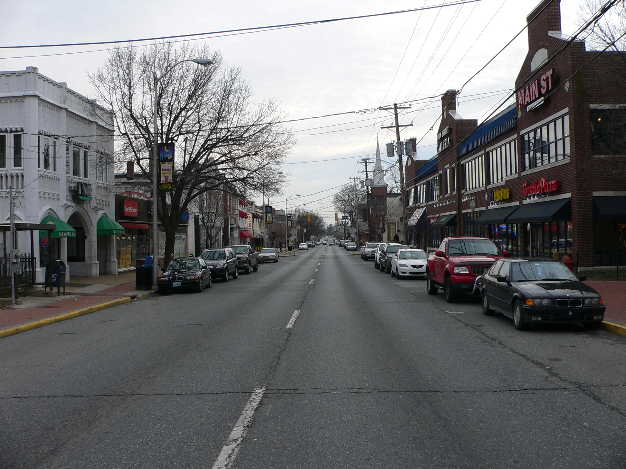
 DE 273 eastbound on Main Street in Newark.
Delaware Route 273 heads east from the Maryland border on Nottingham Road, passing through suburban neighborhoods to the west of downtown Newark. Approximately two miles east of the Delaware-Maryland line, Route 273 meets Delaware Route 896 and Delaware Route 2 Business and splits into Main Street (westbound) and Delaware Avenue (eastbound) in downtown Newark as it passes through the campus of the University of Delaware along with DE 2 Bus. On the eastern edge of Newark, the route meets Delaware Route 2 and Delaware Route 72. At this intersection, DE 2 Bus ends and DE 273 becomes the four-lane, divided Ogletown Road. DE 273 is a divided highway with a speed limit of 50 mph (80 km/h) from just east of the Newark city limits all the way to Hares Corner.[1][2]
During this stretch, Route 273 passes through many suburban areas. It first heads through industrial areas to the east of Newark and then crosses over the Amtrak Northeast Corridor and features an interchange with Delaware Route 4 in Ogletown and it becomes Christiana Road. It then heads southeast and is served by an interchange with Interstate 95, the Delaware Turnpike. DE 273 then bypasses the center of the community of Christiana to the southwest and then intersects Delaware Route 7. Immediately after that intersection, it features a diamond interchange with Delaware Route 1, a tolled highway that goes south to Dover (explaining why I-95 exit 3A, Route 273 East, is labeled as a route to Dover).[1][2]
 DE 273 eastbound approaching DE 37
DE 273 continues east and intersects the southern terminus of Delaware Route 37 in Pleasantville. It then intersects the eastern terminus of Delaware Route 58 near the New Castle Airport. Shortly after, the route crosses the Dupont Parkway (U.S. Routes 13 and 40) in Hares Corner. Route 273 turns into two-lane Frenchtown Road and heads east through business parks. It then meets Delaware Route 9 and the southern terminus of Delaware Route 141 just to the west of New Castle, where the route officially ends. At this intersection, DE 273 signage continues east along DE 9, which heads east toward the town of New Castle, which is Delaware's colonial capital, on Delaware Street. Before reaching the New Castle Historic District, the two routes make a left turn onto Ferry Cut Off Street. Route 273's signed eastern terminus is at Sixth Street, roughly a quarter mile away from the banks of the Delaware River. DE 9 makes a left turn to head north on Sixth Street, heading toward Wilmington.[1][2]
History
What is now DE 273 originally existed as a county road by 1920.[3] By 1924, the portion of road through Newark was upgraded to a state highway while the road was paved between Hares Corner and New Castle.[4] A year later, the section between Ogletown and Christiana was planned as a state highway while the section east of Basin Road was upgraded to a state highway.[5] By 1931, US 40 was designated to run on the portion of road between Hares Corner and New Castle, where it connected to a ferry across the Delaware River to Pennsville, New Jersey. Also by this time, all of present-day DE 273 was upgraded to a state highway except the portion of US 40 between Hares Corner and Basin Road.[6] When Delaware first designated state highways by 1936, DE 273 was designated to run from the Maryland border west of Newark east to US 13 and US 40 in Hares Corner, roughly following its current alignment.[7] By 1952, US 40 was realigned to use the Delaware Memorial Bridge to cross the Delaware River, and DE 273 was extended east along the former alignment of US 40 to end at present-day DE 9 in New Castle.[8] By 1984, DE 9 was realigned to follow DE 273 east of the DE 141 intersection.[9] DE 273 was realigned to bypass Christiana by 1985.[10] By 1997, DE 273 was moved to its current alignment in the Ogletown area, eliminating a short concurrency with DE 4 and involving the construction of an interchange with that route.[11]
Major intersections
The entire route is in New Castle County.
Location Mile[1] Road Notes Newark 0.00 MD 273 west (Telegraph Road)Maryland state line, western terminus 1.91 


 DE 2 Bus. west / DE 896 (Elkton Road) to I-95
West end of DE 2 Bus. overlap 3.09  DE 2 west / DE 72 south (Library Avenue)
West end of eastbound overlap with DE 2/DE 72 3.29 DE 2 east / DE 72 north (Capitol Trail)East end of eastbound overlap with DE 2/DE 72 Ogletown DE 4 (Ogletown Road) – South Newark, Churchmans CrossingInterchange Christiana 6.87 I-95 – Delaware Memorial Bridge, Wilmington, Newark, BaltimoreInterchange 8.50 DE 7 (Main Street) DE 1 to US 13 – Churchmans Crossing, DoverInterchange 9.38  DE 37 north (Airport Road)
Hares Corner 10.85  DE 58 west (Churchmans Road)
11.21 
US 13 / US 40 / DE 9 Truck south (Dupont Parkway)West end of DE 9 Truck overlap New Castle 12.56 DE 9 (Washington Street/Delaware Street) / DE 141 north (Basin Road)Eastern terminus 1.000 mi = 1.609 km; 1.000 km = 0.621 mi See also
 U.S. Roads portal
 Delaware portal
References
- ^ a b c d e http://www.deldot.gov/information/pubs_forms/manuals/traffic_counts/2006/pdf/rpt_pgs1_38_rev.pdf DelDOT 2006 Traffic Count and Mileage Report
- ^ a b c Google, Inc. Google Maps – overview of Delaware Route 273 (Map). Cartography by Google, Inc. http://maps.google.com/maps?f=d&source=s_d&saddr=DE+273+and+MD+273&daddr=DE+273+and+DE+9&hl=en&geocode=FTOzXQIdz457-ykhF3FD66vHiTGXvQL84zTUfQ%3BFdg6XQIddfx--ylfIYVqcgPHiTGpk4IiETccpg&mra=ls&sll=39.611215,-75.71771&sspn=0.241217,0.676346&ie=UTF8&t=h&z=12. Retrieved February 7, 2011.
- ^ Delaware Department of Transportation (PDF). Delaware Official Highway Map (Map) (1920 ed.). http://www.deldot.gov/archaeology/historic_pres/historic_highway_maps/pdf/cd_002.pdf. Retrieved April 15, 2010.
- ^ Delaware Department of Transportation (PDF). Delaware Official Highway Map (Map) (1924 ed.). http://www.deldot.gov/archaeology/historic_pres/historic_highway_maps/pdf/cd_003.pdf. Retrieved August 1, 2010.
- ^ Delaware Department of Transportation (PDF). Delaware Official Highway Map (Map) (1925 ed.). http://www.deldot.gov/archaeology/historic_pres/historic_highway_maps/pdf/cd_004.pdf. Retrieved August 19, 2010.
- ^ Delaware Department of Transportation (PDF). Delaware Official Highway Map (Map) (1931 ed.). http://www.deldot.gov/archaeology/historic_pres/historic_highway_maps/pdf/cd_005.pdf. Retrieved 2010-08-19.
- ^ Delaware Department of Transportation (PDF). Delaware Official Highway Map (Map) (1936/37 ed.). http://www.deldot.gov/archaeology/historic_pres/historic_highway_maps/pdf/cd_008.pdf. Retrieved April 15, 2010.
- ^ Delaware Department of Transportation (PDF). Delaware Official Highway Map (Map) (1952/53 ed.). http://www.deldot.gov/archaeology/historic_pres/historic_highway_maps/pdf/cd_026.pdf. Retrieved February 7, 2011.
- ^ Delaware Department of Transportation (PDF). Delaware Official Highway Map (Map) (1984 ed.). http://www.deldot.gov/archaeology/historic_pres/historic_highway_maps/pdf/cd_062.pdf. Retrieved February 5, 2011.
- ^ Delaware Department of Transportation (PDF). Delaware Official Highway Map (Map) (1985 ed.). http://www.deldot.gov/archaeology/historic_pres/historic_highway_maps/pdf/cd_060.pdf. Retrieved April 15, 2010.
- ^ Delaware Department of Transportation (PDF). Delaware Official Highway Map (Map) (1997 ed.). http://www.deldot.gov/archaeology/historic_pres/historic_highway_maps/pdf/cd_056.pdf. Retrieved February 7, 2011.
Road transportation infrastructure of the metro Philadelphia area Interstates U.S. Routes Pennsylvania Routes New Jersey Routes Delaware Routes Named roads/streets Benjamin Franklin Parkway · Broad Street · City Avenue · Front Street · Girard Avenue · Market Street · Roosevelt Boulevard · South Street · Chestnut Street · Walnut Street
Pennsylvania Turnpike · New Jersey Turnpike · Delaware Turnpike · Atlantic City Expressway · Schuylkill Expressway · Delaware Expressway · Blue Route · Vine St Expressway · North South Freeway · Lancaster Avenue · Bethlehem Pike · Baltimore Pike · Black Horse PikeBridges Delaware Memorial Bridge · Commodore Barry Bridge · Walt Whitman Bridge · Ben Franklin Bridge · Betsy Ross Bridge · Tacony–Palmyra Bridge · Burlington–Bristol Bridge · Delaware River – Turnpike Toll BridgeCategories:- State highways in Delaware
- Transportation in New Castle County, Delaware


Wikimedia Foundation. 2010.