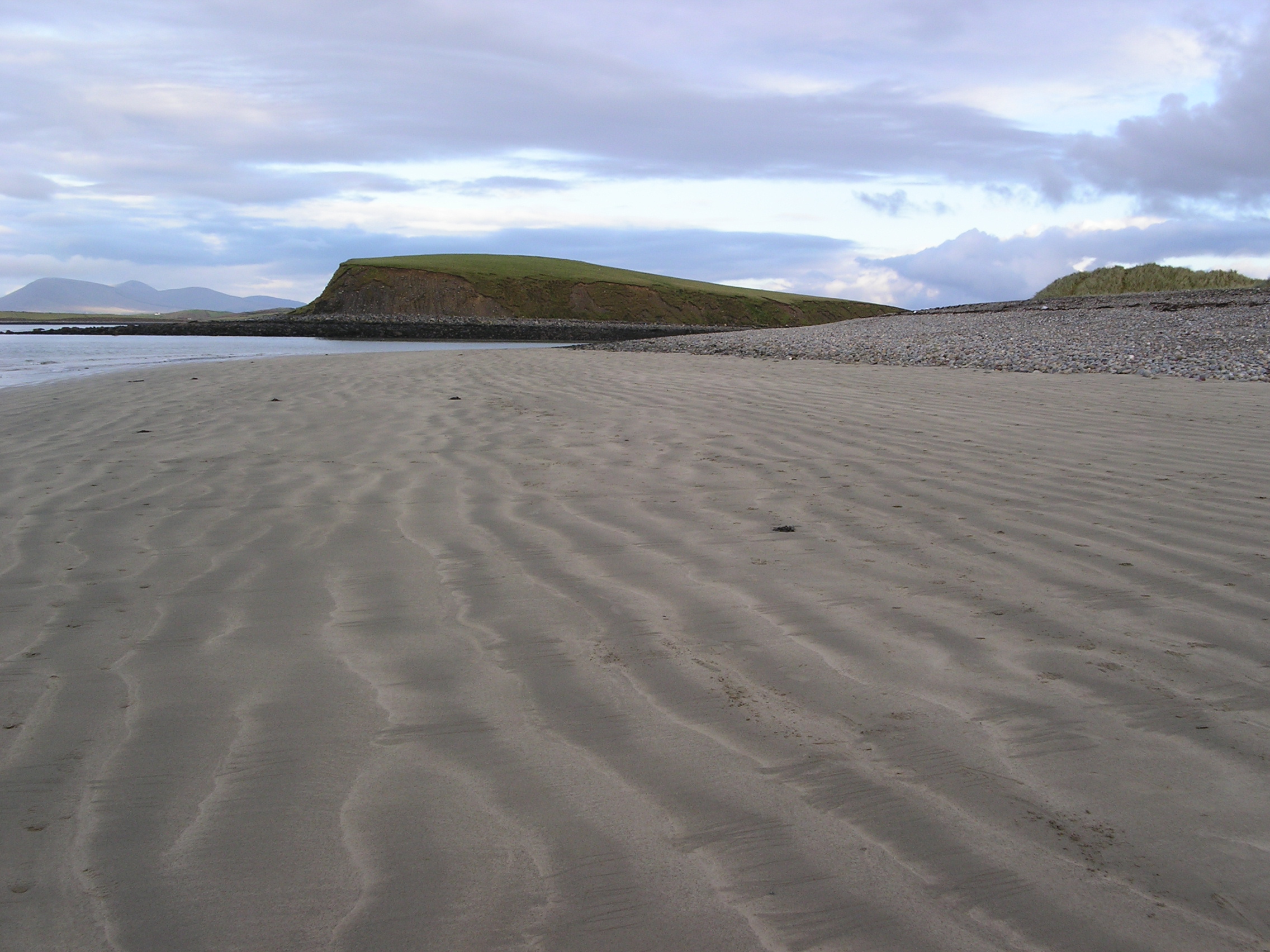
- Drumlin
-
For the band, see Drumlin (band).
 Elongate and forested drumlins south of Puerto Williams, Chile. Flow direction here was at time of formation from west to east (left to right on picture).

A drumlin, from the Irish word droimnín ("little ridge"), first recorded in 1833, is an elongated whale-shaped hill formed by glacial ice acting on underlying unconsolidated till or ground moraine.
Contents
Drumlin formation
 Drumlin at Withrow Moraine and Jameson Lake Drumlin Field National Natural Landmark, Washington state. The glacier flowed from left to right.
Drumlins and drumlin clusters are glacial landforms which have been extensively studied. Geologists have proposed several theories about their origin. They are formed a short distance within the receding glacier ice and record the final direction of ice movement.[1] Drumlins occur in symmetric, spindle, parabolic, and transverse asymmetrical forms. Drumlins are commonly found with other major glacially-formed features and are related on a regional scale to these landforms. The large-scale patterns of these features exhibit spatial organization of the drumlin-forming flows with related tunnel valleys, eskers, scours, and exposed bedrock erosion (scalloping and sichelwannen).[2]
Although one formation theory originally proposed since the 1980s by John Shaw and collaborators postulates drumlin creation by a catastrophic flooding release of highly pressurized water flowing underneath the glacial ice,[3] the recent retreat of a marginal outlet glacier of Hofsjökull in Iceland[4] provided the opportunity for direct study of a drumlin field with formation of >50 drumlins ranging from 90–320 m (300–1,050 ft) in length, 30–105 m (98–344 ft) in width, and 5–10 m (16–33 ft) in height. This, when combined with drumlin formation identified through imaging beneath the West Antarctica ice, resulted in a significant step in geomorphologic understanding. The Hofsjökull marginal drumlins formed through a progression of subglacial depositional and erosional processes with each horizontal till bed within the drumlin created by an individual surge of the glacier.[5] Erosion under the glacier in the immediate vicinity of the drumlin can be on the order of a meter's depth of sediment per year, with the eroded sediment forming a drumlin as it is repositioned and deposited.[6]
Geomorphology
A drumlins long axis is parallel with the movement of the ice it is roughly symmetrical around the long axis.[7] Drumlins are typically 1–2 km (0.62–1.2 mi) long, less than 50 m (160 ft) high and between 300 to 600 metres (980–2,000 ft) wide. Drumlins generally have a consistent ratio of 2:3.5 width to length dimensions. Drumlins are often in drumlin fields of similarly shaped, sized and oriented hills. Drumlins usually have layers indicating that the material was repeatedly added to a core, which may be of rock or glacial till. The composition of drumlins varies depending on the area in which they are found, and can consist of similar material to the till of the surrounding moraine or be composed almost entirely of bedrock, sand and gravel or various mixtures thereof.
Many Pleistocene drumlin fields are observed to occur in a fan-like distribution.[8] The Múlajökull drumlins are also arrayed in a splayed fan distribution around an arc of 180°.[5]
Soil development on drumlins
Drumlin soil is variable but on recently-formed drumlins often consists of a thin A soil horizon (often referred to as "'topsoil'" which accumulated after formation) and a thin Bw horizon (commonly referred to as "'subsoil'"). The C horizon, which shows little evidence of being affected by soil forming processes (weathering), is close to the surface, and may be at the surface on an eroded drumlin. Below the C horizon the drumlin consists of multiple beds of till deposited by lodgment and bed deformation. On drumlins with longer exposure (e.g. in the Lake Ontario drumlin field in New York State) soil development is more advanced, for example with the formation of clay-enriched Bt horizons.[5]
Examples of drumlins
 Drumlin Field in Eastern New York state. The drumlins align with glacial flow.
Europe
The retreat of Icelandic glacier Múlajökull, which is an outlet glacier of Hofsjökull, recently exposed a 50 drumlin cluster, which serves as the basis for improved understanding of drumlin formation.[5]
The literature also documents extensive drumlin fields in Scotland, England[9], Switzerland[10], Poland, Estonia, Sweden, around Lake Constance north of the Alps, County Monaghan, County Mayo, County Cavan, County Fermanagh and County Down in Ireland, Germany, Hindsholm in Denmark, Finland and Greenland.[9]
Clew Bay in Ireland is a good example of a 'drowned drumlin' landscape where the drumlins appear as islands in the sea, forming a 'basket of eggs' topography. Drumlins are typically aligned parallel to one another, usually clustered together in numbers reaching the hundreds or even thousands. These clusters can sometimes lead to the natural emergence and growth of complex water systems.
North America
Drumlins are common in Upstate New York[11], the lower Connecticut River valley, eastern Massachusetts, the Monadnock Region of New Hampshire, Minnesota,[9] and Wisconsin. Drumlins, which are usually found in swarms or large groups, occur in every Canadian province and territory. Swarms of thousands of drumlins are found in Southern Ontario, Douro-Dummer, Ontario, the Thelon Plan of the Northwest Territories, Alberta, Nunavut and Nova Scotia.[12] The majority of those observed in North America were formed during the Wisconsin glaciation.
The islands of Boston Harbor Islands National Recreation Area are drumlins that became islands when sea levels rose as the glaciers melted.
Asia
Drumlins are found at Tiksi, Sakha Republic, Russia.[9]
South America
Extensive drumlin fields are found in Patagonia,[9] for example near Punta Arenas Carlos Ibáñez del Campo Airport and on Navarino and Gable Island in the Beagle Channel.
Antarctica
In 2007 drumlins were observed while forming beneath the ice of a West Antarctica glacier.[13]
See also
- Landform
- Glacial landforms
- Crag and tail, a similar formation, with a more resilient core (generally composed of igneous or metamorphic rock)
- Lincoln Hills
- Ribbed moraines
- Roche moutonnée
- Sediment
Supplemental Bibliography
- Tarbuck, Edward J.; Frederick K. Lutgens (2002). Earth: An Introduction to Physical Geography. Upper Saddle River, New Jersey: Prentice Hall. pp. 347–350. ISBN 0-13-092025-8.
- Trenhaile, Alan (2007). Geomorphology: A Canadian Perspective. Don Mills, Ontario: Oxford University Press. pp. 183–6. ISBN 0-19-542474-3.
- Easterbrook, Don J. (1999). Surface Processes and Landforms, 2nd Edition. Upper Saddle River, New Jersey: Prentice Hall. pp. 347–350. ISBN 0-13-860958-6.
- Grotzinger, John; Jordan, Tom (2010). Understanding Earth; 6th Edition. New York, NY: W.H. Freeman and Company. pp. 586. ISBN 978-1-4292-1951-8.
References and Footnotes
- ^ Dyke, A. S.; Morris, T. F. (1988). "DRUMLIN FIELDS, DISPERSAL TRAINS, and ICE STREAMS IN ARCTIC CANADA". The Canadian Geographer/Le Géographe canadien 32: 86. doi:10.1111/j.1541-0064.1988.tb00860.x.
- ^ Shaw, J.; Kvill, D. (1984). "A glaciofluvial origin for drumlins of the Livingstone Lake area, Saskatchewan". Canadian Journal of Earth Sciences 21: 1442. doi:10.1139/e84-150.
- ^ http://www.uofaweb.ualberta.ca/water//pdfs/ShawQuatInt.pdf Shaw, John, The meltwater hypothesis for subglacial bedforms, Quaternary International 90 (2002) 5–22
- ^ A satellite image of the region of Hofsjökull where drumlin growth has been observed (see 64°39′25″N 18°41′41″W / 64.65694°N 18.69472°W). The drumlins can be observed between pools of water.
- ^ a b c d Johnson, M. D.; Schomacker, A.; Benediktsson, I. O.; Geiger, A. J.; Ferguson, A.; Ingolfsson, O. (2010). "Active drumlin field revealed at the margin of Mulajokull, Iceland: A surge-type glacier". Geology 38 (10): 943. doi:10.1130/G31371.1.
- ^ Clark, C. D.; Hughes, A. L. C.; Greenwood, S. L.; Spagnolo, M.; Ng, F. S. L. (2009). "Size and shape characteristics of drumlins, derived from a large sample, and associated scaling laws". Quaternary Science Reviews 28: 677. Bibcode 2009QSRv...28..677C. doi:10.1016/j.quascirev.2008.08.035.
- ^ M.Spagnolo, C.D. Clark, A.L.C. Hughes, P. Dunlop & C.R. Stokes (2010) The planar shape of drumlins Sedimentary Geology 232, 119-129
- ^ Patterson, C.J., and Hooke, R.L., 1995, Physical environment of drumlin formation: Journal of Glaciology, v. 41, p. 30–38.
- ^ a b c d e Clark, C.D.; Anna L.C. Hughes, Sarah L. Greenwood, Matteo Spagnolo, Felix S.L. Ng (2009). Quaternary Science Reviews (Elsevier Ltd.) 28: 677–692. doi:10.1016/j.quascirev.2008.08.035.
- ^ Fiore, J. (2007). "Quaternary subglacial processes in Switzerland: geomorphology of the plateau and seismic stratigraphy of western Lake Geneva". Terre & Environnement (University of Geneva) 69: 169. http://archive-ouverte.unige.ch/unige:714.
- ^ Kerr, Michael; Nick Eyles. "Origin of drumlins on the floor of Lake Ontario and in upper New York State". Sedimentary Geology (Elsevier) (193): 7–20. http://www.elsevier.com/locate/sedgeo.
- ^ Gray, Charlotte; The Museum Called Canada: 25 Rooms of Wonder, Random House, 2004 ISBN 978-0679312208
- ^ Smith, A.M., Murray, T., Nicholls, K.W., Makinson, K., Aðalgeirsdóttir, G., Behar, A.E., and Vaughan, D.G., 2007, Rapid erosion, drumlin formation, and changing hydrology beneath an Antarctic ice stream: Geology, v. 35, p. 127– 130, doi: 10.1130/G23036A.1.
External links
- Diagrams of an idealized drumlin
- Drumlin field, northwestern Manitoba, image from Geological Survey of Canada Canadian Landscapes Photo Collection
- Word of the day defines drumlin.
Glaciers Types of glaciers - Cirque glacier
- Ice cap
- Ice field
- Ice sheet
- Ice shelf
- Ice stream
- Outlet glaciers
- Rock glaciers
- Valley glaciers
- Ledoyom (Ice body)
Anatomy Processes Measurements Glaciovolcanic relations Glacial landforms Erosional- Arête
- Cirque
- Crag and tail
- Fjord
- Glacial horn
- Glacial striae
- Hanging valley
- Ribbon lake
- Roche moutonnée
- Tunnel valley
- U-valley
Depositional- Drumlin
- Drumlin field
- Erratic block
- Moraine
- Pulju moraine
- Rogen moraine
- Terminal moraine
- Till plain
- Veiki moraine
Glacifluvial- Esker
- Kame
- Kame delta
- Kettle hole
- Outwash fan
- Sandur
- Giant current ripples
- Diluvium
- Glaciology
- Category:Glaciers
Categories:


Wikimedia Foundation. 2010.