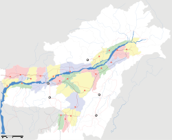
Dhekiajuli

Dhekiajuli
Dhekiajuli
—  city  —
Dhekiajuli
Location of Dhekiajuli
in Assam and India
Coordinates 26°42′N 92°30′E / 26.7°N 92.5°E / 26.7; 92.5Coordinates: 26°42′N 92°30′E / 26.7°N 92.5°E / 26.7; 92.5
Country India
State Assam
District(s) Sonitpur
Population 19,743 (2001)
Time zone IST (UTC+05:30)
Area

Elevation


100 metres (330 ft)

Dhekiajuli is a city and a municipal board in Sonitpur district in the state of Assam, India.

Contents

Geography

Dhekiajuli is located at 26°42′N 92°30′E / 26.7°N 92.5°E / 26.7; 92.5.[1] It has an average elevation of 100 metres (328 feet). There are several tea estates in its vicinity. Some of the major ones include Sapoi, Julia, Dibrudarrang, Tinkhuria and Dhekiajuli TE, Panbari TE (Kanoi Groups of Co.)etc. It is also very close to the Orang National Park.

Demographics

As of 2001 India census,[2] Dhekiajuli had a population of 19,743. Males constitute 53% of the population and females 47%. Dhekiajuli has an average literacy rate of 74%, higher than the national average of 59.5%: male literacy is 79% and, female literacy is 69%. In Dhekiajuli, 10% of the population is under 6 years of age. The town is a fairly active commercial place, thanks largely to the presence of several tea estates in its vicinity.

Politics

Dhekiajuli is part of Tezpur (Lok Sabha constituency).[3]

References


Wikimedia Foundation. 2010.

Игры ⚽ Поможем написать реферат

Look at other dictionaries:

  • Dhekiajuli — Original name in latin Dhekiajuli Name in other language Dhekiajuli State code IN Continent/City Asia/Kolkata longitude 26.70367 latitude 92.47808 altitude 83 Population 21271 Date 2012 10 06 …   Cities with a population over 1000 database

  • List of India-related articles — Articles (arranged alphabetically) related to India or Indian culture include: NOTOC List of India related topics People are listed by their first names. 1231 SGM 3 STR 2002 Gujarat violence 2005 in India ( previous years ) 2004 Indian Ocean… …   Wikipedia

  • Tezpur — Infobox Indian Jurisdiction native name = Tezpur | type = city | latd = 26.63 | longd = 92.8 locator position = left | state name = Assam district = Sonitpur leader title = leader name = altitude = 48 population as of = 2001 population total = 58 …   Wikipedia

  • List of accredited colleges in Assam — Accredited colleges of higher education in Assam include those accredited by the National Assessment and Accreditation Council (NAAC) of India. NAAC accredits approximately 200 colleges in the state, including:*Abhayapuri College, Abhayapuri… …   Wikipedia

  • Tezpur (Lok Sabha constituency) — Tezpur is a Lok Sabha constituency in Assam. Assembly segmentsTezpur Lok Sabha constituency is composed of the following assembly segments [cite web url = http://archive.eci.gov.in/se2001/background/S03/AS ACPC.pdf title = List of Parliamentary… …   Wikipedia

  • Udalguri district — is one of the 27 districts of Assam state in north eastern India. Udalguri town is the headquarters of the district. This district is bounded by Bhutan and West Kameng district of Arunachal Pradesh state in the north, Sonitpur district in the… …   Wikipedia

  • List of cities and towns in India — This is a list of cities in India whose population is above 20,000. According to Census 2001 data cities and towns are broadly classified as: Class I – Population greater than 100,000 Class II – Population between 80,000 – 99,999 Class III –… …   Wikipedia

  • Index of India-related articles — Articles (arranged alphabetically) related to India or Indian culture include: List of India related topics Contents: Top · 0–9 A B C D E F G H I J K L M N O P Q R S T U V W X Y Z People are listed by their first names …   Wikipedia

Share the article and excerpts

Direct link
Do a right-click on the link above
and select “Copy Link”