Maltahöhe

Maltahöhe
Maltahöhe
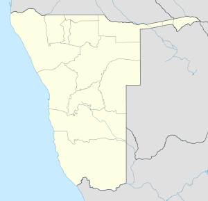
Maltahöhe is located in Namibia
Maltahöhe
Location in Namibia
Coordinates: 24°50′S 16°59′E / 24.833°S 16.983°E / -24.833; 16.983
Country  Namibia
Region Hardap Region
Time zone South African Standard Time (UTC+1)

Maltahöhe is a village in Namibia, about 110 km west of Mariental in the Hardap Region.

The settlement has about 2,400 inhabitants. Maltahöhe got its name from the German Hauptmann Henning von Burgsdorf who supervised a police station of the German colonial administration there in 1895. He named the place after his wife Malta. The Maltahöhe Hotel was founded in 1907 and is therefore the oldest country hotel in Namibia.[citation needed] The town is a centre for sheep farming and provides supply for surrounding farms. It lies close to The Swartrand escarpment.

Near the town of Maltahöhe lies Duwisib Castle.

Coordinates: 24°50′S 16°59′E / 24.833°S 16.983°E / -24.833; 16.983


Wikimedia Foundation. 2010.

Игры ⚽ Нужно сделать НИР?

Look at other dictionaries:

  • Maltahöhe — es un pueblo en Namibia, al oeste de Mariental en la Región de Hardap. Maltahöhe está situado a 24° 50 South, 16° 58 East. Coordenadas: 24°50′S 16°59′E /  24.833 …   Wikipedia Español

  • Maltahöhe — Dieser Artikel wurde im Portal Namibia zur Verbesserung eingetragen. Hilf mit, ihn zu bearbeiten und beteilige dich an der Diskussion! Vorlage:Portalhinweis/Wartung/Namibia …   Deutsch Wikipedia

  • Maltahohe — Original name in latin Maltahhe Name in other language Maltahohe, Maltahhe State code NA Continent/City Africa/Windhoek longitude 24.83333 latitude 16.98333 altitude 1348 Population 2329 Date 2012 01 17 …   Cities with a population over 1000 database

  • Maltahöhe Railway Station — is a railway station serving the town of Maltahöhe in Namibia. It is part of the TransNamib Railway, and is located along the Windhoek to Upington line that connects Namibia with South Africa …   Wikipedia

  • Maltahoehe — Wappen Karte Basisdaten Staat …   Deutsch Wikipedia

  • Liste der Krankenhäuser in Namibia — Dies ist eine Liste der Krankenhäuser, Gesundheitszentren und Kliniken in Namibia. Das Gesundheitssystem in Namibia wird vom Ministerium für Gesundheit und Soziale Dienste (englisch Ministry of Health Social Services) koordiniert und… …   Deutsch Wikipedia

  • Flughäfen in Namibia — Eine B747 der Air Namibia auf dem Flughafen Windhoek Hosea Kutako Dies ist eine Liste der Flughäfen in Namibia. Der Luftverkehr spielt aufgrund der Größe und Weite des Landes eine herausragende Rolle im Transport in Namibia. Es wird zwischen… …   Deutsch Wikipedia

  • Kameeta — Zephania Kameeta (* 7. August 1945 in Otjimbingwe) ist ein namibischer Politiker und Befreiungstheologe. Seit dem 20. Januar 2002 ist er Bischof der Evangelical Lutheran Church in the Republic of Namibia (ELCRN), der mit etwa 350.000 Mitgliedern… …   Deutsch Wikipedia

  • Evangelisch-Lutherische Kirche in Namibia (DELK) — Basisdaten Fläche: 824.292 km² Bischof: Erich Hertel Mitgliedschaft: LWB, Weltkirchenrat, Union der Lutherischen Kirchen im Südlichen Afrika, Lutherische Kommunion im Südlichen Afrika[1], Ver …   Deutsch Wikipedia

  • Nubibberge — p1p3 Nubibberge die Nubibberge zwischen Hammerstein und Maltahöhe Lage …   Deutsch Wikipedia

Share the article and excerpts

Direct link
Do a right-click on the link above
and select “Copy Link”