- National parks of New Zealand
-
National Park, New Zealand is the name of a village and railway station near Tongariro National Park.
 Map of New Zealand with the national parks marked in green.
The national parks of New Zealand are 14 protected areas administered by the Department of Conservation[1] "for the benefit, use, and enjoyment of the public".[2] These are popular tourist destinations, with three-tenths of tourists visiting at least one national park during their stay in New Zealand.[3] Although the national parks contain some of New Zealand's most beautiful scenery, the first few established were all focused on mountain scenery. Since the 1980s the focus has been on developing a more diverse representation of New Zealand landscapes in the national parks.[4] New Zealand's national parks are all culturally significant; many also contain historic features.[5] Tongariro National Park, in particular, is one of 27 World Heritage Sites that is of both cultural and natural significance, while four of the South Island national parks form Te Wahipounamu, another World Heritage Site.
Contents
National Parks Act
The National Parks Act of 1980 was established in order to codify the purpose, governance and selection of national parks. It begins by establishing the definition of a national park:
It is hereby declared that the provisions of this Act shall have effect for the purpose of preserving in perpetuity as national parks, for their intrinsic worth and for the benefit, use, and enjoyment of the public, areas of New Zealand that contain scenery of such distinctive quality, ecological systems, or natural features so beautiful, unique, or scientifically important that their preservation is in the national interest.
— National Parks Act 1980, Part 1, section 4, subsection 1[6]
The National Parks Act goes on to state that the public will have freedom of entry and access to the parks, though this is subject to restrictions to ensure the preservation of native plants and animals and the welfare of the parks in general. Access to specially protected areas (550 km²) constituted under the act is by permit only. Under the Act, national parks are to be maintained in their natural state as far as possible to retain their value as soil, water and forest conservation areas. Native plants and animals are to be preserved and introduced plants and animals removed if their presence interferes with the natural wildlife. Development in wilderness areas established under the act is restricted to foot tracks and huts used for wild animal control or scientific research.
Services available for public use
The Act allows the Department of Conservation to provide hostels, huts, camping grounds, ski tows and similar facilities, parking areas, roading and tracks within the parks. In addition to these, the department also provides some accommodation, transport and other services at entry points to the parks, but these are also offered by other government agencies, voluntary organisations and private firms. More comprehensive services within the parks, such as guided walks and skiing tutorials, are privately provided with concessions from the department.
List of national parks

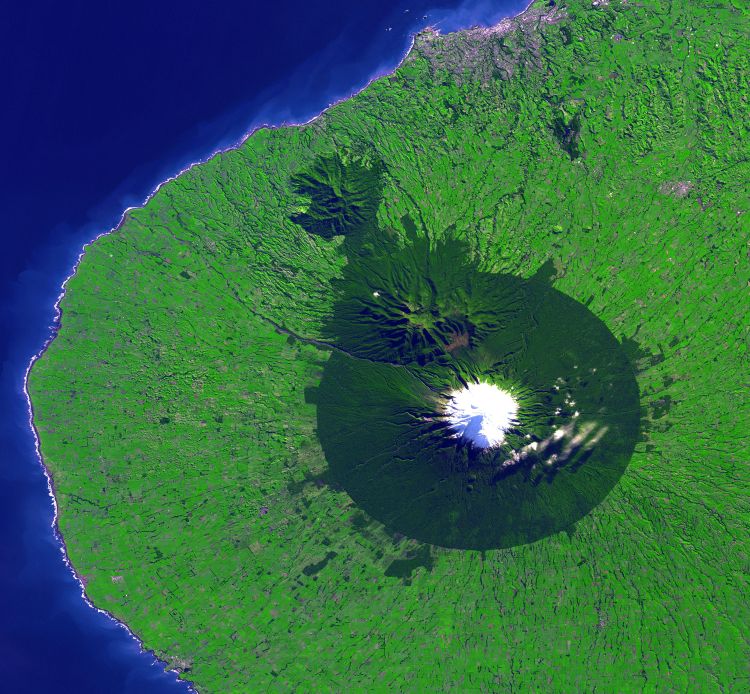
 Satellite photo of Egmont National Park (the forested area).

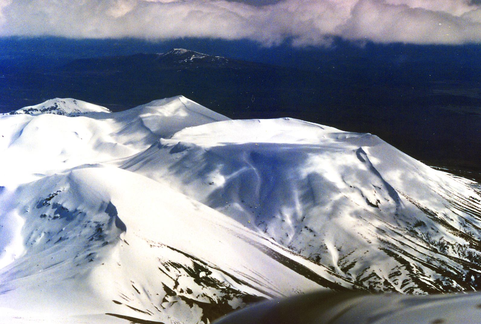
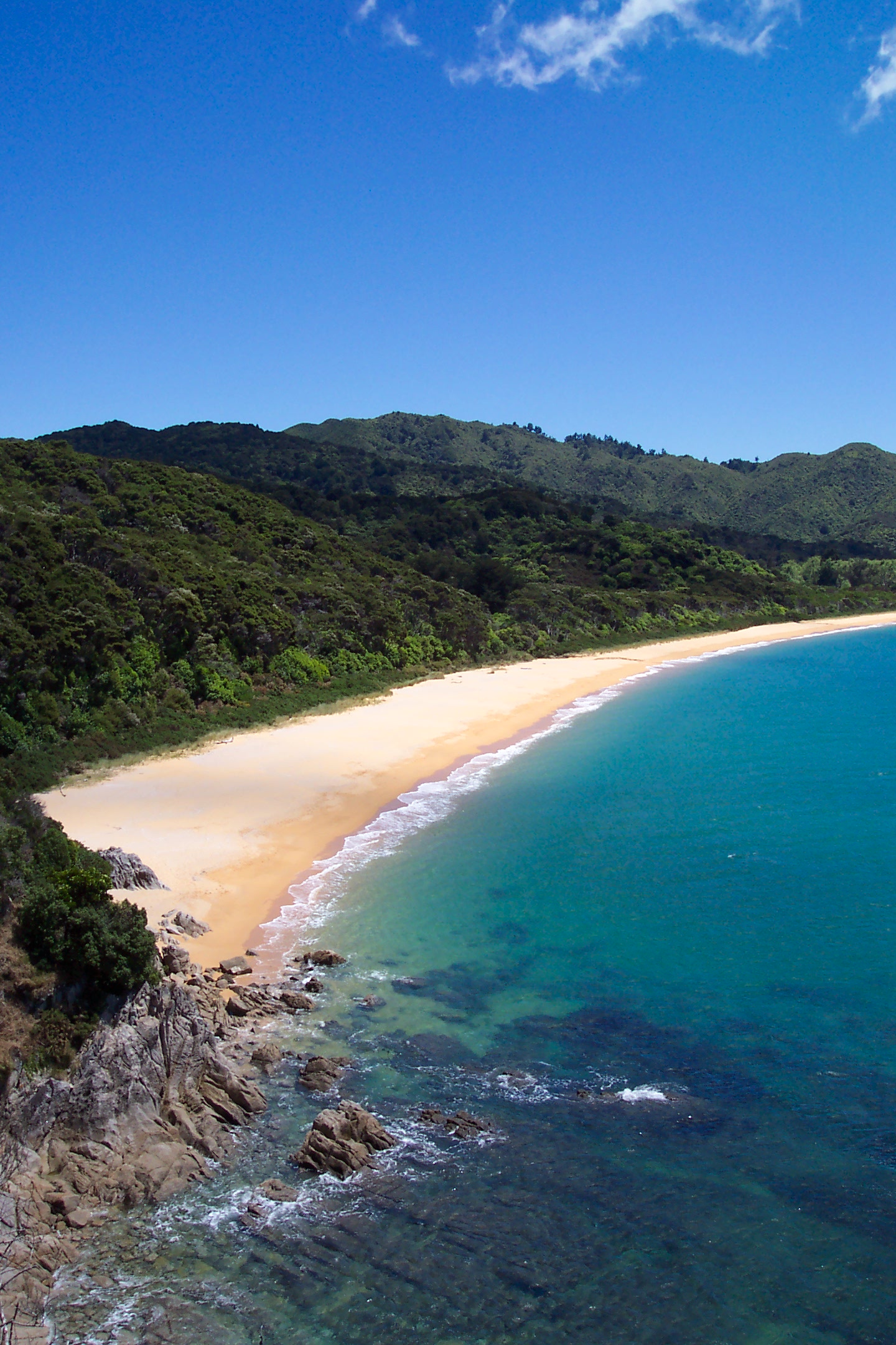
National Park Area Established Location Description Te Urewera National Park 2,127 km² 1954 38°45′S 117°9′E / 38.75°S 117.15°E Together with neighbouring Whirinaki Forest Park, Te Urewera is the largest remaining stand of native forest in the North Island. Lake Waikaremoana, within the park, is noted for its scenic shoreline. Tongariro National Park* 796 km² 1887 39°12′S 175°35′E / 39.2°S 175.58333°E New Zealand's first national park, recognised as one of the 27 World Heritage Sites that are of both outstanding natural and cultural value. Gifted to the Crown by Te Heuheu Tūkino IV, the park includes several sacred Māori sites and three active volcanoes, Ruapehu, Ngauruhoe and Tongariro. Egmont National Park 335 km² 1900 39°16′S 174°6′E / 39.26667°S 174.1°E This park comprises the land about a nine-kilometre radius of Mount Taranaki/Egmont and some outlying areas to the north. The symmetrical cone of the dormant volcano is a provincial landmark. Whanganui National Park 742 km² 1986 39°35′S 175°5′E / 39.58333°S 175.08333°E Bordering the Whanganui River, it incorporates areas of Crown land, former state forest and a number of former reserves. Abel Tasman National Park 225 km² 1942 40°50′S 172°54′E / 40.83333°S 172.9°E The smallest national park, this popular tourist destination has numerous tidal inlets and beaches of golden sand along the shores of Tasman Bay. "Doing the Abel Tasman" as a tramping or kayaking journey is a popular activity. Kahurangi National Park 4,520 km² 1996 41°15′S 172°7′E / 41.25°S 172.11667°E Situated in the north-west of the South Island, Kahurangi contains spectacular and remote country, including the well-used Heaphy Track. Ancient landforms and unique flora and fauna add to the value of New Zealand's second largest national park. Nelson Lakes National Park 1,018 km² 1956 41°49′9″S 172°50′15″E / 41.81917°S 172.8375°E A rugged, mountainous area in Nelson Region. It extends southwards from the forested shores of Lake Rotoiti and Rotoroa to the Lewis Pass National Reserve. Paparoa National Park 306 km² 1987 42°5′S 171°30′E / 42.08333°S 171.5°E On the West Coast of the South Island between Westport and Greymouth. It includes the celebrated Pancake Rocks at Punakaiki. Arthur's Pass National Park 1,144 km² 1929 42°57′S 171°34′E / 42.95°S 171.56667°E A rugged and mountainous area straddling the main divide of the Southern Alps. Westland Tai Poutini National Park* 1,175 km² 1960 43°23′S 170°11′E / 43.38333°S 170.18333°E Extends from the highest peaks of the Southern Alps to a wild remote coastline. Included in the park are glaciers, scenic lakes and dense rainforest, as well as remains of old gold mining towns along the coast. Aoraki/Mount Cook National Park* 707 km² 1953 43°44′S 170°6′E / 43.73333°S 170.1°E An alpine park, containing New Zealand's highest mountain, Aoraki/Mount Cook (3,754 m) and its longest glacier, Tasman Glacier (29 km). A hotspot for mountaineering, ski touring and scenic flights, the park is an area of outstanding natural beauty. Mount Aspiring National Park* 3,555 km² 1964 44°23′S 168°44′E / 44.38333°S 168.73333°E A complex of impressively glaciated mountain scenery centred on Mount Aspiring/Tititea (3,036 m), New Zealand's highest peak outside of the main divide. Fiordland National Park* 12,519 km² 1952 45°25′S 167°43′E / 45.41667°S 167.71667°E The largest national park in New Zealand and one of the largest in the world, the park covers the southwest corner of the South Island. The grandeur of its scenery, with its deep fiords, its glacial lakes, its mountains and waterfalls, make it a popular tourist destination. Rakiura National Park 1,500 km² 2002 46°54′S 168°7′E / 46.9°S 168.11667°E Covering about 85% of Stewart Island/Rakiura, this is the newest of the national parks. * – World Heritage Site or part thereof.
Proposed national park
The area centred on Waipoua Forest, north of Dargaville, has been proposed as a possible Kauri National Park. The area contains most of New Zealand's remaining kauri, including the largest known kauri, Tāne Mahuta. These stands of kauri are also valuable as havens for endangered species including the North Island Brown Kiwi.[7] This proposal is currently being investigated by the Department of Conservation.[8]
Mining concerns
In 2010 the New Zealand Government proposed removing some national park and conservation areas from Schedule 4 protection of the Crown Minerals Act which prohibits mining in those areas.[1] In July the government abandoned the proposal after receiving a large number of submissions, most of which opposed mining.
See also
- Protected areas of New Zealand
- List of national parks for other national parks around the world.
- Regional parks of New Zealand
- Forest parks of New Zealand
References
- ^ a b "Miners press to enter the green zone". The New Zealand Herald. 6 March 2010. http://www.nzherald.co.nz/pollution/news/article.cfm?c_id=281&objectid=10630166&pnum=0. Retrieved 26 March 2010.
- ^ "8. Benefit, Use and Enjoyment of the Public: General Policy for National Parks". doc.govt.nz. Department of Conservation. http://www.doc.govt.nz/publications/about-doc/role/policies-and-plans/general-policy-for-national-parks/8-benefit-use-and-enjoyment-of-the-public/. Retrieved 14 August 2010.
- ^ "International visitor numbers to larger national parks: Visitor statistics and research". doc.govt.nz. Department of Conservation. http://www.doc.govt.nz/about-doc/role/maps-and-statistics/visitor-statistics-and-research/national-parks-visitor-statistics/. Retrieved 14 August 2010.
- ^ "National Parks Act 1980: DOC's role". doc.govt.nz. Department of Conservation. http://www.doc.govt.nz/about-doc/role/legislation/national-parks-act/. Retrieved 14 August 2010.
- ^ "5. Historical and Cultural Heritage: General Policy for National Parks". doc.govt.nz. Department of Conservation. http://www.doc.govt.nz/publications/about-doc/role/policies-and-plans/general-policy-for-national-parks/5-historical-and-cultural-heritage/. Retrieved 14 August 2010.
- ^ Retrieved from http://www.legislation.govt.nz/act/public/1980/0066/10.0/096be8ed802f3e20.pdf on 21 August 2010
- ^ "Beehive — New Kauri National Park for Northland". beehive.govt.nz. http://www.beehive.govt.nz/release/new+kauri+national+park+northland. Retrieved 21 August 2010.
- ^ "Minister welcomes progress on Kauri National Park". Wellington, NZ: New Zealand Government. 11 February 2010. http://www.beehive.govt.nz/release/minister+welcomes+progress+kauri+national+park. Retrieved 12 February 2010.
External links
- National Park information at the Department of Conservation
- Kauri National Park proposal at the Department of Conservation
National parks of New Zealand North Island South Island Abel Tasman · Aoraki/Mount Cook · Arthur's Pass · Fiordland · Kahurangi · Mount Aspiring · Nelson Lakes · Paparoa · WestlandStewart Island Categories:- National parks of New Zealand
- Lists of national parks
- Lists of places in New Zealand


Wikimedia Foundation. 2010.