- Charles River Reservation
-
Charles River Basin Historic District
 The Esplanade
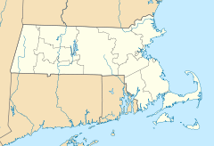

Location: Both banks of Charles River from Eliot Bridge to Charles River Dam, Cambridge, Massachusetts Coordinates: 42°21′46″N 71°6′28″W / 42.36278°N 71.10778°WCoordinates: 42°21′46″N 71°6′28″W / 42.36278°N 71.10778°W Area: 820 acres (330 ha) Built: 1893 Architect: Multiple Architectural style: Colonial Revival, Classical Revival, Moderne Governing body: State NRHP Reference#: 78000436[1] Added to NRHP: December 22, 1978 The Charles River Reservation is a 17-mile (27 km)-long Massachusetts state park located along the banks of the Charles River in Boston, Cambridge, Watertown, and Newton. The park is managed by the Department of Conservation and Recreation ("DCR"). The portion of the Reservation between the Charles River Dam and the Eliot Bridge is a Historic District. The portions of the Charles River above the Watertown Dam are managed as the Upper Charles River Reservation.
Features of the park include the Charles River Dam, the Charles River Basin and Esplanade, and John F. Kennedy Park, a small memorial park to the late president.
Contents
Charles River Dam
The 1978 Charles River Dam, located behind the TD Garden, controls the water level in the river basin. An earlier dam (see Charles River Dam Bridge), located beneath the Museum of Science, was completed in 1910 with the purpose of creating a fresh water river basin and riverfront park in Boston. The newly landscaped banks of the river became known as the Charles River Esplanade. The modern dam houses six pumps that provide flood control protection. The dam's lock system permits travel of recreational and commercial vessels from the river to the harbor year round. A fish ladder allows for passage of anadromous fish (alewife, rainbow smelt and shad) during the migration season in late spring.
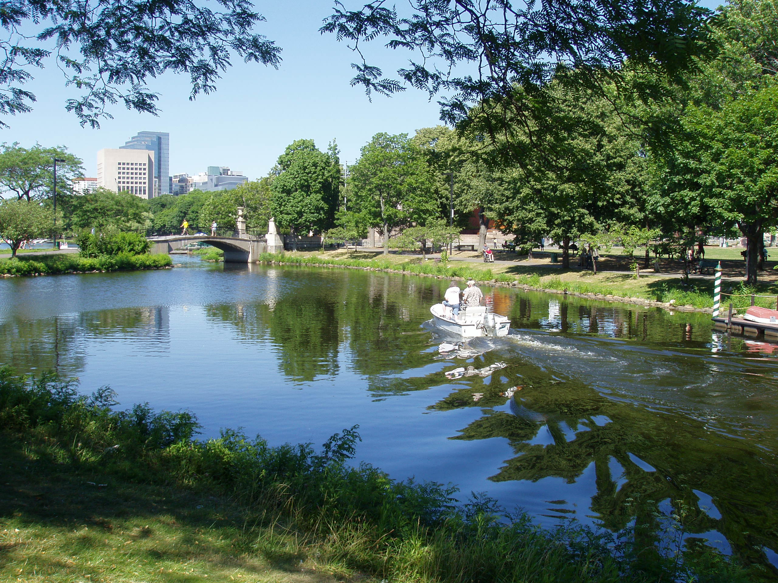
Charles River Basin and Esplanade
Created in the early 20th-century from tidal marshes and mud flats, the Charles River Basin was designed to provide city dwellers access to outstanding river scenery and recreational opportunities on both water and land. Though entirely designed—and in that sense artificial—the Basin is also a wildlife habitat for hundreds of animal and plant species that play a role in the ecology of the region and enrich the experience of urban park users. Water quality in the once heavily polluted Basin has improved dramatically in recent years, creating better habitat for wildlife and attracting people back to the river.
The character of the Basin changes along this 8.5-mile (13.7 km) stretch, forming three discernible zones: the Lower Basin, from the historic Charles River Dam to the Boston University Bridge; the Middle Basin, from the BU Bridge to Herter Park, and the Upper Basin, from Herter Park to the Watertown Dam. The Lower Basin is 2.5 miles (4.0 km) long and up to 2,000 feet (610 m) wide. The panoramas in the Lower Basin define the image of Boston and Cambridge. The Longfellow Bridge is a powerful presence in the Lower Basin, as are the slope of Beacon Hill and the gold dome of the State House. Particular park sections within the Reservation, such as Magazine Beach and Herter Park, provide intensely used open space for the bordering urban neighborhoods.
The Middle Basin is a zone of transition from urban and formal to rural and natural. Parkways lining the Charles River Basin separate it from contiguous open spaces. The largest open space is between the Harvard University athletic fields on the south and Mount Auburn and Cambridge cemeteries on the north. Together, these areas form a critical oasis for migrating birds.
History
Frederick Law Olmsted's 1889 design for Charlesbank included the first public outdoor gymnasium in the United States.[citation needed] The Esplanade, then known as the Boston Embankment, was created along with the construction of the 1910 Charles River Dam (today the site of the Museum of Science). The parkland was criticized for its lack of shade trees, refreshment stands, recreation facilities, transportation utility, and visitors.[2] It extended to Charlesgate (upstream of the Harvard Bridge) and connected with Olmsted's Emerald Necklace. To address criticism, trees, a refreshment pavilion, and concerts were brought to the park.[2]
The Esplanade went through a major expansion from 1928 to 1936, widening and lengthening the park land. These improvements were aided by a one million dollar donation from Helen Osbourne Storrow, in memory of her husband James. The Storrow Memorial Embankment, designed by Arthur Shurcliff added beaches, the first lagoon, boat landings, plazas, playgrounds, and the Music Oval,[2] where a temporary bandshell was placed. The summer of 1929 was the first year Arthur Fiedler and the Boston Pops performed on the Esplanade.
In 1941, the construction of the Hatch Memorial Shell gave the Pops, and a wide range of other artists and performers, a first class stage for popular summer events. In the 2000s, half a million people attend the Boston Pops concert and fireworks display held there every Independence Day. The Hatch Shell also hosts more than seventy free public concerts and movies, and special events—walkathons, races, and festivals such as Earth Day—draw hundreds of thousands of additional spectators each year.
Sailing on the Charles began in the 1930s, and the boathouse on the Esplanade was built in 1941.[3] Organized in 1946, Community Boating was the country's first public boating program. For a modest fee, thousands of people have learned to sail on the Charles River. For those who prefer rowing, Community Rowing, located at Harry Parker Boathouse on Nonantum Broad in Brighton, offers instruction to the public.
The next major change to the Esplanade began in 1949, with the construction of Storrow Drive. To make up for park land lost to the new road, additional islands including multiple paths were built along the Esplanade, also designed by Arthur Shurcliff and his son Sydney.[2] In the 1960s, the Esplanade was linked to Herter Park in Brighton, and other upstream parks, with the construction of the Dr. Paul Dudley White Bike Path. This 18-mile (29 km) loop travels along the entire basin on both the North and South sides of the river, and makes it especially suitable for biking, inline skating, and running.
John F. Kennedy Park
 Eliot Bridge
A memorial to President Kennedy, this 5-acre (2.0 ha) site near Harvard Square is landscaped with plants that bloom at the time of the President's May birthday and a memorial fountain. The park uses materials indigenous to New England including native trees, and the granite fountain and the entrance pillars are inscribed with quotations from the President's speeches.
Riverbend Park
Riverbend Park extends on the north side of the Charles, from the Eliot Bridge to Western Ave. in Cambridge. Memorial Drive here is closed to automobile traffic on Sundays during warmer months.[4]
Recreational opportunities
- Charles River Bike Paths
- Boat ramp
- Boat tours
- Canoeing
- Concerts
- Exercise area
- Ice skating
- Picnicking
- Playing fields
- Rowing
- Sailing, e.g. with rental from Community Boating, Inc
References
- ^ "National Register Information System". National Register of Historic Places. National Park Service. 2009-03-13. http://nrhp.focus.nps.gov/natreg/docs/All_Data.html.
- ^ a b c d Moskowitz, Eric (2010-07-04). "100 years of celebrating the Fourth of July at Esplanade". The Boston Globe. http://www.boston.com/yourtown/cambridge/articles/2010/07/04/100_years_of_celebrating_the_fourth_of_july_at_esplanade/. Retrieved 2010-08-11.
- ^ "History of Community Boating, Inc". Community-boating.org. http://www.community-boating.org/about-us/history. Retrieved 2011-08-31.
- ^ "Department of Conservation and Recreation - It's Your Nature". Mass.gov. http://www.mass.gov/dcr/parks/charlesRiver/recreation.htm. Retrieved 2011-08-31.
- Department of Conservation and Recreation: Charles River Reservation Retrieved June 30, 2006.
Further reading
- Haglund, Karl. Inventing the Charles River.
External links
- Official DCR page
- Bike path map
- DCR maps
- Charles River Activity Guide (DCR)
- Charles River Watershed Association
- Esplanade Association
- Charles River Conservancy
- Charles River Canoe & Kayak
- Newton Conservators
Metropolitan Park System of Greater Boston Coastal reservations Belle Isle Marsh • Boston Harbor Islands • Castle Island • Dorchester Shores • Fort Revere Park • Lynn Shore • Nahant Beach • Nantasket Beach • Quincy Shore • Revere Beach • Rumney Marsh • Webb Memorial State Park • Weymouth Back RiverRiver reservations Alewife Brook • Charles River • Chestnut Hill • Cutler Park • Elm Bank • Hemlock Gorge • Mystic River • Neponset River • Pope John Paul II Park • Squantum Point Park • Upper Charles RiverWoodland reservations Beaver Brook • Blue Hills • Breakheart • Hammond Pond • Middlesex Fells • Quincy Quarries • Southwest Corridor Park • Stony Brook • Wilson MountainHeritage state parks Lynn Heritage State Park • Roxbury Heritage State ParkParkways and roads Alewife Brook Parkway · Arborway · Blue Hills Parkway · Blue Hills Reservation Parkways · Charles River Reservation Parkways · Day Boulevard · Fells Connector Parkways · Fenway · Fresh Pond Parkway · Furnace Brook Parkway · Hammond Pond Parkway · Hull Shore Drive · Jamaicaway · Lynn Fells Parkway · Memorial Drive · Morrissey Boulevard · Mystic Valley Parkway · Nahant Beach Boulevard · Nantasket Avenue · Park Drive · Quincy Shore Drive · Revere Beach Parkway · Riverway · Soldiers Field Road · Stony Brook Reservation Parkways · Storrow Drive · Truman Parkway · VFW Parkway · West Roxbury Parkway • Winthrop Parkway • Winthrop Shore DriveProtected Areas of Massachusetts Federal Adams · Boston · Boston African American · Frederick Law Olmsted · John Fitzgerald Kennedy · Longfellow House · Lowell · Minute Man · New Bedford Whaling · Salem Maritime · Saugus Iron Works · Springfield Armory
Appalachian National Scenic Trail · Boston Harbor Islands National Recreation Area · Cape Cod National Seashore · Stellwagen Bank National Marine Sanctuary · Waquoit Bay National Estuarine Research Reserve · West Hill Dam
Assabet River · Great Meadows · Mashpee · Massasoit · Monomoy · Nantucket · Nomans Land · Oxbow · Parker River · Silvio O. Conte · Thacher Island
State Alewife Brook · Ames Nowell · Ashland · Bash Bish Falls · Blackstone River and Canal Heritage · Borderland · Boston Harbor Islands · Bradley Palmer · C. M. Gardner · Callahan · Castle Island State Park · Chicopee Memorial · City Square · Clarksburg · Cochituate · Connecticut River Greenway · Demarest Lloyd · Dighton Rock · Dunn · Ellisville Harbor · Fall River Heritage · Gardner Heritage · Great Brook Farm · Halibut Point · Hampton Ponds · Holyoke Heritage · Hopkinton · Lake Lorraine · Lake Wyola · Lawrence Heritage · Lowell Heritage · Lynn Heritage · Massasoit · Maudslay · Moore · Mount Holyoke Range · Natural Bridge · Nickerson · Pearl Hill · Pilgrim · Quinsigamond · Robinson · Roxbury Heritage · Rutland · Skinner · South Cape Beach · Wahconah Falls · Webb Memorial · Wells · Western Gateway Heritage · Whitehall · Wompatuck
State Parks:
ReservationsBeaver Brook · Belle Isle Marsh · Blue Hills · Breakheart · Charles River · Chestnut Hill · Cutler · Dorchester Shores · Elm Bank · Fort Phoenix · Hammond Pond · Hemlock Gorge · Horseneck Beach · Jug End · Lynn Shore · Middlesex Fells · Mount Everett · Mount Greylock · Mount Sugarloaf · Mount Tom · Myles Standish · Mystic River · Nahant Beach · Nantasket Beach · Nasketucket Bay · Neponset River · Pope John Paul II · Purgatory Chasm · Quincy Quarries · Quincy Shore · Revere Beach · Rumney Marsh · Salisbury Beach · Sandy Point · Scusset Beach · Stony Brook · Upper Charles River · Wachusett Mountain · Walden Pond · Weymouth · Wilson Mountain
State Parks:
OtherAppalachian Trail · Ashuwillticook Rail Trail · Cape Cod Rail Trail · Fort Revere · Lake Dennison Recreation Area · Lower Neponset River Trail · Nashua River Rail Trail · Norwottuck Rail Trail · Quabbin Reservoir · Southwest Corridor Park · Squantum Point Park · Streeter Point Recreation Area · Sudbury Reservoir · Wachusett Reservoir · Ware River Watershed Area
Barnstable · Beartown · Brimfield · Chester-Blandford · DAR · Douglas · Erving · F. Gilbert Hills · Federated Women's Club · Freetown-Fall River · Georgetown Rowley · Granville · Harold Parker · Kenneth Dubuque Memorial · Leominster · Lowell-Dracut-Tyngsboro · Manuel F. Correllus · Mohawk Trail · Monroe · Mount Grace · Mount Washington · Myles Standish · October Mountain · Otter River · Pittsfield · Sandisfield · Savoy Mountain · Shawme-Crowell · Spencer · Tolland · Upton · Wendell · Willard Brook · Willowdale · Windsor
Agawam Lake · Agawam Mill Pond · Ashby · Ashfield Hawley · Attitash · Ayer Game Farm · Baddacook Pond · Bakers Pond · Bay Circuit Trail · Bearse Pond · Becket · Bennett · Birch Hill · Black Brook · Blackstone / West River · Bolton Flats · Boxboro Station · Brayton Point Salt Marsh · Breakneck Brook · Brewer Brook · Bullock Ledge · Burrage Pond · Canoe River · Catamount · Chalet · Chase Garden Creek Salt Marsh · Childs River · Chockalog Swamp · Church Homestead · Clapps Pond · Clinton Bluff · Concord River · Connecticut River · Cook Pond · Copicut · Coy Hill · Crane Pond · Cummington · Cusky Pond · Dartmoor Farm · Darwin Scott Memorial · Day Mountain · Deerfield River · Dogfish Bar Beach Coastal · Dolomite Ledges · Dunstable Brook · E. Kent Swift · Eagle Island · East Mountain · Eastham Salt Marsh · Elbow Meadow · English Salt Marsh · Eugene D. Moran · Facing Rock · Fairfield Brook · Farmington River · Fish Brook · Fisherville Pond · Fisk Forestdale Lot · Fisk Meadows · Five Mile River · Flagg Swamp · Flint Pond · Four Chimneys · Fox Den · Fox Island Salt Marsh · Frances A. Crane · Freetown Swamp · George L. Darey Housatonic Valley · Glen Echo Lake · Gosnold · Grassy Pond (Dennis) · Grassy Pond (Plymouth) · Green River (Franklin County) · Green River (Berkshire County) · Greenfield River · Halfway Pond · Hamilton · Hancock · Harlow / Cooks Pond · Haskell Swamp · Hauk Swamp · Hawksnest State Park · Hawley · Head Of The Plains · Herman Covey · High Ridge · Hinsdale Flats · Hiram H. Fox · Hockomock Swamp · Hog Pond Lot · Honey Pot · Hoosatonic River · Hoosic River · Hop Brook · Housatonic River · Hubbard Brook · Hunting Hills · Hyannis Ponds · Ipswich River · John J. Kelly · Jug End Fen · Jug End · Kampoosa Fen · Katama Plains · Knops Pond · Konkapot River · Lackey Pond · Lake Lorraine · Lake Rohunta · Lake Snipatuit · Lake Warner · Lanesboro · Lawrence Brook · Lawrence Pond Lot · Leadmine · Leyden · Lilly Pond · Little Alum Pond · Long Sought For Pond · Maple Hill · Maple Springs · Martha Deering · Martin H. Burns · Mascuppic Lake · Mashpee Pine Barrens · Mashpee Pond Lot · Mashpee River · Massachusetts Military Reservation · Mckinstry Brook · Meetinghouse Swamp · Merrill Pond · Miacomet Heath · Mill River · Millers River · Mine Brook · Montague Plains · Montague · Moose Brook · Moose Brook · Moose Hill · Mossy Pond · Mount Watatic Reservation · Mt. Esther · Mt. Toby Highlands · Mt. Toby · Mt. Tom · Muddy Brook · Muddy Pond · Mulpus Brook · Nashua River · Natty Brook · Nemasket River · Nissitissit River · Noquochoke · Nordeen Marsh · North Brookfield · North Shore Salt Marsh · Northboro · Oakham · Olivers Pond · Orange · Otis · Packard Pond · Palmer · Pantry Brook · Pauchaug Brook · Peru · Peterson Swamp · Phillipston · Podunk Marsh · Poland Brook · Popple Camp · Popponesset Beach · Poutwater Pond · Powell Brook · Prince River · Provincetown Route 6 Corridor · Purchade Brook · Quaboag · Quacumquasit · Quag Pond Bog · Quashnet River · Quashnet Woods State Reservation · Quinapoxet River · Quinsigamond Marsh · Quisset · Raccoon Hill · Rainbow Beach · Red Brook · Richardson · Robbins Pond · Rochester · Rocky Gutter · Rowe · Salisbury Salt Marsh · Salisbury Salt Marsh · Sandwich Game Farm · Sandy Pond · Satan's Kingdom · Savage Hill · Savoy · Sawmill River · Scorton Creek Coastal · SE Mass Bioreserve · Sevenmile River · Shattuck Brook · Sheperds Island · Shubael Pond · Sibley Brook · Sly Pond · South Barrier Beach · South Meadow Pond · South Shore Salt Marsh · South Triangle Pond · Southampton · Southwick · Spectacle Pond · Springhill Lot · Sputtermill Pond · Squannacook River · Stafford Hill · Sudbury River · Sunderland Islands · Taconic Mountain · Taunton River · Taunton River · Tekoa Mountain · Thad Ellis · Thayer Pond · Three Mile Pond · Townsend · Townsend Hill · Trapfall Brook · Triangle Pond · Tully Brook · Tully Mountain · Tully River · Wakeby Pond · Wales · Walnut Hill · Ware River · Warwick · Wendell · West Meadows · Westboro · Westfield River · Westfield · Weymouth Back River · Whately Great Swamp · Whately Ponds · Whately · Wilbraham Game Farm · William Forward · Williams River · Williamsburg · Winimusset · Wolf Swamp ·Billingsgate Island · Carr Island · E. Howe Forbush · Egg Rock · Grace A. Robson · J.C. Phillips · Knight · Penikese Island · Ram Island (Salisbury) · Ram Island (Mattapoisett) · Susan B. Minns · Tarpaulin Cove · Watatic Mountain ·Private Roger and Virginia Drury Preserve · Tatkon Preserve · McElwain-Olsen Preserve · Reed Brook Preserve · Hawley Bog Preserve · Stacy Mountain Preserve · Greene Swamp Preserve · Black Pond Bog Nature Preserve · Halfway Pond Island Preserve · Grassy Pond Preserve · Boat Meadow Preserve · Sandy Neck Preserve · Hockomock Swamp · David H. Smith Preserve and Fire Trail · Hoft Farm Preserve · Katama Plains Preserve · Francis Newhall Woods Nature and Wildlife Preserve · Miacomet Moors Preserve · Homer-Watcha Preserve ·
Agassiz Rock · Appleton Farms · Appleton Farms Grass Rides · Ashintully Gardens · Bartholomew's Cobble · Bear's Den · Bear Swamp · Colonel John Ashley House · Francis William Bird Park · Eleanor Cabot Bradley Estate · Bridge Island Meadows · Brooks Woodland Preserve · William Cullen Bryant Homestead · Cape Poge Wildlife Refuge · Cedariver · Castle Hill · Chapel Brook · Charles River Peninsula · Chase Woodlands · Chesterfield Gorge · Coolidge Reservation · Copicut Woods · Cormier Woods · Coskata-Coatue Wildlife Refuge · Crane Beach · Crane Wildlife Refuge · Crowninshield Island · Dexter Drumlin · Dinosaur Footprints · Doane's Falls · Doyle Reservation · Dry Hill · East Over Reservation · Elliott Laurel · Field Farm · Fork Factory Brook · Glendale Falls · Goose Pond Reservation · Greenwood Farm · Halibut Point Reservation · Hamlin Reservation · Holmes Reservation · Governor Hutchinson's Field · Jacobs Hill · Little Tom Mountain · Long Hill · Long Point Wildlife Refuge · Lowell Holly Reservation · Lyman Reserve · Malcolm Preserve · Mashpee River Reservation · McLennan Reservation · Medfield Meadow Lots · Medfield Rhododendrons · Menemsha Hills · Misery Islands · Mission House · Monument Mountain · Moose Hill Farm · Mount Ann Park · Mountain Meadow Preserve · Mytoi · Naumkeag · Noanet Woodlands · Noon Hill · Norris Reservation · North Common Meadow · Norton Point Beach · Notchview · Old Manse · Old Town Hill · Peaked Mountain · Pegan Hill · Peters Reservation · Petticoat Hill · Pierce Reservation · Pine and Hemlock Knoll · Powisset Farm · Questing · Quinebaug Woods · Ravenswood Park · Redemption Rock · Rock House Reservation · Rocky Narrows · Rocky Woods · Royalston Falls · Shattuck Reservation · Signal Hill · Slocum's River Reserve · Stavros Reservation · The Stevens-Coolidge Place · Swift River Reservation · Tantiusques · Tully Lake Campground · Two Mile Farm · Tyringham Cobble · Ward Reservation · Wasque · Weir Hill · Weir River Farm · Westport Town Farm · Whitney and Thayer Woods · World's End ·
Arcadia · Broad Meadow Brook · Broadmoor · Drumlin Farm · High Ledges · Ipswich River · North River · Pleasant Valley · Stony Brook · Wachussett Meadow · Wellfleet Bay
OtherConcord Land Conservation Trust · Harvard Forest · Lincoln Land Conservation Trust ·
U.S. National Register of Historic Places Topics Lists by states Alabama • Alaska • Arizona • Arkansas • California • Colorado • Connecticut • Delaware • Florida • Georgia • Hawaii • Idaho • Illinois • Indiana • Iowa • Kansas • Kentucky • Louisiana • Maine • Maryland • Massachusetts • Michigan • Minnesota • Mississippi • Missouri • Montana • Nebraska • Nevada • New Hampshire • New Jersey • New Mexico • New York • North Carolina • North Dakota • Ohio • Oklahoma • Oregon • Pennsylvania • Rhode Island • South Carolina • South Dakota • Tennessee • Texas • Utah • Vermont • Virginia • Washington • West Virginia • Wisconsin • WyomingLists by territories Lists by associated states Other Categories:- Historic districts in Massachusetts
- Charles River
- Massachusetts state parks
- Parks in Boston, Massachusetts
- Cambridge, Massachusetts
- Watertown, Massachusetts
- Newton, Massachusetts
- Visitor attractions in Cambridge, Massachusetts
- Parks in Middlesex County, Massachusetts


Wikimedia Foundation. 2010.