- Dordogne
-
Dordogne — Department — 
Coat of armsLocation of Dordogne in France
Coordinates: 45°00′N 00°40′E / 45°N 0.667°ECoordinates: 45°00′N 00°40′E / 45°N 0.667°E Country France Region Aquitaine Prefecture Périgueux Subprefectures Bergerac
Nontron
Sarlat-la-CanédaGovernment – President of the General Council Bernard Cazeau (PS) Area1 – Total 9,060 km2 (3,498.1 sq mi) Population (2007) – Total 406,793 – Rank 58th – Density 44.9/km2 (116.3/sq mi) Time zone CET (UTC+1) – Summer (DST) CEST (UTC+2) Department number 24 Arrondissements 4 Cantons 50 Communes 557 ^1 French Land Register data, which exclude estuaries, and lakes, ponds, and glaciers larger than 1 km2 See also: Dordogne (river)Dordogne (Occitan: Dordonha) is a départment in south-west France. The départment is located in the region of Aquitaine, between the Loire valley and the High Pyrénées named after the great river Dordogne that runs through it. It roughly corresponds with the ancient county of Périgord.
Contents
History
The county of Périgord dates back to when the area was inhabited by the Gauls, it was home to four tribes, the name for "four tribes" in the Gaulish language was "Petrocore". The area eventually became known as the county of Le Périgord and its inhabitants became known as the Périgordins (or Périgourdins). There are four Périgords in the Dordogne: the "Périgord Vert" (Green Périgord) with its main town of Nontron, consists of verdant valleys in a region crossed by many rivers and streams; the "Périgord Blanc" (White Périgord) situated around the department's capital of Périgueux, is a region of limestone plateaux, wide valleys and meadows; the "Périgord Pourpre" (Purple Périgord) with its capital of Bergerac, is a wine region; and the "Périgord Noir" (Black Périgord) surrounding the administrative center of Sarlat, overlooks the valleys of the Vézère and the Dordogne, where the woods of oak and pine give it its name.
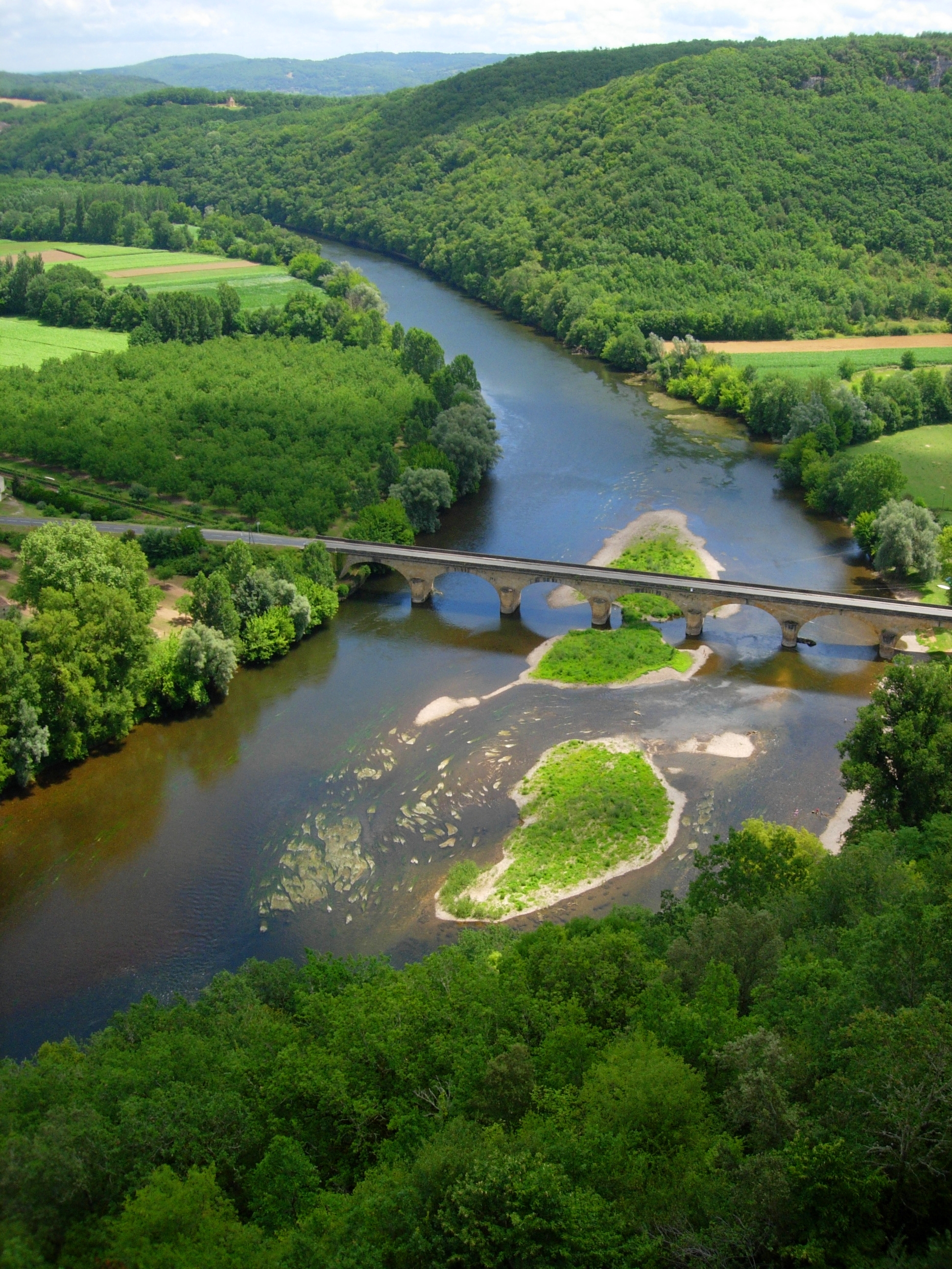
 Dordogne River
The Petrocores took part in the resistance against Rome. Concentrated in two or three major sites are the vestiges of the Gallo-Roman period – the gigantic ruined tower and arenas in Périgueux (formerly Vesone), the Périgord museum's archaeological collections, villa remains in Montcaret and the Roman tower of La Rigale Castle in Villetoureix. The first cluzeaux, or artificial caves either above or below ground, are found throughout the Dordogne. These subterranean refuges and lookout huts could shelter entire populations. According to Julius Caesar the Gauls took refuge there.
Since the Guienne province had returned to the Crown under the Plantagenets following the re-marriage of Eleanor of Aquitaine in 1152, Périgord passed by right into English suzerainty. Being situated at the boundaries of influence of the monarchies of France and England, it was to oscillate between the two dynasties for a long time. Over three hundred years of struggle until 1453 and the end of the Hundred Years' War were to tear apart and, as a consequence, model its physiognomy.
With the end of the Hundred Years' War, the Castillon plain on the banks of the Dordogne, during the calmer periods of the late 15th and early 16th centuries, saw a development in urban architecture. The finest Gothic and Renaissance residences were built in Périgueux, Bergerac and Sarlat. In the countryside, the nobility had the majority of our 1200 chateaux, manors and country houses erected. In the second half of the sixteenth century, however, they experienced attacks, pillaging and fires as the Wars of Religion reached a rare degree of violence in Périgord. At the time, Bergerac was one of the most powerful Huguenot strongholds, along with La Rochelle. Following these wars, Périgord, fief of Henry of Navarre. was to return to the Crown for good and suffer henceforth from the sudden political changes of the French nation, from the Revolution to the tragic hours of the Resistance. We also encounter the memory of its most illustrious literary figures: Bertran de Born, Michel de Montaigne, Etienne de La Boetie, Brantôme, Fenelon, Mahle de Biran, Eugene Le Roy and Andre Maurois; its great captains: Talleyrand, Saint-Exupery, Biron... and even Josephine Baker. A number of ruins (La Chapelle-Faucher, I'Herm...) have retained the memory of the tragedies which took place within their walls. Several of our castles and châteaux are open to visitors and some of them such as Bourdeilles and Mareuil, house remarkable collections.
In addition to its castles, chateaux, churches, bastides and cave fortresses, the Périgord region has preserved from centuries past, a number of wonderful villages which still have their market halls, dovecotes, tories (stone huts), churches, abbeys and castles. Saint-Leon-sur-Vezere, Connezac, Saint-Jean-de-Côle, La Roque-Gageac and many others are real jewels of architecture. As for the old quarters of Périgueux or Bergerac, restored and developed into pedestrian areas, they have regained their former charm. A number of small towns, such as Brantôme, Issigeac, Eymet and Mareuil, have withstood the often brash changes of modern times. A special mention should be made in this respect to Sarlat and its Black Périgord area.
Dordogne is one of the original 83 departments created during the French Revolution on 4 March 1790. It was created from the former province of Périgord, the county of Périgord.
During the next thee decades the departmental borders were changed several times.
- In 1793 the communes of Boisseuilh, Coubjours, Génis, Payzac, Saint-Cyr-les-Champagnes, Saint-Mesmin, Salagnac, Savignac, Saint-Trié and Teillots were transferred to Dordogne from Corrèze.
- In 1794 Dordogne ceded Cavarc to Lot-et-Garonne. Later in 1794 (albeit during the subsequent year under the Republican Calendar in use at the time) Dordogne gained Parcoul from Charente-Inférieure.
- Following the restoration, in 1819, the commune of Bonrepos was suppressed and merged with the adjacent commune of Souillac in Lot.
In 1870, shortly after France had been attacked by Prussia in a war which the enemy was believed to be winning, a young aristocrat called Alain de Monéys was savagely tortured by a crowd of between 300 and 800 people for two hours on 16 August in a public square in the village of Hautefaye in the north-west of the department. After this he was roasted. Details of the incident remain unclear: the leading participants appear to have been drunk and before the introduction of mass education most of the witnesses would have been unable (and possibly unwilling) to write down what they saw. But at some stage the victim died, and following a trial four individuals identified as culpable were in their turn condemned to die by guillotine. The sentence was carried out in the same public square on 6 February 1871.
It was suggsted that the victim had reported the (bad) news about the war in a way that implied support for the enemy, although subsequently it became clear that his patriotic credentials were beyond approach. It was also suggested that the mob had been antagonised when he called out, "Vive la République!" (Long live the republic) at a time when the patriotic villagers valued the imperial regime which the Prussians were even then in the process of destroying.
The incident was widely reported at the time and has been extensively researched subsequently. This summary leans on the work of Alain Corbin,[1] a historian specialising in the nineteenth century who has carefully and objectively analysed the incident and the mass-psychology behind it.
Geography
The department is part of the region of Aquitaine and is surrounded by the six départements of Haute-Vienne, Corrèze, Lot, Lot-et-Garonne, Gironde, and Charente. Dordogne is the third largest department of France.
Politics
The President of the General Council is Bernard Cazeau of the Socialist Party.
Party seats • Socialist Party 30 Union for a Popular Movement 9 • French Communist Party 5 • Miscellaneous Left 3 MoDem 1 Miscellaneous Right 1 • Left Radical Party 1 Demographics
The population peaked at 505,789 in 1851 according to that year's census. After 150 year of steady decline it fell below 400,000 by the year 2000. This reflected the long term population decline observed in many of the rural departments, resulting from changes in agriculture and the lure of higher industrial wages available in more urbanized regions. However, during the first decade of the twenty-first century the decline has been reversed.
Dordogne has become one of the favourite destinations of British immigration to France, (more than 20 000 in 2006), but most take care not to stay more than six months per year, in order to avoid being considered resident in France.
Tourism
There are more than 1,500 castles in Dordogne, including the following:
- Beynac
- Biron
- Bourdeilles
- Castelnaud-la-Chapelle
- Commarque
- Hautefort
- Milandes
- Monbazillac
- Pécany
- Puymartin
The famous caves of Lascaux have been closed to the public, but a replica of Lascaux II is open to visitors and is a major tourist attraction. Périgueux has important Roman ruins, including an arena which is still visible inside a public park located near the town centre.
See also
- Cantons of the Dordogne department
- Communes of the Dordogne department
- Arrondissements of the Dordogne department
Dordogne in Popular Culture
- Michael Crichton's novel Timeline is placed in two time periods of Dordogne.
- Douglas Boyd, the author husband of flautist Atarah Ben-Tovim, set parts of each of his six thrillers in Dordogne.
- Meg Cabot's series Queen of Babble begins with part of the book set in the Dordogne region.
- Jean M. Auel's Shelters of Stone takes place in what is now Dordogne.
- Glenn Cooper's The Tenth Chamber is set and based on prehistoric cave paintings in the Vézère River Valley in the Dordogne.
- Dordogne was the setting for the 1998 film Ever After starring Drew Barrymore and Angelica Houston.
References
- ^ Corbin Alain, Le village des "cannibales", Paris, Aubier, 1990, 204 p.
External links
- (French) Préfecture website
- (French) Conseil général website
- (English) Greendordogne
- (French) Atlaspol website. Politics of Dordogne
- (English) Bed and Breakfast in Dordogne
- (English) Balcon en Foret Duplicate site to the one above ^^
- (English) DordogneHomes.com
- (Dutch) Vakantiehuizen Dordogne
- (Dutch) villasdordogne.nl
- (English) Dordognemaison.com
- (English) Dordogne at the Open Directory Project
- Dordogne travel guide from Wikitravel
Categories:


Wikimedia Foundation. 2010.