- Wawona, California
-
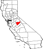
Wawona — census-designated place — The Wawona Hotel Location in California
 Wawona
Coordinates: 37°32′13″N 119°39′23″W / 37.53694°N 119.65639°WCoordinates: 37°32′13″N 119°39′23″W / 37.53694°N 119.65639°W Country  United States
State  California
County Mariposa Area[1] – Total 6.345 sq mi (16.434 km2) – Land 6.345 sq mi (16.434 km2) – Water 0 sq mi (0 km2) 0% Elevation[2] 3,999 ft (1,219 m) Population (2010) – Total 169 – Density 26.6/sq mi (10.3/km2) Time zone Pacific (PST) (UTC-8) – Summer (DST) PDT (UTC-7) ZIP Code 95389 Area code(s) 209 GNIS feature IDs 1652868; 2583183 U.S. Geological Survey Geographic Names Information System: Wawona, California; U.S. Geological Survey Geographic Names Information System: Wawona, California Wawona (formerly, Big Tree Station,[2] Clark's Station,[2] Clarks Station,[2] Wah-wo-nah,[2] and Clark's Ranch[3]) is a census-designated place[4] in Mariposa County, California.[2] It is located 18 miles (29 km) east of Mariposa,[3] at an elevation of 3999 feet (1219 m).[2] The population was 169 at the 2010 census.
Wawona is located entirely within Yosemite National Park, as it preceded the founding of the park as a national recreation area. It has approximately 160 year-round residents.[5] The number of inhabitants increases dramatically during peak tourist seasons, due to the large number of rental cabins in the town. It is located at 37°32′13″N 119°39′23″W / 37.53694°N 119.65639°W.[2]
It was known to the local Native American Miwok in their language as Pallachun ("a good place to stay").[6] Other sources say Wawō'na was the Miwok word for "big tree", or for "hoot of the owl", a bird considered the sequoia trees' spiritual guardian.[7][dead link]
Galen Clark, who helped gain preservation legislation for Mariposa Grove and what became Yosemite National Park, occupied this area in 1855. He established a tourist rest and modest ranch in 1856.[3] Clark sold the property to the Washburn brothers in 1874, who built a larger hotel in 1876, adding to it later. Hotel keeper Jean Bruce Washburn named the resort property Wawona in 1883.
The town is located on the south fork of the Merced River, at an elevation of approximately 1300 m (4000 feet). It is on State Route 41, the main highway from Fresno to Yosemite Valley.
Wawona is the location of the historic Wawona Hotel, built by Washburn in 1876, with additional structures added into the early 20th century. A classic Victorian resort, it was designated a National Historic Landmark in 1987.[8]
This is the town nearest to Chilnualna Falls and the Mariposa Grove of Giant Sequoia. The principal trailheads into the southern Yosemite wilderness are located in Wawona.
The Clark's Station US Post Office opened in 1878. In 1883 its name was changed to Wawona.[3]
The ZIP Code is 95389. The community is inside area code 209.
Contents
Geography
According to the United States Census Bureau, the CDP covers an area of 6.345 square miles (16.433 km2), all of it land.
Demographics
The 2010 United States Census[9] reported that Wawona had a population of 169. The population density was 26.6 people per square mile (10.3/km²). The racial makeup of Wawona was 138 (81.7%) White, 2 (1.2%) African American, 3 (1.8%) Native American, 4 (2.4%) Asian, 0 (0.0%) Pacific Islander, 8 (4.7%) from other races, and 14 (8.3%) from two or more races. Hispanic or Latino of any race were 12 persons (7.1%).
The Census reported that 163 people (96.4% of the population) lived in households, 6 (3.6%) lived in non-institutionalized group quarters, and 0 (0%) were institutionalized.
There were 71 households, out of which 16 (22.5%) had children under the age of 18 living in them, 29 (40.8%) were opposite-sex married couples living together, 3 (4.2%) had a female householder with no husband present, 4 (5.6%) had a male householder with no wife present. There were 4 (5.6%) unmarried opposite-sex partnerships, and 2 (2.8%) same-sex married couples or partnerships. 26 households (36.6%) were made up of individuals and 2 (2.8%) had someone living alone who was 65 years of age or older. The average household size was 2.30. There were 36 families (50.7% of all households); the average family size was 2.94.
The population was spread out with 32 people (18.9%) under the age of 18, 10 people (5.9%) aged 18 to 24, 46 people (27.2%) aged 25 to 44, 66 people (39.1%) aged 45 to 64, and 15 people (8.9%) who were 65 years of age or older. The median age was 43.6 years. For every 100 females there were 141.4 males. For every 100 females age 18 and over, there were 149.1 males.
There were 370 housing units at an average density of 58.3 per square mile (22.5/km²), of which 22 (31.0%) were owner-occupied, and 49 (69.0%) were occupied by renters. The homeowner vacancy rate was 4.3%; the rental vacancy rate was 2.0%. 45 people (26.6% of the population) lived in owner-occupied housing units and 118 people (69.8%) lived in rental housing units.
Politics
 Wawona is near the southern entrance to Yosemite.
In the state legislature, Wawona is located in the 14th Senate District, represented by Republican Tom Berryhill, and in the 25th Assembly District, represented by Republican Kristin Olsen.
Federally, Wawona is located in California's 19th congressional district, which has a Cook PVI of R +10[10] and is represented by Republican Jeff Denham.
Attractions
- Wawona Hotel
- Wawona Golf Course
- Camp Wawona
- Chilnualna Falls
- Wawona Stables
- Wawona Campground
- Yosemite Pioneer History Center
See also
- Wawona Tunnel Tree
- Camp Wawona
References
- ^ U.S. Census
- ^ a b c d e f g h U.S. Geological Survey Geographic Names Information System: Wawona, California
- ^ a b c d Durham, David L. (1998). California's Geographic Names: A Gazetteer of Historic and Modern Names of the State. Quill Driver Books. p. 844. ISBN 9781884995149.
- ^ U.S. Geological Survey Geographic Names Information System: Wawona, California
- ^ [1], Wawona-Yosemite Website
- ^ Towns:Wawona, Yosemite/Madera County Film Commission, accessed 8 Dec 2009
- ^ "The Old-fashioned Charm of Wawona", Sacramento Bee
- ^ "Wawona Hotel and Thomas Hill Studio". National Historic Landmark summary listing. National Park Service. 2007-09-25. http://tps.cr.nps.gov/nhl/detail.cfm?ResourceId=1529&ResourceType=Building.
- ^ All data are derived from the United States Census Bureau reports from the 2010 United States Census, and are accessible on-line here. The data on unmarried partnerships and same-sex married couples are from the Census report DEC_10_SF1_PCT15. All other housing and population data are from Census report DEC_10_DP_DPDP1. Both reports are viewable online or downloadable in a zip file containing a comma-delimited data file. The area data, from which densities are calculated, are available on-line here. Percentage totals may not add to 100% due to rounding. The Census Bureau defines families as a household containing one or more people related to the householder by birth, opposite-sex marriage, or adoption. People living in group quarters are tabulated by the Census Bureau as neither owners nor renters. For further details, see the text files accompanying the data files containing the Census reports mentioned above.
- ^ "Will Gerrymandered Districts Stem the Wave of Voter Unrest?". Campaign Legal Center Blog. http://www.clcblog.org/blog_item-85.html. Retrieved 2007-10-20.
External links
Municipalities and communities of Mariposa County, California CDPs Bear Valley | Bootjack | Buck Meadows | Catheys Valley | Coulterville | El Portal | Fish Camp | Greeley Hill | Hornitos | Lake Don Pedro | Mariposa | Midpines | Wawona | Yosemite Valley
Unincorporated
communitiesBagby | Barrett | Ben Hur | Blanchard | Briceburg | Bridgeport | Buena Vista | Clearing House | Curry Village | Darrah | Dogtown | Elliott Corner | Foresta | Granite Springs | Hayward | Hite Cove | Incline | Indian Gulch | Jerseydale | Mormon Bar | Mount Bullion | North Wawona | Ponderosa Basin | South Wawona | Yosemite Village | Yosemite West
Former
settlementsAgua Fria | Bondville | Chinquapin | Drum | Eightmile | Elevenmile | Elkhorn | Emory | Hokokwito | Kocher | Kumaini | Macheto | Minear | Mount Ophir | Newtown | Notomidula | Opie | Phillip's Flat | Quartzburg | Ridleys Ferry | Sakaya | Sloss | Wenger | Wiskala | Yosemite Mill
Categories:- Unincorporated communities in California
- Census-designated places in Mariposa County, California
- Yosemite National Park
- Populated places established in 1856


Wikimedia Foundation. 2010.