- Tunkhannock Viaduct
-
Tunkhannock Viaduct 
A Steamtown National Historic Site excursion train crosses Tunkhannock Viaduct.Carries railroad traffic Crosses Tunkhannock Creek Locale Nicholson, Pennsylvania, USA Designer Abraham Burton Cohen Design Deck arch bridge Material concrete Total length 2,375 feet (724 m) Width two tracks Longest span 180 feet (55 m) each span Number of spans 10 Piers in water 13 Clearance below 240 feet (73 m) Construction begin May 1912 Opened November 6, 1915
Tunkhannock Viaduct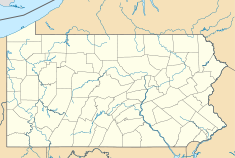
 Location in Pennsylvania
Coordinates: 41°37′20″N 75°46′38″W / 41.622205°N 75.777335°WCoordinates: 41°37′20″N 75°46′38″W / 41.622205°N 75.777335°W Built: 1912-1915 NRHP Reference#: 77001203[1] Added to NRHP: April 11, 1977[1] Tunkhannock Viaduct (also known as the Nicholson Bridge) is a concrete deck arch bridge that spans the Tunkhannock Creek in Nicholson, Wyoming County, Pennsylvania in the United States. It was the largest[clarification needed] concrete bridge in the U.S. when it opened, and remained so even 50 years later.[2]
The bridge contains about 169,000 cubic yards (129,000 m3) of concrete and 1,240 short tons (1,120 t) of steel.[3][citation needed] It is 2,375 feet (724 m) long and 240 feet (73 m) tall when measured from the creek bed (300 feet (91 m) tall from the bedrock). The bridge was built as part of the Clark's Summit-Hallstead Cutoff, which was part of a project of the Lackawanna Railroad to revamp a winding and hilly system. This rerouting was built between Scranton, Pennsylvania and Binghamton, New York. All thirteen piers were excavated to bedrock, which was up to 138 feet (42 m) below ground level. Almost half of the bulk of the bridge is underground.
The bridge was built by the Delaware, Lackawanna and Western Railroad and was designed by Abraham Burton Cohen.[4] Construction on the bridge began in May 1912, and dedication took place on November 6, 1915.[5] It was listed on the National Register of Historic Places on April 11, 1977.[1] Today, the bridge is owned by the Canadian Pacific Railway and is used daily for regular through freight service, including those of the Norfolk Southern.
Contents
Gallery
-

Tunkhannock Viaduct under construction in 1914
-

Tunkhannock Viaduct from a commercial airline flight from Ottawa to Philadelphia
-

Tunkhannock Viaduct, as seen from Route 11
-

Viaduct over Nicholson, PA
Notes
- ^ a b c "National Register Information System". National Register of Historic Places. National Park Service. no date specified. http://nrhp.focus.nps.gov/natreg/docs/All_Data.html.
- ^ Historic American Engineering Record (HAER) No. PA-87. "Erie-Lackawanna Railroad, Tunkhannock Viaduct". http://hdl.loc.gov/loc.pnp/hhh.pa1629. Retrieved 5 March 2010.
- ^ Volume estimate from "Progress of Tunkhannock Viaduct Construction on D., L. & W. Relocation," Engineering Record 68, No. 22 (29 Nov. 1913): 594.
- ^ "The Nicholson Bridge". http://www.pocono.org/nicholson.html.
- ^ "Northeast Pennsylvania, Nicholson Viaduct". http://www.northeastpennsylvania.com/NicholsonViaduct.htm.
See also
References
- Plowden, David (2002). Bridges: The Spans of North America. New York, NY: W.W. Norton and Company.
- "Tunkhannock Viaduct". ASCE History and Heritage of Civil Engineering. http://live.asce.org/hh/index.mxml?lid=180. Retrieved 2009-11-02.
External links
U.S. National Register of Historic Places Topics Lists by states Alabama • Alaska • Arizona • Arkansas • California • Colorado • Connecticut • Delaware • Florida • Georgia • Hawaii • Idaho • Illinois • Indiana • Iowa • Kansas • Kentucky • Louisiana • Maine • Maryland • Massachusetts • Michigan • Minnesota • Mississippi • Missouri • Montana • Nebraska • Nevada • New Hampshire • New Jersey • New Mexico • New York • North Carolina • North Dakota • Ohio • Oklahoma • Oregon • Pennsylvania • Rhode Island • South Carolina • South Dakota • Tennessee • Texas • Utah • Vermont • Virginia • Washington • West Virginia • Wisconsin • WyomingLists by territories Lists by associated states Other Categories:- Deck arch bridges
- Bridges on the National Register of Historic Places in Pennsylvania
- Bridges completed in 1915
- Railway bridges on the National Register of Historic Places
- Railroad bridges in Pennsylvania
- Concrete bridges
- Viaducts in the United States
- Historic Civil Engineering Landmarks
- Bridges in Wyoming County, Pennsylvania
-


Wikimedia Foundation. 2010.