- Curonian Spit
-
Curonian Spit * UNESCO World Heritage Site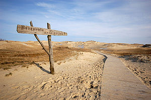
Country Lithuania and Russian Federation Type Cultural Criteria v Reference 994 Region ** Europe and North America Inscription history Inscription 2000 (24th Session) * Name as inscribed on World Heritage List
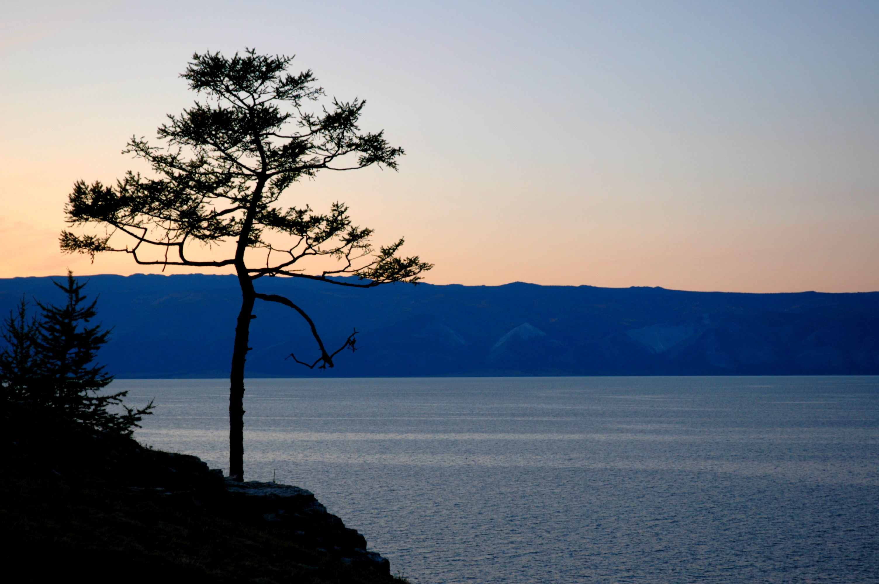
** Region as classified by UNESCOThe Curonian Spit (Lithuanian: Kuršių nerija, Russian: Куршская коса, German: Kurische Nehrung, Latvian: Kuršu kāpas) is a 98 km long, thin, curved sand-dune spit that separates the Curonian Lagoon from the Baltic Sea coast. Its southern portion lies within Kaliningrad Oblast, Russia and its northern within southwestern Lithuania. It is a UNESCO World Heritage Site shared by the two countries.
Contents
Geography
The Curonian Spit stretches from the Sambian Peninsula on the south to its northern tip next to a narrow strait, across which is the port city of Klaipėda on the mainland of Lithuania. The northern 52 km long stretch of the Curonian Spit peninsula belongs to Lithuania, while the rest is part of the Kaliningrad Oblast, Russia (see the map). The width of the spit varies from a minimum of 400m in Russia (near the village of Lesnoy) to a maximum of 3,800 m in Lithuania (just north of Nida).
Geologic history
The Curonian Spit was formed about 3rd millennium BC.[1] A glacial moraine served as its foundation; winds and sea currents later contributed enough sand to raise and keep the formation above sea level.[1]
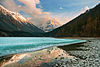
 Curonian Spit and Lagoon
The existence of this narrow shoal is inherently threatened by the natural processes that govern coastal shoreline features.[2] It depends on a dynamic balance between sand transport and deposition. If (hypothetically) the source area to the south-west were cut off, say, by a large port construction with a pier, the Spit would erode and eventually disappear. It is thus a geologically speaking ephemeral coast element. The most likely development, however, is that the shallow bay inside the Spit will eventually fill up with sediment, thus creating new land.
Human history
According to Baltic mythology, the Curonian Spit was formed by a giantess, Neringa, who was playing on the seashore. This child also appears in other myths (in some of which she is shown as a young strong woman, similar to a female version of the Greek Heracles).
From ca. 800 to 1016, the Spit was the location of Kaup, a major pagan trading centre which has not been excavated yet. The Teutonic Knights occupied the area in the 13th century, building their castles at Memel (1252), Neuhausen (1283), and at Rossitten (1372). The Spit may have been the home of the last living speaker of a now-extinct Baltic language, Old Prussian.[3]
Significant human impacts on the area began in the 16th century.[1] Deforestation of the spit due to overgrazing, timber harvesting, and building of boats for the siege of Königsberg in 1757 led to the dunes taking over the spit and burying entire villages. Alarmed by these problems, the Prussian government sponsored large-scale revegetation and reforestation efforts, which started in 1825. Owing to these efforts, much of the spit is now covered with forests. In the 19th century the Curonian Spit was inhabited primarily by Curonians (Kursenieki) with a significant German minority in the south and a Lithuanian minority in the north. The population of Curonians eventually dwindled due to assimilation and other reasons; it is close to non-existent these days and even before 1945, when the spit had become totally ethnic German.[citation needed] Until the 20th century, most people in the area made their living by fishing. From 1901 to 1946 the village of Rossitten, now Rybachy, became the site of the pioneering Rossitten Bird Observatory, the world's first, founded by German ornithologist Johannes Thienemann there because of the Spit's importance as a bird migration corridor. The German population was expelled by force after World War II.
 A Crowbiter about 1930. Crows, killed by a bite in the head, were a traditional food supplement
After the breakup of the Soviet Union, tourism flourished; many Germans, mostly the descendants of the inhabitants of the area, choose the Curonian Spit (especially Nida, as no visas are needed for Germans in Lithuania) as their holiday destination.
Reforestation may have been 'sponsored' at some point by the Prussian government, but most reports state in the late 19th century George David Kuwert, the owner of a post station in Nida, began the spit’s reforestation.
Current state
 Landsat photo
The Curonian Spit is home to the highest moving (drifting) sand dunes in Europe. Their average height is 35 meters, but some attain the height of 60 meters. Several ecological communities are present on and near the Spit, from its outer beaches to dune ridges, wetlands, meadows, and forests.[4] Its location on the East Atlantic Flyway means it is frequently visited by migratory waterfowl. Between 10 and 20 million birds fly over the feature during spring and fall migrations, and many pause to rest or breed there.[4]
The largest town on the spit is Nida in Lithuania, a popular holiday resort, mostly frequented by Lithuanian and German tourists. The northern shoreline of Curonian Spit is the site of beaches for tourists. Both the Russian and Lithuanian parts of the spit are national parks. The settlements of the Curonian Spit (from north to south) are:
- Smiltynė
- Alksnynė
- Juodkrantė
- Pervalka
- Preila
- Nida
- Morskoe
- Rybachy
- Lesnoy
The first six are on the Lithuanian side, while the last three are on the Russian side. The Russian side of the Curonian Spit belongs to Zelenogradsk district of the Kaliningrad Oblast, while the Lithuanian side is partitioned among Klaipėda city municipality and Neringa municipality.
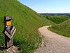
There is a single road that traverses the whole length of the Curonian Spit. In the Russian side it goes to Zelenogradsk, while on the Lithuanian side it goes to Smiltynė. The spit is not connected to mainland Lithuania. Car ferries provide a transportation link between Smiltynė, located on the spit, and the port town of Klaipėda.
Since 2000, the Curonian Spit has been on UNESCO's World Heritage List under cultural criteria "V" (an outstanding example of a traditional human settlement, land-use, or sea-use which is representative of a culture [...], or human interaction with the environment especially when it has become vulnerable under the impact of irreversible change).
Environmental concerns
 The Curonian Spit is known for its fine sandy beaches.
There are various environmental concerns related to the Curonian Spit, which is often promoted as a refuge of clean nature.
Due to the importance of tourism and fishing for the regional economy, pollution of sea and coastlines may have disastrous effects for the area as both the unique nature and the economy would be damaged. The construction of an offshore oil-drilling facility (the Kravtsovskoye (D-6) oilfield) in the territorial waters of Russia, 22.5 kilometres from the coastline of the Curonian Spit (location) raised concerns over possible oil spills. Between 2002 and 2005 local environmentalists in both Kaliningrad Oblast[5] and Lithuania[6] protested against Lukoil's plans to exploit the oilfield, objecting to the possible great damage to the environment and tourism (a vital source of income in the area) in case of oil leakage. These concerns did not engender support in the government of Russia. They were, however, supported by the government of Lithuania, as the oilfield is about four kilometers from the boundary of Lithuanian territorial waters and the prevailing northward currents means that the Lithuanian coastlines would receive a large part of potential damage in case of leakage. However, opposition to the operation of D-6 met little international support and the oil platform was opened in 2004. During the first decade of the 21st century the two states agreed to a joint environmental impact assessment of the D-6 project, including plans for oil spill mitigation.[7] The assessment and mitigation project had not been completed as of 2010.[7]
Another concern is that increased tourism destroys the very nature that attracts it. For this reason, various measures have been taken, such as banning tourists from hiking in certain areas of the spit.
Natural hazards are also more dangerous in the Curonian Spit than elsewhere in Lithuania or the Kaliningrad Oblast. For example, storms tend to be stronger here. Due to the importance of trees in preventing soil erosion, forest fires that happen in summer are more dangerous to the ecology.
See also
References
- ^ a b c "The Development of the Baltic Sea and the Curonian Lagoon". Kuršių Nerija National Park. http://www.nerija.lt/en/nature/geology. Retrieved 2010-06-15.
- ^ "Curonian Spit". UNESCO. http://whc.unesco.org/en/list/994. Retrieved 2010-06-15.
- ^ The Kaliningrad question. Rowman & Littlefield. 2002. p. 17. ISBN 9780742517059. http://books.google.com/books?id=sDOUZEEnHFUC&pg=PA17&dq=curonian+spit+existence&hl=en&ei=E6cXTM3FMYHknAeurNWiCg&sa=X&oi=book_result&ct=result&resnum=6&ved=0CDkQ6AEwBQ#v=onepage&q=curonian%20spit%20existence&f=false.
- ^ a b "Curonian Spit". UNESCO. http://www.unesco.lt/documents/Paveldas/Kursiu%20nerija/curonian%20spit_nomination.pdf. Retrieved 2010-06-15.
- ^ [1][dead link]
- ^ [2][dead link]
- ^ a b "32COM 7B.98 - Curonian Spit (Lithuania / Russian Federation) (C 994)". UNESCO World Heritage Committee. http://whc.unesco.org/en/decisions/1705. Retrieved 2010-06-15.
External links
- UNESCO World Heritage Site Curonian Spit
- Kuršių Nerija National Park (in Lithuania)
- National Park Kurshskaya Kosa (in Russia)
- Rybachy Biological Station, Russian Academy of Sciences
- Curonian Spit at Natural Heritage Protection Fund
 World Heritage Sites in Lithuania
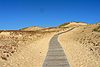
- Curonian Spit (with Russia)
- Kernavė Archaeological Site (Cultural Reserve of Kernavė)
- Struve Geodetic Arc (with nine other countries)
- Vilnius Historic Centre
 World Heritage Sites in Russia by federal district

Central 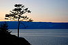
Southern Northwestern Far Eastern - Volcanoes of Kamchatka
- Central Sikhote-Alin
- Wrangel Island
Siberian Volga North Caucasian Coordinates: 55°16′28″N 20°58′15″E / 55.27444°N 20.97083°E
Categories:- World Heritage Sites in Lithuania
- Baltic Sea
- Landforms of Lithuania
- Landmarks in Lithuania
- World Heritage Sites in Russia
- Spits of Russia
- Kaliningrad Oblast
- Spits
- Borders of Russia


Wikimedia Foundation. 2010.