- Cowal
-
 Cowal shown within Argyll
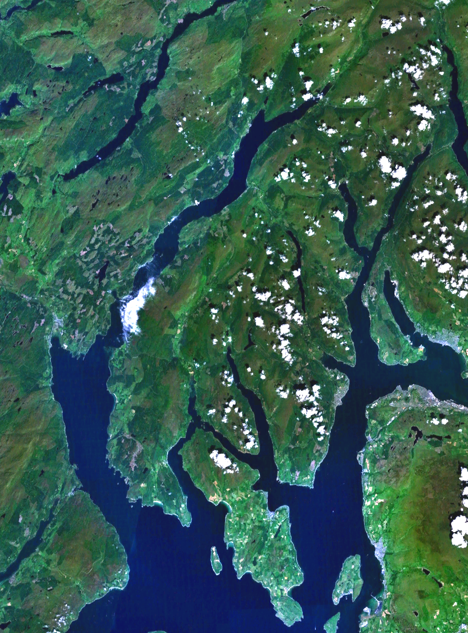
 Satellite photo of Cowal
Cowal (Scottish Gaelic: Còmhghall) is a peninsula in Argyll and Bute in the Scottish Highlands.
Description
The northern part of Cowal is mostly the mountainous Argyll Forest Park. Cowal is separated from the Kintyre peninsula to the west by Loch Fyne, and from Inverclyde and North Ayrshire to the east by the Firth of Clyde. The sea lochs Loch Long and Loch Goil lie to the northeast, and the south of the peninsula is split into three forks by two further sea lochs, Loch Striven and to its west Loch Riddon. The Isle of Bute lies to the south of Cowal, separated from the peninsula by the narrow Kyles of Bute which connect the Clyde to Loch Riddon.
Much of Cowal was once held by the Lamont Clan; encroachments by the neighbouring Campbells and other powerful families reduced the Lamont holdings in the Covenanting Wars of the seventeenth century.
Cowal's only burgh is Dunoon in the south east,[1] from which ferries sail to Gourock in Inverclyde. Other ferries run from Portavadie in the west to Tarbert in Kintyre, and from Colintraive in the south to Rhubodach on the Isle of Bute.
The Arrochar Alps and Ardgoil peninsula in the north frindge the edges of the sea lochs whilst the Argyll Forest Park spreads out across the hillsides and mountain passes in north part of cowal, making this one of the most remote areas in the west of Scotland.
The towns and villages in Cowal are: Innellan, Toward, Castle Toward, Dunoon, Hunters Quay, Sandbank, Kilmun, Strone, Ardentinny, Blairmore in the South East part facing the lowlands at Inverclyde. Carrick Castle, Lochgoilhead, Ardgartan, Arrochar, Rest and be thankful, Succoth, Tarbet, Inverglas, Ardlui, Cairndow, St Catherines in the north of Cowal in the Arrochar Alps. Creggans, Strachur, Castle Lachlan, Otter Ferry, Kilfinan, Portavadie are on the eastern shore of Loch Fyne facing Mid-Argyll and Kintyre. Kames, Tighnabruaich, Colintraive,are on the Kyles of Bute. From the Kyles of Bute Ormidale leads into Glendaruel.Leaving the Holy Loch westwards brings you to Clachaig, Glean Lean, and the Tarsan dam leading down to Ardtaraig on Loch Striven.
References
External links
Traditional provinces and districts of Scotland Major districts (former counties, provincial lordships and rural deaneries) The Aird · Annandale · Angus · Argyll · Atholl · Boyne · Buchan · Badenoch · Breadalbane · Caithness · Carrick · Clydesdale (or Strathclyde) · Cowal · Cunningham · Desnes · Eskdale · Farines · Fife · Fothriff · Galloway · Garioch · Garmoran · The Glenkens · Gowrie · Kintyre · Knapdale · Kyle · Lauderdale · Lennox · Liddesdale · Lochaber · Lorn · Lothian · Mar · Mearns · Menteith · Merse · Moray · Nithsdale · The Rhinns · Ross (Easter and Wester) · Stormont · Strathavon · Strathbogie · Strathearn · Strathgryfe · Strathnaver · Strathspey · Sutherland · Teviotdale · Tweeddale
Minor districts Applecross · Appin · Ardgour · Ardmeanach · Ardnamurchan · Assynt · Avondale · Balquhidder · Benderloch · The Black Isle · Braemar · Coigach · Cromar · Cromdale · Douglasdale · Durness · Eddrachilles · Enzie · Ettrickdale · Ewesdale · Formartine · Gairloch · Glen Albyn · Glen Almond · Glen Cassley · Glen Clova · Glen Dochart · Glenelg · Glen Esk · Glengarry · Glen Lethnot · Glen Lyon · Glen Moriston · Glen Orchy · Glen Prosen · Glenshee · Glen Spean · Glen Urquhart · Gruinard · Howe of Fife · Howe of the Mearns · Kintail · Kintyre · Knoydart · Lochalsh · Loch Broom · Locheil · The Machars · Midmar · Moidart · Morar · Morven · Muir of Ord · Rannoch Moor · Rhinns of Kells · Strathallan · Strathardle · Strathbran · Strathbraan · Strathcarron (Forth) · Strathcarron (Oykel) · Strathconon · Strathdearn · Strathdeveron · Strathdee (Deeside) · Strathdon · Strathfarrar · Strath Gartney · Strathglass · Strathisla · Strathmore · Strath of Kildonan · Strath Oykel · Strath Tay · Strathyre · Sunart · Trossachs
Insular districts
For smaller islands, usually districts in their own right, see List of Scottish islandsBorder Areas Coordinates: 56°1′N 5°8′W / 56.017°N 5.133°W
Categories:- Peninsulas of Scotland
- Argyll and Bute
- Argyll and Bute geography stubs
Wikimedia Foundation. 2010.