- A55 road
-
A55 road

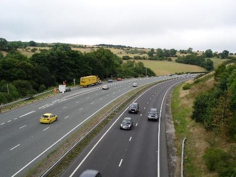
The A55 at Warren Mountain.Route information Part of 
Length: 87 mi (140 km) Major junctions East end: Chester West end: Holyhead Location Primary
destinations:Conwy
BangorRoad network Roads in the United Kingdom
Motorways • A and B road zonesThe A55, also known as the North Wales Expressway, is a major road in Britain. Its entire length is a dual carriageway primary route, with the exception of the point where it crosses the Britannia Bridge over the Menai Strait. All junctions are grade separated except for two roundabouts — one east of Penmaenmawr and one in Llanfairfechan. The road originally ran from Chester to Bangor but was extended parallel to the A5 across Anglesey right into Holyhead Docks in 2001. The road improvements have been part funded with European money, under the Trans-European Networks programme, as the route is designated part of Euroroute E22 (Holyhead - Leeds - Amsterdam - Hamburg - Malmoe - Riga - Moscow - Perm - Ekaterinburg - Ishim).
Contents
Route
The Chester Southerly Bypass
The A55 runs west from its junction with the M53 motorway near Chester, where it is known as the Chester Southerly Bypass, crossing the River Dee and the Welsh border before passing close to Broughton then passing north of Buckley and Northop. There is a major climb westbound between Broughton and Buckley (Junctions 35a to 35) though with no crawler lane. There is a difficult junction with the A494 at Junction 34/33b and the road briefly has a three lane section as traffic joins from Queensferry and leaves towards Mold. In the eastbound direction there is also a short three lane section for the same reason. In the eastbound direction there is also a 270 degree speed limited single lane curve to climb up and over the A55/A494. There were plans that might have affected this often congested junction as part of the A494 Queensferry to Ewloe improvement but the Welsh Assembly Government rejected these on 26 March 2008 as being of too large a scale.[1] However, a scheme for improving the A55/A494 Junction is planned to go ahead and includes widening the dual carriageway to three lanes between Ewloe roundabout and Junction 33 (Northop). Junction 33A at Northop Hall and Junction 33B with the A494 for Mold would be closed and a new junction for all traffic flows will be constructed near the Northop Hall service station for the A494 traffic. This proposal will remove all weaving traffic at the A55 junction with the A494 and remove the infamous 270 degree trumpet junction. Work might start by April 2010.[2][dated info]
Ewloe to Colwyn Bay
 Climbing up Rhuallt Hill eastwards.
From Ewloe, the road is relatively flat until after Northop when it climbs up onto the flanks of Halkyn Mountain range, passing to the southwest of Holywell with major climbs between Northop and Halkyn (Junctions 33 and 32b) and Halkyn and Holywell Summit (Junctions 32 and 31). This section of road is notorious for poor weather conditions including fog, ice and snow in winter months. In fine weather, however there are extensive views over the River Dee estuary to the Wirral Peninsula, Liverpool and beyond. The highest part of the road is in the vicinity of Brynford at around 790 feet (240 m). The steep descent towards St Asaph is down the new Rhuallt Hill (Junctions 29 to 28), which also provides the first views of the mountains of Snowdonia in the far distance. There is a crawler lane on Rhuallt Hill for eastbound traffic. The road bypasses St Asaph to the north, and runs past Bodelwyddan and Abergele to reach the North Wales coast at Pensarn (Junction 23A). From here onwards to Bangor, the route is close to the North Wales Coast railway.
Colwyn Bay Bypass
Part of the route (Junction 23) Llanddulas to (Junction 17) Conwy is signed as a 70 mph (110 km/h) speed limit (as opposed to most of the other sections of the A55, which are the National Speed Limit) and is a non-motorway special road, which has restrictions on access by pedestrian and other traffic, similar to the restrictions applied to a motorway. There is also a stretch passing through Colwyn Bay (Old Colwyn to Mochdre) signed as a 50 mph (80 km/h) limit. These restrictions are imposed as added safety precautions because the slip-roads in this stretch are unusually short because of the difficulty of fitting the road into a very narrow area of land, and, due to the road underpassing much of the town, to reduce road surface noise levels. The section from west of Colwyn Bay railway station to the Station Road overbridge at Mochdre was constructed on the trackbed of the North Wales Coast railway. The former 4 track railway was reduced to the two more northerly tracks to make space for the road.
The Conwy Bypass
 Approaching the tunnel from the west.
The crossing of the estuary of the River Conwy is by means of an immersed tube tunnel, the first of its kind constructed in the United Kingdom.[3]
The decision to construct an immersed tube tunnel bypass followed an extensive public consultation, named the Collcon Feasibility Study. This ruled out another bridge by the castle on aesthetic grounds, since it would have damaged the view of the world heritage site Conwy Castle, and the two bridges by Robert Stephenson and Thomas Telford. Another alternative bridge crossing was proposed at Deganwy, but this too was ruled out for aesthetic reasons. An inland alternative with heavy grades which would have passed over Bwlch y Ddeufaen pass at 430 metres (1,410 ft), following the old Roman road, was also worked up but rejected for cost and utility reasons.
The tunnel was constructed by a Costain/Tarmac Construction joint venture,[4] as pre-formed concrete sections, and then floated into position over a pre-prepared trench in the bed of the estuary. The 3million tonnes of silt and mud extracted to create the trench in which the tunnel sections sat, were vacuumed to one side of the construction site, as to let them drift down river would have harmed the large mussel fishing beds downstream. The silt was deposited upstream of the bridge at Conwy which created a large new area of low lying land which was subsequently given to the RSPB for a wildlife preserve. The casting basin for the tunnel sections was later converted into a new marina in the lower estuary. Because of the valuable fishery in the river and also because of the history of heavy metal mining in the catchment of the river, extensive ecological assessments were made both prior to the construction of the tunnel and subsequently. These studies finally concluded that no significant environmental damage had been caused.
After five years of construction, the tunnel was opened in October 1991. It initially had an advisory 50 miles per hour (80 km/h) speed limit, but this was dropped in 2007 as accidents were rare in the tunnels.
Pen-y-clip and Penmaenbach tunnels
 An easterly view of the A55 at Penmaenmawr with the North Wales Coast Railway on the seaward side. The Penmaenbach Tunnels are in the distance
The construction of the coastal section of the road involved major civil engineering works, with hard rock tunnels passing through the cliffs in two places. In the westbound direction both the Penmaenbach and the Pen-y-clip tunnels (east and west of Penmaenmawr respectively) were initially subject to advisory 50mph speed limits but these were lifted in 2007 as there had been few accidents. In the Eastbound direction, the road still uses the 1930s cliffhugging route at both locations. The eastbound carriageway at Penmaenbach is subject to a 30 mph (50 km/h) speed limit due to sharp curves and double white lines nominally preclude lane changing. Plans to rectify the awkward alignment by building another tunnel parallel to the current westbound tunnel (as originally intended when the westbound tunnel was proposed) have been discussed for several years. The original Telford road around the cliffs is now a cycleway at both locations although at Pen-y-Clip it cannot be used in an easterly direction without cycling the wrong way along the westbound carriageway. Recent work (late 2007) at Penmaenbach eastbound has seen the erection of gantries to close lanes when bidirectional working is in place.
Penmaenmawr to Anglesey
Some sections of the rest of the route are of lower standard than that of those further east. Some traffic leaves for major holiday destinations such as Caernarfon or the Llŷn Peninsula, though much continues on to the port of Holyhead. As such part of the route is not classed as clearway and has two at grade junctions (roundabouts), Penmaenmawr (Junction 16) and Llanfairfechan (Junction 15). The Bangor bypass, in which the road previously terminated and became the A5 regains high standards and is such through the Anglesey section, bar the Britannia Bridge, which is a single carriageway deck above the North Wales Coast railway over the Menai Strait. In 2007 the Welsh Assembly Government undertook a consultation to determine which of four options would be preferred for a second crossing. This section intersects with the A487 towards Caernarfon, and the west coast of North Wales.
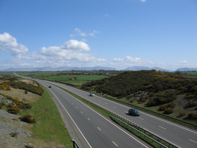
Anglesey
The final section of the A55 to be constructed was the Anglesey section. This 20 mile (32 km) section from the end of the Llanfairpwll bypass to Holyhead Harbour was constructed as Private Finance Initiative scheme where the builders, a Carillion / John Laing joint venture, earn a shadow toll based on usage and lane availability. They also have to maintain the road for the extended period of their shadow toll agreement. When travelling eastbound along this section there are fine views of Snowdonia. The approach to Holyhead required major work with a new section over the sea paralleling the Stanley Embankment that carries the original A5 and the North Wales Coast railway.
Planned improvements
The Welsh Assembly Government (WAG) published its National Transport Plan in July 2009. [5] This includes mention of improvements to the A55 including the possible removal of the two roundabouts at Penmaenmawr and Llanfairfechan.
History
The A55 partly follows the alignment of the Roman road from Chester (Deva) to Caernarfon (Segontium), particularly from Junction 31 to 30 and Junction 13 to 12. Between Chester and Holywell the alignment of this road is uncertain and between St. Asaph and Abergele, the Roman road followed an inland route avoiding the difficulties of the crossing of the Conwy estuary and the cliffs at Penmaenbach and Pen-y-Clip.
A55 opening dates of major improvements
- Unknown date 1930s? Ewloe to Northop avoiding Northop Hall
- Unknown date 1930s? Northop Bypass
- Unknown date 1930s? Holywell Bypass
- Unknown date 1930s? St. Asaph to Rhuallt dual carriageway
- Unknown date 1930s? Short section of 'experimental' concrete road west of St Asaph
- 1932 Penmaenbach Tunnel
- 1935 Pen-y-Clip Tunnels
- 1958 Conway new bridge avoiding Telford's suspension bridge
- 1960s Tai'r Meibion to Tan-y-lon dual carriageway east of Bangor
- 1964? Ewloe roundabout (part of the A494 Queensferry to Ewloe dualling, the 'Aston Bypass')
- Unknown date 1965? Llysfaen dualling
- 1968 Abergele Bypass
- 1970 St. Asaph Bypass
- 1975 Northop Hall Crossroads to East of Gables
- 1976 Coed-y-Cra to Chaingates (Holywell)
- 1976 Chester Southerly Bypass (terminating at Broughton)
- 1980 Britannia Bridge and link roads
- December 1980 Holywell By-Pass (Stage 1)
- March 1981 Diversion East of Abergele
- December 1983 Bangor By-Pass
- Unknown Date Llanfairpwll By-Pass
- September 1984 Hawarden By-Pass (from a point east of Broughton on the Chester Southerly Bypass to Northop Hall)
- December 1984 Llanddulas to Glan Conwy (Colwyn Bay By-Pass, Stage 1)
- June 1985 Llanddulas to Glan Conwy (Colwyn Bay By-Pass, Stage 2)
- October 1986 Holywell By-Pass (Stage 2)
- December 1986 Bodelwyddan By-Pass
- June 1989 Penmaenbach Tunnel
- June 1989 Northop By-Pass (Northop Hall to Halkyn)
- October 1989 Penmaenmawr and Llanfairfechan By-Passes (excluding Pen-y-Clip Tunnel)
- May 1990 Travellers' Inn Improvement
- 1991 tunnel crossing of the River Conwy
- June 1991 Extension of Chester Bypass to M53 (Junction 12)
- May 1992 Rhuallt Hill Improvement
- October 1993 Pen-y-Clip Tunnel
- October 1994 Abergwyngregyn Improvement
- 16 March 2001 Anglesey section (Llanfairpwll to Holyhead)
- 2000/2004 Penmaenmawr eastbound slip road and grade separation at the summit of the Rhuallt Hill
- 2004 Improvements to railway underbridges and cliffs at Penmaenbach (eastbound)
- 2007 Alterations to roundabout at Llanfairfechan and bidirectional road indicators at Penmaenbach (eastbound)
- 2008 New overbridge between Junction 32A and 32B for improved local access
Junctions
A55 Road km Westbound exits (B Carriageway) Junction Eastbound exits (A Carriageway) 0.0 Holyhead Ferry Port Terminus
[coord 1]Start of Road 0.5 Holyhead Town centre A5154
Amlwch A5 (A5025)Road
junctionHolyhead Town centre A5154
Amlwch A5 (A5025)0.7 Trearddur Bay B4545 J1
RoundaboutTrearddur Bay B4545 1.2
2.0A5153 J2 A5153 7.1
7.7Caergeiliog, Valley A5
Amlwch A5025J3 Caergeiliog, Valley A5
Amlwch A50259.6
10.2Caergeiliog, RAF Valley, Bryngwran A5 J4 Caergeiliog, RAF Valley, Bryngwran A5 14.0
14.6Bryngwran, Gwalchmai A5
Rhosneigr A4080J5 Bryngwran, Gwalchmai A5
Rhosneigr A408023.2
24.0Pentre Berw, Gwalchmai A5
Llangefni A5114J6 Pentre Berw A5
Llangefni A511427.8
28.6Gaerwen A5152 J7 Gaerwen A5152 31.3 No access
Llanfair PG A5J7A No exit
Access only32.9
33.4Llanfair PG, Benllech A5025 J8 Llanfair PG, Benllech A5025 33.8 No access
Llanfair PG, Menai Bridge A5J8A No exit
Access only34.1
34,4Britannia Bridge Bridge
[coord 2]Britannia Bridge 35.3
35.6Bangor, Menai Bridge, Ysbyty Gwynedd A487 J9 Caernarfon, Menai Bridge, Ysbyty Gwynedd A487 36.4
37.0Caernarfon, Bangor A4087 J10 Bangor A4087 40.3
40.9Bangor, Bethesda A5
B4366J11 Bethesda A5
B436643.6
44.2Talybont J12 Talybont 47.2
47.5Abergwyngregyn J13 Abergwyngregyn 48.9
49.2Llanfairfechan J14 Llanfairfechan 51.7 Llanfairfechan J15
RoundaboutLlanfairfechan 52.8
53.7Pen-y-Clip Westbound Tunnel (930 m)[6] Tunnel Two short tunnels 53.8
54.2access only
No exitJ15A Penmaenmawr 56.2 Penmaenmawr J16
RoundaboutPenmaenmawr 57.8
57.8Dwygyfylchi J16A No exit 58.4
59.1Penmaenbach Westbound Tunnel (658 m)[6] Tunnel Penmaenbach Eastbound Headland Tunnel(172 m)[6] 60.4
61.0Conwy A547 J17 Conwy A547 61.8
62.9Conwy Road Tunnel (1080 m)[6]
Restictions applyTunnel
[coord 3]Conwy Road Tunnel
Restictions apply63.6
64.2Conwy (A547) J18 Llandudno Junction A546 64.8
65.5Llandudno, Llanrwst A470
Llandudno JunctionJ19 Llandudno, Llanrwst A470
Colwyn Bay (A547)
Llandudno Junction68.7
69.8Colwyn Bay, Mochdre, Penrhyn Bay B5115 J20 Colwyn Bay, Mochdre, Penrhyn Bay B5115 70.6
71.0Colwyn Bay A547 J21 Colwyn Bay A547 71.5
72.0Old Colwyn A547 J22 Old Colwyn A547 Start of Special road End of Special road 76.0
76.1Llanddulas A547
Prohibited TrafficJ23 Llanddulas A547 80.0
80.4Access only
No exitJ23A Pensarn, Abergele A548
No access81.2
81.9Abergele, Rhuddlan A547 J24 Abergele, Rhuddlan A547 84.6 no access
St. George, TowynJ24A No exit
no access86.7
86.8Bodelwyddan, Ysbyty Glan Clwyd J25 Bodelwyddan, Ysbyty Glan Clwyd 88.2
88.8St Asaph Business Park J26 St Asaph Business Park 89.9
90.6St Asaph, Trefnant, Denbigh, Rhuddlan, Rhyl A525 J27 St Asaph,Trefnant, Denbigh, Rhuddlan, Rhyl A525 91.6
91.6St Asaph A525 J27A No exit
No access92.9
93.2Rhuallt, Rhuddlan B5429 J28 Rhuallt B5429 96.7
97.3Rhuallt J29 Rhuallt 99.0
99.3Pen-y-Cefn J30 Pen-y-Cefn 100.3
100.8Trelawnyd A5151
Caerwys B5122J31 Holywell A5151
Caerwys B5122108.7
108.8no access
Holywell A5026J32 Holywell A5026
Halkyn, Pentre Halkyn
No access109.3
109.9Pentre Halkyn J32A No exit
Access only111.3
111.4Halkyn J32B No exit
No access114.6
115.3Northop, Flint, A548 Coast Road A5119 J33 Northop, Flint, Mold A5119 116.5 No access
Connah's Quay B5126J33A No exit
No access117.8
117.9No exit Northop Hall 120.0 No access
Mold A494J33B No exit
Access only120.5
128.8Ewloe, Queensferry A494
Manchester (M56)J34
"Totso"[See notes]Ewloe, Queensferry A494
Manchester (M56)123.1
123.6Hawarden, Buckley, Corwen A550 J35 Hawarden, Wrexham A550 125.3
125.9Penyffordd J35A Broughton, Saltney A5104 128.5 no access
Broughton (A5104)No exit
Access only128.6 Entry into England 
Border Entry into Wales 
Wrexham, Chester A483 J36 Wrexham, Chester A483 Access only
No exitJ36a Chester A5115
Whitchurch (A41)
No accessChester
Nantwich, Northwich A51
Whitchurch (A41)J37 Chester
Nantwich, Northwich A51Start of road M53 J12
[coord 4]Chester, Helsby A56
Non-motorway trafficChester, Helsby A56 Road continues as M53 to Wallasey Notes - Data[7] from location marker posts are used to provide distance and carriageway identification information. Where a junction spans several hundred metres and the data is available, both the start and finish values for the junction are shown.
- Totso = "Turn off to stay on" meaning that the driver must leave the main carriageway to stay on the specified (A55) route.
Motorway • Primary road • Secondary road
Concurrency terminus • Closed/Former • Incomplete access • Unopened- Coordinate list
- ^ 53°18′32″N 4°37′44″W / 53.3089°N 4.6290°W Start of A55 - Holyhead Ferry Port
- ^ 53°12′58″N 4°11′08″W / 53.2161°N 4.1856°W Britannia Bridge - crosses the Menai Straits
- ^ 53°17′15″N 3°49′26″W / 53.2875°N 3.8240°W Conwy Tunnel - Crossing of the Conwy Estuary
- ^ 53°12′42″N 2°51′13″W / 53.2116°N 2.8536°W End of the A55 - becomes the M53
References
- ^ Welsh Assembly Government - Decision on A494 Drome Corner to Ewloe scheme
- ^ Welsh Assembly Government website[dead link]
- ^ BBC News - Conwy Tunnel praised on 20th anniversary
- ^ Motoway archive
- ^ Welsh Government | National Transport Plan
- ^ a b c d "Tunnels". North Wales Trunk Road Agency. 2011. http://www.northwales-tra.gov.uk/index.php?id=329&L=0. Retrieved 2011-09-04.
- ^ "Resources". Traffig Cymru/Traffic Wales. http://www.traffic-wales.com/resources. Retrieved 2011-0822. "Select Telephone & marker post locations."
External links
- Traffic Wales - containing A55 webcams
- SABRE Roaders Digest - A55
- Images of diversion of North Wales Coast Railway at Colwyn Bay to accommodate A55
- BBC News - Engineers look at more A55 relief - 03/09/2004
- The Motorway Archive - A55
- The Chester-Bangor Trunk Road (A55) (Rhuallt Hill Improvement and Slip Roads) Order 1989 (S.I. 1989/2091)
- Other Statutory Instruments pertaining to the A55
- Roads UK: A55
A roads in Zone 5 of the Great Britain road numbering scheme  Categories:
- Roads in England
- Roads in Wales
- Roads in Cheshire
- Transport in Anglesey
- Transport in Conwy county borough
- Transport in Denbighshire
- Transport in Flintshire
- Roads in Gwynedd
- Tunnels in Wales


Wikimedia Foundation. 2010.