- Queens (New York City borough)
Infobox Settlement
name =Queens
official_name =Queens County
other_name =
native_name =
nickname =
settlement_type =Borough of New York City
total_type =
motto =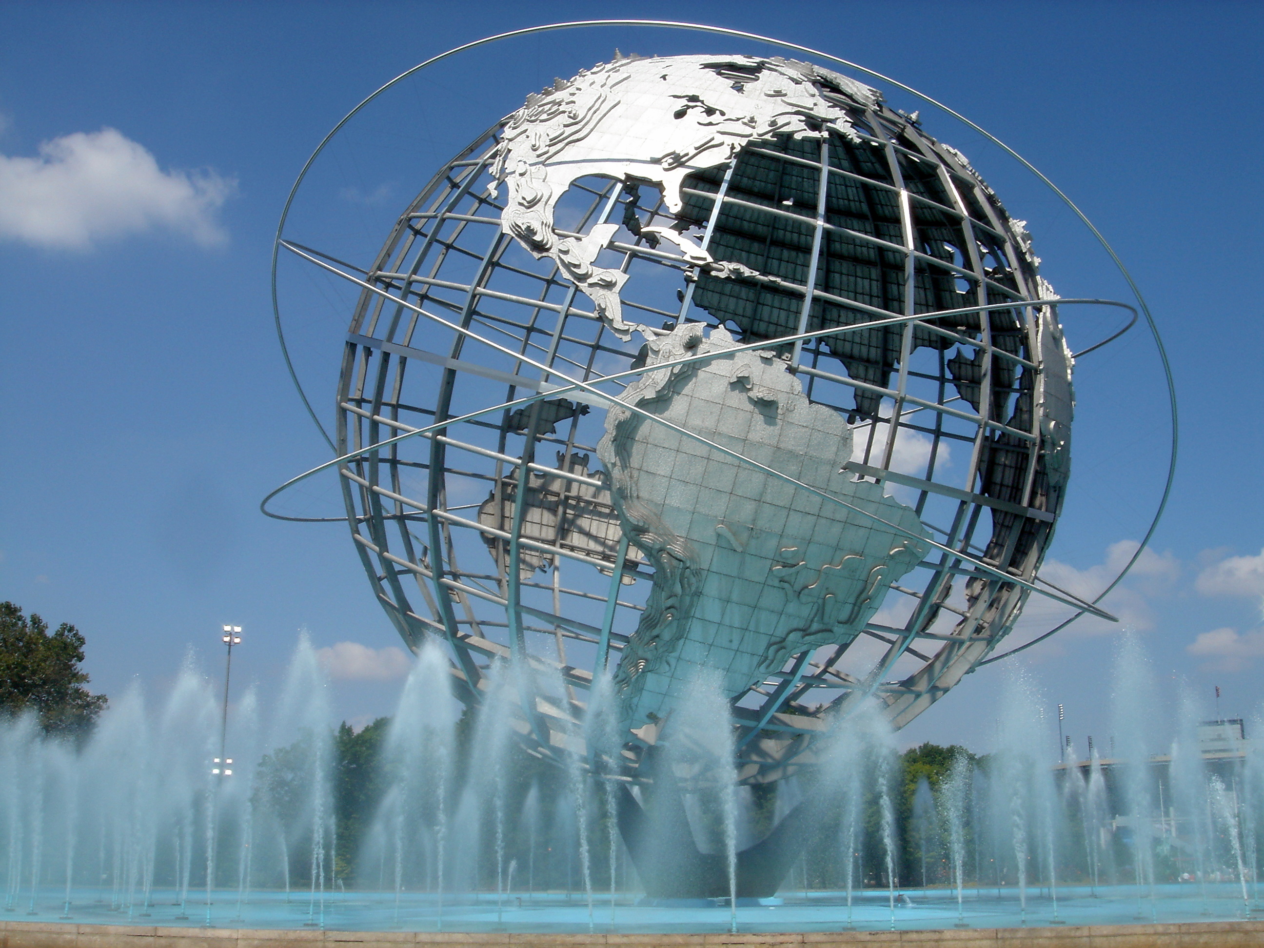
imagesize =
image_caption = TheUnisphere , unofficial symbol of Queens.
flag_size =
image_
seal_size =
image_shield =
shield_size =
image_blank_emblem =
blank_emblem_type =
blank_emblem_size =
mapsize =
map_caption = Location of Queens shown in yellow.
pushpin_
pushpin_label_position =
pushpin_map_caption =
pushpin_mapsize =
subdivision_type = Country
subdivision_name = United States
subdivision_type1 = State
subdivision_name1 =New York
subdivision_type2 = County
subdivision_name2 = Queens
subdivision_type3 = City
subdivision_name3 =New York City
seat_type =
seat =
parts_type =
parts_style =
parts =
p1 =
p2 =
government_footnotes =
government_type =
leader_title =Borough president
leader_name =Helen Marshall
leader_title1 =
leader_name1 =
established_title = Settled
established_date = 1683
area_magnitude =
unit_pref =
area_footnotes =
area_total_sq_mi =178.28
area_land_sq_mi =109.24
area_water_sq_mi =69.04
area_water_percent =
elevation_footnotes =
elevation_m =
elevation_ft =
elevation_max_m =
elevation_max_ft =
elevation_min_m =
elevation_min_ft =
population_as_of =
population_footnotes =
population_note =
population_total =2270338
population_density_sq_mi =20409.0
timezone =
utc_offset =
timezone_DST =
utc_offset_DST =
latd=40 |latm=42 |lats=15.0 |latNS=N
longd=73 |longm=55 |longs=4.0 |longEW=W
postal_code_type =
postal_code =
area_code =
website = [http://www.queensbp.org Official Website of the Queens Borough President]
footnotes = Queens is the largest in area and the second most populous of the five boroughs ofNew York City ,New York , USA. The borough is coterminous with Queens County, a county of New York State.Located on the western portion of
Long Island , Queens is home to two of the three major New York City area airports (John F. Kennedy and LaGuardia), theNew York Mets baseball team, theUSTA Billie Jean King National Tennis Center (home of the annual U.S. Open),Kaufman Astoria Studios ,Silvercup Studios ,Flushing Meadows Corona Park , andQueens Center (the most profitable per-square-foot mall in America).As of the 2005 American Community Survey, immigrants comprise 47.6% of Queens residents making Queens the city's most diverse borough. [ [http://factfinder.census.gov/servlet/ACSSAFFFacts?_event=&geo_id=05000US36081&_geoContext=01000US%7C04000US36%7C05000US36081&_street=&_county=queens&_cityTown=queens&_state=&_zip=&_lang=en&_sse=on&ActiveGeoDiv=&_useEV=&pctxt=fph&pgsl=050&_submenuId=factsheet_1&ds_name=null&_ci_nbr=null&qr_name=null®=null%3Anull&_keyword=&_industry= 2005 American Community Survey Fact Sheet for Queens County, New York] ,
United States Census Bureau , accessedFebruary 24 ,2007 .] With a population of 2.2 million it is the second most populous borough in New York City (behindBrooklyn ) and the tenth most populous county in the United States. The 2.2 million figure is the highest historical population for the borough. [http://www.census.gov/population/www/documentation/twps0027.html] Were each borough an independent city, Queens would be the fifth largest city in the United States (and Brooklyn would be fourth).Queens was established in 1683 as one of the original 12 counties of New York and was supposedly named for the then-
queen consort ,Catherine of Braganza , the Catholic wife of Charles II [http://queens.about.com/od/queensalmanac/f/queens_name.htm] [http://www.ny.com/histfacts/geography.html#queens] (this is not supported by contemporary documents).The borough is often considered one of the moresuburb an boroughs of New York City. Neighborhoods in central (except those situated alongQueens Boulevard and the neighborhoods of Flushing and Jamaica), southern, and eastern Queens have a look and feel similar to the bordering suburbs of western Nassau County. In its northwestern section, however, Queens is home to many urban neighborhoods and several central business districts.Long Island City , on the Queens' waterfront across fromManhattan , is the site of theCiticorp Building , the tallest skyscraper in New York City outside of Manhattan.History
European colonization brought both Dutch and English settlers, as a part of the
New Netherlands colony. First settlements occurred in 1635, with colonization at Maspeth in 1642, [cite web |url=http://www.nnp.org/vtour/regions/Long_Island/mespath.html |title=A Virtual Tour of New Netherland] andVlissingen (now Flushing) in 1643.cite book |title=The Epic of New York City |author=Ellis, Edward Robb |publisher=Old Town Books |year=1966 |pages=p. 54] Other early settlements included Newtown (now Elmhurst) and Jamaica. However, these towns were mostly inhabited by English settlers fromNew England via easternLong Island (Suffolk County) subject to Dutch law. After the capture of the colony by the English and its renaming as New York in 1664, the area (and all of Long Island) became known as Yorkshire.Originally, Queens County included the adjacent area now comprising Nassau County. It was an original county of New York State, one of twelve created in 1683.
Queens played a minor role in the
American Revolution , as compared toBrooklyn where theBattle of Long Island was largely fought. Queens, like the rest of Long Island, fell under British occupation after the Battle of Long Island in 1776 and remained occupied throughout most of the rest of the war. Under theQuartering Act , British soldiers used, as barracks, the public inns and uninhabited buildings belonging to Queens residents, against the will of many of the local people. The quartering of soldiers in private homes, except in times of war, was banned by theThird Amendment to the United States Constitution .Nathan Hale was captured by the British on the shore of Flushing Bay in Queens before being executed inManhattan .From 1683 until 1784, Queens County consisted of five towns: Flushing, Hempstead, Jamaica, Newtown, and Oyster Bay. On
April 6 ,1784 , a sixth town, the Town of North Hempstead, was formed through secession by the northern portions of the Town of Hempstead. [cite web
url=http://www.city-data.com/forum/new-york-city/214288-geographic-history-queens.html |title=Geographic history of Queens
date=2007-12-16
accessdate=2007-12-23] [cite web
url=http://www.rootsweb.com/~nyqueen2/History.htm
title=Geographic History of Queens County
author=Walter Greenspan
accessdate=2007-12-23] [cite web
url=http://history.rays-place.com/ny/queens-towns.htm
title=Towns in Queens County, NY; From: Gazetteer of the State of New York
author=J. H. French, LL.D.
year=1860
accessdate=2007-12-28]The seat of the county government was located first in Jamaica, [cite web
url=http://www.hopefarm.com/5boros.htm
title=Early Five Borough's History
quote=When Queens County was created the courts were transferred from Hempstead to Jamaica Village and a County Court was erected. When the building became too small for its purposes and the stone meeting house had been erected, the courts were held for some years in that edifice. Later a new courthouse was erected and used until the seat of justice was removed to North Hempstead
accessdate=2007-12-30] but was moved about 1788 to Mineola, [cite web
url=http://www.queensbp.org/content_web/tourism/tourism_history.shtml
title=Historical Essay: A Thumbnail View
quote=From the final withdrawal of the British in November, 1783, until the 1830s, Queens continued as an essentially Long Island area of farms and villages. The location of the county government in Mineola (in present-day Nassau County) underscores the island orientation of that era. Population grew hardly at all, increasing only from 5,791 in 1800 to 7,806 in 1830, suggesting that many younger sons moved away, seeking fortunes where land was not yet so fully taken up for farming.
publisher=Official History Page of the Queens Borough President's Office
accessdate=2007-12-29
note=article does not give specific datecite book
title=A Research Guide to the History of the Borough of Queens and Its Neighborhood
author=Jon A. Peterson and Vincent Seyfried, ed.
year=1983cite book
author=Peterson, Jon A., ed.
title=A Research Guide to the History of the Borough of Queens, New York City
location=New York
publisher=Queens College, City University of New York
year=1987] [cite web
url=http://www.timevoyagers.com/bookstore/NewYork/counties/queens.htm
title=New York - Queens County - History
accessdate=2007-12-29 cite web
url=http://www.courts.state.ny.us/history/elecbook/sullivan/pg1.htm
title=History of New York State 1523-1927
publisher=The Historical Society of the Courts of the State of New York cite book
author=Sullivan, Dr. James
title=History of New York State 1523-1927
year=1927
publisher=Lewis Historical Publishing Company, Inc
location=New York, Chicago] [cite web
url=http://www.mynewyorkgenealogy.com/ny_history.htm
title=New York State History
year=1999
publisher=Genealogy Inc
quote=Under the Reorganization Act of 7 March 1788, New York was divided into 120 towns (not townships), many of which were already in existence.
accessdate=2007-12-28] [cite web
url=http://www.dos.state.ny.us/lgss/pdfs/Handbook.pdf
title=State of New York; Local Government Handbook; 5th Edition
month=January | year=2000
format=PDF
pages=Ch 4, p 13; Ch 5 p 2
quote=The 1777 New York State Constitution, Article XXXVI, confirmed land grants and municipal charters granted by the English Crown prior to October 14, 1775. Chapter 64 of the Laws of 1788 organized the state into towns and cities...The basic composition of the counties was set in 1788 when the State Legislature divided all of the counties then existing into towns. Towns, of course, were of earlier origin, but in that year they acquired a new legal status as components of the counties.] [cite web
url=http://www.newsday.com/community/guide/lihistory/ny-history_mysteries_hs221a,0,670882.story
title=HISTORY MYSTERIES: Shelter Island Ferry/Mineola Building
quote=The building shown below "is one of the most important buildings in the history of Mineola," wrote Jack Hehman, president of the Mineola Historical Society. Built in 1787 and known as the "old brig," it was the first Queens County courthouse and later a home for the mentally ill. The building was at Jericho Turnpike and Herricks Road until 1910, when it burned to the ground.
accessdate=2008-04-01] [cite web
url=http://query.nytimes.com/gst/abstract.html?res=9D01E7D61430E433A2575AC2A96E9C94639FD7CF
title=THE MINEOLA ASYLUM.; WITNESSES WHO TESTIFIED THAT IT IS AND HAS BEEN A MODEL INSTITUTION.
quote=The investigation of the charges made against the Superintendent and keepers of the Mineola Asylum for the Insane, which was begun last Tuesday, was continued yesterday by the standing Committee on Insane Asylums of the Queens County Board of Supervisors-- Messrs. Whitney, Brinckerhoff, and Powell. The committee were shown through the asylum, which is the old building of the Queens County Court-house over 100 years old
date=1882-08-29
publisher=NY Times
accessdate=2008-04-01] cite web |url=http://www.bklyn-genealogy-info.com/Civil/Nassau.P.O.html |title=Nassau County Post Offices 1794-1879 |author=David Roberts
accessdate=2008-04-01cite book |title=New York Postal History: The Post Offices & First Postmasters from 1775 to 1980
quote=There was only one post office established in present Nassau County when the Long Island post road to Sag Harbor was established September 25, 1794. It appears that the mail from New York went to Jamaica. This was the only post office in the present day Boroughs of Queens or Brooklyn before 1803. From Jamaica the mail went east along the Jericho Turnpike/Middle Country Road route and ended at Sag Harbor. The only post office on this route between Jamaica and Suffolk County was QUEENS established the same date as the others on this route 9/25/1794. This post office was officially Queens, but I have seen the area called "Queens Court House" and was located approximately in the Mineola-Westbury area. The courthouse was used until the 1870's when the county court was moved to Long Island City. Later it served as the Queens County Insane Asylum and still later as an early courthouse for the new Nassau County, during construction of the present "old" Nassau County Courthouse in Mineola. It was demolished shortly after 1900 ... after about 120 years of service of one type or the other.
author=John L. Kay & Chester M. Smith, Jr.|publisher=American Philatelic Society|year=1982] [cite web
url=http://query.nytimes.com/gst/abstract.html?res=9E05E1D8113EEE34BC4D51DFB4668389669FDE
title=The Queens County Court-House Question A New Building to be Erected at Mineola.
date=1872-02-25
quote=For forty years the Supervisors of Queens County have been quarreling over a site for a Court-house. The incommodious building used
accessdate=2008-04-01] (now part of Nassau County, it was called Clowesville until 1858 [cite news
url=http://www.newsday.com/community/guide/lihistory/ny-historytown-hist002d,0,6131005.story?coll=ny_community_guide_lihistory_promo
title=Mineola: First Farmers, Then Lawyers
author= Rhoda Amon (Staff Writer)
publisher=Newsday
accessdate=2007-12-31] [cite web
url=http://www.bklyn-genealogy-info.com/Map/No.Hemp.html
title=1873 map of North Hempstead
quote=bottom right by spur road off Jericho Tpk - location is now known as Garden City Park. Clowesville was the name of the nearest station on the LIRR, approximately at the location of the present Merillon Avenue station. The courthouse (photo at http://www.newsday.com/community/guide/lihistory/ny-hs2tmi01,0,3275994.photo ) was north of the station.
accessdate=2007-12-31] ).In 1870, Long Island City was incorporated as a city (consisting of what had been the Village of Astoria and some unincorporated areas in the Town of Newtown), and about 1874, the seat of county government was moved there from Mineola. [cite news
url=http://www.queenstribune.com/guides/2005_PatchworkOfCultures/pages/QueensTimeline.htm
title=A Queens Timeline
publisher="The Queens Tribune"
quote=1874 – Queens County Courthouse and seat of county government moved from Mineola (in present-day Nassau County) to Long Island City.
accessdate=2007-12-23] [cite news
url=http://www.newsday.com/community/guide/lihistory/ny-historytown-hist002d,0,6131005.story?coll=ny_community_guide_lihistory_promo
title=Mineola: First Farmers, Then Lawyers
author= Rhoda Amon (Staff Writer)
quote=That was the year when the "Old Brig" courthouse was vacated after 90 years of housing lawbreakers. The county court moved from Mineola to Long Island City.
publisher=Newsday
accessdate=2007-12-31] [cite web
title=Nassau's Difficult Birth; Eastern factions of Queens win the fight to separate after six decades of wrangling
author=Geoffrey Mohan (Staff Writer)
publisher=Newsday
url=http://www.newsday.com/community/guide/lihistory/ny-history-hs615a,0,7026626.story?page=2
note=Courthouse move from Mineola to LIC
year=2007
accessdate=2007-12-31]The New York City Borough of Queens was formed on
January 1 ,1898 , after an 1894 vote on consolidation. [cite web
url=http://mapsites.net/gotham01/ConsolidationDBQ.htm
title=Inventing Gotham
accessdate=2007-12-28] [cite news
url=http://query.nytimes.com/mem/archive-free/pdf?res=9E0CE2D81730E033A25756C1A9649D94659ED7CF
title=Official Announcement of the Results of the Election
publisher= NY Times
date=1894-12-15
quote=The area included a radius of twenty miles (32 km), with the city hall in New York as a center to circumscribe it
accessdate=2007-12-28] [cite web
url=http://www.usgennet.org/usa/ny/state/his/bk2/ch4/pt8.html
title=The History of New York State
author=Holice, Deb & Pam
accessdate=2007-12-28 cite book
title=The History of New York State
pages= Book II, Chapter IV Part VIII
author=Dr. James Sullivan (editor)] Long Island City, the towns of Newtown, Flushing, and Jamaica, and the Rockaway Peninsula portion of the Town of Hempstead were merged to form the new borough, dissolving all former municipal governments (Long Island City, the county government, all towns and all villages) within the new borough. The areas of Queens County that were not part of the consolidation plan, [cite news
url=http://query.nytimes.com/gst/abstract.html?res=9C05EFDD1131E033A25750C1A96F9C94659ED7CF
title=OF INTEREST TO POLITICIANS.
pages=p 9, 620 words
date=1894-09-13 (before vote)
publisher=The New York Times
quote=The question of the Greater New-York, which is also to be submitted to the people at this coming election, involves the proposition to unite in one city the following cities, counties, and towns: New-York City, Long Island City, in Queens County; the County of Kings, (Brooklyn;) the County of Richmond, (S.I.;) the towns of Flushing, Newtown, Jamaica, in Queens County; the town of Westchester, in Westchester County, and all that portion of the towns of East Chester and Pelham which lies south of a straight line drawn from a point where the northerly line of the City of New-York meets the centre line of the Bronx River, to the middle of the channel between Hunter's and Glen Islands, in Long Island Sound, and that part of the town of Hempstead, in Queens County, which is westerly of a straight line drawn from the south-easterly point of the town of Flushing in a straight line to the Atlantic Ocean.
accessdate=2007-12-28] [cite news
url=http://query.nytimes.com/gst/abstract.html?res=9D06E0D91131E033A25755C1A9669D94659ED7CF
title=Vote for Greater New York
date=1894-10-16 (before election)
publisher=The New York Times
accessdate=2007-12-28] [cite news
url=http://query.nytimes.com/gst/abstract.html?res=9A0DE3D71131E033A25757C0A9679D94659ED7CF
title=NEW-YORK'S PLACE IN DANGER; CONSOLIDATION DEFEATED, SHE MUST YIELD TO CHICAGO.
date=1894-11-04 (before election)
publisher=The New York Times
note= again, no mention of Town of Oyster Bay, nor Town of North Hempstead, nor any plan for ALL of Town of Hempstead, indeed only part of Hempstead was ever planned to become part of Queens
accessdate=2007-12-28] [cite news
url=http://query.nytimes.com/gst/abstract.html?res=9403E0D61531E033A2575BC0A9679D94659ED7CF
title=GREATER NEW-YORK IN DOUBT; THE CITY VOTE IS FOR IT AND BROOKLYN IS UNCERTAIN
date=1894-11-08 (before results of Queens vote known)
publisher=NY Times
quote=The increase in area and population that New-York will acquire if consolidation becomes a fact will become evident by a glance at the following table... Flushing... *Part of the town of Hempstead... Jamaica... Long Island City ... Newtown... The townships in Queens County that are to be included in the Greater New-York have not been heard from yet...
note= no mention of Town of Oyster Bay, nor Town of North Hempstead, nor any plan for ALL of Town of Hempstead, indeed only part of Hempstead was ever planned to become part of Queens
accessdate=2007-12-28] [cite news
url=http://query.nytimes.com/gst/abstract.html?res=9B02E3DD123EE333A25751C2A9649C94679ED7CF
title=REPORT FAVORS CONSOLIDATION.; An Argument Against the Claims of the Resubmissionists.
pages= Page 1, 5318 words
date=1896-02-22
publisher=The New York Times
accessdate=2007-12-28] [cite news
url=http://query.nytimes.com/gst/abstract.html?res=9C04E2DC1730E132A25751C1A9649C94689ED7CF
title=THE EAST CITY LINE FIXED
date=1899-02-12
pages=page 15, 1267 words
publisher=The New York Times
accessdate=2007-12-28] [cite web
title=Nassau's Difficult Birth; Eastern factions of Queens win the fight to separate after six decades of wrangling
author=Geoffrey Mohan (Staff Writer)
publisher=Newsday
url=http://www.newsday.com/community/guide/lihistory/ny-history-hs615a,0,7026626.story?page=4
quote=North Hempstead, Oyster Bay and the rest of Hempstead were excluded from the vote.
year=2007
accessdate=2007-12-31] consisting of the towns of North Hempstead and Oyster Bay, and the major remaining portion of the Town of Hempstead, remained part of Queens County until they seceded to form the new Nassau County on
January 1 ,1899 , whereupon the boundaries of Queens County and the Borough of Queens became . Lloyd Neck, which was part of the Town of Oyster Bay became part ofSuffolk County, New York . [ [Beers Atlas of Long Island (1873)] ] With consolidation, Jamaica once again became the county seat, though county offices now extend to nearby Kew Gardens also. [cite news
url=http://query.nytimes.com/gst/abstract.html?res=9E0DE3DC1038E533A65754C0A9609C94679ED7CF |title=THE COMING GREATER CITY; BENEFITS TO LONG ISLAND AND VILLAGES UNDER ITS CONTROL
publisher= NY Times
date=1896-06-10
accessdate=2007-12-23] [The borough's administrative and court buildings are presently located in Kew Gardens and downtown Jamaica respectively, two neighborhoods that were villages of the former Town of Jamaica.]From 1905 to 1908 the
LIRR in Queens was electrified. Transportation to and fromManhattan , previously by ferry or via bridges in Brooklyn, opened up when theQueensboro Bridge was finished in 1909, and with railway tunnels under theEast River in 1910. From 1915 onward, much of Queens was connected to the New York City subway system. [cite web
url=http://www.queensbp.org/content_web/tourism/tourism_history.shtml
title=Historical Essay: A Thumbnail View
author=Vincent F. Seyfried and Jon A. Peterson, History Department, Queens College/CUNY
publisher=Official History Page of the Queens Borough President's Office
quote=Even more crucial to future development was the opening of the Queensboro Bridge in 1909. This span ended the isolation of the borough's road system at precisely the time when mass use of the automobile was getting underway in the United States.
accessdate=2007-12-31] [cite web
url=http://www.thirteen.org/queens/history3.html
title= A Walk Through Queens with David Hartman and Historian Barry Lewis
quote=The most momentous event in the history of Queens occurred in 1909 when the long planned Queensboro Bridge was finally opened. This ended the century old isolation of the county and dependence on ferries.
author=Vincent F. Seyfried
publisher=Educational Broadcasting Corporation
year=2004
accessdate=2007-12-29] With the construction of theSteinway Tunnel carrying theIRT Flushing Line between Queens and Manhattan, and the emergent expansion of the use of theautomobile , the population of Queens more than doubled in the 1920s, from 469,042 in 1920 to 1,079,129 in 1930. [cite web |url=http://www.census.gov/population/www/documentation/twps0027.html |title=US Census figures for Queens 1900-1990] . This was followed by theIND Queens Boulevard Line via the53rd Street Tunnel which included a special loop station for the1939 World's Fair .Geography
Queens County is in the western part of Long Island and includes a few smaller islands, most of which are in
Jamaica Bay and form part ofGateway National Recreation Area , which is in turn one of the National Parks of New York Harbor [http://www.nps.gov/npnh/index.htm ] The Rockaway Peninsula sits between Jamaica Bay and theAtlantic Ocean . The western and northern edge of the borough is defined a watery continuum made up ofNewtown Creek which flowsinto the tidal estuary known as theEast River , which includes the associatedFlushing Bay andFlushing River . The East River opens intoLong Island Sound . The mid-section of Queens is crossed by theLong Island straddling terminalmoraine created by theWisconsin Glacier . This feature evolved into a land use pun due to the siting of many cemeteries.Geographic Location
Centre = Queens County, New York
North =Bronx County, New York
Northeast =
East =Nassau County, New York
Southeast =
South =Atlantic Ocean
Southwest =Brooklyn, New York
West =New York County, New York
Northwest =The tallest tree in the
New York metropolitan area , called theQueens Giant , is also the oldest living thing in the New York metro area. It is located in northeastern Queens, and is 450 years old and convert|132|ft|m|0 tall as of 2005.According to the
United States Census Bureau , the county has a total area of 178.3 sq mi); convert|109.2|sqmi|km2|abbr=on of it is land and 38.73% of it is water.Neighborhoods
The
United States Postal Service divides the borough into five "towns" based roughly on those in existence at the time of the consolidation of the five boroughs into New York City: Long Island City, Jamaica, Flushing, Far Rockaway, and Floral Park. These ZIP codes do not necessarily reflect actual neighborhood names and boundaries; "East Elmhurst," for example, was largely coined by the USPS and is not an official community. Most neighborhoods have no solid boundaries. The Forest Hills and Rego Park neighborhoods, for instance, overlap.Residents of Queens often closely identify with their neighborhood rather than with the borough or city as a whole. Postal addresses are written with the neighborhood, state, and then zip code rather than the borough or city. The borough is a patchwork of dozens of unique neighborhoods, each with its own distinct identity:
* Howard Beach, Ozone Park, and Middle Village, are home to largeItalian American populations.
* Rockaway Beach and Woodside have largeIrish American populations. Woodside also has a largeHispanic andAsian American population.
* Astoria, in the northwest, is traditionally home to one of the largest Greek populations outside ofGreece , and is also home to a growing population of Arabs as well as young professionals fromManhattan . Nearby Long Island City is a major commercial center and the home of theQueensbridge housing project.
* Maspeth and Ridgewood are home to many European immigrants, including large Romanian, Polish, and other Slavic populations. Ridgewood also has a largeHispanic population.
* Jackson Heights, Elmhurst, and Corona make up an enormous conglomeration ofHispanic ,Asian American andSouth Asian communities.
* Flushing, one of the largest neighborhoods in Queens, has one of the largest Asian communities in the city, made up of Koreans, Chinese and Indians as well as a smaller Hispanic population and thinning European population.
* Richmond Hill, in the south, is often thought of as "Little Guyana" for its largeIndo-Caribbean community. [O'Grady, Jim. [http://query.nytimes.com/gst/fullpage.html?res=9B0DE3DD1F39F930A25752C0A9649C8B63 " NEIGHBORHOOD REPORT: RICHMOND HILL; Making Guyana More Accessible, Two Sisters Start an Airline"] , "The New York Times ",January 13 ,2002 . AccessedSeptember 30 ,2007 . "Many of them live in Richmond Hill. Just as Chinese-Americans energized downtown Flushing, the Guyanese have revived a once-moribund shopping strip on Liberty Avenue between the Van Wyck Expressway and Lefferts Boulevard, now known as Little Guyana."] It also has the largest population of Sikhs from the Indian state of Punjab.
* Rego Park, Forest Hills, and Kew Gardens have traditionally largeJewish populations (many of these communities are Jewish immigrants from Israel, Iran and the former Soviet Union). Also known for large and growingHispanic /Latino community, mainly immigrants fromSouth America .
* Jamaica Estates, Fresh Meadows, and Hollis Hills are also populated with many people of Jewish background. Many Asian families reside in parts of Fresh Meadows as well.
* Jamaica is home to largeAfrican American andCaribbean populations. There are also middle-class African American and Caribbean neighborhoods such as Hollis, Saint Albans, Cambria Heights, Springfield Gardens, Rosedale,Laurelton and Briarwood along east and southeast Queens.
* Bellerose and Floral Park are home to a largeSouth-Asian population, predominantlyIndian-Americans from the north-Indian state of Punjab and the south-Indian state ofKerala . There are some less diverse, but still prosperous part of Queens, such as South Jamaica.Together, these neighborhoods comprise the most diverse county in the United States. [Roberts, Sam. [http://www.nytimes.com/2006/10/18/us/18population.html "A 300 Millionth American. Don’t Ask Who."] , "
The New York Times ",October 18 ,2006 . "In Queens, the nation’s most diverse county, Emanuel Plata weighed in at convert|6|lb|15|oz|kg at Elmhurst Hospital Center..."] Several of these neighborhoods are home to a diverse mix of many different ethnicities.Adjacent counties
*Bronx County, New York - north
*Nassau County, New York - east
*New York County, New York - west
*Kings County, New York - west and south
*Richmond County, New York- southwestGovernment
As of the
census of 2000, there were 2,229,379 people, 782,664 households, and 537,690 families residing in the county. Thepopulation density was 7,879.6/km² (20,409.0/sq mi). There were 817,250 housing units at an average density of 2,888.5/km² (7,481.6/sq mi). The racial makeup of the county was 44.08% White, 20.01% Black or African American, 0.50% Native American, 17.56% Asian, 0.06% Pacific Islander, 11.68% from other races, and 6.11% from two or more races. 24.97% of the population were Hispanic or Latino of any race.Some main European ancestries in Queens, 2000: [ [http://factfinder.census.gov/servlet/QTTable?_bm=y&-geo_id=05000US36081&-qr_name=DEC_2000_SF3_U_QTP13&-ds_name=DEC_2000_SF3_U&-redoLog=false American Factfinder 2000 Ancestry: Queens County, NY ] ]
*Italian: 8.4%
*Irish: 5.5%
*German: 3.5%
*Polish: 2.7%
*Russian: 2.3%
*Greek: 2.0%Queens has the largest
Asian American population outside ofWestern United States . According to the 2006 American Community Survey it ranks 5th among US counties with 477,772(21.18%) Asian Americans, behindLos Angeles County ,Honolulu County ,Santa Clara County andOrange County, CA . The 2000 census showed that the borough is home to the largest concentration ofIndian-American s in the nation, with a total population of 129,715 (5.79% of the borough population) ( [http://www.aafny.org/cic/briefs/indianamer.pdf] , as well asPakistani-American s who number 15,604 [http://www.aafny.org/cic/briefs/pakistani.pdf] .Queens has the second largestSikh population in the nation afterCalifornia . According to a 2002 UJA-Federation of New York study, Queens is home to 186,000Jewish Americans . [http://www.geocities.com/mplaut2/ujafed1.html]According to a Census Bureau estimate, the population increased to 2,241,600 in 2005.
There were 782,664 households out of which 31.5% had children under the age of 18 living with them, 46.9% were married couples living together, 16.0% had a female householder with no husband present, and 31.3% were non-families. 25.6% of all households were made up of individuals and 9.7% had someone living alone who was 65 years of age or older. The average household size was 2.81 and the average family size was 3.39.
In the county the population was spread out with 22.8% under the age of 18, 9.6% from 18 to 24, 33.1% from 25 to 44, 21.7% from 45 to 64, and 12.7% who were 65 years of age or older. The median age was 35 years. For every 100 females there were 92.9 males. For every 100 females age 18 and over, there were 89.6 males.
The median income for a household in the county was $37,439, and the median income for a family was $42,608. Males had a median income of $30,576 versus $26,628 for females. The
per capita income for the county was $19,222. About 16.9% of families and 21.6% of the population were below thepoverty line , including 18.8% of those under age 18 and 13.0% of those age 65 or over. In Queens the black population earns more than whites on average. [ [http://www.nytimes.com/2006/10/01/nyregion/01census.html Black Incomes Surpass Whites in Queens - New York Times ] ] Many of these African-Americans live in quiet middle class suburban neighborhoods near the Nassau County border, such as Laurelton andCambria Heights which have large black populations who's family income is higher than average. Those areas are known for their well kept homes and suburban feel. The migration of whites from parts of Queens has been long ongoing with departures from Ozone Park, Woodhaven, Bellerose, Floral Park, and Flushing. etc (most of the outgoing population has been replaced with Asian Americans). Neighborhoods such as Whitestone, College Point, North Flushing, Auburndale, Bayside, Middle Village, Little Neck, and Douglaston have not had a substantial exodus of white residents, but have seen an increase of Asian population (mostly South Korean). Queens has recently experienced a real estate boom making most of its neighborhoods very desirable for people who want to reside near Manhattan in a less urban setting. According to a 2001 Claritas study, Queens is the most diverse county in the United States among counties of 100,000+ population.. [ [http://findarticles.com/p/articles/mi_m0EIN/is_2001_July_23/ai_76689304 Claritas Study Ranks Racial/Ethnic Diversity in Counties Nationwide ] ] There are 138 languages spoken in the borough. [ [ http://www.osc.state.ny.us/osdc/rpt1100/rpt1100.htm Queens: An Economic Review] ] The top languages include: [ [http://queens.about.com/od/queensalmanac/f/languages.htm How Many Languages Are Spoken in Queens, NY?] ]# English
# Spanish
# Chinese
# Korean
# Italian
# Greek
# Russian
# Tagalog (Filipino)
# French
# Punjabi
# Guarani
# ArabicCulture
Queens was an epicenter of jazz in the 1940s. Such jazz greats as
Louis Armstrong ,Count Basie andElla Fitzgerald found refuge from segregation in the mixed communities of the borough, while a younger generation —Charlie Parker ,Sonny Rollins ,Thelonious Monk ,Dizzy Gillespie , and others — were developing bebop in the clubs of Harlem. Also in Queens was where the majority of punk rock band The Ramones were raised.Western Queens is becoming an artistic hub, including
SculptureCenter , the Flux Factory, theNoguchi Museum ,Socrates Sculpture Park ,Fisher Landau Center , Dorsky Gallery Curatorial Programs , and theMuseum of the Moving Image . TheP.S. 1 Contemporary Art Center in the neighborhood ofLong Island City is one of the largest and oldest institutions in the United States dedicated solely to contemporary art. In addition to its renowned exhibitions, the institution also organizes the prestigious International and National Projects series, the Warm Up summer music series, and the Young Architects Program with The Museum of Modern Art. The current poet laureate of Queens is Ishle Yi Park.Queens is home to many other cultural institutions, including among others:
* [http://www.jcal.org/| Jamaica Center for Arts and Learning (JCAL)]
* [http://www.york.cuny.edu/pac/ Jamaica Performing Arts Center]
*Bowne House
*King Manor
* Kupferberg Center for the Arts [http://kupferbergcenterarts.org/]
*New York Hall of Science
*Noguchi Museum
*Queens Botanical Garden
* [http://www.queenstheatre.org/ Queens Theatre in the Park]
* [http://www.flushingtownhall.org/ Flushing Town Hall] Home of jazz in Queens
* Thalia Spanish Theater [http://www.thaliatheatre.org/pages/home.cfm]Queens was the setting for path breaking 1970s sitcom, "
All in the Family ". It is featured in the "Spider-Man " comics and films as the home of Peter Parker andMary Jane Watson . On "Ugly Betty " it is also home to Betty and her family. TV shows shot in Queens include "Sesame Street " (atKaufman Astoria Studios ) and "30 Rock " (atSilvercup Studios , although the show's setting is actually across theEast River in Manhattan). The two studios have also served as the site for many movies, music videos and commercials.ports
Queens is the home of
Shea Stadium , the former home ofNew York Mets ofMajor League Baseball and theNew York Jets of theNational Football League , as well as the temporary home of theNew York Yankees and theNew York Giants .Citi Field , the Mets' future home, is currently under construction adjacent to Shea. The US Open tennis tournament is played at theUSTA Billie Jean King National Tennis Center , located just south of Shea and Citi Field inFlushing Meadows-Corona Park . The US Open was formerly played at theWest Side Tennis Club in Forest Hills. Queens is also the home ofAqueduct Racetrack , located in Ozone Park. Just over the Queens line (in Nassau County) isBelmont Park Race Track, the home of theBelmont Stakes . In the past,Extreme Championship Wrestling has been held at an Elks lodge in Elmhurst.Food
Being the most diverse county in the nation Queens is home to restaurants from all cultures.A wide variety of foods from all different cultures, particularly Chinese, Colombian, Ecuadorian, Filipino, Indian, Korean, Mexican restaurants, along Roosevelt Avenue; Dominican food in Corona; African-American cuisine in Jamaica; and many Chinese, Korean restaurants in Flushing. Other cultures, such as Greek, Arab, Latin American, and Southeast Asian, have very prominent standings in Astoria. There are several
Bukharian restaurants that serveCentral Asia n food all around Forest Hills and Rego Park.Transportation
Twelve
New York City Subway routes traverse Queens, serving 81 stations on seven main lines. The A, G, J, and M routes connect Queens to Brooklyn without going through Manhattan first. The F, N, and R trains connect Queens and Brooklyn via Manhattan, while the E, V, W, and 7 connect Queens to Manhattan only.About 100 local bus routes move people around within Queens, and another 15 express routes shuttle commuters between Queens and Manhattan, under the MTA New York City Bus and MTA Bus brands.
A commuter train system, the
Long Island Rail Road , operates 20 stations in Queens with service to Manhattan, Brooklyn, and Long Island. Jamaica Station is a hub station where all the lines in the system but one (thePort Washington Branch ) converge. It is the busiest commuter rail hub in the United States.Sunnyside Yard is used as a staging area byAmtrak andNew Jersey Transit for intercity and commuter trains from Penn Station in Manhattan.Queens has crucial importance in international and interstate air traffic. Two of the
New York metropolitan area 's three major airports are located there;LaGuardia Airport is in northern Queens, whileJohn F. Kennedy International Airport is to the south on the shores ofJamaica Bay .AirTrain JFK provides a rail link between JFK and local rail lines.Queens is traversed by three trunk east-west highways. The
Long Island Expressway (Interstate 495) runs from theQueens Midtown Tunnel on the west through the borough to Nassau County on the east. TheGrand Central Parkway , whose western terminus is theTriborough Bridge , extends east to the Queens/Nassau border, where its name changes to theNorthern State Parkway . TheBelt Parkway begins at theGowanus Expressway in Brooklyn, and extends east into Queens, pastAqueduct Racetrack and JFK Airport. On its eastern end at the Queens/Nassau border, it splits into theSouthern State Parkway which continues east, and the Cross Island Parkway which turns north.There are also several major north-south highways in Queens, including the
Brooklyn-Queens Expressway (Interstate 278 ), theVan Wyck Expressway (Interstate 678 ), theClearview Expressway (Interstate 295), and the Cross Island Parkway.treets
The streets of Queens are laid out in a semi-grid system, with a numerical system of
street name s (similar to Manhattan and the Bronx). Nearly all roadways oriented north-south are "Streets", while east-west roadways are "Avenues", beginning with the number 1 in the west for Streets and in the north for Avenues. In some parts of the borough, several consecutive streets may share numbers (for instance, 72nd Street followed by 72nd Place, or 52nd Avenue followed by 52nd Road, 52nd Drive, and 52nd Court), often causing confusion for non-residents. In addition, incongruous alignments of street grids, unusual street paths due to geography, or other circumstances often lead to the skipping of numbers (for instance, on Ditmars Boulevard, 70th Street is followed by Hazen Street which is followed by 49th Street).This confusion stems from the fact that many of the village street grids of Queens had only worded names, some were numbered according to local numbering schemes, and some had a mix of words and numbers. In the early 1920s a "Philadelphia Plan" was instituted to overlay one numbered system upon the whole borough. Train stations were only partly renamed, thus now share dual names after the original street names. On the number 7 line in Sunnyside, there are 40th-Lowery St., 46th-Bliss St., 52nd St.-Lincoln Ave. and so forth. Numbered roads tend to be residential, although numbered commercial streets are not rare.
A fair number of streets that were country roads in the 18th and 19th centuries, (especially major thoroughfares such as Northern Boulevard,
Queens Boulevard , Hillside Avenue, and Jamaica Avenue) carry names rather than numbers, typically though not uniformly called "Boulevards" or "Parkways".The Rockaway Peninsula does not follow the same system as the rest of the borough and has its own numbering system. Streets are numbered in ascending order heading west from near the Nassau County border, and are prefixed with the word "Beach." Streets at the easternmost end, however, are nearly all named. Another deviance from the norm is Broad Channel; it maintains the north-south numbering progression but uses only the suffix "Road," as well as the prefixes "West" and "East," depending on location relative to Cross Bay Boulevard, the neighborhood's major through street.
The other exception is the neighborhood of Ridgewood, which for the most part shares a grid and house numbering system with the Brooklyn neighborhood of Bushwick. The grid runs east-west from the LIRR
Bay Ridge Branch right-of-way to Flushing Avenue; and north-south from Forest Avenue in Ridgewood to Bushwick Avenue in Brooklyn before adjusting to meet up correctly with the Bedford-Stuyvesant grid at Broadway. All streets on the grid have names.Waterways
Queens is connected to the Bronx by the
Bronx Whitestone Bridge , theThrogs Neck Bridge , theTriborough Bridge and theHell Gate Bridge . Queens is connected to Manhattan by theTriborough Bridge , theQueensboro Bridge , and theQueens Midtown Tunnel .While most of the Queens/Brooklyn border is on land, the Kosciuszko Bridge crosses the
Newtown Creek connecting Maspeth toGreenpoint, Brooklyn . ThePulaski Bridge connects McGuinness Boulevard in Greenpoint to 11th Street, Jackson Avenue, and Hunters Point Avenue in Long Island City. The Greenpoint Avenue Bridge connects Greenpoint and Long Island City avenues of the same name, which, east of Queens Boulevard (NY-25), becomes Roosevelt Avenue. A lesser bridge connect Grand Avenue in Queens to Grand Street in Brooklyn.The
Cross Bay Veterans Memorial Bridge traverses Jamaica Bay to connect the Rockaway Peninsula to the rest of Queens.Marine Parkway-Gil Hodges Memorial Bridge links the western part of the Peninsula withFlatbush Avenue , Brooklyn's longest thoroughfare. Both crossings were built and continue to be operated by what is now known as MTA Bridges and Tunnels. TheIND Rockaway Line parallels the Cross Bay, has a mid-bay station atBroad Channel which is just a short walk from theJamaica Bay Wildlife Refuge , now part ofGateway National Recreation Area and a major stop ontheAtlantic Flyway .One year-round scheduled ferry service connects Queens and Manhattan.
New York Water Taxi operates service across theEast River from Hunters Point in Long Island City to Manhattan at 34th Street and south to Pier 11 atWall Street . During baseball season,New York Waterway ferries operate to Shea Stadium for New York Mets weekend home games. [ [http://mets.mlb.com/NASApp/mlb/nym/ballpark/nym_ballpark_directions.jsp#ferry Ferry Services to Shea Stadium] ,New York Mets . AccessedMay 16 ,2006 .] In 2007, limited weekday service was begun between Breezy Point, the westernmost point in the Rockaways, to Pier 11 via theBrooklyn Army Terminal . Summertime weekend service provides service from Lower Manhattan and southwest Brooklyn to the peninsula's Gateway beaches.Education
Education in Queens is provided by a vast number of public and private institutions. Public schools in the borough are managed by the
New York City Department of Education , the largest public school system in the United States.Public Schools
*Aviation High School
*Information Technology High School
*Richmond Hill High School
*William Cullen Bryant High School
*John Adams High School (Jamaica/Ozone Park) Private Schools
Queens has a number of private schools, including:
*Al-Iman School
*Archbishop Molloy High School
*Cathedral Preparatory Seminary
*Christ The King Regional High School
*Gateway to Health Science High School
*Holy Cross High School (all-boys')
*The Mary Louis Academy (all-girls')
*Monsignor McClancy Memorial High School (all-boys')
*Our Lady of the Miraculous Medal
*Our Lady Of Perpetual Help School
*St. Agnes High School (all-girls')
*Saint Demetrios School
*St. Francis Preparatory School
*St. John's Preparatory School
*Samuel H. Wang Yeshiva University High School for Girls (all-girls')
*Stella Maris High School (all-girls')Postsecondary institutions
*
Bramson ORT College is anundergraduate college inNew York City operated by the American branch of theJewish charityWorld ORT . Its main campus is inForest Hills, Queens , with a satellite campus inBrooklyn .*
LaGuardia Community College , part of theCity University of New York (CUNY), is known as "The World's Community College" for its diverse international student body representing more than 150 countries and speaking over 100 languages. The college has been named a National Institution of Excellence by the Policy Center on the First Year of College and one of the top three large community colleges in the United States. ["Top 3 Large Community Colleges in the U.S." Community College Survey of Student Engagement, 2002] The college hosts the LaGuardia and Wagner Archives.*
Queensborough Community College , originally part of theState University of New York , is in Bayside and is now part of CUNY. It prepares students to attend senior colleges mainly in the CUNY system.*Queens College is one of the elite colleges in the CUNY system. Established in 1937 to offer a strong liberal arts education to the residents of the borough, Queens College has over 16,000 students including more than 12,000 undergraduates and over 4,000 graduate students. Students from 120 different countries speaking 66 different languages are enrolled at the school, which is located in Flushing. Queens College is also the host of CUNY's law school. The Queens College Campus is also the home of
Townsend Harris High School .*York College is one of CUNY's leading general-purpose liberal arts colleges, granting bachelor's degrees in more than 40 fields, as well as a combined BS/MS degree in Occupational Therapy. Noted for its Health Sciences Programs York College is also home to the Northeast Regional Office of the
Food and Drug Administration .*
Vaughn College of Aeronautics and Technology is a private, cutting edge, degree granting institution located across the Grand Central Parkway from LaGuardia Airport. Its presence underscores the importance of aviation to the Queens economy.*St. John's University is a private, coeducational Roman Catholic university founded in 1870 by the Vincentian Fathers. With over 19,000 students, St. John's is known for its medical, pharmacy, business and law programs as well as its men's basketball and soccer teams.
Public Library
The
Queens Borough Public Library is the public library system for the borough and one of three library systems serving New York City. Dating back to the foundation of the first Queens library in Flushing in 1858, the Queens Borough Public Library is one of the largest public library systems in the United States. Separate from theNew York Public Library , it is composed of 63 branches throughout the borough. In fiscal year 2001, the Library achieved a circulation of 16.8 million. First in circulation in New York State since 1985, the Library has maintained the highest circulation of any city library in the country since 1985 and the highest circulation of any library in the nation since 1987. The Library maintains collections in many languages, including Spanish, Chinese, Korean, Russian, Haitian Creole, Polish, and six Indic languages, as well as smaller collections in 19 other languages.Queens reflected in literature
The
Forest Hills andFlushing sections of Queens are featured in Jacob Appel's short story, "The Atatürk of the Outer Boroughs," which tells of the experiences of a Turkish locksmith named Onur Erdem who attempts to preserve his beloved neighborhood from a developer who wants to seize and raze local businesses in order to build a hockey arena. ["Raritan", Volume 24, Number 3 (Winter 2005) p. 78-93 ]Trivia
Queens is the setting of the popular
sitcom ,The King of Queens and the 1988 comedy film,Coming To America . Queens was also the home to the Bunker family from the TV show "All in the Family"References
Wikimedia Foundation. 2010.