- Chamba, Himachal Pradesh
-
This article is about the municipality in Himachal Pradesh. For its namesake district, see Chamba district. For the town in Uttarakhand, see Chamba, Uttarakhand.
Chamba — Town — Chamba town from across the river
 Chamba
Coordinates: 32°34′12″N 76°7′48″E / 32.57°N 76.13°E Country  India
IndiaState Himachal Pradesh District Chamba district Founded 920 Elevation 3,268 ft (996 m) Population (2005) - Total 20,327(7th) Time zone IST (UTC+5:30) Post code 176310 Chamba (Hindi: चंबा) is an ancient town in the Chamba district in the state of Himachal Pradesh, in northern India. According to the 2001 Indian census, Chamba has a population of 20,312 people.[1] Located at an altitude of 996 metres (3,268 ft) above mean sea level, the town is situated on the banks of the Ravi River (a major tributary of the Trans-Himalayan Indus River), at its confluence with the Sal River.
Though historical records date the history of the Chamba region to the Kolian tribes in the 2nd century BC, the area was formally ruled by the Maru dynasty, starting with the Raju Maru from around 500 AD, ruling from the ancient capital of Bharmour, which is located 75 kilometres (47 mi) from the town of Chamba.[2] In 920, Raja Sahil Varman (or Raja Sahil Verma) shifted the capital of the kingdom to Chamba, following the specific request of his daughter Champavati [3] (Chamba was named after her). From the time of Raju Maru, 67 Rajas of this dynasty have ruled over Chamba until it finally merged with the Indian Union in April 1948, although Chamba was under British suzerainty from 1846 to this time.[2]
The town has a large number of temples and palaces,[3][4] and hosts two popular jatras (fairs), the "Suhi Mata Mela" and the "Minjar Mela", which last for several days and involve music and dancing. Chamba is also well noted for its arts and crafts, particularly its Pahari paintings, which originated in the Hill Kingdoms of North India between the 17th and 19th century and its handicrafts and textiles.[5][6][7]
Contents
History
Early history
Chamba has an ancient history, which is inseparable from that of the surrounding district of Chamba. The earliest rulers were Kolian tribes. In the 2nd century BC the Khasas and Audumbaras were in power in the region. In the 4th century AD during the Gupta period, the Thakurs and Ranas ruled. From the 7th century, the Gurjara Pratiharas or the Rajput dynasty came into power.[8]
 Bharmour, the ancient capital of the district.
The recorded history of the Rajput rulers is traced to an eminent individual named Maru who is said to have moved to northwest India from Kalpagrama, around 500 AD.[9] He founded his capital in the Budhal river valley at a place called Brahmaputra, which later became known as Bharmour or Bhramaur, which is situated 75 kilometres (47 mi) to the east of the present day Chamba town. For three hundred years, kings of Rajput Dynasty ruled from their capital in Bharmour.[9]
However, in 920, Raja Sahil Varman (or Raja Sahila Verma), King of Bharmour, shifted his capital from Bharmour to a more centrally located plateau in the lower Ravi valley, and named the city Champavati, after his daughter.[9] There is some variation in the story to how exactly this transition came about in the historical records of Chamba. One version tells how Varman, who, after being childless for a significant period, was blessed with ten sons and a daughter, named "Champavati". It was Champavati who urged her father to build a new capital town in the valley.[9] However, obstacles stood in the way to relocating his capital, given that the king had previously granted the land in the modern Chamba vicinity to the Kanwan Brahmins. A solution was found in the form of offering a gift of eight copper coins called chaklis on the occasion of every marriage that took place in the Brahmin family, if they would agree to surrender their land to pave the way for the new capital.[9] With the land thus obtained, the new capital was built and named as Champa after Chamapavati, the King’s daughter, which, over the years, was simply shortened to "Chamba'.[9]
A variation of this origin of Chamba is that it originated as a hermitage where Champavati, a devout Hindu, used to frequent.[10] The king, being suspicious of his daughter's fidelity, one day investigated and followed her to the hermitage, but surprisingly he found neither his daughter nor the hermit there. Suddenly he was said to have heard a voice which informed him that his suspicions were ill founded, admonishing him and informing him that his daughter had been taken away from him permanently as a punishment of his lack of trust in her morals.[11] The King, fully chastened, sought redemption for his sin by expanding the hermitage into a temple, named in his daughter’s honour and built a city around the temple. Today this temple, called the Champavati Temple, belongs to the Royal family and the King’s daughter is venerated as a goddess. Every year, since 935, the Minjar festival or fair has been held.[12] It lasts for 21 days, coinciding with the first day of Baisakhi.[11]
 The remoteness and ruggedness of the Ravi River valley secured Chamba from successful invasions for around a 1,000 years.
Since Raja Sahil Varman, the dynasty ruled, without successful invasion for around a millennium until the British gained power.[8][13] The isolation of the town and its rugged hilly terrain is believed to have been a contributing factor to this unusual state of security. Later, Mughal emperors Akbar and Aurangzeb did attempt to annex Chamba but were unsuccessful in subjugating this territory into their kingdoms. Raja Prithvi Singh (1641-1664 AD), who was on amiable terms with Emperor Shahjahan was instrumental in introducing the court life styles of the Mughals. He also introduced Mughal-Rajput art and architecture in Chamba and the Mughal influence in the 17th and 18th centuries can be seen in modern Chamba today in the artwork and construction, and the exquisite tastes in its handicrafts.[8]
Modern history
By the late 18th century, the Sikhs under Maharaja Ranjit Singh controlled the region and had even placed a garrison at Chamba, forced the hill states to pay tribute to them. Ranjit Singh deposed the hill princes, including the more powerful Kangra ruler, Sansar Chand Katoch, but spared Chamba, given that the Wazir Nathu of Chamba had been important as an ambassador in negotiations with Katoch in 1809 and had saved his life in 1817 by succumbing his horse to King Singh to escape during a winter campaign in Kashmir.[8] After Ranjit Singh’s death, Chamba became unprotected and was drawn into the vortex of the disintegration of the Sikh Kingdom.
 The Chamba Valley, c. 1865
In 1845, the Sikh army invaded the British territory.[8] The result was disastrous, with the British defeating the army, leaving Chamba in a poor position. Wazir Bagha of Chamba was important in negotiations in its aftermath, and the Rajas of Chamba, upon on the advice of Bagha, agreed to the British suzerainty as part of Jammu and Kashmir in favour of an annuity of Rs 12,000.[8] The Treaty of Lahore was signed in 1846, in which the Rajas agreed to ceding the territory of Chamba district.[14] From then on, relations with the British were cordial, and the all of the Rajas of Chamba under the British rule, Sri Singh, Gopal Singh, Sham Singh, Bhuri Singh, Ram Singh and Laxman Singh were on good terms with the British army officers.[8]
Many progressive reforms and developments were made in Chamba under the British.[8] In 1863, the first Post office was established in Chamba and a daily mail service and a primary school.[15] In December, 1866, a hospital was opened by Doctor Elmslie of the Kashmir Medical Mission.[15] In the late 1860s two new roads to Dalhousie via Kolri and Khajiar were built. Gopal Singh, who ruled from 1870 to 1873, after abdicating, was responsible for building the grand Jandarighat Palace as his summer residence.[13][15]
Subsequent to India becoming an independent nation in August 1947, the princely state of Chamba finally merged with India on April 15, 1948 along with the other princedoms of Mandi-Suket, Sirmour and all of those in the Shimla hills.[8]
Geography and climate
 Panorama of the upper part of the town and mountains surrounding it
Chamba is the headquarters of the Chamba district, bordered by Jammu and Kashmir to the north-west and west, the Ladakh area of Jammu and Kashmir and Lahaul and Bara Banghal to the north-east and east, Kangra to the south-east and Gurdaspur district of Punjab to the south. It has an average elevation of 1,006 metres (3,301 ft).[16]
 The Ravi River flowing through Chamba
The town, the district and the valley where the town is located, share the name of Chamba. The town of Chamba is located at the junction of Ravi River and its tributary, the Sal River, with the Shah Madar hill forming the backdrop on its eastern side.[17] The Ravi flows in east-west direction forming deep canyons. During the spring and summer months, the levels of the river rise significantly from snow melt and pose a flooding risk.[18] Record levels were experienced in early July 2005, when the National Hydroelectric Power Corporation was forced to shut down the power generation on its 300-MW Chamera Power Station.[18]
Located on the right bank of the Ravi river valley, built on successive flat terraces, the town is bounded topographically by the Dhauladhar and Zanskar ranges, south of the inner Himalayas.[17][19] Chamba, despite its hill location, is well connected by road to the rest of the state and country, including Shimla, Delhi and Chandigarh along several routes.[20][21][22] The nearest broad gauge railway stations are at Chakki Bank and Pathankot, the latter of which is 120 kilometres (75 mi) away by road.
The temperatures in summer vary between 38 °C (100 °F) and 15 °C (59 °F) and in winter: 15 °C (59 °F) and 0 °C (32 °F).[20] The maximum temperature recorded in summer is 39 °C (102 °F) and the minimum temperature in winter is −1 °C (30 °F).[20] Climatically March to June is said to be the best period to visit Chamba, which is a well known hill station.[20] The average annual rainfall in the town is 785.84 millimetres (30.939 in).[23]
Demographics
As of 2001[update] India census,[1] Chamba had a population of 20,312. Males constituted 52% of the population and females 48%. Chamba has an average literacy rate of 81%, higher than the national average of 59.5%; with a male literacy of 85% and female literacy of 77%.[24] The main languages are Hindi, the local language of Pahari, and Himachali is also spoken by some inhabitants.[20]
Away from the urban centre, the tribal people of Chamba are divided into two major groups; the Gujjars and the Gaddis.[25] The Gujjars, mainly nomads, came to Chamba across the state border from Kashmir along the trade routes. They belong to nomadic herdsmen of the Islamic community, and travel to lowland Punjab in the autumn with their livestock to avoid the harsh winter of the Chamba hills.[25] Their features are middle-eastern and have a distinct language and culture aloof from the main town.[25]
The Gaddis comprise several ethnic groups; namely the Brahmans, Rajputs, Thakkurs, Rathis and the Khatris, who form the majority.[25] They are agricultural peoples, and the name "Gaddi" means "shepherd".[25] They mainly inhabit an area of the Chamba district in the Dhaula Dhar mountains, known as Brahmaur Wazarat or "Gadaran", located between Chamba and Kangra. "Gadar" means sheep, so their land is informally referred to as "Gadaran", literally meaning "sheep country".[25] They are believed to have come to Chamba in the 10th century, although an influx of Gaddi people migrated to Chamba from Lahore in the 18th century, during the Mughal Empire.[7] They are said to practice animism combined with the worship of Lord Siva.[7]
Administration
 Gopal Singh, Raja of Chamba (ruled 1870–1873)
There have been a total of 67 rajas who have ruled Chamba district since the Principality of Bharmour was established in the 6th century, beginning with Raja Maru.[2] Indeed it is believed to have been an isolated case in the history of India that the Chamba kingdom remained independent without interference for over 1000 years.[2] Before Raja Sahila Varman, however, the territorial extent of the state of Chamba was ill-defined and was more a loosely based territory, marked by disunity. Chamba state was run by Ranas, petty rulers who were allocated locally governed areas known as "fiefdoms" and treated them as their own virtually independent kingdoms.[2] It wasn't until the reign of Sahila Varman that these Raja lords were subjugated and the district of Chamba was consolidated formally as a unified entity.[26] The rajas of the Chamba Kingdom, ruling from the capital in Chamba divided the kingdom into 5 mandalas, later termed wazarats. These sub-territories consisted of Chamba, Bharmour, Bhatti, Churah and Pangi.[26]
Landmarks and cityscape
The city layout can be distinctly demarcated into two zones; namely the 'Old Town' before the British introduced their urban architectural styles and the British period of contemporary monuments, bridges and buildings. In a study of the architecture of Chamba, instituted by the Indian National Trust for Art and Cultural Heritage (INTACH), with the objective of conserving and restoring individual heritage buildings, it has been observed that the urban architecture of Chamba evolved under three distinct phases. The first phase from 930, dating from the Rajput dynasty establishing the capital at Chamba until 1846, the second phase during the British period; and the third phase constituting the post independent period after its merger with the Indian Union in April 1948.[4][27]
Monuments built prior to 1846
 View of Chamba.
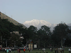 Chamba Town.
Buildings in Chamba were traditionally constructed using local materials. Buildings were made out of dry stone masonry, with the walls and floors of the older houses plastered with a concoction of clay and cow-dung.[28] Thick wooden beams were used to support the walls, paying attention to durability and to withstand earthquakes, and wooden cantilever construction was often used to support the verandas.[28] The staircases and doors were made from wood, with the doors often decorated in religious reliefs and flanked by two lamps to light it at night. Before the arrival of the British, who introduced slate roofs to Chamba, roofs were covered with planks, coated in clay.[28] Few of these houses remiain today, although a number still have wood-clay roofs in villages in the suburbs.[28]
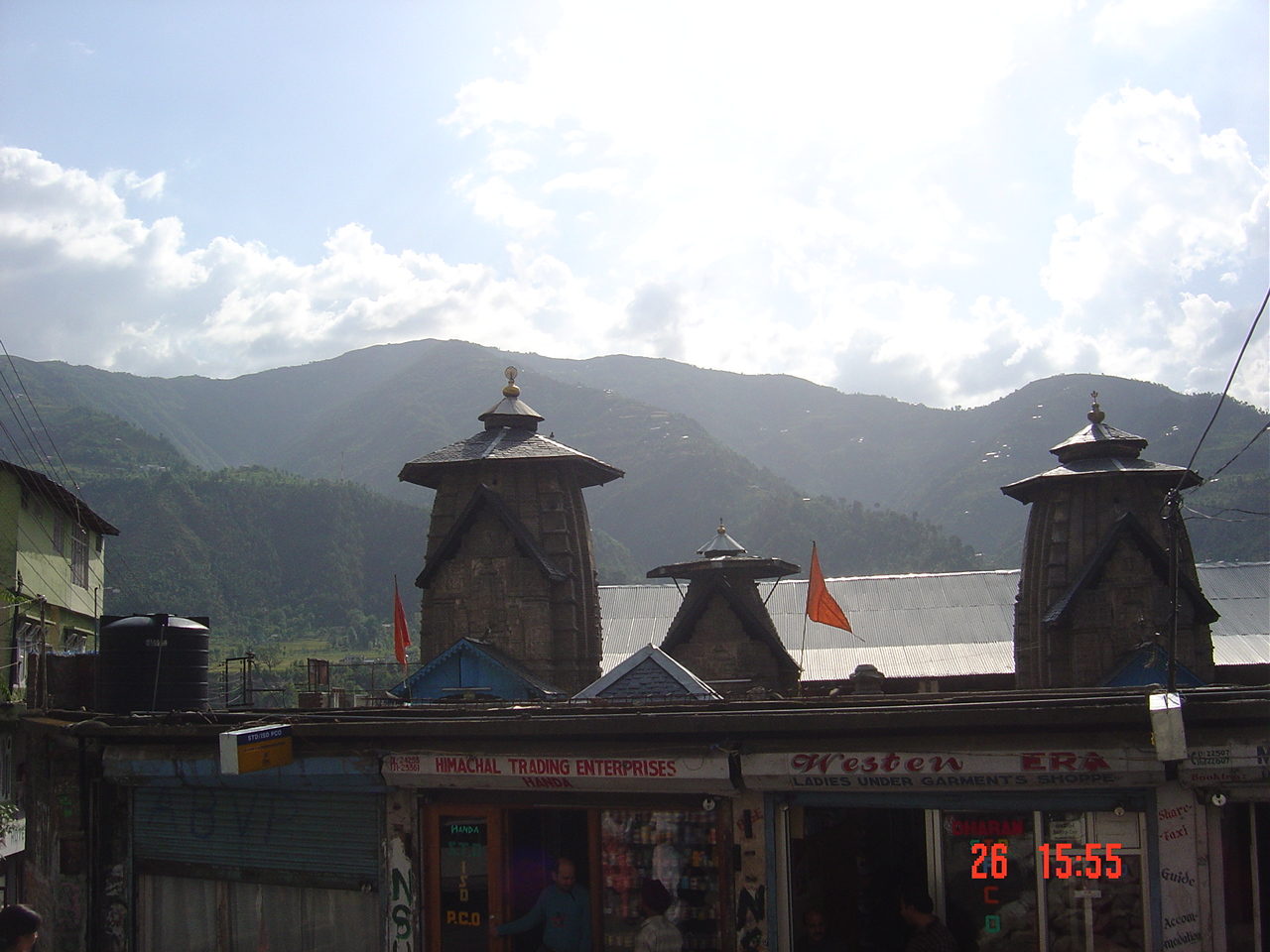
The old heritage monuments, which comprise of palaces and temples are located in the old town (east of the Chaugans), on the lower slopes of Shah Madar hill. They were built in the lower valley where the two rivers and steep thickly forested hillsides provided a strong defense. Located here is the 10th century Champavati Temple, said to have marked the birth of the town, the Lakshmi Narayan group of temples (built from 10th-19th century), the 10th century Sita Ram Temple, Bansi Gopal temple, Kharura Mohalla and Hari Rai temple, the 11th century Sui Mata Temple and Chamunda Devi Temple, and the Akhand Chandi palace, overlooking the Chaugan, which has since been converted in to a college.[29] Additions were made to the palace in the form of the Zenana Mahal and the Rang Mahal in the 18th century. The temples built in Chamba demonstrate a strong Kashmiri influence with their stone temple architecture and temple iconography.[4][30][31] Given their age however, only their unicellular layout with fluted pillars has been retained.
Champavati Temple
This temple was built by Raja Sahil Varman in memory of his daughter Champavati. The temple, located near the Police Post and the Treasury building, is built in the Shikhara style, with intricate stone carvings. It has a wheel roof and is large as the Laxmi Narayan Temple. An idol of the goddess Mahishasuramardini (Durga) is worshipped in the temple. The walls of the temple are full of exquisite stone sculptures. On account of its historical and archeological importance, the temple is maintained by the Archeological Survey of India.[4][11][32]
Lakshmi Narayan temples

 Laxmi Narayan temple in Chamba
The Lakshmi Narayan temples complex, devoted to the Vaishnavite sect, includes the main Lakshmi Narayan temple, built in the 10th century by Raja Sahil Verman. It has been built to suit the local climatic conditions with wooden chatries and has a shikara, and a sanctum sanctorum (Garbhagriha), with an antarala and a mantapa. A metallic image of Garuda, the vahana (mount) of Vishnu is installed on the dwajastamba pillar at the main gate of the temple. In 1678, Raja Chhatra Singh adorned the temple roof with gold plated pinnacles, as a riposte to Auranagzeb, who had ordered demolition of this temple.[4]
Chamunda Devi Temple
 Champa Devi Temple near old market place, 1860
Chamunda Devi Temple is located in a prominent position on the spur of Shah Madar range of hills, opposite to the Chamba town. It was built by Raja Umed Singh, and was completed in 1762.[33] It is the only wooden temple with gabled roof (single storied) in Chamba, while all others in the town are built from stone in the north Indian Nagara architectural style.[33]
In the past, the temple was accessed through a stone paved steep path laid with 378 steps, but it is now approached by a 3 kilometres (9,800 ft) motorable road.[4] The temple, a trabeated structure, is built on a high raised plinth, buttressed on all four sides, and has a rectangular layout on the outside. It exterior measures 9.22 metres (30.2 ft) x 6 metres (20 ft), the inner square sanctum measures 3.55 metres (11.6 ft) x 3.55 metres (11.6 ft) and has a parikrama path (circumambulatory path) of 1.67 metres (5.5 ft) around the perimeter.[4][33][34]
There is a mandap in the foreground of the temple of 5.1 metres (17 ft) x 6 metres (20 ft) size with an agni-kund or fire pit in the centre and a gable roof covered with slates.[33] The mandapa has carvings in wood in its multi paneled ceiling with reliefs of human figures on the pillars and brackets. Votive bells are provided in the mandap entrance and it has a Nagari inscription, which records it as the offering from Pandit Vidhadhara to the goddess Chamunda deified in the temple on April 2, 1762, the date when the temple was consecrated.[4]
Akhand Chandi Palace
 Akhand Chandi Palace
The Akhand Chandi Palace, noted for its distinct green roof, was built by Raja Umed Singh between 1747 and 1765 and used as his residence.[35] Later, Raja Sham Singh refurbished it with the assistance of British engineers. In 1879, the Darbar Hall (also named 'Marshal Hall' after the builder) was built.[4] Raja Bhuri Singh added the Zenana Mahal (residence of Royal ladies). The building was exemplary of the fusion of Mughal and British architectural influences. In 1958, the Royal family of Chamba sold the palace to the Government of Himachal Pradesh, who in turn converted it in to a Government College and District Library.[4] Maintenance of the attractive palace, however, which has painted walls and glass work and intricate woodwork, has not been satisfactory, due to the lack of funds allocated to refurbish it.[35] The palace provides scenic views of the Chaugan, Laxmi Narayana Temple, Sui Mata, Chamunda Devi Temple, Rang Mehal, Hari Rai Temple and Bansi Gopal Temple.[4]
Monuments built after 1846
 The lower, old part of the town and bridge
In the second half of the nineteenth century, the British administration drew up an urban plan for the development of Chamba. They laid emphasis on the building of civic buildings around the Chaugan to conceal the unorthodox structural layout of the residential complexes. The western oriented development programme grew particularly active after the arrival of Major Blair Reid in January 1863, during the reign of Raja Shri Singh.[36] The next fourteen years in particular, until his retirement in March 1877, were characterised by large scale building projects in Chamba, with Reid fully revising the administrative and revenue departments of Chamba and reorganizing the state machinery to make development more efficient.[36]
Orderly new building complexes with "simple visual discipline with white plastered walls, lancer arch windows, cornices, sloping sheet roofs, wooden eaves and deep verandahs were planned and built". Road communications were dramatically improved, with the approach road to the town being diverted, to provide a way for vehicular traffic to enter from the western end of the chaugan. A cabled suspension bridge was built across the Ravi River in the lower outskirts of the town, and many important public welfare projects were started,[36] and well as many temples, gates, gardens and churches between 1863 and 1910. Notable works built during the colonial period include the temples in the Jansali Bazar, Gandhi Gate (Curzon Gate), Shiva Temple, the Chaugans, the Police Lines, the Church of Scotland, the Shyam Singh Hospital (built in 1891), Chamba Library, the Post Office building, Bhuri Singh Museum, the State Forces barracks, and the administrative buildings of the British period.[30] Today, architectural materials have evolved considerably since ancient times and reinforced concrete structures are rapidly changing the skyline of the town.[28]
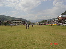
Chaugan
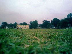 Chaugan at Chamba
The Chaugan (a Sanskrit word meaning: “four sided”) is the nucleus of all activity in Chamba, surrounded by impressive administrative buildings and a shopping arcade built during the British period, with the old Akhand Chandi palace standing nearby. It has a terraced grass green, and is exceptionally large for a hill station, measuring 800 metres (2,600 ft) length and 80 metres (260 ft) width. In 1890, the British converted five small chaugans into a single chaugan for use as an esplanade and sports complex, and today it is commonly used for cricket matches, picnics and promenades during the mid summer months.[12] During the annual ‘Minjar Mela’ fair, the entire ground becomes a flea market. After the Dussera festival, the grounds are closed to the public until April, for maintenance purposes.[3][4]
Church of Scotland
The Church of Scotland, a Presbyterian Church, known as 'St. Andrew’s Church', was established by the first missionary in Chamba, the Reverend William Ferqueen, who served there between 1863 and 1873.[37][38] The foundation stone for building the new church was laid by the Raja of Chamba on 17 February 1899, in the presence of the Scottish reverend Dr. M’Clymont who had come from Scotland. The Raja had contributed a generous grant to build the church and ensured that it was exquisitely built in fine stone masonry.[37] The walls are supported by buttresses, and lancer arch windows provide the light and ventilation. Several schools are run by the Mission located within the church precincts.[4][37]
Bhuri Singh Museum
 The Bhuri Singh Museum
The Bhuri Singh Museum at Chamba was established on September 14, 1908 in honour of the raja at the time, Raja Bhuri Singh, who ruled Chamba from 1904 to 1919.[4] J. Ph. Vogel, an eminent indologist, and expert on the history of Chamba state, proposed the museum to preserve a number of valuable inscriptions, mostly in Sarda script, which contained some rare information about the medieval history of Chamba; the parasites of Sarahan, Devi-ri-kothi and mul Kihar are still preserved in the museum.[4] Bhuri Singh donated his family collection of paintings to the museum, including royal portraits which ranged from Basohli to Guler-Kangra in style, and embroidered Pahari miniatures.[4] Numerous artifacts, important to the heritage of Chamba were added, including coins, hill jewelry and royal and tradiitional costumes, arms and armour, musical instruments and other items.[4] The current museum was built in 1975 in concrete.[4]
Culture
Arts
Chamba miniature Pahari paintings 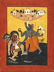
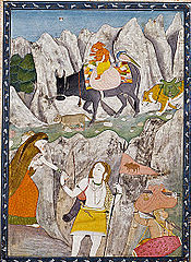
Varaha, the boar Avatar (incarnate) of god Vishnu Pahari painting of Chamba dated 1800– depicts god Shiva’s Family on the March Chamba miniature paintings
Chamba is noted for its miniature Pahari paintings,[39] where Basohli style of Pahari paintings took roots with Nikku, the artist of Basohli migrating from Guler to Chamba in the eighteenth century. Raja Udai Singh and Raja Jai Singh patronized this school of painting.[40] During the reign of Raja Charhat Singh, folk art developed and had a lasting influence on local artists. The paintings of Chamba encompass both miniatures and murals and the Mughal influence is clearly discerned in these paintings.[40] Distinguished artists of Chamba who have painted in this art form include Lehru, Durga and Miyan Jara Singh. The paintings were generally painted with Hindu religious themes, particularly the legends of Hindu mythology such as Radha Krishna, Shiva-Parvati, Rama Darbar, Yashoda and Krishna, Gopis, love scenes, deer, birds and women, Daya Saptashati and Krishna - Sudama.[39][41] Romantic ambiance of the monsoon season in Chamba has also been painted by the artists of Pahari miniature art, in various moods and styles in Basholi colours. They are displayed in the museums at Chamba and also at Shimla and Dharamsala.[42]
Handicrafts and musical instruments
Chamba is an important centre for the making of traditional handicrafts, and the town has numerous small workshops maintained by the artisans. Many of the items produced are exquisite and lavish, testament to the towns' aristocratic heritage.[43]
Casting metalware in Chamba is an ancient tradition, dating back to the Bronze Age period, with items typically made out of copper or brass, and also iron, especially in the traditional making of implements and weapons by blacksmiths. Of particular note in this trade are the large plaques with reliefs, commonly used for wall decoration. The temple cupolas in Chamba district are often furnished with copper and brass items made in Chamba and often the golden kalasha or vessel crowning them is produced here.[43]
Chamba has its own unique traditional system of men’s and women’s foot wares. The foot wares were originally made from locally produced leather but is today transported to Chamba from the south of India.[43] Women's foot wares are embroidered as are the "vegetarian" foot wares which are purposefully made without leather for use in places where leather is prohibited for religious reasons. Handkerchiefs and shawls are also made in abundance in Chamba. Traditionally handspun, they are designed in such a way as to make both sides of the cloth look identical, and are beautifully embroidered.[43] Chamba shawls are woven on hand looms in wool and typically have a bright border in a traditional design.[43] A similar woven design is used for making caps.
Traditional jewellery is made in gold and silver in Chamba as its pottery, typically kitchenware, utensils and earthen pots.[43] Given Chamba's history of new immigration from other parts of the country and Tibet, a variety of influences can be seen in the pieces of jewellery that are produced in Chamba.[43] Chamba is also noted for its wood carvings, which, like the metalware is often used for iconography in temples, such as Chamunda Devi.[44] A “Nagara”, a form of kettle drum is produced in Chamba as are cymbals, bells and "Singa” or "Ransinga" (horns) produced in both straight and curved styles.[43] Other instruments include Shankh, Nad, Beiunsuli, Saihna, Nag Pheni, Thali Ghada, Bhana, Karnal, Pohol, Dhons, Kahal, Kansi, Hasat Ghanta and Drugg.[45]
Festivals, fairs and dances
 The Chaugan in Chamba, where fairs are held
Two melas or fairs, also known as Jatras, are of particular note in Chamba; "Suhi Mata Mela" and "Minjar Mela". A notable event of such fairs is when the ‘chela’. a subordinate of the deity who is being worshipped goes into a trance and answers the queries and prayers of the devotees.[46]
An important festival held in Chamba is known as the "Suhi Mata Mela". It is held annually in March–April for four days to commemorate the sacrifice made by the queen of Chamba with her life, to bring water to the town. The legend associated with this festival and the Sui Mata temple, built in memory of the queen (wife of Raja Sahil Varman), relates to the sacrifice she made to fulfill a prophesy in a dream, which said that water from the Sarota stream could only be accessed through an aqueduct if the queen or her son was sacrificed. Rather than kill her own son she sacrificed her own life for the town. To commemorate this event, women and children take a lead role in the festival. An image of Champavati, with banners of the Rajput solar emblem, are taken by them in a procession, dancing and singing, through the Chaugan to the Suhi Mata temple.[4][20][46]
Another popular festival held in Chamba is the "Minjar Mela", held on the second Sunday of the Shravana month, corresponding to the month of August in the Gregorian calendar. It marks the triumph of the Raja of Chamba over the ruler of Trigarta (now called as Kangra), in 935 AD and also celebrates the paddy and maize crops grown at this time of the year.[22] The festival commences with offerings of 'minjar', consisting of a bunch of paddy plant and golden silk wrapped in red fabric.[22] The offerings also include a rupee, a seasonal fruit, and a coconut.[22] This occasion is also celebrated with a flag hoisting ceremony at the Chaugan that initiates a week of cultural and social programmes.[22] The image of the deity, Lord Raghuvira, and more than 200 other deities, are taken in a procession, in a chariot pulled by ropes. Folk dances and music performances known as 'Kunjari Malhar' are part of the festivities. On the last day of the festival, a parade is held from the Akhand Chandi Palace to Ravi River, where offerings are made to the river.[22] This commemorates an event in which Raja Sahil Verman changed the course of the river, to make the Hari Rai temple accessible to all devotees.[46][47]
Chamba and the surrounding district have many local customs in dancing, illustrating the differences in geographical, anthropological and social cultures and religious beliefs in the area.[48] A solo dance or a dance of two people such as the Pharati or Khad-dumbi is commonly performed during the Nuwala ceremony and other important occasions, such as marriages etc. and the Dangri and Sikri are said to be of note.[48][49] Notable male dances include the Gaddi and Gujjar dances, Dandaras, Nat, Ghorda, Nachan, Dharumsde, the Khad-dumbi and the Chhinjhati.[50] Notable female dances include the Ghurei, Dangi and Kikli, whilst dances such as the Shain, Dhamal, Sohal, Sal Kukdi Nachan, Ratege and Til-Chauti are performed by both sexes.[51] Several forms of masked dance are also performed in Chamba, such as the Chhatradhi Jatar.[51]
Costumes
Ancient people of Chamba were known to have worn a fine woolen blanket or chadar around the waist, to keep warm in the cold climate. It was often tied or girdled with a band or patka, as evidenced by some archaeological discoveries in the area depicting this fashion.[52] The Gaddi people have traditionally worn white embroidered caps and loose-fitting white woolen garments known as a chola, tied around the waist with a black wool rope.[29] A local custom in Chamba was to give the Jogi of the Natha sect a cotton maikhal sheet to wear over the head during the Nuwala ceremony to honour Lord Siva. Chamba and the surrounding district have been well documented as being a producer of fine cloth and embroidered dresses for centuries.[52]
"The Jakatas, the Milinda Panha and the Vinaya of the Mulasarvastivadins mention the beautifully embroidered Kotumbara clothes of the Audumbara country (Pathankot and Chamba) and the fine textiles captured in the lot of Kangra Fort in 1009 around the astonishment of the soldiers of Mahmud of Ghazni. A heavier, though not less luxurious type of embriodered dresses can be traced on the fountain stones, which had been erected by the local aristocracy of Churah, in western Chamba in the 11th to 12th centuries." - Hermann Goetz[52]
Given the history of migrants arriving in Chamba from across Kashmir and Tibet over the centuries, today Chamba has a variety of traditional dresses, defined by the region to which they belong. The most traditional dress worn by Hindu women, on special occasions, is the pashwaj. Pashwaj is a gown with a short bodice (blouse) covering up to the waist. A shirt is worn, below which the dress falls in many folds, nearly touching the ground. The typical casual dress though, however, is a pairahan, with a chadar or dupatta (stoll) worn over the head. The lower half of the body is covered by a pyjama, known as a suthan.[53]
Muslim women also generally wear similar dresses as the Hindu women. However, the one difference is that the tunic they wear is considerably shorter, just touching the knee. They don a small vest called a angi, worn beneath the bodice. A small shirt or kurta is also common.[53] Hindu men wear an angrakha, long tunic that touches the knees. A cloth waist-band and tight fitting pajama and a small pagri (top hat) worn on top of the head completes their ensemble.[53]
Notes
- ^ a b "Census of India 2001: Data from the 2001 Census, including cities, villages and towns (Provisional)". Census Commission of India. Archived from the original on 2004-06-16. http://web.archive.org/web/20040616075334/http://www.censusindia.net/results/town.php?stad=A&state5=999. Retrieved 2008-11-01.
- ^ a b c d e Sharma & Sethi (1997), p.34
- ^ a b c Bhatnagar (2008), pages 39-44
- ^ a b c d e f g h i j k l m n o p q r s "Places of Interest in Chamba". National Informatics Centre:Government of Chamba district. http://hpchamba.nic.in/placeschamba.htm. Retrieved 2009-10-28.
- ^ "Hindu Hill Kingdoms". Victoria and Albert Museum. http://www.vam.ac.uk/collections/asia/asia_features/sikhism/art/hindu/index.html. Retrieved 2010-04-06.
- ^ "PahariKamat". http://www.kamat.com/kalranga/art/pahari.htm.
- ^ a b c Bradnock (2000), p.211
- ^ a b c d e f g h i "Chamba at Glance:History". National Informatics Centre:Government of Chamba district. http://hpchamba.nic.in/history.htm. Retrieved 2009-10-28.
- ^ a b c d e f Bharati (2001), pp.16-23
- ^ Bharati (2001), pp.23-24
- ^ a b c Bharati (2001), p.24
- ^ a b "Introducing Chamba". Lonely Planet. http://www.lonelyplanet.com/india/himachal-pradesh/chamba. Retrieved 2010-04-06.
- ^ a b "CHAMBA: Gopal Singh, Raja of Chamba (ruled 1870-1873)". British Library. http://www.bl.uk/onlinegallery/onlineex/apac/photocoll/c/019pho000000127u00053000.html.
- ^ Archer (1973), p.68
- ^ a b c Pramanik, Prabal. "History of Chamba". Chamba Heritage. http://www.chambaheritage.net/history.html. Retrieved 2010-04-06.
- ^ "About Chamba". Himachal Pradesh Tourism Department. http://www.himachalpradeshtourismindia.com/chamba/. Retrieved 2009-10-28.
- ^ a b Bharati (2001), p.16
- ^ a b "Chamera power station shut down". The Tribune (Himachal Pradesh). 2005-07-06. http://www.tribuneindia.com/2005/20050707/himachal.htm. Retrieved 2010-04-06.
- ^ Bhatnagar (2008), p.40
- ^ a b c d e f "Chamba Hill station". http://www.shubhyatraindia.com/india-hill-stations/chamba-hill-station.html. Retrieved 2009-10-29.
- ^ "Access to Chamba". National Informatics Centre:Government of Chamba district. http://hpchamba.nic.in/access.htm. Retrieved 2009-10-29.
- ^ a b c d e f "Chamba Tourism". India Line. http://www.indialine.com/travel/himachalpradesh/chamba/. Retrieved 2009-10-28.
- ^ "Chamba- Himachal Pradesh". Hill Resorts in India. http://www.hillresortsinindia.com/chamba.html. Retrieved 2009-10-29.
- ^ "Census of India". Chamba at Srno932. Census of India. Archived from the original on 2004-06-16. http://web.archive.org/web/20040616075334/http://www.censusindia.net/results/town.php?stad=A&state5=999. Retrieved 2010-04-05.
- ^ a b c d e f Pramanik, Prabal. "Gaddis and Gujjars". Chamba Heritage. http://www.chambaheritage.net/tribal.html. Retrieved 2010-04-06.
- ^ a b Sharma & Sethi (1997), p.35
- ^ Bhatnagar (2008), p.43
- ^ a b c d e Pramanik, Prabal. "Traditional architecture in Chamba". Chamba Heritage. http://www.chambaheritage.net/traditional.html. Retrieved 2010-04-06.
- ^ a b Bradnock (2000), p.212
- ^ a b Bhatnagar (2008), p.42
- ^ Handa (2005), p.174
- ^ "ChampavatiTempleChamba". Himachal Tourism. http://www.himachalpradeshtourismindia.com/chamba/champavatitemplechamba.php. Retrieved 2010-04-06.
- ^ a b c d "Chamunda devi temple history". Tourism Chamba. http://www.tourismchamba.org/2010/01/chamunda-devi-temple-history/. Retrieved 2010-04-06.
- ^ Handa (2001), pp.133-135
- ^ a b "AkhandChandiPalaceChamba". Himachal Pradesh Tourism. http://www.himachalpradeshtourismindia.com/chamba/akhandchandipalacechamba.php. Retrieved 2010-04-06.
- ^ a b c Pramanik, Prabal. "Development of Chamba". Chamba Heritage. http://www.chambaheritage.net/development.html. Retrieved 2010-04-06.
- ^ a b c The Church of Scotland home and foreign mission record, Volume 24. Church of Scotland. 1899. p. 136. http://books.google.com/books?id=pFErAAAAYAAJ&pg=RA1-PA136&lpg=RA1-PA136.
- ^ "Church of Scotland". http://www.india9.com/i9show/Church-of-Scotland-18419.htm. Retrieved 2010-04-06.
- ^ a b Dogra legends of art & culture By Aśoka Jeratha pp. 112-4
- ^ a b "Himachal Pradesh:Fine Arts- Chamba School". Archived from the original on October 22, 2007. http://web.archive.org/web/20071022043908/http://culturenorthindia.com/hp/fine_arts.htm. Retrieved 2009-11-07.
- ^ "FINE ARTS Himachal Pradesh". Chamba School. Archived from the original on October 22, 2007. http://web.archive.org/web/20071022043908/http://culturenorthindia.com/hp/fine_arts.htm. Retrieved 2009-10-28.
- ^ "Tourism". National Informatics Centre:Government of Chamba district. http://hpchamba.nic.in/tourism.htm. Retrieved 2009-10-29.
- ^ a b c d e f g h Pramanik, Prabal. "Handicrafts of Chamba". Chamba Heritage. http://www.chambaheritage.net/roster.html. Retrieved 2010-04-06.
- ^ Margabandhu, Chedarambattu (1991). Indian Archaeological Heritage: Shri K.V. Soundara Rajan Festschrift, Chedarambattu Margabandhu, Volume 2. Agam Kala Prakashan. p. 595. http://books.google.co.uk/books?id=3AZuAAAAMAAJ&q=Chamba,+Himachal+Pradesh&dq=Chamba,+Himachal+Pradesh&cd=8.
- ^ "Folk instruments". National Informatics Centre:Government of Chamba district. http://hpchamba.nic.in/folkinstruments.htm. Retrieved 2010-04-06.
- ^ a b c "Fairs in Chamba". National Informatics Centre:Government of Chamba district. http://hpchamba.nic.in/Fairs&festivals.htm. Retrieved 2010-04-06.
- ^ "MinjarMelaChamba". Himachal Tourism. http://www.himachalpradeshtourismindia.com/chamba/minjarmelachamba.php. Retrieved 2010-04-06.
- ^ a b Sharma (2004), p.50
- ^ Pramanik, Prabal. "Festivals of Chamba". Chamba Heritage. http://www.chambaheritage.net/festival.html. Retrieved 2010-04-06.
- ^ Sharma (2004), p.08
- ^ a b Sharma (2004), p.07
- ^ a b c Sharma (1997), p.36
- ^ a b c "Dress and Ornaments". National Informatics Centre. http://hpchamba.nic.in/dress&ornament.htm. Retrieved 2010-04-06.
References
- Archer, W. G (1973). Indian Paintings from the Punjab Hills: A Survey and History of Pahari Miniature Painting. Sotheby Parke Bernet. ISBN 0856670022.
- Bhatnagar, Manu (2008). "Indian Heritage Cities Network" (pdf). Journal of the Development and Research Organization for Nature, Arts and Heritage (UNESCO) 5 (1): 39–44. http://unesdoc.unesco.org/images/0016/001622/162292E.pdf. Retrieved 2009-10-26.
- Bharati, K.R (2001). Chamba Himalaya: amazing land, unique culture. Indus Publishing. ISBN 8173871256. http://books.google.com/books?id=VO9cP6LYR8wC&printsec=frontcover&dq=Chamba&lr=#v=onepage&q=&f=false. Retrieved 2009-10-26.
- Bradnock, Robert & Roma (2000). Footprint Indian Himalaya Handbook:The Travel Guide. Footprint Travel Guides. ISBN 1900949792. http://books.google.co.uk/books?id=TyZGp_YVzb8C&dq=Akhand+Chandi+palace+college&source=gbs_navlinks_s.
- Handa, O.C (2001). Temple architecture of the western Himalaya: wooden temples. Indus Publishing. ISBN 8173871159. http://books.google.com/books?id=_KmaKomlI-UC&pg=PA131&dq=Chamba&lr=#v=onepage&q=Chamba&f=false. Retrieved 2009-10-28.
- Handa, O.C (2005). Gaddi land in Chamba: its history, art & culture : new light on the early .... Indus Publishing. ISBN 8173871744. http://books.google.com/books?id=2EaFNQ7Zfl8C&pg=PA174&dq=Chamba&lr=#v=onepage&q=&f=false.
- Scotland, Church of (1899). The Church of Scotland home and foreign mission record, Volume 24. Church of Scotland. http://books.google.com/books?id=pFErAAAAYAAJ&pg=RA1-PA136&lpg=RA1-PA136&dq=Church+of+Scotland,+Chamba&source=bl&ots=N94pdAnWAQ&sig=HqM_XIIpXDqnwtIfqACMiaWf51A&hl=en&ei=jP_pSpqWJ4bUtgP4_9ziCA&sa=X&oi=book_result&ct=result&resnum=9&ved=0CBwQ6AEwCA#v=onepage&q=Church%20of%20Scotland%2C%20Chamba&f=false.
- Sharma, K.P.; Sethi, S.M. (1997). Costumes and ornaments of Chamba. Indus Publishing. ISBN 8173870675. http://books.google.co.uk/books?id=TQwKtSFn9FMC&printsec=frontcover&dq=Costumes+and+ornaments+of+Chamba&cd=1#v=onepage&q=&f=false.
- Sharma, K.P. (2004). Folk dances of Chambā. Indus Publishing. ISBN 8173871663. http://books.google.co.uk/books?id=Gz4ZAxYR6igC&printsec=frontcover&dq=Folk+dances+of+Chamb%C4%81&hl=en&ei=WWa7S5jmGI3B-QbCronTCA&sa=X&oi=book_result&ct=result&resnum=1&ved=0CDsQ6AEwAA#v=onepage&q=&f=false.
Further reading
- Hutchinson, J. & J. PH Vogel (1933). History of the Panjab Hill States, Vol. I. 1st edition: Govt. Printing, Pujab, Lahore, 1933. Reprint 2000. Department of Language and Culture, Himachal Pradesh. Chapter IV Chamba State, pp. 268–339.
External links
Himachal Pradesh topics Major cities Districts Culture Economy Jurisdiction Geography History Education Indian Institute of Technology Mandi · Dr. Yashwant Singh Parmar University of Horticulture and Forestry · Green Hills Engineering College · Himachal University · IITT college of Engineering · Indian Institute of Advanced Study · Institute of Engineering and Emerging Technologies · National Institute of Technology, Hamirpur · Jaypee University of Information Technology · Chitkara University · Lawrence School · University Institute of Information Technology (UIIT)People Images Picture gallery · Image gallery at Wikimedia CommonsCategories:- 920 establishments
- Cities and towns in Chamba district
- Chamba


Wikimedia Foundation. 2010.