- City Circle Tram
-
City Circle 
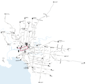
Route Information Route Number 35 Number of stops 30 Timetables Link Route Map Link Zone Location Zone 1 Not applicable, free service. Zone 1 & 2 Not applicable, free service. The City Circle is a zero-fare tram running around the central business district of Melbourne, Australia. Aimed towards tourists the route passes many Melbourne attractions while running along the CBD's outermost thoroughfares, as well as the developing Docklands waterfront precinct.
Contents
History
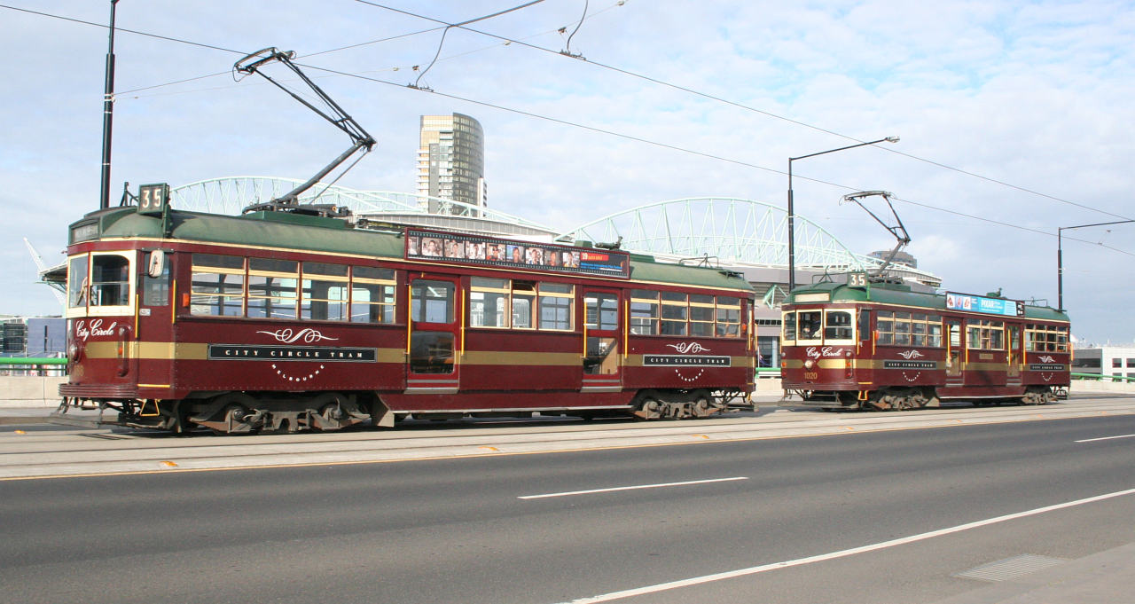
 City Circle trams on La Trobe Street
The tram route was introduced on 29 April 1994,[1] requiring a small track extension along Spring Street to enable a complete CBD loop to be formed.[2] The Commonwealth Government's Building Better Cities program funded the $6.4 million capital cost of the track expansion, while the State Government funded the running costs.[3] The original route of the tram included Spencer Street as the western edge until January 2003, when the route was extended west into Docklands. The travel time before this change was 40 minutes.[4]
During early 2006, new Passenger Information Displays (PIDs) were installed with Digital Voice Announcements (DVA) from the series 1 announcements. The information display upgrades were due to the unreliability and the storage capacity problems since the route extension into Docklands.
In April 2008, the service adopted the daylight saving timetable on a permanent basis, operating from 10am to 9pm every Thursday, Friday and Saturday. The end of service at other times is 6pm.[5]
On 30 May 2009, the route was altered for a second time, extended from Harbour Esplanade to the NewQuay and Waterfront City precincts via Docklands Drive. This made the route an elongated 'q'.[6]
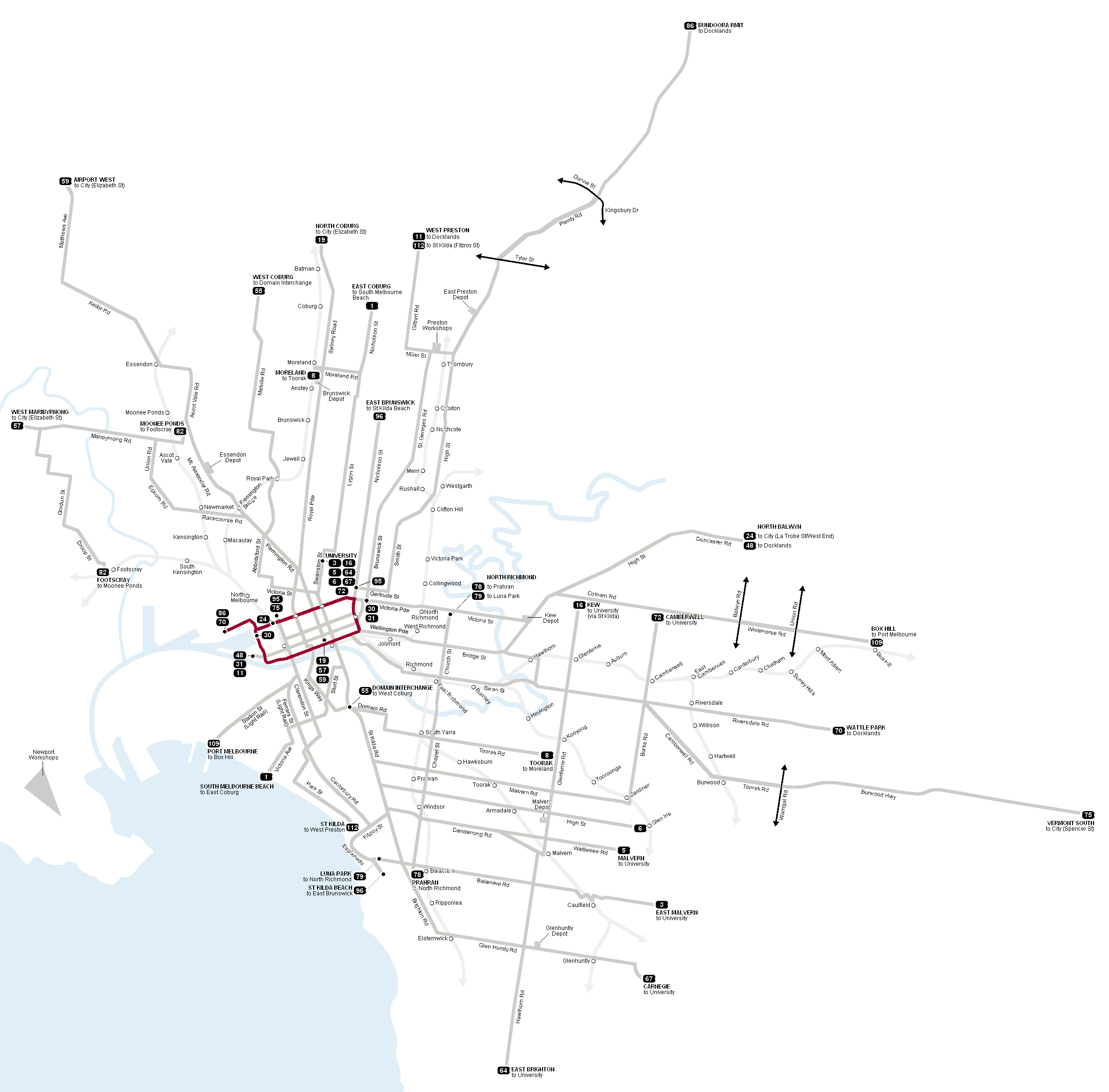
Route
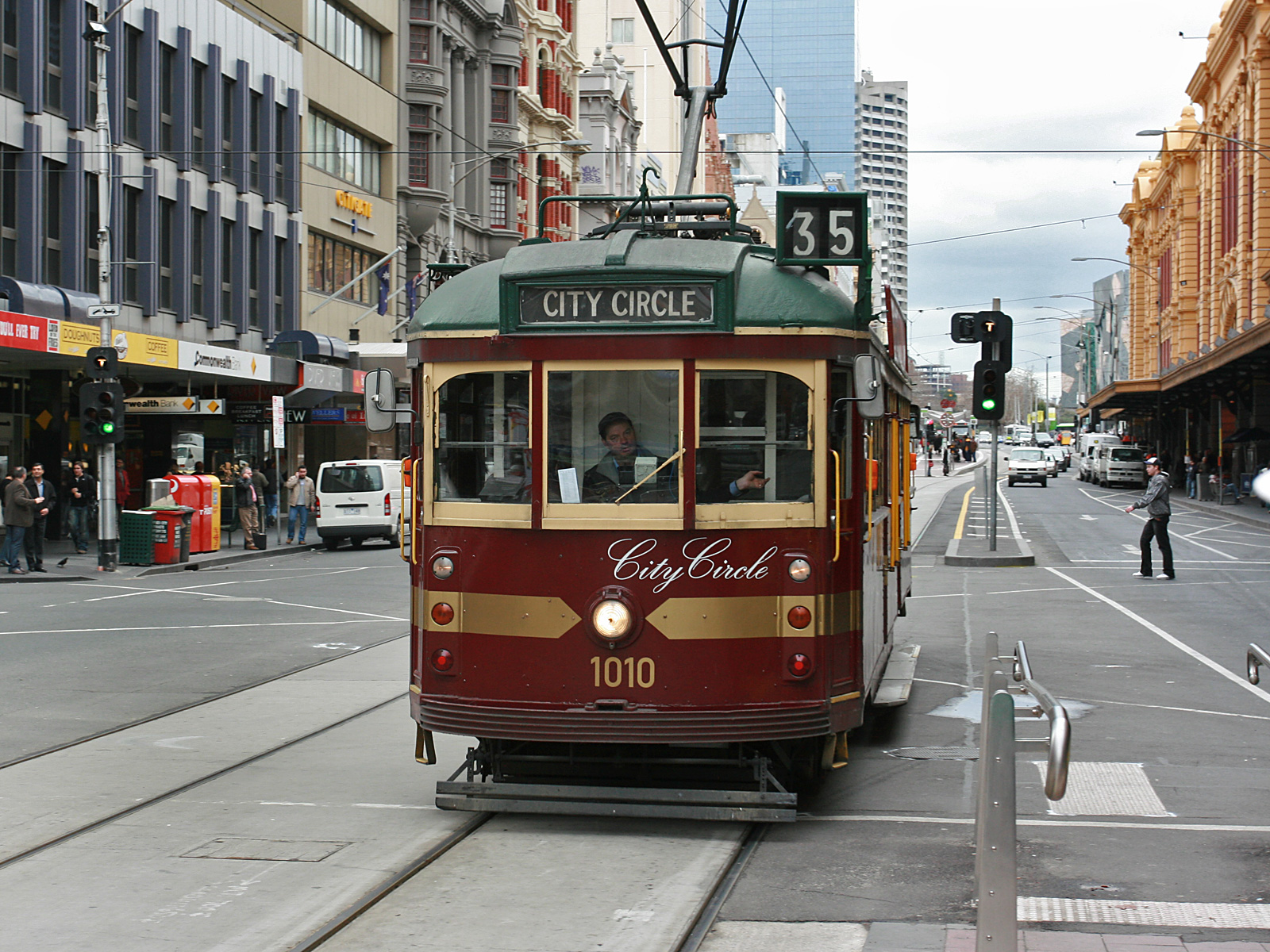
 Interior of a W class tram in City Circle service
 A Route 35 City Circle tram in its official livery in Flinders St
The route of the City Circle trams roughly follows the outer edges of the Hoddle Grid, with three diversions. It takes in all of La Trobe Street, Harbour Esplanade and Flinders Street. It follows Spring Street between Flinders Street and Bourke Street, but travels along Nicholson Street and Victoria Street before turning into La Trobe. At the junction of Harbour Esplanade and Latrobe Street trams turn off the loop to run to and from a terminus towards the end of Docklands Drive, Waterfront City.
Operation
The City Circle route is serviced by heritage W class trams liveried in special maroon and green with yellow and gold trimmings, however rolling stock shortages often see MMTB's standard traditional green liveried W Class trams on the service. Trams display the route number 35.[7] The City Circle operates at a headway of 12 minutes in both directions, with the service taking approximately 48 minutes to complete a loop.[8] Eight trams are allocated to the service at any one time (four in each direction). An average of three million passengers uses the service every year, with each tram circling the city 11 times a day, or 14 times when the tram operates to 9pm.[5]
Maps and timetables
- Official timetables
- Official route map
- Official tram network map
- Melbourne tram and train network map from railmaps.com.au
See also
- Trams in Melbourne
- Transportation in Australia
References
- ^ "Public transport - City Loop history". www.doi.vic.gov.au. http://www.doi.vic.gov.au/Doi/Internet/transport.nsf/AllDocs/74164766E0CEAF95CA25700500122952?OpenDocument. Retrieved 2008-08-06.
- ^ Lyndsay Neilson. "Getting implementation going". The ‘Building Better Cities’ program 1991-96: a nation-building initiative of the Commonwealth Government. epress.anu.edu.au. http://epress.anu.edu.au/anzsog/auc/mobile_devices/ch08s11.html. Retrieved 2010-11-01.
- ^ Lyndsay Neilson. "Appendix 1: Funding Allocation, Victorian Area Strategies". The ‘Building Better Cities’ program 1991-96: a nation-building initiative of the Commonwealth Government. epress.anu.edu.au. http://epress.anu.edu.au/anzsog/auc/mobile_devices/ch08s15.html#d0e3496. Retrieved 2010-11-01.
- ^ "CITY CIRCLE TRAM EXTENDED TO MELBOURNE’S WATERFRONT AT DOCKLANDS". Media Release: MINISTER FOR MAJOR PROJECTS, MINISTER FOR PUBLIC TRANSPORT. January 23, 2003. http://www.legislation.vic.gov.au/domino/Web_Notes/newmedia.nsf/b0222c68d27626e2ca256c8c001a3d2d/527ef3e293dc01dcca256cb7007d2c50!OpenDocument. Retrieved 2008-08-06.
- ^ a b "CITY CIRCLE TRAM TO RUN WHEN THE SUN GOES DOWN". Media Releases: Premier of Victoria. April 6, 2008. http://www.premier.vic.gov.au/minister-for-public-transport/city-circle-tram-to-run-when-the-sun-goes-down.html. Retrieved 2008-08-06.
- ^ Yarra Trams (2009-05-01). "Media Release: Popular City Circle tram extended to Docklands Drive". www.yarratrams.com.au. http://www.yarratrams.com.au/desktopdefault.aspx/tabid-105/99_read-1954. Retrieved 2010-03-28.
- ^ "Tram 35 (City Circle)". Metlink. http://www.metlinkmelbourne.com.au/maps_stations_stops/free_tram_service_city_circle/tram_35_city_circle. Retrieved 2008-08-06.
- ^ "City Circle (Free Tourist Tram)". Metlink. http://www.metlinkmelbourne.com.au/route/view/1112. Retrieved 2008-08-06.
External links
Trams in Melbourne - Yarra Trams Routes Current Tram Fleet W • Z • A • B • C • C2 • DOperator KDR Melbourne (Yarra Trams)Former operators Prahran and Malvern • Hawthorn • Melbourne, Brunswick and Coburg • Fitzroy, Northcote and Preston • Footscray • Northcote Municipality • North Melbourne Electric Tramway and Lighting Company • Melbourne and Metropolitan Tramways Board • Victorian Railways • M>Tram • Transdev TSLTourist services City Circle Tram • Colonial Tramcar Restaurant • Karachi TramTram depots Brunswick • Camberwell • East Preston • Essendon • Glenhuntly • Hawthorn • Kew • Malvern • North Fitzroy • Preston Workshops • Newport Workshops • Southbank • South MelbourneMiscellaneous Categories:- Landmarks in Melbourne
- Tram routes in Melbourne
- Zero-fare transport services

Wikimedia Foundation. 2010.