- Novokuznetsk
-
Not to be confused with Kuznetsk.
Novokuznetsk (English)
Новокузнецк (Russian)- City[citation needed] - 
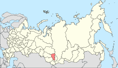
Location of Kemerovo Oblast in Russia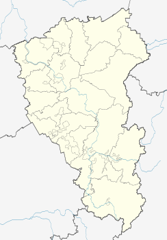
 Novokuznetsk
Coordinates: 53°45′N 87°07′E / 53.75°N 87.117°ECoordinates: 53°45′N 87°07′E / 53.75°N 87.117°E 
Coat of arms Administrative status Country Russia Federal subject Kemerovo Oblast Administrative center of Novokuznetsky District[1] Municipal status Urban okrug Novokuznetsk Urban Okrug[citation needed] Mayor[citation needed] Valery Smolego[citation needed] Representative body City Duma[citation needed] Statistics Population (2010 Census,
preliminary)547,885 inhabitants[2] - Rank in 2010 28th Population (2002 Census) 563,020 inhabitants[3] - Rank in 2002 26th Time zone OMSST (UTC+07:00)[4] Founded 1618[citation needed] Previous names Kuznetsk (until 1931),[citation needed]
Stalinsk (until 1961)[citation needed]Dialing code(s) +7 3843[citation needed] Official website Novokuznetsk (Russian: Новокузне́цк) is a city in Kemerovo Oblast, Russia. It serves as the administrative center of Novokuznetsky District,[1] but it is not administratively a part of it. Population: 547,885 (2010 Census preliminary results);[2] 549,870 (2002 Census);[3] 599,947 (1989 Census).[5]
The Novokuznetsk urban agglomeration, which includes the towns of Kiselyovsk, Mezhdurechensk, and Prokopyevsk, has a population of 1.13 million people.[citation needed]
Founded in 1618 by men from Tomsk as a Cossack ostrog (fort) on the Tom River, it was initially called Kuznetsk (Кузне́цк). It was granted town status in 1622. It was here that Fyodor Dostoevsky married his first wife, Maria Isayeva (1857). Joseph Stalin's rapid industrialization of the Soviet Union transformed the sleepy town into a major coal mining and industrial center in the 1930s. It merged with Sad Gorod in 1931. In 1931–1932 the city was known as Novokuznetsk and between 1932–1961 as Stalinsk (Ста́линск), after Stalin.
On March 19, 2007 a massive methane explosion ripped through the Ulyanovskaya mine in Novokuznetsk killing over 100 people. The mine was the largest coal producing center in the Kemerovo Region, located in a coal rich area of south central Russia known as the Kuzbass region. It is the deadliest mining accident in recent history.
Contents
International relations
Main article: List of twin towns and sister cities in RussiaTwin towns/sister cities
Novokuznetsk is twinned with:
 Nizhny Tagil, Russia
 Zaporizhia, Ukraine
 Pittsburgh, United States
City districts
- Kuybyshevsky
- Kuznetsky
- Novoilyinsky
- Ordzhonikidzevsky
- Tsentralny
- Zavodsky
Education
- Novokuznesk branch of Kemerovo State University
- Siberian State Industrial University
- Novokuznetsk State University of Pedagogy
- State Institute for Postgraduate Training of Physicians of Russian Ministry of Health known also as Novokuznetsk Postgraduate Physician Institute
- Novokuznetsk Scientific Center of Medicosocial Expert Evaluation and Rehabilitation of Invalids, Federal Agency for Public Health and Social welfare
- Institute of General Problems of Hygiene and Occupational Diseases, Russian Academy of Medical Sciences
Industry
Novokuznetsk is a heavily industrial city and is located in the heart of the Kuzbass region factories in the city include:
- West-Siberian Metal Plant
- Novokuznetsk Metal Plant
Sports
Metallurg Novokuznetsk is an ice hockey team based in Novokuznetsk, playing in the Kontinental Hockey League.
RC Novokuznetsk compete in the Professional Rugby League, the highest division of rugby union in Russia.
Transport
The main airport is Novokuznetsk Spichenkovo Airport. The city is also a major railway junction with both local and long distance trains. Local public transport is provided by trams buses and trolleybuses.
Gallery
-

Novokuznetsk from above
-

Novokuznetsk Drama Theatre
-

Vladimir Mayakovsky Monument in Novokuznetsk
-

USSR Nations Friendship Monument in Novokuznestk
-

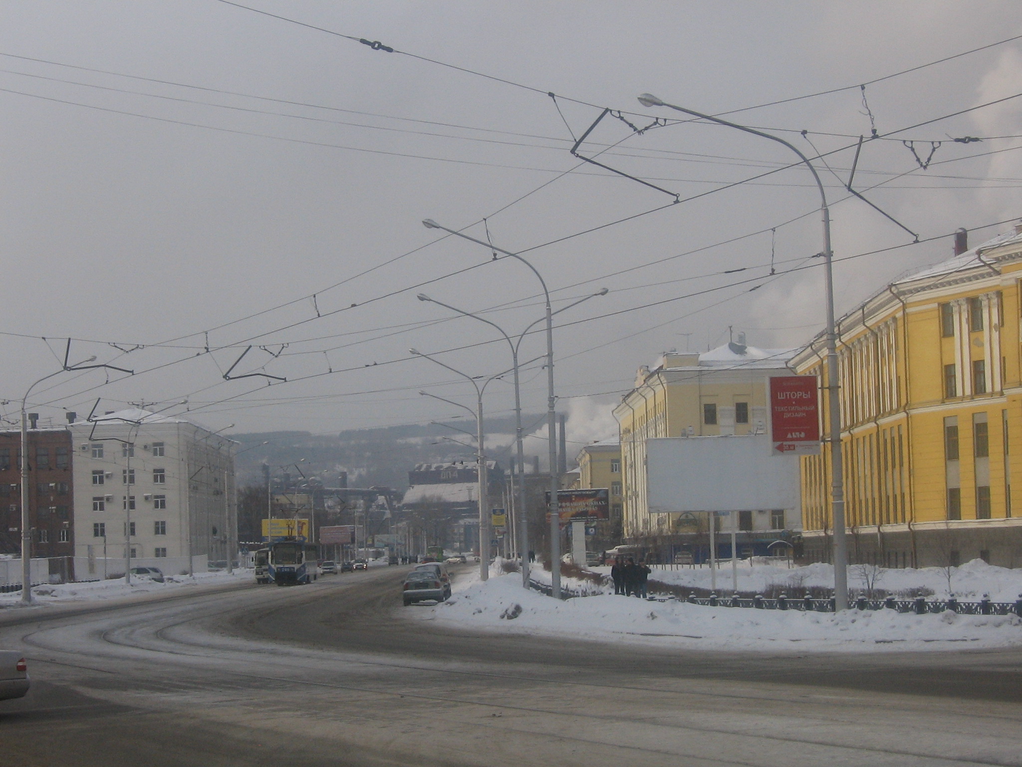
Mettalurgov Avenue in Novokuznetsk
References
Notes
- ^ a b Law #215-OZ, Appendix
- ^ a b Федеральная служба государственной статистики (Federal State Statistics Service) (2011). "Предварительные итоги Всероссийской переписи населения 2010 года (Preliminary results of the 2010 All-Russian Population Census)" (in Russian). Всероссийская перепись населения 2010 года (All-Russia Population Census of 2010). Federal State Statistics Service. http://www.perepis-2010.ru/results_of_the_census/results-inform.php. Retrieved 2011-04-25.
- ^ a b Федеральная служба государственной статистики (Federal State Statistics Service) (2004-05-21). "Численность населения России, субъектов Российской Федерации в составе федеральных округов, районов, городских поселений, сельских населённых пунктов – районных центров и сельских населённых пунктов с населением 3 тысячи и более человек (Population of Russia, its federal districts, federal subjects, districts, urban localities, rural localities—administrative centers, and rural localities with population of over 3,000)" (in Russian). Всероссийская перепись населения 2002 года (All-Russia Population Census of 2002). Federal State Statistics Service. http://www.perepis2002.ru/ct/doc/1_TOM_01_04.xls. Retrieved 2010-03-23.
- ^ Правительство Российской Федерации. Постановление №725 от 31 августа 2011 г. «О составе территорий, образующих каждую часовую зону, и порядке исчисления времени в часовых зонах, а также о признании утратившими силу отдельных Постановлений Правительства Российской Федерации». Вступил в силу по истечении 7 дней после дня официального опубликования. Опубликован: "Российская Газета", №197, 6 сентября 2011 г. (Government of the Russian Federation. Resolution #725 of August 31, 2011 On the Composition of the Territories Included into Each Time Zone and on the Procedures of Timekeeping in the Time Zones, as Well as on Abrogation of Several Resolutions of the Government of the Russian Federation. Effective as of after 7 days following the day of the official publication).
- ^ "Всесоюзная перепись населения 1989 г. Численность наличного населения союзных и автономных республик, автономных областей и округов, краёв, областей, районов, городских поселений и сёл-райцентров. (All Union Population Census of 1989. Present population of union and autonomous republics, autonomous oblasts and okrugs, krais, oblasts, districts, urban settlements, and villages serving as district administrative centers.)" (in Russian). Всесоюзная перепись населения 1989 года (All-Union Population Census of 1989). Demoscope Weekly (website of the Institute of Demographics of the State University—Higher School of Economics. 1989. http://demoscope.ru/weekly/ssp/rus89_reg.php. Retrieved 2010-03-23.
Sources
- Совет народных депутатов Кемеровской области. Закон №215-ОЗ от 27 декабря 2007 г. «Об административно-территориальном устройстве Кемеровской области», в ред. Закона №120-ОЗ от 3 декабря 2010 г «О регулировании отношений, связанных с изменением границ муниципальных образований». Вступил в силу в день, следующий за днём официального опубликования. Опубликован: "Кузбасс", №243, 28 декабря 2007 г. (Council of People's Deputies of Kemerovo Oblast. Law #215-OZ of December 27, 2007 On the Administrative-Territorial Structure of Kemerovo Oblast, as amended by the Law #120-OZ of December 3, 2010 On the Regulation of the Issues Related to the Border Changes of the Municipal Formations. Effective as of the day following the official publication date).
External links
- (Russian) Novokuznetsk City Administration official website
- Siberian State Industrial University (SIBSIU)
Cities and towns in Kemerovo Oblast Administrative center: Kemerovo
Anzhero-Sudzhensk · Belovo · Beryozovsky · Guryevsk · Kaltan · Kiselyovsk · Leninsk-Kuznetsky · Mariinsk · Mezhdurechensk · Myski · Novokuznetsk · Osinniki · Polysayevo · Prokopyevsk · Salair · Tashtagol · Tayga · Topki · Yurga
Categories:- Cities and towns in Kemerovo Oblast
- Novokuznetsk


Wikimedia Foundation. 2010.