- EastLink (Melbourne)
-
EastLink

Route information Maintained by ConnectEast Length: 39 km (24 mi) Existed: March 2005 – present History: Completed 29 June 2008 Major junctions North end:  Eastern Freeway,
Donvale, Melbourne Springvale Road
 Ringwood Bypass
 Burwood Highway
 Monash Freeway
Dandenong BypassSouth end:  Frankston Freeway,
Seaford, MelbourneLocation Primary
destinations:Nunawading
Ringwood
Dandenong
Frankston
Wantirna
Doncaster
BelgraveHighway system Highways in Australia
National Highway • Freeways in Australia
Highways in VictoriaEastLink is a A$2.5 billion tolled freeway linking a large area through the eastern and south-eastern suburbs of Melbourne, Australia.[1] It is a part of Melbourne's Metropolitan Ring Road project.
EastLink is electronically tolled with no cash booths, using a system developed by SICE. The SICE Tolling System is similar to (and interoperable with) the e-TAG system used on the CityLink tollway. EastLink was opened to traffic on Sunday 29 June 2008 and in conjunction with the opening, a month long toll-free period occurred before regular tolling commenced on 27 July 2008.[2]
The project was constructed by a joint venture of Australian construction companies Thiess and John Holland,[3] with tolling system contracted to SICE, and mechanical and electrical work contracted to United Group Infrastructure.[4]
Signs at the entrances and on the tollway direct to Ringwood, Dandenong, Frankston and Doncaster.
Contents
History
 Construction of EastLink over Boronia Road in Wantirna
The road was originally shown in the 1969 Melbourne Transportation Plan as the F35 Freeway.
The motorway has been a contentious issue, amid concerns over environmental damage and the possibility it would lead to a 'complete' metropolitan ring road. In October 1999 the Bracks Government announced that the motorway (which Labor had not promised at the election) had been scrapped. Instead the government promised to investigate a preferred route for the Rowville railway line and extend the 75 tram to Knox, of which neither have been fulfilled.[5] However, in 'major policy about-face' the Bracks Government announced in August 2000 that they would seek federal funding for the motorway.[6] To obtain funding the motorway would need to be classified as a road of 'national importance', despite the fact that it did not form part of the national highway grid. The 'U-turn' on the motorway was strongly criticised by opponents such as the Public Transport Users Association as it would result in public transport alternatives such as the Rowville railway line being scrapped.[7]
In 2001, University of Melbourne academic Paul Mees launched legal action in the Federal Court seeking an injunction under section 475 of the Environment Protection and Biodiversity Conservation Act 1999 to prevent Transport Minister Peter Batchelor and the Roads Corporation (VicRoads) from "taking any further action relating to the construction of the Scoresby freeway or the Eastern Ring Road". He alleged that the motorway would threaten migratory birds, plant species and wetlands and that the motorway was part of a larger plan to build a metropolitan ring road to Greensborough.[8] In light of the court case, state government bureaucrats removed references to the metropolitan ring road from a draft Metropolitan Strategy.[9]
In 2003, the Southern and Eastern Integrated Transport Authority (SEITA) was established by the Victorian Government, to manage and oversee the project on behalf of the government. SEITA was responsible for managing the process of selecting a private sector bidder.[3]
In October 2004, SEITA awarded the contract for the design, construction, and operation of EastLink to ConnectEast, a company that was publicly listed on the ASX in November 2004. ConnectEast subsequently contracted Thiess John Holland, a group formed by the partnership of two major construction companies, to carry out the detailed design and construction of EastLink.[3]
ConnectEast, as owner of the road, is now responsible for its day-to-day management, until the concession deed expires in [(a period of 39 years). EastLink's construction began in March 2005, and the road opened on 29 June 2008
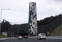
On 27 February 2008, it was announced that the EastLink / Monash Freeway interchange would be named the "Tom Wills Interchange", after the founder of Australian rules football Tom Wills.[10] On 24 March 2008 Tim Pallas announced that the twin tunnels would be named 'Melba' and 'Mullum Mullum', in the inbound and outbound direction, respectively.[11]
The opening of the road on 29 June 2008 saw traffic on nearby Stud, Springvale and Blackburn Roads drop by 30% to 40%,[12] but traffic on the an Eastern Freeway rose by 5 per cent at the Burke Road intersection, and by about 1-2 per cent at Hoddle Street in the city.[13] On average 270,868 cars, trucks and motorbikes travelled on the road every day until the tolling was introduced on 23 July.[14] In the first week after the introduction of tolls, the average number of daily trips fell to 133,722. This was in line with estimates of a 40 to 50 per cent decline, but is a third below prospectus forecasts. The average toll per trip was $3.10 - above the estimates of $2.91.[14]
In its first six months of operation, Eastlink made a loss of almost $93 million.[15] In 2010 the road had to be refinanced with its traffic forecasts rewritten due to lower than expected traffic volumes.[16]
Naming history
Over the years the project was variously referred to as the Eastern Ring Road, Scoresby Freeway, Scoresby Bypass, and Mitcham-Frankston Freeway.
On 23 March 2005, with the beginning of construction on the project, then Premier Steve Bracks announced that the road would be called EastLink, at a ceremony in Rowville.[17] The new name was reportedly chosen because it is easier to say and apparently easier to remember and fit on the street directories.
On 27 February 2008, it was announced that the EastLink / Monash Freeway interchange would be named the "Tom Wills Interchange", after the founder of Australian rules football Tom Wills.[10]
On 24 March 2008 Tim Pallas announced that the twin tunnels would be named 'Melba' and 'Mullum Mullum', in the inbound and outbound direction, respectively.[11]
Route
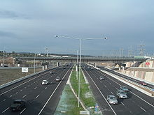
EastLink begins at the eastern end of the Eastern Freeway at Springvale Road in Nunawading, before tunnelling eastward towards Ringwood under the Mullum Mullum Creek area. It then travels 40 km south towards Frankston, passing through the suburbs of Wantirna, Wantirna South, Scoresby, Rowville, Mulgrave, Dandenong North, Noble Park, Keysborough, Dandenong South, Bangholme, and Carrum Downs, before ending at the northern end of the Frankston Freeway.[18] The majority of the freeway has three lanes running in each direction, while between Thompson Rd and Frankston Freeway, there are 2 lanes running in each direction.[19]
Exits and intersections
 Map of EastLink and surrounding roads. For legend, click the image
EastLink 
Northbound exits Distance to
Melbourne
via
(km)Distance to
Frankston
(km)Southbound exits End EastLink
continues as Eastern Freeway
to Melbourne22 44 Start EastLink
from Eastern FreewayNunawading, Donvale
Springvale Road
MELBA TUNNEL -- -- MULLUM MULLUM TUNNEL Ringwood, Mount Dandenong
Ringwood Bypass
27 39 Ringwood, Mount Dandenong
Ringwood BypassNunawading, Box Hill
(left turn only)
Maroondah Highway
Ringwood, Box Hill
Maroondah HighwayBELGRAVE / LILYDALE
RAIL LINEBELGRAVE / LILYDALE
RAIL LINEForest Hill, Heathmont
Canterbury Road
29 37 Heathmont, Forest Hill
Canterbury RoadMitcham, Wantirna
Boronia Road
31 35 Wantirna, Mitcham
Boronia RoadBurwood, Belgrave
Burwood Highway
33 33 Belgrave, Burwood
Burwood HighwayGlen Waverley, Wantirna South
High Street Road
35 31 Glen Waverley, Wantirna South
High Street RoadOakleigh, Scoresby
Ferntree Gully Road
38 28 Scoresby, Oakleigh
Ferntree Gully RoadEASTLINK BP SERVICE CENTRE
Under Construction39 27 EASTLINK BP SERVICE CENTRE
Under ConstructionMulgrave, Rowville
Wellington Road
40 26 Rowville, Mulgrave
Wellington Roadno exit 42 24 Dandenong North, Springvale
Police Road
Northbound exits Distance to
Melbourne
via
(km)Distance to
Frankston
(km)Southbound exits Springvale, Dandenong North
Police Road29 23 TOM WILLS INTERCHANGE
Warragul, Traralgon, Melbourne
Monash Freeway 
TOM WILLS INTERCHANGE
Chadstone, Melbourne
Monash Freeway Oakleigh, Dandenong
Princes Highway
31 21 Dandenong, Oakleigh
Princes HighwayGIPPSLAND RAIL LINE/Pakenham and Cranbourne Rail Lines (Metro) 33 19 GIPPSLAND RAIL LINE/Pakenham and Cranbourne Rail Lines (Metro) no exit 34 18 Dandenong, Mentone
Cheltenham Road
Keysborough, Dandenong
Dandenong Bypass36 16 Dandenong, Keysborough
Dandenong BypassMordialloc, Narre Warren
Greens Road
38 14 Narre Warren, Mordialloc
Greens RoadCarrum, Cranbourne
Thompson Road
44 8 Cranbourne, Carrum
Thompson RoadStart EastLink
continues from Frankston Freeway
47 5 Flinders, Portsea
Peninsula Link
Under ConstructionCarrum Downs, Cranbourne
Rutherford RoadEnd EastLink
continues as Frankston Freeway
to Frankston / PortseaDandenong Bypass
Main article: Dingley FreewayA 4.8 km section of the Dingley Freeway called the Dandenong Bypass (also referred to as the Dandenong Southern Bypass during its construction) was built by ConnectEast and Thiess John Holland as part of the EastLink project.[20] The bypass opened on 9 December 2007.[21]
Tolling
 Ringwood portal of the tunnels under the Mullum Mullum Valley
 EastLink is electronically tolled via a system commercially called Breeze, entirely provided by SICE, Spanish system integrator company with broad experience in the tolling market. This system is fully interoperable with all other tollways in Australia, including the Transurban e-TAG system used on CityLink.[22]
The system features a uniquely designed electronic vehicle tag, the "Breeze Tag", which is about half the size of the standard design of e-TAG. The Breeze system is provided by Spanish company SICE,[23] with the Road Side Equipment, including the Breeze Tags, provided by Swedish firm Kapsch TrafficCom AB, under the PREMID brand of DSRC products.[24]
Tolls on EastLink can be charged in three different ways:
- By having any Australian electronic tolling "tag" (such as a Breeze Tag, or Transurban's e-TAG) in the vehicle. Tolls are charged to the corresponding tag account.[25]
- By registering a Breeze non-tag account with ConnectEast. A photograph of the number plate(s) of each vehicle is taken and matched to an account, charging the account holder the toll plus a small processing fee (23c, waived for motorcycles). Alternatively, "Access" accounts registered with CityLink may also be used in this manner.[26]
- By purchasing a "trip pass" valid for a single one-way trip on EastLink from ConnectEast either over the telephone, via the EastLink website, or from a retail outlet. Vehicle recognition for trip passes is done the same way as for non-tag accounts. Drivers can purchase multiple trip passes at once, as passes are stored until used. However, trip passes expire six months from the date of purchase.[27]
If a driver travels on EastLink without taking any of the three actions above to pay for the toll(s) either prior to, or within three days after travel, an invoice for cost of the toll(s) plus an account processing fee will be sent to the registered vehicle's owner. If the toll invoice is not paid, an overdue notice (with an additional processing fee) is issued. If the invoice is still not paid, a fine is issued by Victoria Police.[28]
Prices and discounts
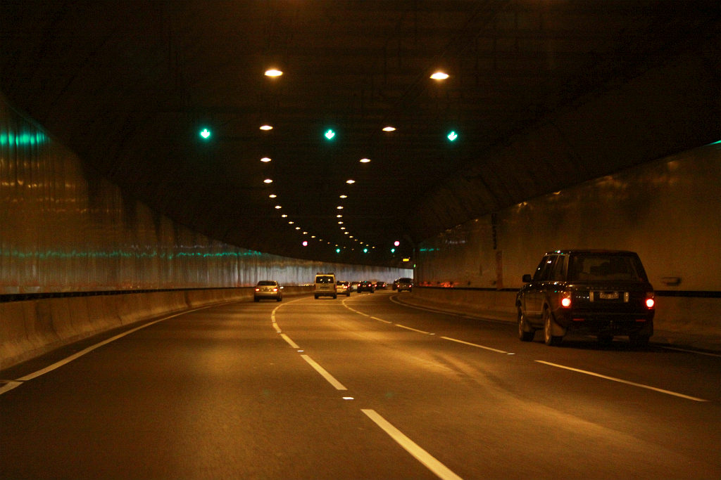
 Inside the Melba (westbound) tunnel
Prices for the use of the tollway vary between sections. For cars, a one way trip between two consecutive interchanges starts from 34c for sections between Maroondah Highway and High Street Road, slightly more for the longer sections near the south of the tollway, right up to a one way trip through the tunnel section between Maroondah Highway / Ringwood Bypass and Springvale Road which costs $2.37. Lower rates apply to motorcycles while higher rates apply for some four wheel drives, some utility vehicles, buses and trucks.[29]
Discounts are also offered to car drivers. A 20 per cent discount applies to the cost of any trip(s) taken on a Saturday or Sunday and also to one way trips between two consecutive interchanges (excluding the tunnels) on weekdays. At any time, cars will not be charged more than $5.15 for a one way trip on EastLink.[29]
Traffic impact on surrounding roads
Whilst the construction of Eastlink alleviated congestion on Springvale Road, it has had the effect of funnelling the traffic onto other roads, particularly increasing traffic on the Eastern Freeway. Many local councils, organisation, community groups and individuals expressed concerns throughout the proposal and construction phases, over the alterations to traffic patterns and flows and how Eastlink would impact upon local roads in their respective areas. In 2009, the City of Manningham was able to conduct a traffic report which found that:[30]
- Traffic on the Eastern Freeway increased "significantly"
- Travel times in peak and off-peak periods at the Eastern Freeway/Hoddle Street interchange had increased "significantly"
- Peak hour congestion at the Eastern Freeway/Bulleen Road interchange had increased.
- 20% decrease in traffic at the Springvale Road outbound offramp.
- 13% increase in traffic on Bulleen Road north of the Eastern Freeway.
- 13% decrease in traffic on Park Road, between Heads & Mitcham Roads.
- 11% decrease in traffic on Doncaster Road, west of Middleborough Road.
- 8% increase in traffic on Fitzsimmons Lane, north of Porter Street.
- 2% increase in traffic on Manningham Road.
- 2% decrease in traffic on Reynolds Road, between Blackburn Road and Springvale Road.
Another study conducted by Banyule Council showed that, since EastLink opened in June 2008, 800 more trucks a day use main roads in Heidelberg and Rosanna.
In general, it appears as though Eastlink has funnelled large amounts of traffic onto the Eastern Freeway and has attracted an increase in commuters using arterial roads in local areas. Decreases appear to be on small stretches of local roads where Eastlink provides a quicker alternative.
The EastLink Trail is a shared walking and cycle path that follows a similar North/South route to the EastLink project. Using it, cyclists and pedestrians are able to cycle or walk most of the distance of the road, along a 3 metre wide dedicated concrete path. Many major roads are crossed via under or over passes. Some roads, such as High Street Road (and until November 2009, Burwood Highway), require crossing the road at grade.[31]
In wet weather, two underpasses are not trafficable as they have been built on floodways. These are the Ferntree Gully Road underpass and the Wellington Road underpass. After a medium amount of rain the underpasses flood and trail users must cross over the major roads to continue along the path. This can prove dangerous and during peak traffic times, trail users are known to have waited up to 20 minutes to safely cross the roads when the underpasses have flooded.
The Eastlink trail stops in Dandenong and does not continue. Users may take the Dandenong Creek Trail from this point which will take them to Carrum. From there, Frankston is approximately 10 km away.
For those using the trail, substantial deviations from Eastlnk must be taken into account in travel times as the shared path does not follow the freeway in many cases as existing trails were joined up to the trails specifically built during the construction of the road. This has led to some very twisty sections of trail and in some cases, detours of over 3 km from the Eastlink.


A panoramic view of EastLink looking north from the Heatherton Road bridge. Accidents
On 18 February 2010, at 3.15pm, a semi-trailer lost control on the north-bound side of the tollway, 300m from the Wellington Rd exit. The truck crossed the road and crashed through the median safety barrier, before crashing into a large pylon holding up a road sign gantry. The truck exploded into flames and the driver was killed. The tollway was closed in both directions, the first time since the road opened, between the Monash Freeway and Ferntree Gully Road. It remained closed until the early hours of the following morning so police could conduct an investigation and ConnectEast could carry out repairs to make the road safe to reopen. The police report is yet to be finalised.
Controversies
 Maroondah Highway bridge, Ringwood looking towards the railway bridge
 EastLink looking south from the Koomba Road footbridge before opening.
 The EastLink Operations Centre in Ringwood during construction.
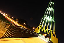 Night-shot of overpass spanning Eastlink, near the Burwood Rd exit.
- The most notable controversy surrounding this project has been the issue of tolls. The Victorian Government, led by Steve Bracks, initially planned not to build the road, instead promising to invest in public transport.[5] Though the government reversed their policy position and decided to go ahead with the road instead. They gave an undertaking that the road would be toll free, a promise on which they later reneged. This led to a total withdrawal of what had been partial federal funding of the project. This policy change has caused much debate, discussion and resentment in some quarters. The Victorian Government's position is that project was not viable without tolls.
- The Federal government withdrawal of funding was based on the premise that funding was only available for the road if the road was toll free. However, at the same time, they were also funding a tolled freeway in Sydney, the Westlink motorway. This led to the controversial belief in some quarters that the funding withdrawal was solely designed to discredit the Victorian Government, rather than being driven by a reluctance to fund toll roads.
- The then Victorian State opposition, led by Robert Doyle, initially opposed any form of tolling on the road. Subsequently this policy was changed to support tolls. After the 2010 state election, the state leadership led by Liberal leader Ted Baillieu continues to support tolls.
- A court case was heard, where the plaintiffs argued that constructing EastLink would result in pressure to build the "missing link" between EastLink and the Metropolitan Ring Road. They claimed that such a freeway would damage the environmentally sensitive green wedges through either Eltham and Warrandyte or Heidelberg and the Yarra Flats. Indeed, as at October 2008 (months after the opening of EastLink) there is mounting pressure to build this "missing link".
- During the planning stages of the project, businesses in the Rutherford Road industrial area (located at the Southern terminus of the freeway) wanted access via on/off ramps to the Mornington Peninsula Freeway and Frankston Freeway, in addition to EastLink. Prior to this project they had an off ramp only from the Mornington Peninsula Freeway into the industrial area. Under Eastlink, this will be retained, but no onramps will be built onto these existing roads. The Mornington Peninsula Freeway, and the Frankston Freeway, despite being on their doorstep will be inaccessible. The only onramp from Rutherford Road will be onto EastLink, Northbound.
- Although there is speculation that existing public roads will be restricted to increase traffic on Eastlink [2], there is legislation in place prohibiting the restriction of traffic [3], and SEITA has stated that "Importantly, the State Government has passed legislation to maintain the existing capacity on arterial roads. The EastLink Act and the contract between the State of Victoria and ConnectEast prohibits closing or narrowing any existing roads in an attempt to force people onto EastLink." [4]
- On 28 August 2006, due to the late completion of bridge preparation works on the Belgrave and Lilydale railway line, the line was closed for the morning with inadequate warning to commuters of the closure of the line between Blackburn and Ringwood stations causing chaos at Ringwood where lengthy queues formed for the replacement buses. Passengers at Heatherdale, Mitcham and Nunawading stations were stranded because of the mess where the delay was caused by the portable crane "Snow White" being unable to operate near the rail line where bridge supports are being constructed. The ground was too soft for the crane and gravel had to be ordered in causing the delay. Theiss John Holland has to pay penalties to Connex Melbourne while commuters will not be reimbursed. It is interesting to note that some of the more willing commuters set about the one hour walk to Blackburn. Those individuals managed to arrive well before other commuters that had been caught in the confusion at Ringwood, by an hour or more.[32]
- Finally, many in the local area at the Southern end of EastLink argue that EastLink will in fact funnel much more traffic onto the Frankston Freeway, which will only aggravate the existing congestion at the Frankston Freeway terminus; at the corner of McMahons Road and Cranbourne Road, and that a Frankston Bypass is necessary to complete the missing link in the currently split Mornington Peninsula Freeway. This has received much attention in local Frankston newspapers. VicRoads argue that their research indicates no such congestion will occur. The Frankston Bypass route has long been marked in the Melway street directory. Former Victorian Transport Minister Peter Batchelor has in the past said that "just because a future freeway appears in the Melway, does not mean that the road is planned or will ever actually be built". Frankston Council has been in talks with EastLink, with a view to getting the bypass built from EastLink to as far as Cranbourne Road. In addition, the local MP for the Federal seat of Dunkley, Bruce Billson, is also working with local councils with a view to applying pressure on the state government for the Frankston Bypass to be built.[33] The government in 2010 signed off on a contract for the construction of Peninsula Link.
Environmental issues
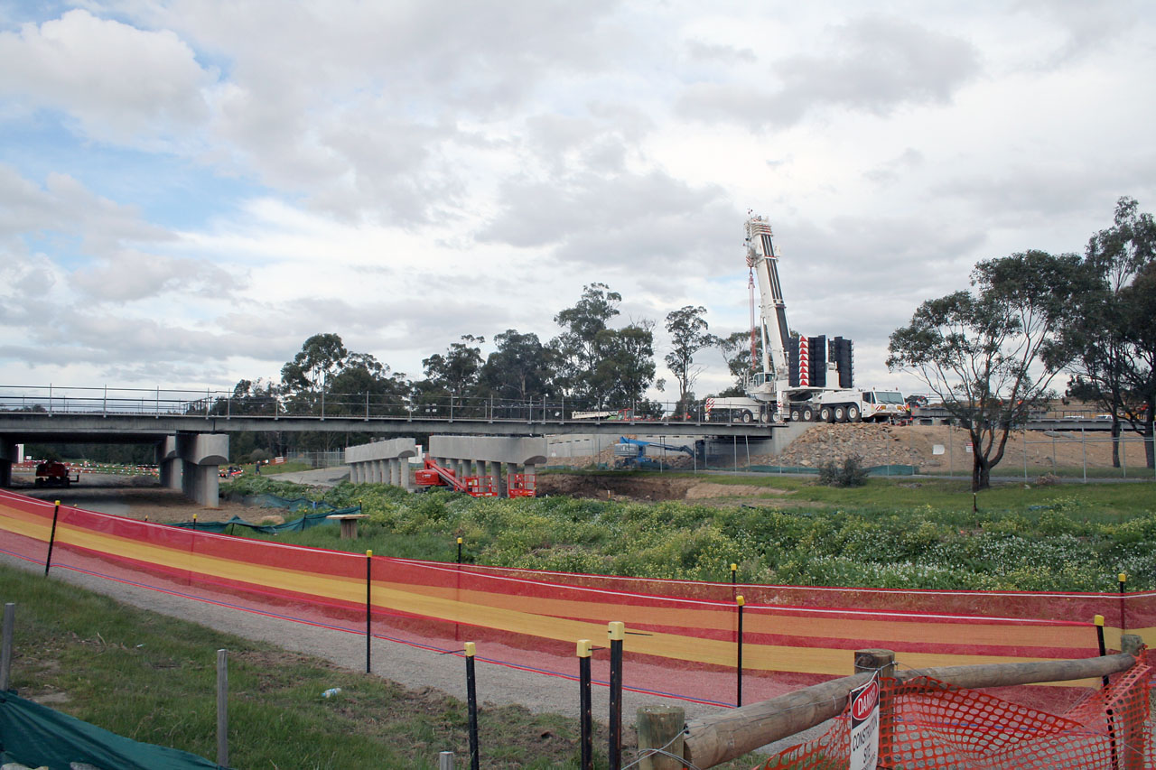
 Constructing the EastLink bridge over Dandenong Creek, in Ringwood/Wantirna
Many environmental groups in Melbourne's east and south-east objected to the project, due to a number of factors, including vehicle emissions and disruption of habitat (in places such as the Mullum Mullum Valley and Dandenong Valley Wetlands). However, the road was the subject of an extensive Environmental Effects Statement (June 1998), which was followed by an extensive public hearing process in April 1999 before the final Government decision to proceed. The statement predicted an 18.5per cent increase in carbon dioxide, impacts on groundwater and wetlands, high impacts on areas of conservation value and the potential to affect 38 species of rare or threatened fauna and flora if the freeway was built.[8]
According to EastLink's builders, the road will relieve traffic congestion throughout Melbourne's eastern and south-eastern suburbs, resulting in more efficient traffic flow, therefore reducing fuel consumption and exhaust output.[34]
During the planning phase (then a VicRoads project), a large debate surrounding damage to the Mullum Mullum Valley occurred. A number of options for the path of the road through the valley were considered. The option chosen - for two 1.6 km tunnels - was the second-to-most expensive, and the second-to-most environmentally friendly.[35] Other options considered in planning included a surface road for the entire length, much shorter tunnels, and slightly longer tunnels.
However, despite the attention on tunneling beneath the Mullum Mullum Gorge, the Ringwood Interchange is entirely above-ground and has resulted in relocation of the creek through this area.
See also
References
- ^ "About Eastlink". Southern and Eastern Integrated Transport Authority. Archived from the original on 25 June 2008. http://web.archive.org/web/20080625005149/http://www.seita.com.au/pages/about-eastlink.asp. Retrieved 26 June 2008.
- ^ "EastLink set to open on 29 June". EastLink. ConnectEast. http://www.eastlink.com.au/news-detail.aspx?newsid=26. Retrieved 26 June 2008.
- ^ a b c "Who's involved?". Southern and Eastern Integrated Transport Authority. Archived from the original on 1 June 2008. http://web.archive.org/web/20080601105438/http://www.seita.com.au/pages/whos-involved.asp. Retrieved 26 June 2008.
- ^ Woodberry, Trent (12 December 2006). "EastLink: - Commencement of mechanical and electrical work by United Group Ltd" (PDF). Thiess John Holland. Archived from the original on 25 July 2008. http://web.archive.org/web/20080725050513/http://www.seita.com.au/pages-support/news/data/NEWS_358_1.pdf. Retrieved 26 June 2008.
- ^ a b Das, Sushi (28 October 1999t). "$786m Freeway Link Scrapped". The Age. pp. 6.
- ^ Das, Sushi (8 August 2000). "Scoresby Freeway Back On Agenda". The Age. pp. 3.
- ^ Das, Sushi (21 August 2000). "Anger At U-turn On Scoresby Freeway". The Age. pp. 3.
- ^ a b Heasley, Andrew (27 October 2001). "Scoresby Freeway Faces Hurdle". The Age. pp. 13.
- ^ Heasley, Andrew (31 October 2002). "Ring road plan altered before case". The Age. pp. 6. http://www.theage.com.au/articles/2002/10/30/1035683473571.html.
- ^ a b EastLink interchange honours one of football's founders SEITA. 27 February 2008. Retrieved on 26 March 2008.
- ^ a b Pilcher, Georgie (24 March 2008). "East Link Twin Tunnels named as Melba and Mullum Mullum". The Herald Sun. AAP. http://www.news.com.au/heraldsun/story/0,21985,23422172-2862,00.html.
- ^ Julia Milesi (30 June 2008). "No delays as EastLink tollway cuts traffic". The Ague. www.theage.com.au. http://www.theage.com.au/news/national/b-traffic-advice-b-get-the-latest-on-roads-and-public-transport/2008/06/30/1214677921667.html. Retrieved 17 August 2008.
- ^ Ashley Gardiner (1 July 2008). "Traffic on surrounding roads plummets after EastLink opens". Herald Sun (www.news.com.au). http://www.news.com.au/heraldsun/story/0,21985,23949282-2862,00.html. Retrieved 17 August 2008.[dead link]
- ^ a b Beveridge, John (8 August 2008). "Road fees take a toll". Herald Sun (www.news.com.au). http://www.news.com.au/heraldsun/story/0,21985,24144604-5014150,00.html. Retrieved 17 August 2008.
- ^ Murphy, Mathew (26 February 2009). "EastLink owner optimistic despite loss". The Age (Fairfax). http://www.theage.com.au/business/eastlink-owner-optimistic-despite-loss-20090225-8i0p.html. Retrieved 23 October 2010.
- ^ Santow, Simon (29 June 2010). "Tolls cut as motorists run from costly roads". ABC (abc.net.au). http://www.abc.net.au/am/content/2010/s2939555.htm. Retrieved 24 October 2010.
- ^ Silkstone, Dan (24 March 2005). "Naming and blaming launches tollway". The Age. pp. 10.
- ^ "EastLink Map (Melway)" (PDF). Melway. Melway Publishing Pty Ltd. http://www.eastlink.com.au/downloadFile.aspx?file_id=176. Retrieved 26 June 2008.
- ^ "EastLink facts and figures". Southern and Eastern Integrated Transport Authority. Archived from the original on 1 June 2008. http://web.archive.org/web/20080601105357/http://www.seita.com.au/pages/eastlink-facts-and-figures.asp. Retrieved 26 June 2008.
- ^ "Dandenong Bypass". Southern and Eastern Integrated Transport Authority. Archived from the original on 19 July 2008. http://web.archive.org/web/20080719223153/http://www.seita.com.au/pages/dandenong-bypass.asp. Retrieved 26 June 2008.
- ^ EastLink tollway to open six months early Herald Sun 10 December 2007. Retrieved on 12 December 2007.
- ^ "Breeze - Products". ConnectEast. http://www.breeze.com.au/products. Retrieved 26 June 2008.
- ^ "Free-flow tolling system for Mitcham–Frankston Freeway". Sociedad Ibérica de Construcciones Eléctricas, S.A. (SICE). http://www.sice.com/contenidos/referencias/peajes/ref_peajes_011.html. Retrieved 26 June 2008.
- ^ "Kapsch awarded new prestigious contract in Australia" (PDF). Kapsch TrafficCom AB. 2 September 2005. http://www.kapsch.se/64007be2-f465-4878-a9b1-821fc8b89ab4. Retrieved 26 June 2008.
- ^ "Breeze - Tag account". ConnectEast. http://www.breeze.com.au/page.aspx?cid=608. Retrieved 26 June 2008.
- ^ "Breeze - Non-tag account". ConnectEast. http://www.breeze.com.au/page.aspx?cid=609. Retrieved 26 June 2008.
- ^ "Breeze - EastLink trip pass". ConnectEast. http://www.breeze.com.au/page.aspx?cid=607. Retrieved 26 June 2008.
- ^ "Breeze - Toll invoice". ConnectEast. http://www.breeze.com.au/page.aspx?cid=611. Retrieved 26 June 2008.
- ^ a b "EastLink - Tolls". ConnectEast. http://www.eastlink.com.au/page.aspx?code=TOLLS. Retrieved 26 June 2008.
- ^ City of Manningham, traffic report on the effects, alterations and impacts of Eastlink to surrounding and local roads in the City of Manningham, 2009.
- ^ "EastLink Trail". ConnectEast. http://www.eastlink.com.au/page.aspx?cid=106. Retrieved 26 June 2008.
- ^ "Chaos after EastLink bungle". Herald Sun. 28 August 2006. pp. Internet Article.
- ^ Mornington Peninsula Shire Council Meeting Minutes. [1]. 10 April 2006. Internet Article.
- ^ Gardiner, John (March 2006). "In the Headlights". EastLink News. ConnectEast. pp. 2. "Vehicles travelling at reasonably consistent speeds use less fuel ... emissions are all reduced by better and more consistent speeds."
- ^ Costa, Gabrielle (14 October 2000). "Government compromises on freeway". The Age. p. 4.
External links
- EastLink official website (run by ConnectEast)
- ConnectEast (the developer of EastLink)
- The Southern and Eastern Integrated Transport Authority (EastLink information)
- SICE (the main contractor for the free-flow tolling system project)
Other links
- EastLink Flyover - a video clip from heraldsun.com.au showing aerial footage of the EastLink route
- ABC Online Report on project groundbreaking
- Justice Gray's ruling on the likelihood of the Scoresby Freeway being a catalyst for further freeway building in environmentally sensitive areas
Landmarks in the Melbourne City Centre Note: this includes landmarks in the Melbourne City Centre and its fringe areas, not the Greater Melbourne metropolitan area City Precincts Arts Precinct · Chinatown · Docklands · Government Precinct · Greek Precinct · Little Italy · Paris End · RMIT City · Southbank/Wharf · Sports and Entertainment Precinct · University of MelbourneShopping Block Arcade · Bourke Street · Bridge Road · Brunswick Street · Chapel Street · Collins Street · DFO South Wharf · Elizabeth Street · Flinders Lane · Docklands Harbour Town · Lt. Collins Street · Melbourne Central Shopping Centre · Myer Emporium · Melbourne GPO · Queen Victoria Market · Queen Victoria Village · Royal Arcade · Swanston Street
Entertainment Colonial Tramcar Restaurant · Crown Casino and Entertainment Complex · Luna Park · Melbourne Aquarium · City Tourist Shuttle · Melbourne Zoo · See also: Events in the Melbourne City Centre · Theatres in the Melbourne City Centre
Public Galleries Australian Centre for Contemporary Art · Australian Centre for the Moving Image · National Gallery of Victoria, inc. Ian Potter Centre · State Library of Victoria's Cowen Gallery, Dome Gallery and Murdoch Gallery · RMIT Gallery · See also: Museums in the Melbourne City Centre
Institutions General Post Office · Government House · Melbourne Observatory · Melbourne Town Hall · Old Melbourne Gaol · Old Melbourne Mint · Old Melbourne Magistrates' Court · Old Treasury Building · Parliament House · State Library of Victoria · Supreme Court of Victoria · Victoria Barracks
Structures Sports Stadia Melbourne Rectangular Stadium (AAMI Park) · Docklands Stadium (Etihad Stadium) · Flemington Racecourse · Melbourne Multi Purpose Venue (Hisense Arena) · Melbourne Cricket Ground (MCG) · Melbourne Grand Prix Circuit · Melbourne Sports and Aquatic Centre (MSAC) · National Ice Sports Centre (The Icehouse) · Olympic Park Stadium · Rod Laver Arena · Royal Melbourne Golf Club · Princes Park (Visy Park)
Parks/Spaces Albert Park and Lake · Alexandra Gardens · Birrarung Marr · Carlton Gardens · City Square · Federation Square · Fitzroy Gardens · Flagstaff Gardens · Kings Domain · Queen Victoria Gardens · Royal Botanic Gardens · Royal Park · Treasury Gardens · Yarra Park
Transport Bolte Bridge · Capital City Trail · City Circle Tram · CityLink · Flinders Street Station · Melbourne Airport · Melbourne Seaport · Southern Cross Station · Trams in Melbourne · West Gate Bridge
See also: Events in the Melbourne City Centre · Museums in the Melbourne City Centre · Theatres in the Melbourne City Centre Coordinates: 37°49′48″S 145°13′03.47″E / 37.83°S 145.2176306°E
Categories:- Landmarks in Melbourne
- Highways and freeways in Melbourne
- Toll roads in Australia


Wikimedia Foundation. 2010.