- Merivale
-
Not to be confused with Merrivale.
Merivale 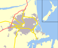
 Merivale
Coordinates: 43°31′01″S 172°36′59″E / 43.517031°S 172.616522°ECoordinates: 43°31′01″S 172°36′59″E / 43.517031°S 172.616522°E Area - Total 0.9798 km2 (0.4 sq mi) Population (2006) - Total 3,012 - Density 3,074.1/km2 (7,961.9/sq mi) Merivale is a suburb of Christchurch, New Zealand, north of the city centre. Its boundaries are defined by Statistics New Zealand[1] as being Heaton Street to the north, Papanui Road to the east, Harper and Bealey Avenues to the south and Rossall Sreet to the west, although Real Estate advertising often will claim residences outside this area, especially St Albans to the east of Papanui Road, as being Merivale due to the perceived desirability of the area.[citation needed]
Early history
Charlotte Jackson of Rugby arrived in 1851 for her two rural sections which went from Merivale Lane to Aikmans Road and from Papanui Road to Boundary Road. She named the 100 acres (0.40 km2) block Merevale. Her brother-in-law, the Rev. Thomas Jackson, was the vicar of Merevale, near Atherstone in Warwickshire. Charlotte Jackson later sold the sections. In December 1859 she sold the northern 50 acres (200,000 m2) to Capt. T. H. Withers of Deptford, and in 1862 the southern 50 acres (200,000 m2) to William Sefton Moorhouse. Moorhouse build a magnificent home on Merevale farm of which half still stands today on Naseby Street.[2]
A hotel has stood at the intersection of Papanui Road and Bealey Avenue since 1865. Carlton Hotel was built in its place in 1906 in time for the New Zealand International Exhibition.[3] The hotel was demolished in April 2011.[4]
Today
Merivale has retained much of the charm and graciousness of the early estates. There are still a few of the narrow streets and lanes and many of the original cottages have been restored. The Mall with supermarket, boutiques and upmarket shops is close to the city. The area is predominantly residential.
Rangi Ruru is located in Merivale. St Margaret's College is also located in Merivale.
References
- ^ Statistics New Zealand.
- ^ St Albans, from Swamp to Suburbs, An Informal History. New Zealand federation of University Women Canterbury Branch. 1989. pp. 10–18. ISBN 0-473-00693-6.
- ^ "Carlton Hotel". Register of Historic Places. New Zealand Historic Places Trust. http://www.historic.org.nz/TheRegister/RegisterSearch/RegisterResults.aspx?RID=1841&m=advanced. Retrieved 10 April 2011.
- ^ Davis, Joanna (9 April 2011). "Historic hotel for urgent demolition". The Press. http://www.stuff.co.nz/the-press/news/4868732/Historic-hotel-for-urgent-demolition. Retrieved 10 April 2011.
Suburbs of Christchurch City, Canterbury, New Zealand Main Suburbs Minor Suburbs Addington • Aidanfield • Avondale • Avonhead • Avonside • Balmoral Hill • Barrington • Beckenham • Bexley • Bridgend • Bromley • Brooklands • Broomfield • Burwood • Bryndwr • Casebrook • Chaneys • Clifton • Coutts Island • Cracroft • Dallington • Ferrymead • Harewood • Heathcote Valley • Hei Hei • Hillmorton • Hillsborough • Hoon Hay • Huntsbury • Hyde Park • Ilam • Islington • Kainga • Kennedys Bush • Mairehau • Marshland • Masham • Middleton • Moncks Bay • Moncks Spur • Mount Pleasant • Murray Aynsley • North Linwood • North New Brighton • Northcote • Northwood • Oaklands • Opawa • Ouruhia • Parklands • Phillipstown • Queenspark • Redcliffs • Redwood • Richmond • Richmond Hill • Richmond South • Russley • St Albans • St Andrews Hill • St Martins • Scarborough • Sockburn • Somerfield • South New Brighton • Southshore • Spencerville • Spreydon • Stewarts Gully • Strowan • Styx • Taylors Mistake • Upper Riccarton • Waimairi Beach • Wainoni • Waltham • Westlake • Westmorland • Wigram • YaldhurstCategories:- Suburbs of Christchurch
- Canterbury Region geography stubs

Wikimedia Foundation. 2010.