- Samoan Islands
-
For other uses, see Samoa (disambiguation).
Samoan Islands 
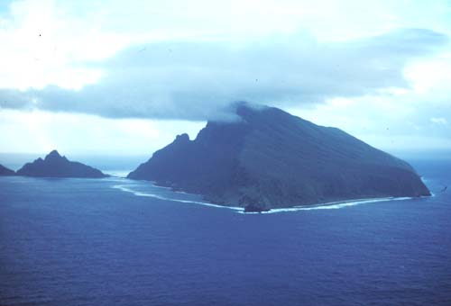
Olosega island in the Manu'a group, eastern Samoa Islands
Geography Location Polynesia Area 3,030 km2 (1,170 sq mi) Highest elevation 1,858 m (6,096 ft) Highest point Mauga Silisili Country SamoaLargest city Apia (pop. 38,800) U.S./American SamoaLargest city Pago Pago (pop. 11,500) Demographics Population 250,100 (as of 2001) Main article: SamoaThe Samoan Islands or Samoa Islands is an archipelago covering 3,030 km2 (1,170 sq mi) in the central South Pacific, forming part of Polynesia and the wider region of Oceania. The population of the Samoan Islands is approximately 250,000, sharing a common language, Samoan, a culture, known as fa'a Samoa and an indigenous form of governance called fa'amatai.[1]
Due to colonialism, the Samoa Islands and people were divided by Western powers. Today, the islands have two jurisdictions, the independent country of Samoa in the western half of the islands, and the territory of American Samoa comprising the islands to the east. The two regions are separated by 64 km of ocean. Most Samoans are full-blooded and are one of the largest Polynesian populations in the world.[2]
The oldest date so far from prehistoric remains in the Samoan Islands has been calculated from archaeology in Samoa to a likely true age of circa 3,000 BP (before present, where present is AD 1950) from a Lapita site at Mulifanua wharf on Upolu island.[3]
In 1768, the eastern islands were visited by French explorer Bougainville, who named them the Navigator Islands, a name used by missionaries until about 1845 and in official European dispatches until about 1870.[4]
Contents
Samoa and American Samoa
 German, British and American warships in Apia harbour, 1899.
Politically the two jurisdictions of the Samoa Islands are;
 Samoa, independent nation, situated at the western half of the islands, gained political independence in 1962 (2,831 km² and 185,000 inhabitants). Formerly known as German Samoa (1900–1914) and Western Samoa (up to 1997).
- Capital Apia, currency Samoan tala.
 American Samoa, an unincorporated territory of the United States consisting of the islands to the east (199 square kilometers and 65,000 inhabitants).
- Capital Pago Pago, currency US dollar
Political partition
In the late 1800s, rivalry between the United States, Germany and the United Kingdom resulted in the Tripartite Convention (1899) that formally partitioned the Samoan archipelago into a German colony (German Samoa) and a United States territory (American Samoa). The international convention occurred on the brink of World War I. Forerunners to the Tripartite Convention of 1899 were the Washington Conference of 1887, the Treaty of Berlin of 1889 and the Anglo-German Agreement on Samoa of 1899. New Zealand occupied the German colony through 1920, then governed the western islands until independence in 1962 as a (1) League of Nations Class C Mandate[5] and (2) United Nations Trust Territory after 1946. The pro-independence Mau movement across the islands eventually led to the political independence of the western islands from New Zealand in 1962 while the eastern islands, American Samoa, remains a political territory of the United States.[6]
Islands
 Map of Samoa
Samoa
 Map of American Samoa
- Upolu, population 134,400 (2001), most populous island in the group.
- Savai'i, population 43,142 (2006), largest landmass and most western in the group, most recent volcanic eruptions Mt Matavanu (1905–1911); Mata o le Afi (1902); Mauga Afi (approximately 1725).
- Manono, population 889 (2006)
- Apolima, population 75 (2006)
- Fanuatapu, uninhabited, volcanic tuff ring.
- Namua, uninhabited, has beach fale accommodation for visitors, viewed from Lalomanu beach.
- Nu'ulopa, uninhabited, lies in the Apolima Strait between Upolu and Savai'i.
- Nu'ulua, uninhabited, volcanic tuff ring, land area 25 hectares, conservation habitat for endemic native birdlife.[7]
- Nu'usafe'e, uninhabited, tiny rocky islet off the south coast of Upolu by the village of Poutasi.
- Nu'utele, uninhabited, volcanic tuff ring, conservation for native birdlife, also viewed from popular Lalomanu beach.
The islands of Manono, Apolima and Nu'ulopa lie in the Apolima Strait between Upolu and Savai'i. The four small uninhabited islands Nu'utele, Nu'ulua, Namua and Fanuatapu are situated off the east coast of Upolu and comprise the Aleipata Islands.
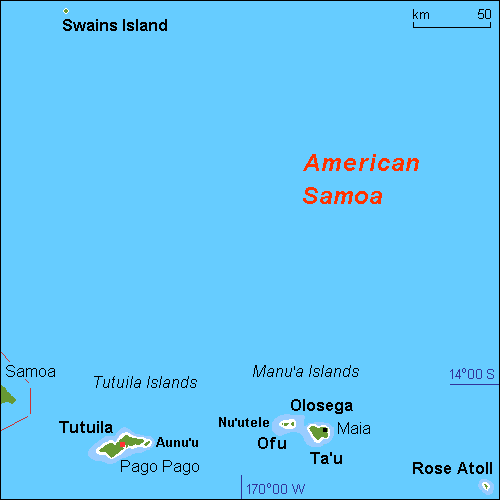
American Samoa
- Tutuila, population 55,876 (2000 census), main island in the territory.
- Aunu'u, population 476 (2000 census), located south east of Tutuila.
- Ta'ū, population 873 (2000 census), largest island in Manu'a Group
- Ofu‑Olosega, volcanic doublet comprising Ofu (population 289, census 2000) and Olosega (population 216, census 2000), in the Manu'a Group of islands.
- Rose Atoll also known as Motu o Manu, conservation habitat for native birdlife, marine life, green turtle and endangered hawksbill turtle.
- Swains Island, politically administered by American Samoa but culturally part of Tokelau, copra plantation.
Location
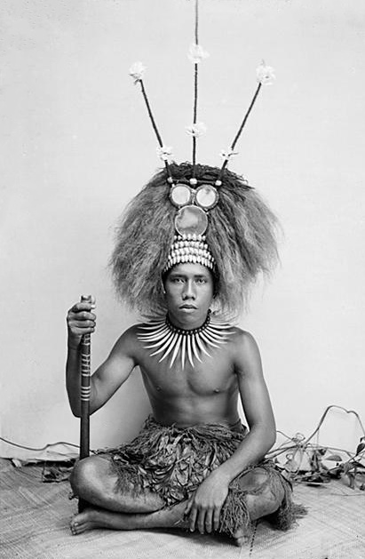
 Young man dressed as a manaia, the son of a Samoan chief (matai), circa 1890–1910. (photo by Thomas Andrew)
The islands are approximately 800 km (500 mi) from Fiji, 530 km (330 mi) from Tonga, 2,900 km (1,800 mi) from New Zealand, and 4,000 km (2,500 mi) from Hawaii, U.S.A.[8]
The islands lies between 13° and 14° south latitude and 169° and 173° west longitude, about 480 km (300 mi) from west to east.
The larger islands are volcanic in origin, mountainous, and covered in tropical moist forest. Some of the smaller islands are coral atolls with black sand beaches.
Highest points
The highest peak is Mt. Silisili, on the island of Savai'i, one of the highest peaks in Polynesia at 1858 m.[9] The highest point in American Samoa is on Ta’u, Lata Mountain, at 966 m (3,169 ft).
Landmass
The two large islands of Upolu and Savai'i in Samoa, are among the largest of Polynesian islands, at 1,718 km2 (663 sq mi) and 1,125 km2 (434 sq mi) , respectively,[10] exceeded in size only by the two main islands of Fiji and the Hawaiian islands of Hawaiʻi and Maui. The island of Upolu is more populated than Savai'i.
The next largest island is Tutuila, where the city and harbor Pago Pago (population 3,519 in 1990) is located. Tutuila is much smaller than Upolu and Savai‘i at 136.2 km2 (52.6 sq mi) in area, but it is the largest island in American Samoa. The highest peak on Tutuila is Matafao Peak.
Smaller islands in the archipelago include the three islets (Manono Island, Apolima and Nu'ulopa) in the Apolima Strait between Savai'i and Upolu; the four Aleipata Islands off the eastern end of Upolu (Nu'utele, Nu'ulua, Namua, and Fanuatapu); and Nu‘usafe‘e.[11] To the east of Tutuila, the Manu'a group comprises Ofu, Olosega, Ta’u, and Aunu'u. An uninhabited coral atoll, Rose Atoll, is the southernmost point in the territory of the United States. Another coral atoll, Swains Island, is within the territory of American Samoa but is geographically distant from the Samoan archipelago.[12]
Geology
 Diagram showing how islands are formed by hotspots
A possible model for the formation of the volcanic Samoa island chain is explained by the Samoa hotspot situated at the east end of the Samoa Islands. In theory, the Samoa hotspot is a result of the Pacific Tectonic Plate moving over a 'fixed' deep and narrow mantle plume spewing up through the Earth's crust. The Samoa islands generally lie in a straight line, east to west, in the same direction the Plate is moving. In the classic hotspot model, primarily based on studies of the Hawaii hotspot, the volcanic islands and seamounts further away from the Samoa hotspot should be progressively older. However, Savai'i, the most western of the Samoa island chain, and Ta'u Island, the most eastern of the Samoa islands, both erupted in the last century, data which is an enigma for scientists.[13] Another discrepancy in the data from the Samoa islands is that subaerial rock samples from Savai'i, the most western of the islands, were too young by several million years to fit the classic hotspot model of age progression in an island chain, raising arguments among scientists that the Samoa islands does not have a plume origin. The nearness of the island chain to the Tonga Trench at the south became a possible explanation for these discrepancies as well as the possibility that the islands were formed by magma seeping through cracks in stressed fracture zones. However, in 2005, an international team gathered further submarine samples from the deep flanks and rifts of Savai'i. Tests on these later samples showed much older ages, about five million years old, that fit the hotspot model.[14]
2009 Samoa earthquake and tsunami

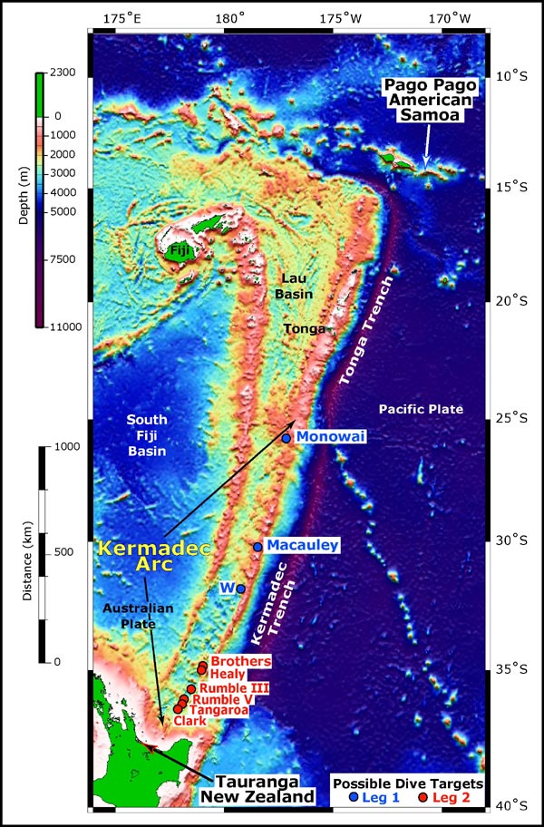
The 2009 Samoa earthquake caused a tsunami that killed more than 170 people in the Samoa Islands and Tonga. The earthquake was an 8.1 Mw submarine earthquake that took place in the region at 06:48:11 local time on September 29, 2009 (17:48:11 UTC, September 29), followed by smaller aftershocks.[15] It was the largest earthquake of 2009. The quake occurred on the outer rise of the Kermadec-Tonga Subduction Zone. This is part of the Pacific Ring of Fire, where tectonic plates in the Earth's lithosphere meet and earthquakes and volcanic activity are common.
Vailulu'u Seamount
The Vailulu'u Seamount, an active submerged volcano, lies 45 km east of Ta'u in American Samoa. It was discovered in 1975 and has since been studied by an international team of scientists, contributing towards understanding of the Earth's fundamental processes.[16] Growing inside the summit crater of Va'ilulu'u is an active underwater volcanic cone, named after Samoa's goddess of war, Nafanua.
Climate
The climate is tropical, with a rainy season from November to April. The island group is frequently hit by typhoons between December and March, due to its positioning in the South Pacific Ocean.[17]
Gallery
- Samoa Islands
-

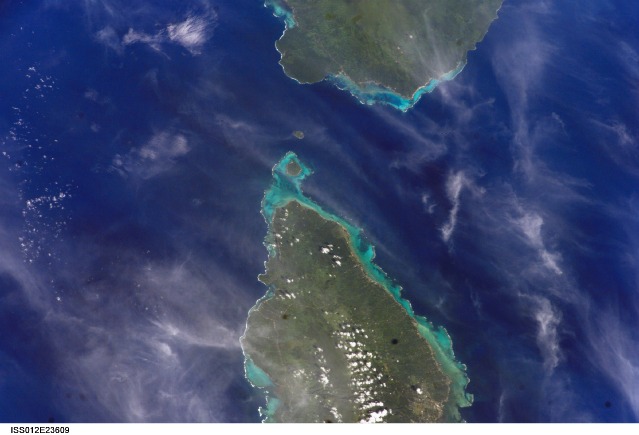
Upolu (bottom) and Savai'i (top) with Manono Island and Apolima
-

Nu'ulopa island (left) with Apolima island (right)
-

View of Apolima island (left) and the tip of Savai'i in the Apolima Strait.
-

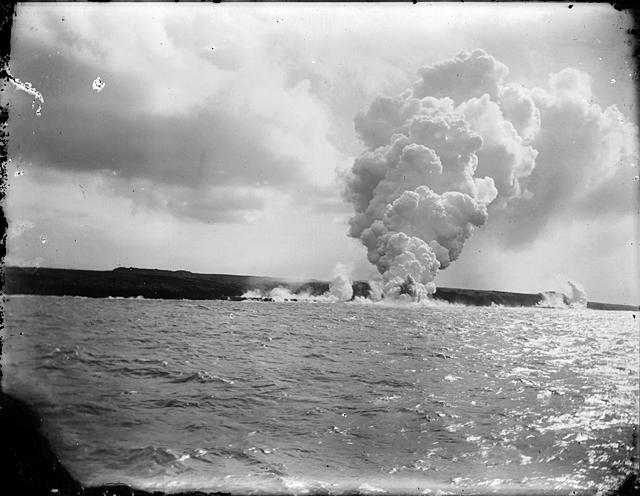
Mt Matavanu volcanic eruption on Savai'i island, 1905
-

Cliffs on Ta'u island
-

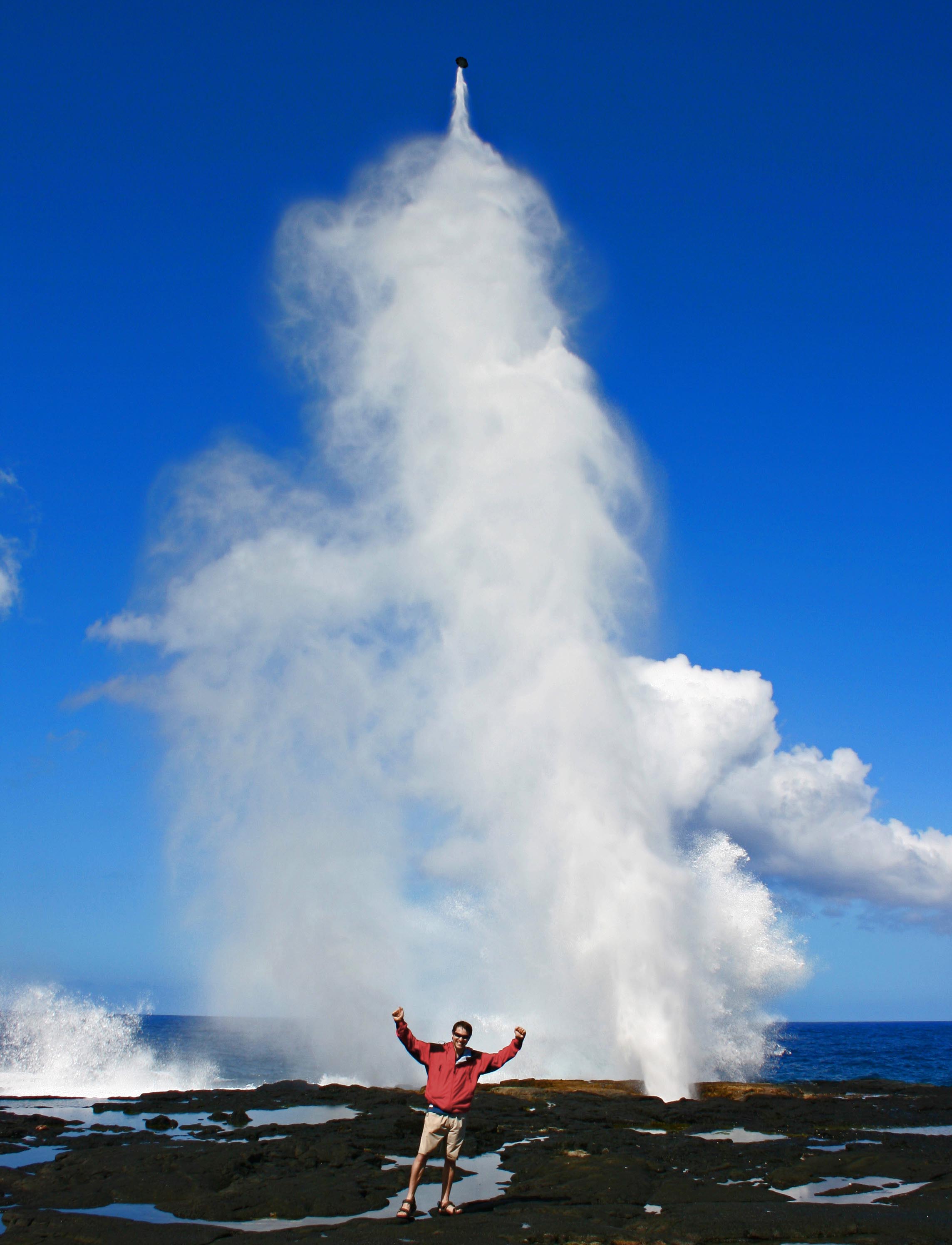
Alofa'aga blowholes on Savai'i, a result of the island's volcanic origins.
-

Aerial view of Rose Atoll in American Samoa.
-

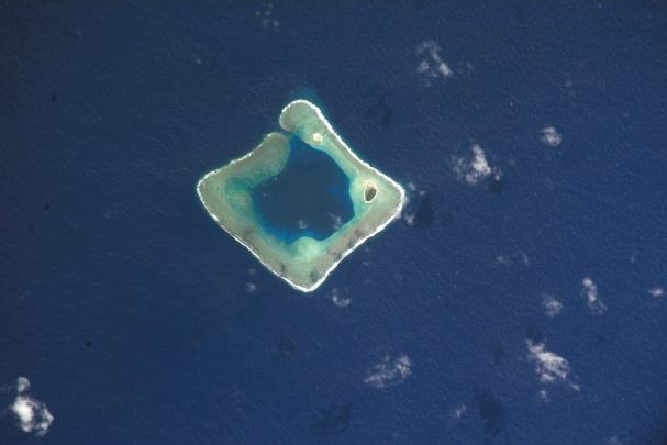
Rose atoll, from space, (NASA photo).
-

Afono village, Tutuila island, American Samoa.
-

Tutuila island from space, NASA photo.
-

Manono Island (centre), Apolima (left), and the tip of Upolu (right) in Samoa
-

Aunu'u island, offshore of the island of Tutuila, American Samoa
-

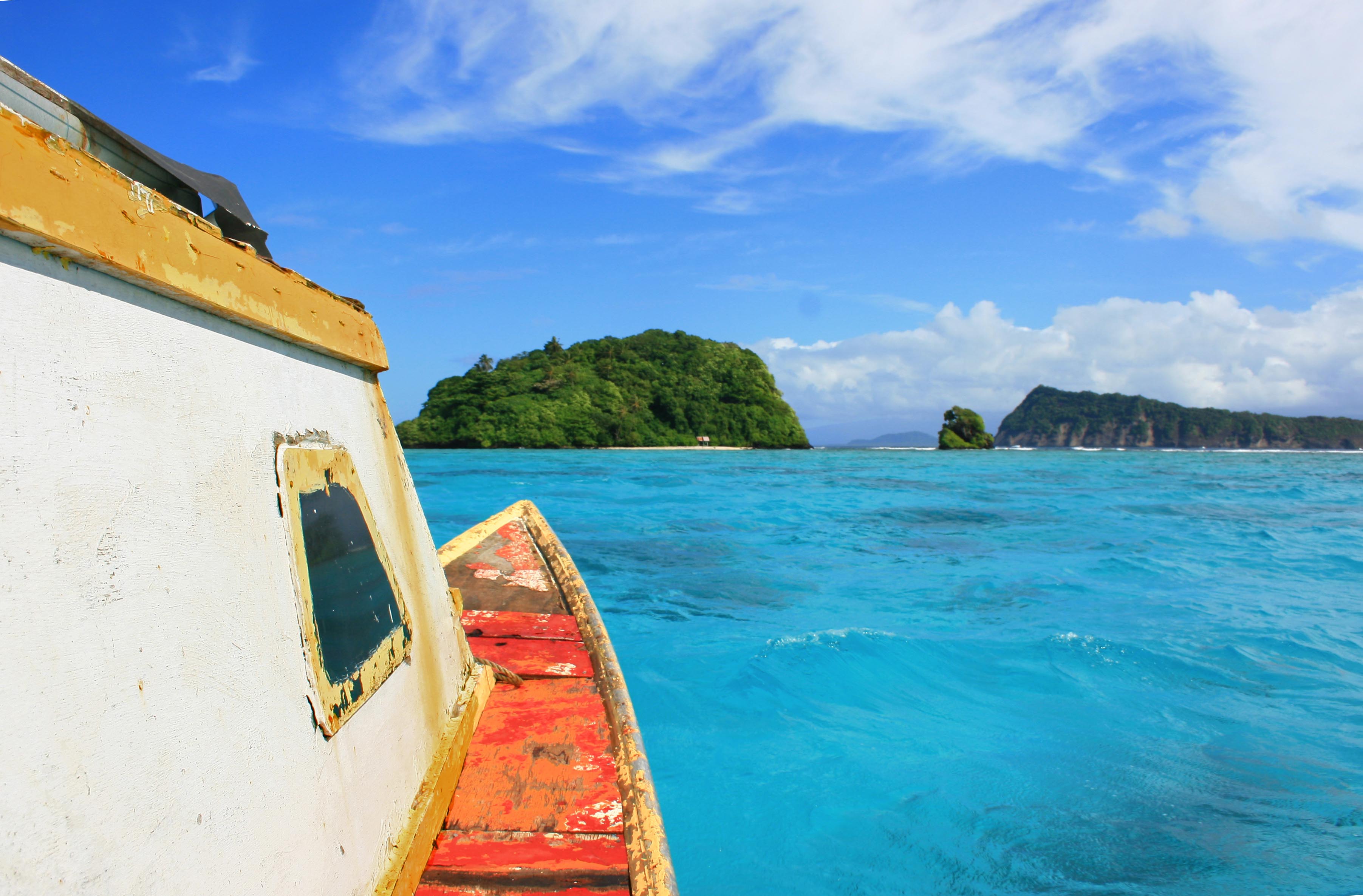
A beach on Ofu-Olosega, a volcanic doublet in the Manu'a Group of islands.
-

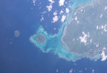
Ofu-Olosega from space.
-

Fuipisia waterfall in Lotofaga, Upolu island.
See also
- Samoans
- Samoan language
- Geography of Samoa
- Archaeology in Samoa
- Architecture of Samoa
- Culture of Samoa
- Tokelauan language closely belonging to the group of Samoic languages, it is the same, derived from Samoan.
- Tuvaluan language belonging to the group of Samoic languages,and is closely related to Samoan.
- First Samoan Civil War
- Second Samoan Civil War
- Siege of Apia
- Coming of age in Samoa
External links
References
- ^ Fana'afi Le Tagaloa, Aiono (1986). "Western Samoa: the sacred covenant". Land Rights of Pacific Women. Institute of Pacific Studies of the University of the South Pacific. p. 103. ISBN 9820200121. http://www.google.co.nz/books?id=wNDgF7Y9hr4C&lpg=PP1&dq=Land%20rights%20of%20Pacific%20women%E2%80%8E&pg=PA103#v=onepage&q=&f=false. Retrieved 17 April 2010.
- ^ Stanley, David (2004). Moon Handbooks: South Pacific. ISBN 1566914116. http://books.google.com/?id=EDGapfBX-CAC&pg=PA500&dq=Samoans+full+blooded+Polynesian+percentage&q. Retrieved 20 June 2010.
- ^ [1] New Information for the Ferry Berth Site, Mulifanua, Western Samoa by Roger C. Green & Helen M. Leach, Journal of the Polynesian Society, Vol. 98, No. 3, 1989. Retrieved 22 April 2010
- ^ Masterman, Sylvia (1934). The Origins of International Rivalry in Samoa: 1845–1884. George Allen and Unwin Ltd, London. pp. 14. http://www.nzetc.org/tm/scholarly/tei-MasOrig-t1-front1-d9.html.
- ^ date of ratification by the League of Nations was 10 January 1920; Class C mandates were designed for populations considered incapable of self-government
- ^ "The rise of the Mau movement". NZ History online. http://www.nzhistory.net.nz/politics/samoa/rise-of-mau. Retrieved 30 June 2010.
- ^ [2] Global Endemic Species Database. Retrieved 17 April 2010
- ^ Robert, Kiste (1993-2002). "Samoa". Microsoft Encarta Reference Library 2003. Redmond, WA: Microsoft Corporation. 60210-442-1635445-74407.
- ^ Pratt, et al, H. Douglas (1987). The Birds of Hawaii and the Tropical Pacific. Princeton University Press. pp. 16–18. ISBN 0-691-02399-9.
- ^ Craig, P.. "Natural History Guide to American Samoa". National Park of American Samoa, Department Marine and Wildlife Resources, American Samoa Community College. http://www.botany.hawaii.edu/basch/uhnpscesu/pdfs/NatHistGuideAS09op.pdf. Retrieved 16 August 2009.
- ^ "Samoa an Overview". donbosco.asn.au. Archived from the original on 2007-11-20. http://web.archive.org/web/20071120020749/http://www.donbosco.asn.au/Bulletins/2004/mar/overview.htm. Retrieved 2007-11-26.
- ^ "American Samoa, World Atlas". Microsoft Encarta Reference Library 2003. Redmond, WA: Microsoft Corporation. 1993-2002. 60210-442-1635445-74407.
- ^ Lippsett, Laurence (3 September 2009). "Voyage to Vailulu'u". Woods Hole Oceanographic Institution. http://www.whoi.edu/page.do?pid=12464&tid=282&cid=2541. Retrieved 19 April 2010.
- ^ Hart, S.R., Koppers, A. A.; Russell, J. A.; Staudigel, H. (2006). "New 40Ar/39Ar Ages for Savai'i Island Reinstate Samoa as a Hotspot Trail with a Linear Age Progression". The Smithsonian/NASA Astrophysics Data System. http://adsabs.harvard.edu/abs/2006AGUFM.V34B..02K. Retrieved 19 April 2010.
- ^ "Magnitude 8.1 - SAMOA ISLANDS REGION". earthquake.usgs.gov. 2009-09-29. http://earthquake.usgs.gov/eqcenter/recenteqsww/Quakes/us2009mdbi.php. Retrieved 22 April 2010.
- ^ et al, Hart (8 December 2000). "Vailulu'u undersea volcano: The New Samoa". G3, An Electronic Journal of the Earth Sciences, American Geophysical Union. ISSN 1525-2027. http://google.com/search?q=cache:LXz8q59NkpAJ:dusk.geo.orst.edu/djl/samoa/vailuluu.pdf+Samoa+hotspot+anomaly&cd=10&hl=en&ct=clnk&gl=nz. Retrieved 19 April 2010.
- ^ "Samoa: Climate". Encyclopædia Britannica. http://www.britannica.com/eb/article-54101/Samoa. Retrieved 2007-11-26.
Islands of Samoa (Independent State of Samoa) Principal islands Small inhabited islands Uninhabited islands  Territory of American Samoa
Topics Government - Politics
- Former Governors
- Former Lieutenant Governors
- Elections
- Current Governor
Districts Villages - Aasu
- Afao
- Afono
- Agugulu
- Alao
- Alega
- Alofau
- Amaluia
- 'Amanave
- Amaua
- Amouli
- Anua
- 'Aoa
- Aoloau
- Asili
- Atu'u
- Aua
- 'Au'asi
- Aumi
- Aunu'u
- Auto
- Avaio
- Faga'alu
- Faga'itua
- Fagali'i
- Fagamalo
- Faganeanea
- Fagasa
- Fagatogo
- Failolo
- Faleasao
- Faleniu
- Fatumafuti
- Futiga
- 'Ili'ili
- Lauli'i
- Leloaloa
- Leone
- Leusoali'i
- Luma
- Maia
- Malaeimi
- Malaeloa/Aitulagi
- Malaeloa/Ituau
- Maloata
- Mapusagafou
- Masausi
- Masefau
- Matu'u
- Mesepa
- Nu'uuli
- Nua
- Ofu
- Olosega
- Onenoa
- Pagai
- Pago Pago
- Pava'ia'i
- Poloa
- Sa'ilele
- Se'etaga
- Si'ufaga
- Sili
- Taulaga
- Tafuna
- Taputimu
- Tula
- Utulei
- Utumea East
- Utumea West
- Vailoatai
- Vaitogi
- Vatia
Islands Polynesia Polynesian triangle Austral Islands · Cook Islands · Easter Island · Gambier Islands · Hawaiian Islands · Marquesas · New Zealand · Pitcairn Islands · Sala y Gómez · Samoan Islands · Society Islands · Tokelau · Tonga · Tuamotus · Tuvalu · Wallis and Futuna IslandsPolynesian outliers Anuta · Emae · Futuna · Kapingamarangi · Loyalty Islands · Mele · Nuguria · Nukumanu · Nukuoro · Ontong Java · Ouvéa · Pileni · Rennell · Sikaiana · Takuu · TikopiaPolynesian-influenced Categories:- Polynesia
- Islands of Samoa
- Landforms of American Samoa
- Archipelagoes of the Pacific Ocean


Wikimedia Foundation. 2010.