- Geography of Croatia
-
Geography of Croatia 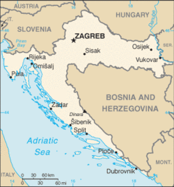
Continent Europe Region Central Europe and Southeastern Europe Coordinates 45°10′N 15°30′E / 45.167°N 15.5°E Area 56,594 km2 (21,851 sq mi)
99% land
1 % waterBorders Total land borders:
2,374.9 kmHighest point Dinara
1,831 mLowest point Mediterranean Sea
0 mLongest river Sava 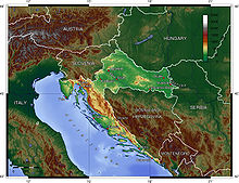 Topographic map.
 Some of the Croatian Islands in the Adriatic Sea.
Geography of Croatia is defined by location of Croatia in the Southeast Europe, bordering Bosnia and Herzegovina and Serbia in the east, Slovenia in the west, Hungary in the north and Montenegro and the Adriatic Sea in the south. It lies mostly between latitudes 42° and 47° N and longitudes 13° and 20° E. Part of the territory in the extreme south is separated from the rest of the mainland by a short coastline strip belonging to Bosnia and Herzegovina around Neum.[1]
The territory covers 56,594 square kilometres (21,851 square miles), consisting of 56,414 square kilometres (21,782 square miles) of land and 128 square kilometres (49 square miles) of water. It is the 127th largest country largest in the world.[2] Elevation ranges from the mountains of the Dinaric Alps with the highest point of the Dinara peak at 1,831 metres (6,007 feet) near the border with Bosnia and Herzegovina in the south[2] to the shore of the Adriatic Sea which makes up its entire south-west border. Insular Croatia consists of over a thousand islands and islets varying in size, 48 of which are permanently inhabited. The largest islands are Cres and Krk,[2] each of them having an area of around 405 km2.
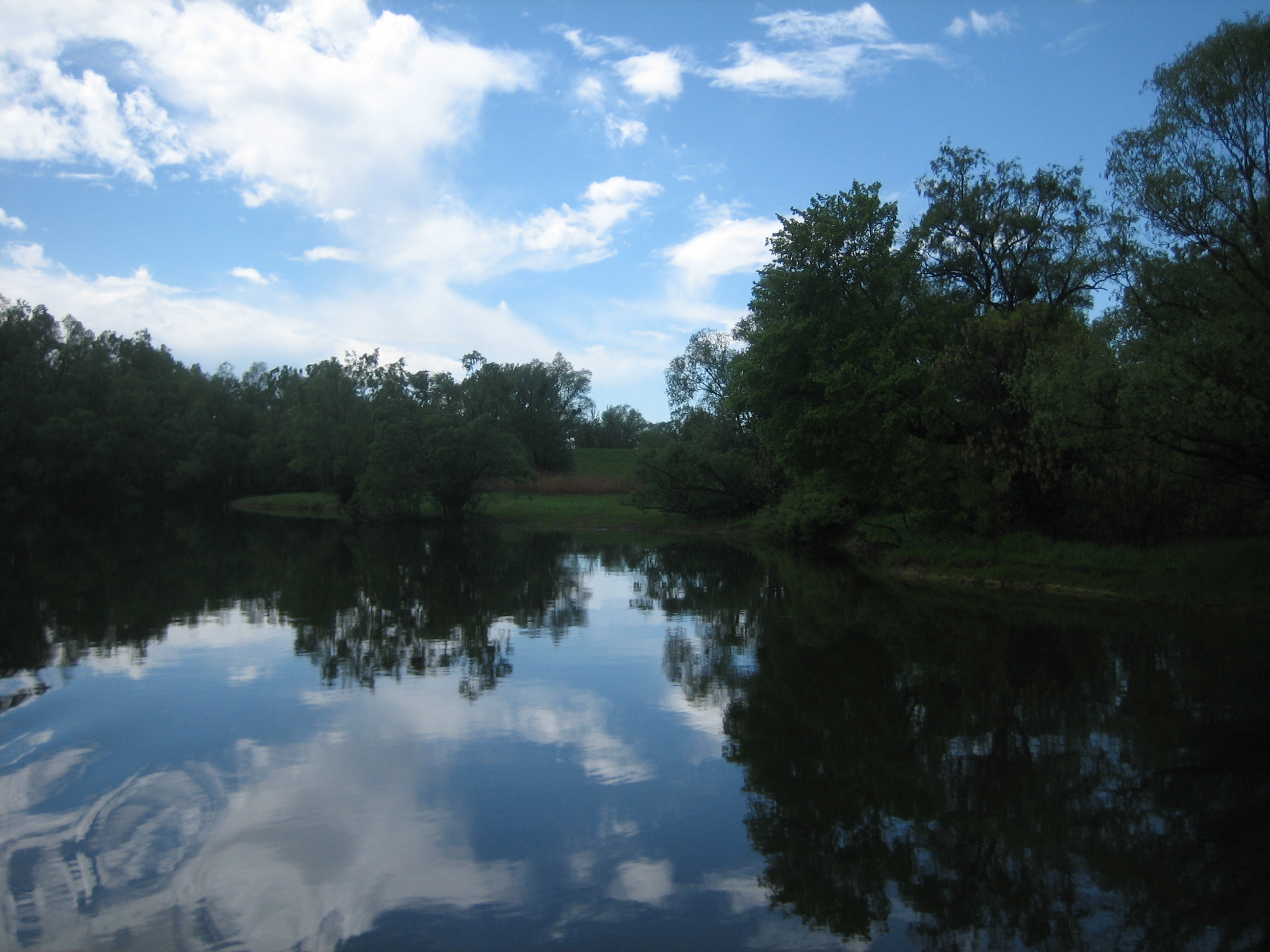
The hilly northern parts of Hrvatsko Zagorje and the flat plains of Slavonia in the east (which is part of the Pannonian Basin) are traversed by major rivers such as Sava, Drava, Kupa and Danube. The Danube, Europe's second longest river, runs through the city of Vukovar in the extreme east and forms part of the border with Serbia. The central and southern regions near the Adriatic coastline and islands consist of low mountains and forested highlands. Significant natural resources include oil, coal, bauxite, low-grade iron ore, calcium, gypsum, natural asphalt, silica, mica, clays, salt and hydropower.[2]
Karst topography makes up about half of Croatia and is especially prominent in the Dinaric Alps.[3] There are 49 caves deeper than 250 m (820.21 ft) in Croatia, with 14 of them deeper than 500 m (1,640.42 ft) and three deeper than 1,000 m (3,280.84 ft) (the Lukina jama-Trojama, Slovacka jama and Velebita cave systems). Croatia's most famous lakes are the Plitvice lakes, a system of 16 lakes with waterfalls connecting them over dolomite and limestone cascades. The lakes are renowned for their distinctive colours, ranging from turquoise to mint green, grey or blue.[4]
Contents
Climate
Most of Croatia has a moderately warm and rainy continental climate as defined by the Köppen climate classification. Mean monthly temperature ranges between −3 °C (27 °F) (in January) and 18 °C (64 °F) (in July). The coldest parts of the country are Lika and Gorski Kotar where snowy forested climate is found at elevations above 1,200 metres (3,900 feet). The warmest areas of Croatia are at the Adriatic coast and especially in its immediate hinterland characterized by the Mediterranean climate, as the temperature highs are moderated by the sea. Consequently, temperature peaks are more pronounced in the continental areas—the lowest temperature of −35.5 °C (−31.9 °F) was recorded on 3 February 1919 in Čakovec, and the highest temperature of 42.4 °C (108.3 °F) was recorded on 5 July 1950 in Karlovac.[1]
Mean annual precipitation ranges between 600 millimetres (24 inches) and 3,500 millimetres (140 inches) depending on geographic region and prevailing climate type. The least precipitation is recorded in the outer islands (Vis, Lastovo, Biševo, Svetac) and in the eastern parts of Slavonia, however in the latter case, it is mostly occurring during the growing season. The maximum precipitation levels are observed on the Dinara mountain range and in Gorski kotar. Prevailing winds in the interior are light to moderate northeast or southwest, and in the coastal area prevailing winds are determined by local area features. Higher wind velocities are more often recorded in cooler months along the coast, generally as bura or less frequently as sirocco. The sunniest parts of the country are the outer islands, Hvar and Korčula, where more than 2700 hours of sunshine are recorded per year, followed by the southern Adriatic Sea area in general, northern Adriatic coast, and Slavonia, all with more than 2000 hours of sunshine per year.[1]
Biodiversity
Main article: Protected areas of Croatia Kopački Rit nature park, one of the largest wetlands in Europe
Croatia can be subdivided between a number of ecoregions because of its climate and geomorphology, and the country is consequently one of the richest in Europe in terms of biodiversity. There are four types of biogeographical regions in Croatia—Mediterranean along the coast and in its immediate hinterland, Alpine in most of Lika and Gorski Kotar, Pannonian along Drava and Danube, and continental in the remaining areas. One of the most significant are karst habitats which include submerged karst, such as Zrmanja and Krka canyons and tufa barriers, as well as underground habitats. The karst geology harbours approximately 7,000 caves and pits, some of which are habitat of the only known aquatic cave vertebrate—the olm. Forests are also significantly present in the country, as they cover 2,490,000 hectares (6,200,000 acres) representing 44% of Croatian land surface. The other habitat types include wetlands, grasslands, bogs, fens, scrub habitats, coastal and marine habitats.[5] In terms of phytogeography, Croatia is a part of the Boreal Kingdom and is a part of Illyrian and Central European provinces of the Circumboreal Region and the Adriatic province of the Mediterranean Region. The World Wide Fund for Nature divides Croatia between three ecoregions—Pannonian mixed forests, Dinaric Mountains mixed forests and Illyrian deciduous forests.[6]
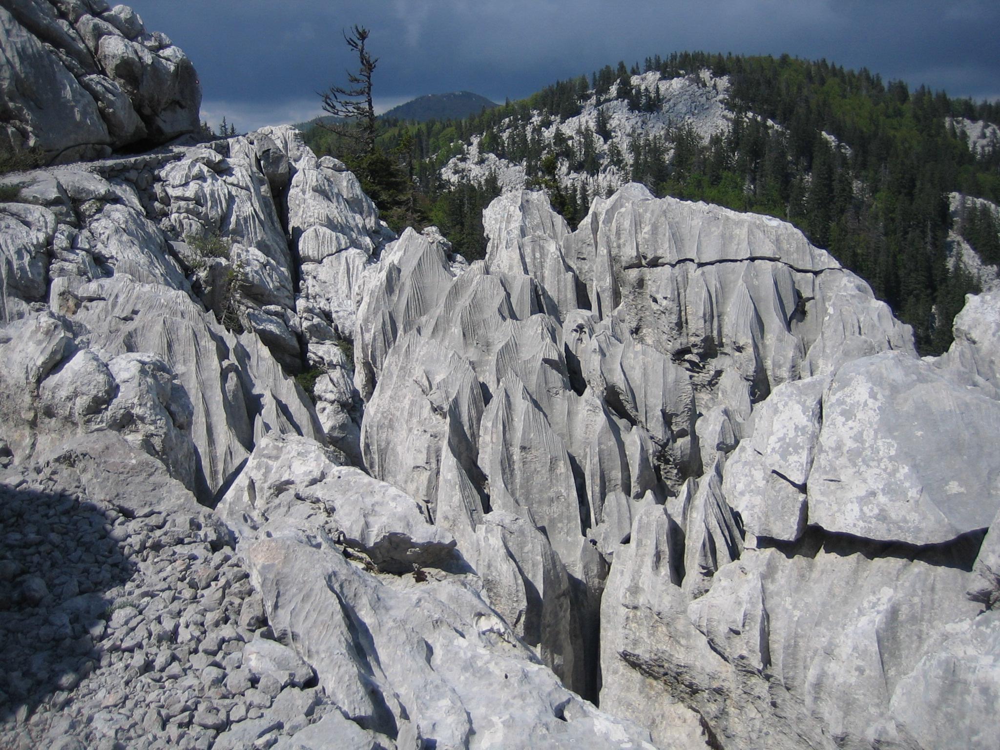
 Karst in National Park Sjeverni Velebit
There are 37,000 known species in Croatia, but their actual number is estimated to be between 50,000 and 100,000.[5] The claim is supported by nearly 400 new taxa of invertebrates discovered in Croatia in the first half of the 2000s alone.[5] There are more than a thousand endemic species, especially in Velebit and Biokovo mountains, Adriatic islands and karst rivers. Legislation protects 1,131 species.[5] The most serious threat to them is loss and degradation of habitats. A further problem is presented by appearance of invasive alien species, especially Caulerpa taxifolia algae. The invasive algae are regularly monitored and removed to protect the benthic habitat. Indigenous sorts of cultivated plants and breeds of domesticated animals are also numerous. Those include five breeds of horses, five breeds of cattle, eight breeds of sheep, two breeds of pigs and a poultry breed. Even the indigenous breeds include nine endangered or critically endangered ones.[5]
There are 444 protected areas of Croatia, encompassing 9% of the country. Those include 8 national parks in Croatia, 2 strict reserves and 10 nature parks. The most famous protected area and the oldest national park in Croatia is the Plitvice Lakes National Park, a UNESCO World Heritage Site. Velebit Nature Park is a part of the UNESCO Man and the Biosphere Programme. The strict and special reserves, as well as the national and nature parks, are managed and protected by the central government, while other protected areas are managed by counties. In 2005, the National Ecological Network was set up, as the first step in preparation of the EU accession and joining of the Natura 2000 network.[5]
Details
 United Nations Cartographic Section's map of Croatia
Maritime claims
-
- Continental shelf: 200-m depth or to the depth of exploitation
- Territorial sea: 12 nmi (22.2 km; 13.8 mi)
Land use
-
- Arable land: 23.55%[citation needed]
- Permanent crops: 2.24%[citation needed]
- Other: 74.21% (1998 est.)
Irrigated land: 30 km² (1998 est.)[citation needed]
Environment
1. Natural hazards: destructive earthquakes[citation needed]
2. Current issues:
-
- Air pollution (from metallurgical plants) and resulting acid rain is damaging the forests[citation needed]
- coastal pollution from industrial and domestic waste;[citation needed]
- Landmine removal and reconstruction of infrastructure as a result of the 1991-1995 Croatian War of Independence.
3. International agreements:
-
- Party to: Air Pollution, Air Pollution-Sulfur 94, Biodiversity, Climate Change, Desertification, Endangered Species, Hazardous Wastes, Law of the Sea, Marine Dumping, Nuclear Test Ban, Ozone Layer Protection, Ship Pollution (MARPOL 73/78), Wetlands
- Signed, but not ratified: Air Pollution-Persistent Organic Pollutants, Climate Change-Kyoto Protocol
See also
- Extreme points of Croatia
- List of rivers of Croatia
- List of islands of Croatia
- List of cities in Croatia
References
- ^ a b c "2010 – Statistical Yearbook of the Republic of Croatia" (PDF). Croatian Bureau of Statistics. December 2010. http://www.dzs.hr/Hrv_Eng/ljetopis/2010/SLJH2010.pdf. Retrieved 7 October 2011.
- ^ a b c d "World Factbook". Central Intelligence Agency. https://www.cia.gov/library/publications/the-world-factbook/geos/hr.html. Retrieved 9 September 2011.
- ^ Mate Matas (18 December 2006). "Raširenost krša u Hrvatskoj [Presence of Karst in Croatia]" (in Croatian). geografija.hr. Croatian Geographic Society. http://www.geografija.hr/clanci/1011/rasirenost-krsa-u-hrvatskoj. Retrieved 18 October 2011.
- ^ "The best national parks of Europe". BBC News. 28 June 2011. http://www.bbc.com/travel/feature/20110617-the-best-national-parks-of-europe. Retrieved 11 October 2011.
- ^ a b c d e f (PDF) Biodiversity of Croatia. State Institute for Nature Protection, Ministry of Culture (Croatia). 2006. ISBN 9537169200. http://www.vukovarsko-srijemska-zupanija.com/upload/paragrafi_upload/2011-3-21_58011335_BiodiversityofCroatia.pdf. Retrieved 13 October 2011.
- ^ "Venue". 6th Dubrovnik Conference on Sustainable Development of Energy, Water and Environment Systems. http://www.dubrovnik2011.sdewes.org/venue.php. Retrieved 13 October 2011.
External links
Geography of Europe Sovereign
states- Albania
- Andorra
- Armenia
- Austria
- Azerbaijan
- Belarus
- Belgium
- Bosnia and Herzegovina
- Bulgaria
- Croatia
- Cyprus
- Czech Republic
- Denmark
- Estonia
- Finland
- France
- Georgia
- Germany
- Greece
- Hungary
- Iceland
- Ireland
- Italy
- Kazakhstan
- Latvia
- Liechtenstein
- Lithuania
- Luxembourg
- Macedonia
- Malta
- Moldova
- Monaco
- Montenegro
- Netherlands
- Norway
- Poland
- Portugal
- Romania
- Russia
- San Marino
- Serbia
- Slovakia
- Slovenia
- Spain
- Sweden
- Switzerland
- Turkey
- Ukraine
- United Kingdom
- (England
- Northern Ireland
- Scotland
- Wales)
- Vatican City
States with limited
recognitionDependencies
and other territories- Åland
- Faroe Islands
- Gibraltar
- Guernsey
- Jan Mayen
- Jersey
- Isle of Man
- Svalbard
Other entities Climate of Europe Sovereign
states- Albania
- Andorra
- Armenia
- Austria
- Azerbaijan
- Belarus
- Belgium
- Bosnia and Herzegovina
- Bulgaria
- Croatia
- Cyprus
- Czech Republic
- Denmark
- Estonia
- Finland
- France
- Georgia
- Germany
- Greece
- Hungary
- Iceland
- Ireland
- Italy
- Kazakhstan
- Latvia
- Liechtenstein
- Lithuania
- Luxembourg
- Macedonia
- Malta
- Moldova
- Monaco
- Montenegro
- Netherlands
- Norway
- Poland
- Portugal
- Romania
- Russia
- San Marino
- Serbia
- Slovakia
- Slovenia
- Spain
- Sweden
- Switzerland
- Turkey
- Ukraine
- United Kingdom
- (England
- Northern Ireland
- Scotland
- Wales)
- Vatican City
States with limited
recognition- Abkhazia
- Kosovo
- Nagorno-Karabakh
- Northern Cyprus
- South Ossetia
- Transnistria
Dependencies
and other territoriesOther entities - European Union
- Sovereign Military Order of Malta
The Danube Countries 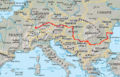
Cities Tributaries Islands List of crossings Categories: -


Wikimedia Foundation. 2010.