- Cypress County, Alberta
-
Cypress County — Municipal district — Welcome sign Location of Cypress County in Alberta
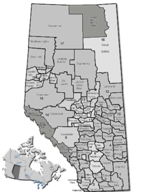
Coordinates: 49°58′0″N 110°35′46″W / 49.966667°N 110.59611°WCoordinates: 49°58′0″N 110°35′46″W / 49.966667°N 110.59611°W Country  Canada
Province  Alberta
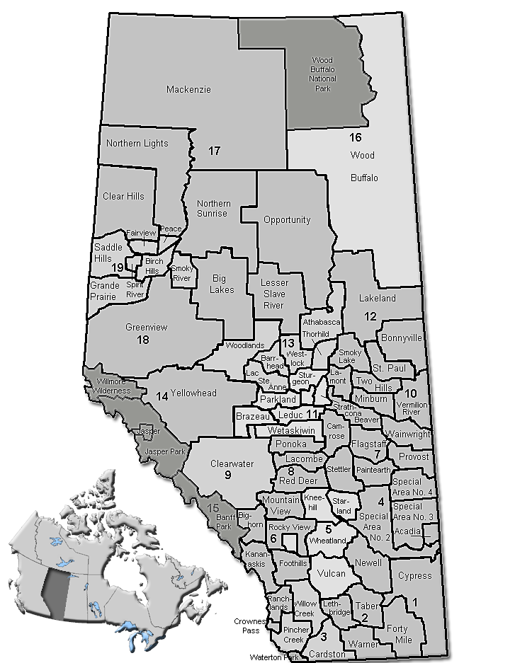
Region Southern Alberta Census division No. 1 Established 1985 Incorporated 1985 Government[1] – Reeve Darcy Geigle – Governing body Cypress County Council – Municipal seat Dunmore Area – Total 13,166.13 km2 (5,083.5 sq mi) Population (2006)[2] – Total 6,729 – Density 0.5/km2 (1.3/sq mi) – Dwellings 2,809 Time zone MST (UTC-7) Website Cypress County Cypress County is a municipal district located in southeastern Alberta, Canada. The County completely surrounds the City of Medicine Hat and the Town of Redcliff. The municipality is part of Census Division 1, Alberta. [3]
Contents
Geography
The Cypress County landscape is dominated by a shortgrass prairie ecosystem.[4] The land is flat to slightly rolling. The Cypress Hills region features mixed grasslands, wetlands and montane habitats.[5] Major hydrological features include the South Saskatchewan and Milk rivers. Extensive coulee systems have formed adjacent to major rivers resulting in badlands terrain.
Near Walsh, Alberta at 50°0′38.2″N 110°6′48.3″W / 50.010611°N 110.113417°W lies the Badlands Guardian. Here the landscape takes the form of a head wearing a feathered headdress. The head is approximately 300 metres (980 ft) wide and 25 metres (82 ft) deep. This unusual geographic feature is a result of natural erosion of the surrounding prairie.
Climate
Cypress County has a semiarid climate[4] with cold, dry winters and warm to hot summers. The winter cold is occasionally tempered by mild and dry chinook winds blowing from the west. Hot summer daytime temperatures are made tolerable by low humidity and rapid cooling in the evening hours. Maximum precipitation typically occurs in late spring and early summer. [3]
Demographics
In 2006, Cypress County had a population [3] of 6,729 living in 2,809 dwellings, a 10.1% increase from 2001. The municipal district has a land area of 13,166.13 km2 (5,083.47 sq mi) and a population density of 0.5 /km2 (1.3 /sq mi).[2]
Politics
Local
Cypress County currently has a Municipal Council consisting of 9 elected Councillors. Councillors are elected by the eligible electors (Cypress County residents) who vote for a candidate in their electoral division. Municipal elections organized by Alberta Municipal Affairs are held on the 3rd Monday in October every third year. Each October, the Councillors elect the Reeve. The position of Deputy Reeve is also an elected position, voted on by the Councillors every year in October.
The current Cypress County Council (elected in October 2010) consists of:[1]
- Reeve Darcy Geigle - Division 2
- Deputy Reeve Brad Betcker - Division 7
- Councillor Floyd Haas - Division 1
- Councillor George Russill - Division 3
- Councillor Garry Lentz - Division 4
- Councillor Herb Scott - Division 5
- Councillor Jerry Clark - Division 6
- Councillor LeRay Pahl - Division 8
- Councillor Bob Olson - Division 9
Provincial
Cypress County is served by the Provincial Electoral Division of Cypress-Medicine Hat and represented in the Alberta Legislature by Progressive Conservative MLA Len Mitzel.
Federal
Cypress County is served by the Federal Electoral Division of Medicine Hat and represented in the Canadian House of Commons by Conservative MP LaVar Payne.
Municipal Services
Cypress County provides municipal services through various departments. Services include Agricultural Programs, Road Maintenance, Bylaw Enforcement, Land Use Planning, Development Advice & Approvals, Fire Protection, Recreation, Street Lighting, Waste Collection, Recycling, Water & Sewer, Emergency Services, Family & Community Support.[3]
Communities
The following communities are located in this municipal district:[6]
- Towns
- Hamlets
- Desert Blume
- Dunmore
- Hilda
- Irvine
- Schuler
- Seven Persons
- Suffield
- Veinerville
- Walsh
Economy
Agriculture and the Oil/Gas Industry are the primary economic activities within the County. Agricultural sectors include ranching, wheat and oil seed crops, irrigated alfalfa and other specialty crops.[3] Irrigation water is supplied by the St. Mary River Irrigation District (SMRID) and other smaller water co-operatives. Oil and gas production is extensive throughout the County. Natural Gas is gathered through pipe networks and processed in Gas Production plants near Hilda. [3]
Transportation
Highways
The Trans-Canada Highway (1), Crowsnest Highway (3) and Highway 41 traverse Cypress County.[3] The Trans-Canada enters the eastern part of the County near Walsh and travels west through Dunmore and on to Medicine Hat. From Medicine Hat the highway travels in a north westerly direction passing near Suffield and on to Calgary. Planning has begun to upgrade The Trans Canada to true freeway status. The Crowsnest highway enters the County near Seven Persons and travels in a north westerly direction to Medicine Hat. Highway 41 begins at the U.S. border (Port of Wild Horse) and passes through the County in a northerly direction. Highway 41 intersects the Trans Canada Highway near Dunmore and continues on in a northerly direction until it exits the County near Sandy Point Recreational Area at the County's most northerly limits.
Roads and Streets
Cypress County has developed and maintains an extensive road network within its municipal jurisdiction. Paved, oiled and graveled roads total more than 2700 km in length.
Rail
The Canadian Pacific Railway Main Line traverses Cypress County.[3] The line enters the eastern part of the County near Walsh and travels west through Dunmore and on to Medicine Hat. From Medicine Hat the line travels in a north westerly direction passing near Suffield and on to Calgary. A secondary line joins the main at Dunmore and travels in a south westerly direction passing near Seven Persons and on to Lethbridge. Major switching yards are located in Dunmore. Several spur lines and side yards exist along the lines route to facilitate the handling of grain and other commodities.
Education
Secondary schools
The Prairie Rose School Division #8 serves the needs of public school students. Schools within this district include Eagle Butte High School, Burdett School, Bow Island Elementary, Sentaor Gershaw School, Parkside School, I. F. Cox School, Margaret Wooding School, Irvine School, Schuler School, Oyen Public School, New Brigden School, Ralston School, Seven Persons School, Beyond Walls Alternative Outreach School and Elkwater Hutterite Colony and six other colony schools.[7] The division office is located in Dunmore.[3]
The Medicine Hat Catholic Separate Regional School Division #20 serves the needs of Roman Catholic students. District schools located in Medicine Hat and Bow Island include McCoy High School, St. Mary's School, Notre-Dame Academy, St. Louis School, St. Francis Xavier School, St. Michael's School, Mother Teresa School and St. Patrick's School.[8] The division office is located in Medicine Hat.[3]
Christian Education K-12 is provided by Cornerstone Christian School.
Post-secondary education
The Medicine Hat College is a junior college located in Medicine Hat. The college offers university transfer programs, applied degrees and apprenticeship programs. Athletics include basketball, volleyball, and soccer.
Military
Cypress County is home to Canadian Forces Base Suffield. The base provides an extensive training area for both Canadian and British Armed Forces.[9] Defence Research and Development Canada facilities are located here as well. [10]
Attractions
- Bullshead Reservoir - Camping, Fishing
- Cavan Lake Municipal Recreation Area - Camping, Boating, Fishing
- Cypress Hills Provincial Park - Camping, Boating, Fishing, Golfing, Swimming, Hiking, Rodeo, Winter Carnival, Skiing (Water, Downhill, Cross Country)
- Desert Blume Golf Club - Golfing
- Golden Sheaf Municipal Recreation Area - Boating, Fishing, Water Skiing, Camping
- Irvine Prairie Memories Museum - Local Historical Displays
- Michelle Reservoir - Camping, Fishing, Boating
- Murray Lake Reservoir - Fishing
- Reesor Lake - Camping, Fishing, Boating, Hiking
- Sandy Point Municipal Recreation Area - Camping, Fishing, Boating
- Spruce Coulee Reservoir - Camping, Fishing, Boating
- Walsh Tourist Information Center - Travel Alberta Rest Area
See also
- List of communities in Alberta
- List of municipal districts in Alberta
References
- ^ a b Cypress County Council Section
- ^ a b Statistics Canada (Census 2006). "Cypress County - Community Profile". http://www12.statcan.ca/english/census06/data/profiles/community/Details/Page.cfm?Lang=E&Geo1=CSD&Code1=4801003&Geo2=PR&Code2=48&Data=Count&SearchText=Cypress%20County&SearchType=Begins&SearchPR=01&B1=All&GeoLevel=&GeoCode=4801003. Retrieved 2007-06-11.
- ^ a b c d e f g h i j http://www.albertafirst.com/profiles/statspack/20662.html AlbertaFirst.Com
- ^ a b http://www1.agric.gov.ab.ca/$department/deptdocs.nsf/all/sag6303?OpenDocument Alberta Agriculture and Rural Development
- ^ http://tpr.alberta.ca/parks/cypresshills/naturalregions.asp Alberta Tourism, Parks and Recreation
- ^ Municipal Profile - Alberta Municipal Affairs
- ^ http://prrdweb.com/Public-Schools.php Prairie Rose School Division (Official Site)
- ^ http://www.mhcbe.ab.ca/cec/ Medicine Hat Catholic Separate Regional Division #20 (Official Site)
- ^ http://www.army.forces.gc.ca/cfb_suffield/home.html Canadian Forces Base Suffield (Official Site)
- ^ http://www.drdc-rddc.gc.ca/centres/index-eng.asp Defence Research and Development Canada (Official Site)
External links
- Cypress County (Official Site)
- albertafirst.com (Marketing Alberta to the World)

County of Newell Special Area No. 4
Special Area No. 2R.M. of Deer Forks No. 232 (SK) Municipal District of Taber
County of Forty Mile No. 8
R.M. of Enterprise No. 142 (SK)
R.M. of Maple Creek No. 111 (SK) Cypress County

Liberty County (MT) Hill County (MT) R.M. of Reno No. 51 (SK) Categories:

Wikimedia Foundation. 2010.