- Don Valley Village
-
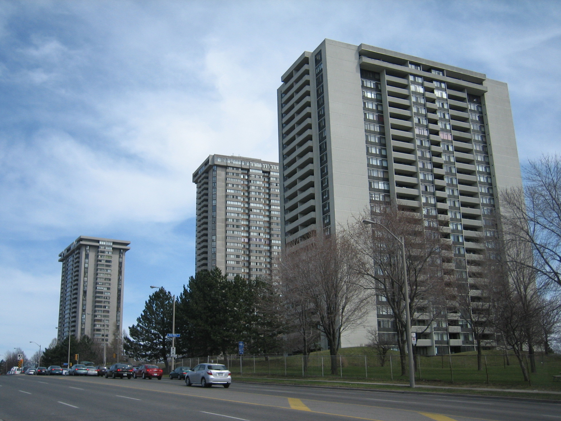
Don Valley Village — Neighbourhood — Large apartment towers are located on the major avenues in Don Valley Village

Country  Canada
Province  Ontario
City  Toronto
Don Valley Village is a neighbourhood in the city of Toronto, Ontario, Canada. It is located north of Highway 401, and is bounded by Sheppard Avenue to the south, Leslie Street to the west, Finch Avenue to the north and Highway 404 to the east. Like the nearby Don River Valley (to the east), the neighbourhood has hill and dale topography.
Contents
Demographics
The population in Don Valley Village mainly consists of mostly Muslim Persian and Arab immigrants, with sizable Asian, African and Caribbean populations as well. The areas residents are mostly low to middle income. It is home to four notable housing projects (Sparrowways, Villaways, Allenbury Gardens, and Brahms) which comprise the infamous "4 Corners."
Character
The neighbourhood, developed in the 1960s and 1970s, occupies the space that was originally a collection of farming hamlets in the early 19th century. In 1963, Consolidated Building Corporation developed a large part of Don Valley Village, advertising three-bedroom houses for $16,550, and providing a "trade-in" on purchasers' current houses.[1]
Three historical landmarks still exist from that period: the Zion Primitive Methodist Church, the Zion Schoolhouse, and the Alexander Muirhead Victorian farmhouse. The area currently includes Fairview Mall, one of Toronto's largest shopping centres. Noteworthy facilities just outside this neighbourhood include North York General Hospital (on the south side of Sheppard Avenue), Seneca College's Newnham Campus (on the north side of Finch), and the Cummer Park Fitness Centre (on the west side of Leslie, just north of Finch), which is one of Toronto's largest municipally operated recreational facilities.
Don Valley Village contains low- to middle-income housing, and is home to many new Canadian immigrants, including those of Armenian, Chinese, West Indian, East Indian or Middle Eastern descent. The mix of housing here includes split level homes, semi-detached homes, and family size detached houses featuring Georgian, Tudor, and contemporary-style designs. There are also a large concentration of high-rise apartment and condominium buildings.
The area is extremely well connected to the rest of the city. Close by is the crossroads of two major freeways (Highway 401 and Highway 404/Don Valley Parkway). As well, two subways stations, Don Mills Station – the current eastern terminus of the Sheppard subway line, which connects with nine Toronto Transit Commission routes, one York Region Transit route, and the Viva Green line – and Leslie Station are both located within the neighbourhood.
Schools
- Don Valley Junior High School: a public middle school on Don Mills Road north of the Peanut. It is a dual track school (English and French Immersion). There is ESL (English as a second language), Special Education, DH[specify], LEAP[specify], and French Immersion.
- Georges Vanier Secondary School: a public high school on Don Mills Road in the Peanut area
- St. Matthias Catholic School: an elementary school located on Van Horne Avenue
- St. Timothy's Catholic School: an elementary school located on Rochelle Crescent. It was founded in 1964. In 2005, a new building was opened to replace the older one. The school currently has approximately 600 students. Some prominent alumni include: actor Scott Speedman, NBA basketball player Jamaal Magloire, rapper Maestro and former Toronto Maple Leaf Pat Graham.
- Woodbine Junior High School: a public middle school on Don Mills Road in the Peanut area
- Kingslake Public School: an elementary school east of Woodbine Junior High School
- Seneca Hill Public School: an elementary school
- Crestview Public School: an elementary school
- Lescon Public School: an elementary school
- Dallington Public School: an elementary school
The Peanut
Don Valley Village encompasses smaller, non-official neighbourhoods. The most prominent of these is "The Peanut", which is centered on 43°47′00″N 79°21′05″W / 43.7833333°N 79.35139°WCoordinates: 43°47′00″N 79°21′05″W / 43.7833333°N 79.35139°W. It is named for the peanut-shaped plot of land created by divergence of the north and southbound lanes of Don Mills Road north of Sheppard Avenue and south of Finch Avenue. The north and southbound lanes, known as Don Mills Road West and Don Mills Road East, split and then are re-joined south of Finch Avenue. This configuration was modeled after Queen's Park in downtown Toronto.[citation needed]
The plot of land formed between the divergent lanes is the site of Woodbine Junior High School, Woodbine Public Arena, Oriole Park and the Oriole Community Resource Centre, Georges Vanier Secondary School, and the "Peanut Plaza" shopping centre. The areas to the east and west of the Peanut are usually referred to as Don Valley Village. Local teens and youths often refer to the surrounding area as the "Four Corners" due to the location of four notable housing projects in the area (Sparrowways, Villaways, Allenbury Gardens, and Brahms).[citation needed]
Notes
- ^ Globe and Mail, 9 September 1963, p.4
External links
- Don Valley Village at TorontoNeighbourhoods
- Don Valley Village neighbourhood profile at the City of Toronto website
- Four Corners - Rap Dictionary

Hillcrest Village Bayview Village 
Pleasant View  Don Valley Village

Henry Farm Categories:- Neighbourhoods in Toronto

Wikimedia Foundation. 2010.