- Atlas Mountains
-
For other uses, see Mount Atlas.
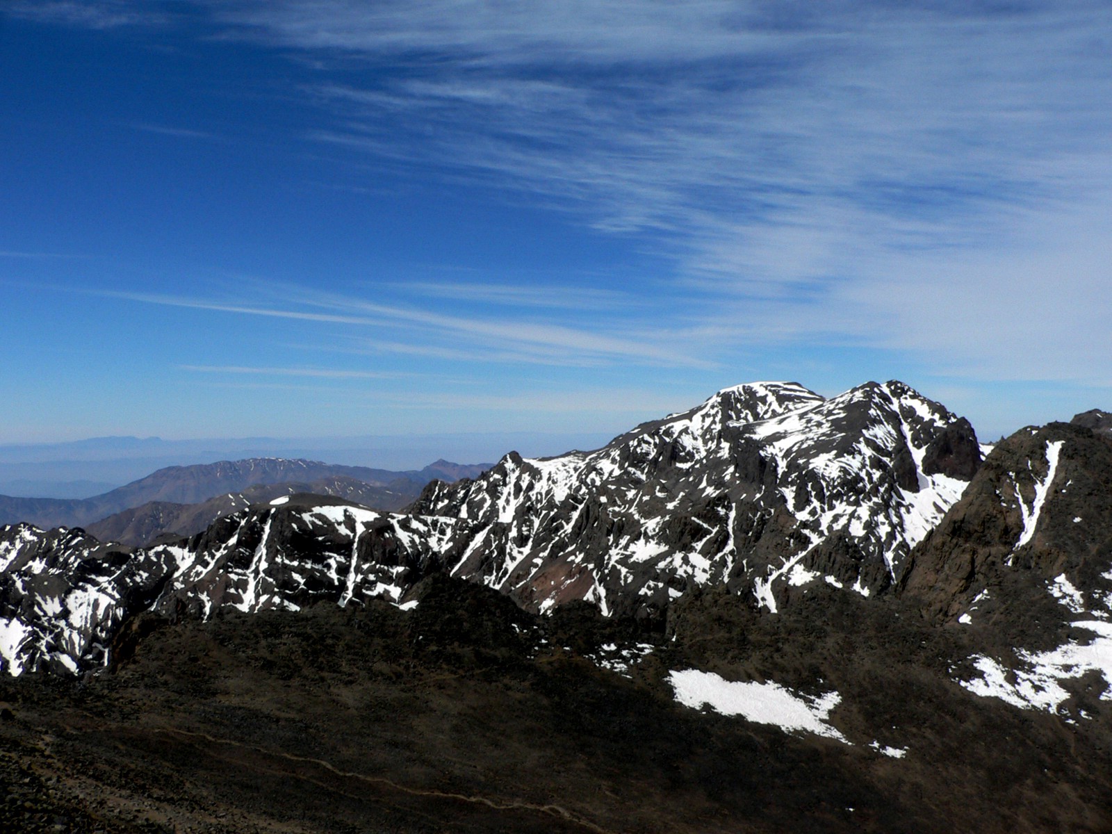
Atlas Mountains Range 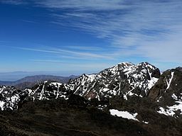 Toubkal Mountain in Toubkal National Park in the High Atlas
Countries Morocco, Algeria, Tunisia Highest point Toubkal - elevation 4,167 m (13,671 ft) - coordinates 31°03′43″N 07°54′58″W / 31.06194°N 7.91611°W Period Precambrian  Location of the Atlas Mountains (colored red) across North Africa
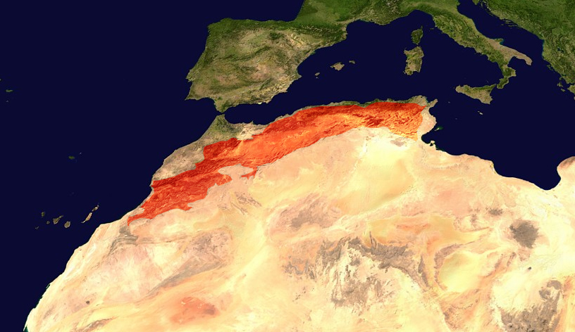
The Atlas Mountains (Berber: idurar n Watlas, Arabic: جبال الأطلس) is a mountain range across a northern stretch of Africa extending about 2,500 km (1,600 mi) through Morocco, Algeria, and Tunisia. The highest peak is Toubkal, with an elevation of 4,167 metres (13,671 ft) in southwestern Morocco. The Atlas ranges separate the Mediterranean and Atlantic coastlines from the Sahara Desert. The population of the Atlas Mountains are mainly Berbers. The terms for 'mountain' in some Berber languages are adrar and adras, believed to be cognate with the toponym.
The mountains have been home to a number of plant and animal species unique in Africa, often more like those of Europe; many of them are endangered and some have already gone extinct. Examples include the Barbary Macaque, the Atlas Bear (Africa's only species of bear; now extinct), the Barbary Leopard, the Barbary stag, Barbary Sheep, the Barbary Lion (extinct in the wild), the Atlas Mountain Badger, the North African Elephant (extinct), the African Aurochs (extinct), Cuvier's Gazelle, the Northern Bald Ibis, Dippers, the Atlas mountain viper, the Atlas Cedar, the European Black Pine, and the Algerian Oak.
Contents
Geology
 Map showing the location of the Atlas Mountains across North Africa
The basement rock of most of Africa was formed in the Precambrian (approximately 4.54 - 0.57 billion years ago) and is much older than the Atlas mountains lying in Africa. The Atlas formed during three subsequent phases of Earth's history.
The first tectonic deformation phase involves only the Anti-Atlas, which was formed in the Paleozoic Era (~300 million years ago) as the result of continental collisions. North America, Europe and Africa were connected millions of years ago.
 The tectonic boundary.
The Anti-Atlas mountains are believed to have originally been formed as part of Alleghenian orogeny. These mountains were formed when Africa and America collided, and were once a chain rivaling today's Himalayas. Today, the remains of this chain can be seen in the Fall line in the eastern United States. Some remnants can also be found in the later formed Appalachians in North America.
A second phase took place during the Mesozoic Era (before ~65 My) and consisted of a widespread extension of the Earth's crust that rifted and separated the continents mentioned above. This extension was responsible for the formation of many thick intracontinental sedimentary basins including the present Atlas. Most of the rocks forming the surface of the present High Atlas were deposited under the ocean at that time.
Finally, in the Tertiary Period (~65 million to ~1.8 million years ago), the mountain chains that today comprise the Atlas were uplifted as the land masses of Europe and Africa collided at the southern end of the Iberian peninsula. Such convergent tectonic boundaries occur where two plates slide towards each other forming a subduction zone (if one plate moves underneath the other) and/or a continental collision (when the two plates contain continental crust). In the case of the Africa-Europe collision, it is clear that tectonic convergence is partially responsible for the formation of the High Atlas, as well as for the closure of the Strait of Gibraltar and the formation of the Alps and the Pyrenees. However, there is a lack of evidence for the nature of the subduction in the Atlas region, or for the thickening of the Earth's crust generally associated with continental collisions. In fact, one of the most striking features of the Atlas to geologists is the relative small amount of crustal thickening and tectonic shortening despite the important altitude of the mountain range. Recent studies suggest that deep processes rooted in the Earth's mantle may have contributed to the uplift of the High and Middle Atlas.[1][2]
Natural resources
The Atlas are rich in natural resources. There are deposits of iron ore, lead ore, copper, silver, mercury, rock salt, phosphate, marble, anthracite coal, and gas among other resources.
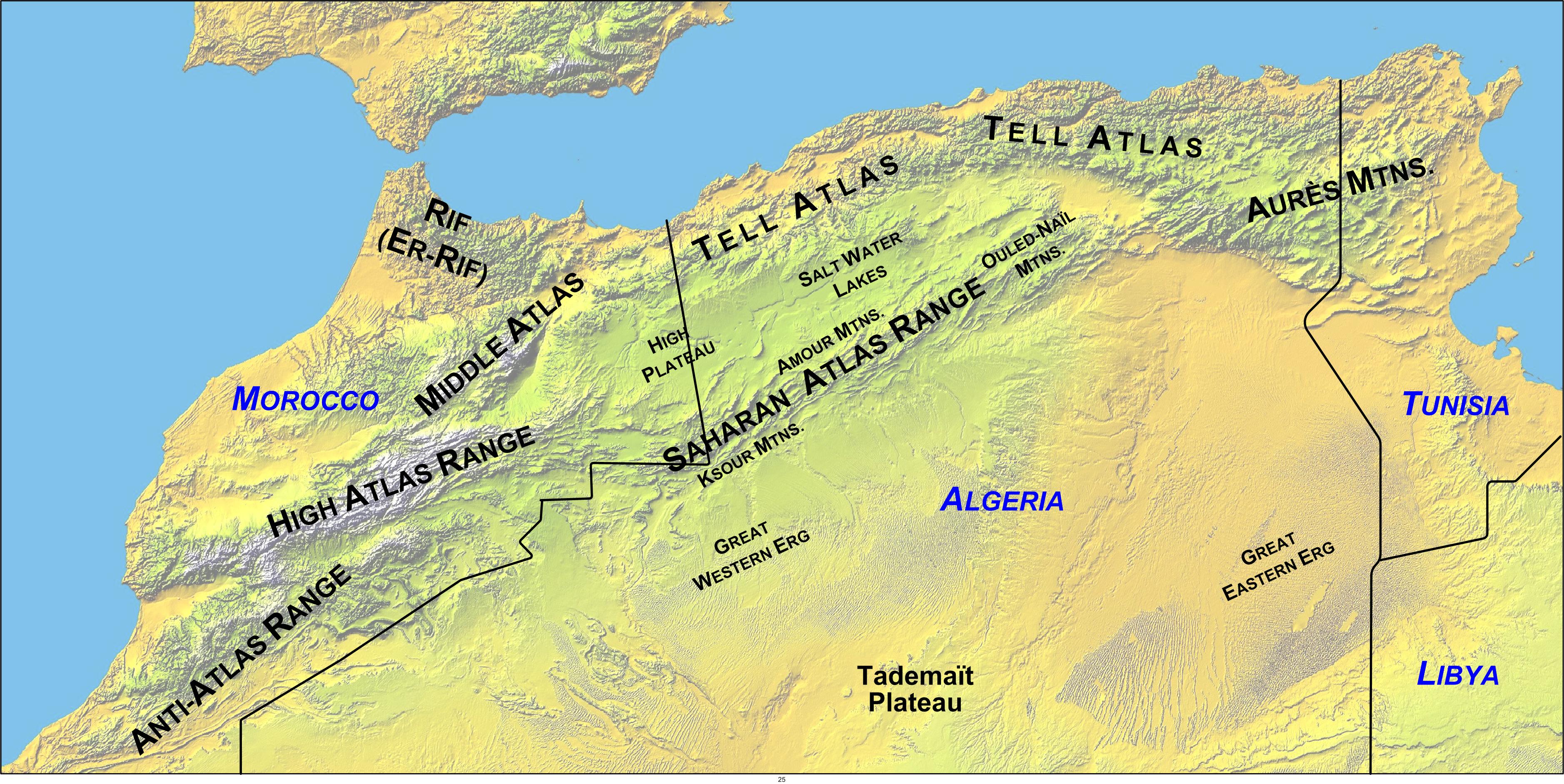
Subranges of the Atlas Mountains
 High Atlas.
The range can be divided into three general regions from west to east:
- Middle Atlas, High Atlas, and Anti-Atlas (Morocco).
- Saharan Atlas (Algeria).
- Tell Atlas (Algeria, Tunisia).
- Aurès Mountains (Algeria, Tunisia).
Middle Atlas range
Main article: Middle AtlasThe Middle Atlas is a portion of the Atlas mountain range lying completely in Morocco. The Middle Atlas is the westernmost of three Atlas Mountains chains that define a large, plateaued basin extending eastward into Algeria. South of the Middle Atlas and separated by the Moulouya and Oum Er-Rbia rivers, the High Atlas stretches for 700 kilometres (430 mi) with a succession of peaks among which ten reach above 4,000 metres (13,000 ft). North of the Middle Atlas and separated by the Sebou River, the Rif mountains are an extension of the Baetic Cordillera (Baetic mountains, which include the Sierra Nevada) in the south of Spain.
High Atlas
Main article: High AtlasThe High Atlas in central Morocco rises in the west at the Atlantic coast and stretches in an eastern direction to the Moroccan-Algerian border. At the Atlantic and to the southwest the range drops abruptly and makes an impressive transition to the coast and the Anti-Atlas range. To the north, in the direction of Marrakech, the range descends less abruptly.
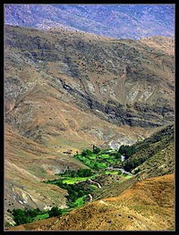
On the heights of Ouarzazate the massif is cut through by the Draa valley which opens southward. In this chaos of rocks the contrasts are astonishing: water runs in some places, forming clear basins. It is mainly inhabited by Berber people, who live in small villages and cultivate the high plains of Ourika Valley.
 Panoramic picture of the artificial lake of Lalla Takerkoust near Barrage Cavagnac, with the hydroelectric dam (far right)
Near Barrage Cavagnac, there is a hydroelectric dam that has created the artificial lake Lalla Takerkoust. The lake serves also as a source for fish for the local fishermen.
The largest villages and towns of the area are Tahanaoute, Amizmiz, imlil, Tin Mal, Ijoukak, and Oukaïmden.
Anti-Atlas ranges
Main article: Anti-AtlasThe Anti-Atlas extends from the Atlantic Ocean in the southwest of Morocco toward the northeast to the heights of Ouarzazate and further east to the city of Tafilalt (altogether a distance of approximately 500 kilometres / 310 miles). In the south it borders the Sahara. The easternmost point of the anti-Atlas is the Djebel Sarhro mountains and its eastern boundary is set by sections of the High Atlas range.
Saharan Atlas range
Main article: Saharan AtlasThe Saharan Atlas of Algeria is the eastern portion of the Atlas mountain range. Though not as high as the Grand Atlas, they are far more imposing than the Tell Atlas range that runs to the north of them and closer to the coast. The tallest peak in the range is the 2,236 m (7,336 ft) high Djebel Aissa. They mark the northern edge of the Sahara Desert. The mountains see some rainfall and are better suited to agriculture than the plateau region to the north. Today most of the population of the region are Berbers.
Tell Atlas range
Main article: Tell Atlas Panoramic view of typical Berber village (Morocco - High Atlas Mountains).
The Tell Atlas is a mountain chain over 1,500 kilometres (930 mi) in length, belonging to the Atlas mountain ranges and stretching from Morocco, through Algeria to Tunisia. It parallels the Mediterranean coast. Together with the Saharan Atlas to the south it forms the northernmost of two more or less parallel ranges which gradually approach one another towards the east, merging in Eastern Algeria. At the western ends at the Middle Atlas range in Morocco. The area immediately to the south of this range is high plateau, with lakes in the wet season and salt flats in the dry.
Aurès mountain range
Main article: Aurès Mountains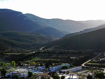 Aures Mountains
 Aures localisation
The Aurès Mountains of Algeria and Tunisia are the farthest eastern portion of the Atlas mountain range.
See also
References and notes
- ^ UAB.es Potential field modelling of the Atlas lithosphere
- ^ UAB.es Crustal structure under the central High Atlas Mountains (Morocco) from geological and gravity data, P. Ayarza, et al., 2005, Tectonophysics, 400, 67-84
Major African geological formations Tectonic plates Cratons and Shields Arabian-Nubian Shield · Congo craton · Kaapvaal craton · Kalahari craton · Saharan Metacraton · Tanzania craton · Tuareg Shield · West African craton · Zimbabwe cratonShear zones Aswa Dislocation · Broodkop Shear Zone · Central African Shear Zone · Chuan Shear Zones · Foumban Shear Zone · Mwembeshi Shear Zone · Todi Shear Zone · Western Meseta Shear ZoneRifts Afar Depression · Anza trough · Bahr el Arab rift · Benue Trough · Blue Nile rift · East African Rift · Gulf of Suez Rift · Lamu Embayment · Melut Basin · Muglad Basin · Red Sea Rift · Atbara rift · White Nile riftSedimentary basins Angola Basin · Blue Nile Basin · Chad Basin · Congo Basin · Douala Basin · Foreland Karoo Basin · Gabon Basin · Iullemmeden Basin · Kufra Basin · Murzuq Basin · Niger Delta Basin · Ogaden Basin · Orange River basin · Owambo Basin · Reggane Basin · Rio del Rey Basin · Sirte Basin · Somali Coastal Basin · Taoudeni basin · Tanzania Coastal Basin · Tindouf BasinMountain ranges Aïr Mountains · Atlas Mountains · Aurès Mountains · Bambouk Mountains · Blue Mountains · Cameroon line · Central Pangean Mountains · Chaillu Mountains · Drakensberg · Ethiopian highlands · East African mountains · Great Escarpment · Great Karas Mountains · Guinée forestière · Imatong Mountains · Jebel Uweinat · Loma Mountains · Mandara Mountains · Marrah Mountains · Mitumba Mountains · Nuba Mountains · Rwenzori Mountains · Sankwala Mountains · Serra da Leba · Serra da Chela · Teffedest Mountains · Tibesti MountainsSubfields of physical geography  Categories:
- Atlas Mountains
- Mountain ranges of Africa
- Maghreb
- Mountain ranges of Morocco
- Mountain ranges of Algeria
- Mountains of Tunisia
- Physiographic provinces


Wikimedia Foundation. 2010.