- Blacktown, New South Wales
Infobox Australian Place | type = suburb
name = Blacktown
city = Sydney
state = nsw
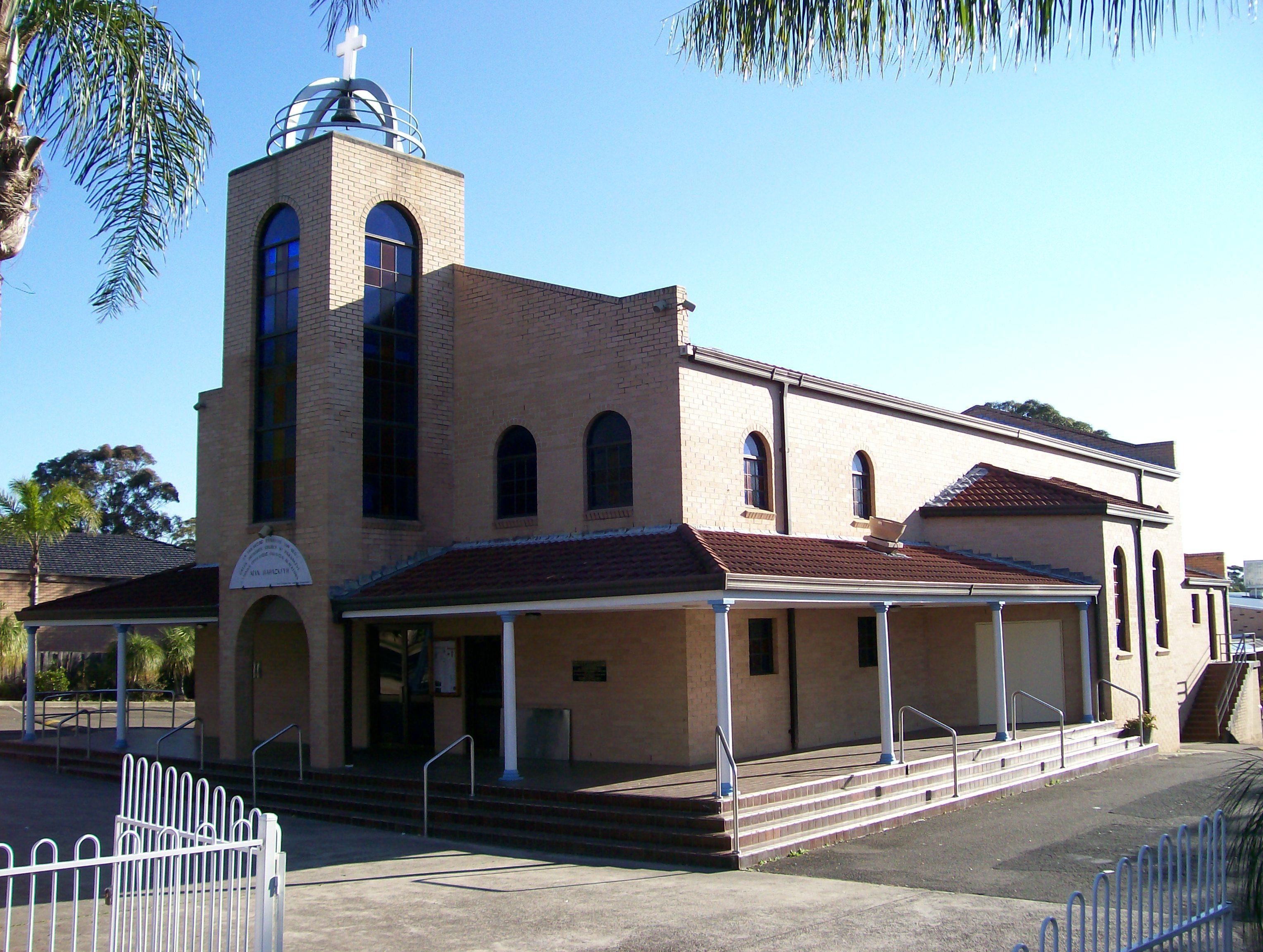
caption = St. Paraskevi Greek Orthodox Church, Blacktown
lga =City of Blacktown
postcode = 2148
est =
pop = 39,000
area =
propval =
stategov = Blacktown
fedgov = Chifley
near-nw = Marayong
near-n = Kings Park
near-ne = Kings Langley
near-w = Woodcroft Doonside
near-e = Lalor Park Seven Hills
near-sw = Arndell Park
near-s = Eastern Creek
near-se = Prospect
dist1 = 34
dir1 = west
location1=Sydney CBD Blacktown is a
suburb in theCity of Blacktown , in WesternSydney , in the state ofNew South Wales ,Australia . Blacktown is located 34kilometres west of theSydney central business district and is the administrative centre of the local government area ofCity of Blacktown . Blacktown is also the largest of any suburb or township in New South Wales.History
Prior to the arrival of the
First Fleet in1788 , Blacktown was inhabited by different groups of theDarug people including the Warmuli, based around what is now Prospect, and their neighbours the Gomerigal from theSouth Creek area and the Wawarawarry from the Eastern Creek area. It is estimated that fifty to ninenty percent of the Darug died ofsmallpox and other introduced diseases within a few years of the British arrival. GovernorArthur Phillip began granting land in the area to white settlers in 1791, a process that was reversed slightly in 1819 when GovernorLachlan Macquarie granted land to two indigenous men, Colebee and Nurragingy. A few years later in 1823, the Native Institution (a school for Aboriginal children) was moved from Parramatta to the site where Richmond Road meets Rooty Hill Road North (this intersection is now in the suburbs of Hassall Grove, Glendenning and Quakers Hill). Although the institution closed in 1833, the road heading out to it became known as the Black Town Road. In 1860 the Railway Department gave the name of Black Town Road Station to the railway station at the junction of the railway and the Black Town Road, with the name shortening to Blacktown by1862 .cite web | url= http://www.blacktown.nsw.gov.au/our-city/history/the-region/important-dates_home.cfm | title=Important dates | publisher=Blacktown City Council | accessdate=2008-05-16 ] [cite web | url= http://www.blacktown.nsw.gov.au/our-city/history/the-region/aboriginal_home.cfm | title=Aborigines | publisher=Blacktown City Council | accessdate=2008-05-16 ]The arrival of the railway led to the formation of a town around the station. A
post office was opened in 1862 and a school in 1877. In 1906, the Shire of Blacktown was formed and in 1930, electricity was introduced to the town. The population in 1933 was then around 13,000. In the 1950s and 60s, there was a large amount of suburban development both in the current suburb of Blacktown and the new suburbs that sprung up around it. This led to civic development in the town centre with the hospital opening in 1965, thecourthouse and police station in 1966, the library in 1967 and theTAFE college in 1969. In 1973, the Westpoint shopping centre opened which was soon followed by the cinema complex.Commercial area
The Blacktown Commercial Business District is located close to Blacktown railway station.
Westpoint Blacktown is a major shopping centre in Blacktown. Blacktown has many restaurants and bars. The Blacktown CBD features the following landmarks:
* Blacktown City Council corporate head office
* Blacktown Courthouse and Police Station
* Max Webber Library - Blacktown City Council's newly completed central library
*Blacktown Hospital Transport
According to the 2006 census, the most common way of getting to work from Blacktown was by
car (74%) with public transport used by just under twenty percent. Most public transport was done bytrain (17%) with five percent catchingbus es for all or part of their journey. [cite web | url= http://www.censusdata.abs.gov.au/ABSNavigation/prenav/ViewData?&action=404&documentproductno=SSC11109&documenttype=Details&tabname=Details&areacode=SSC11109&issue=2006&producttype=Community%20Profiles&&producttype=Community%20Profiles&javascript=true&textversion=false&navmapdisplayed=true&breadcrumb=PLD&&collection=Census&period=2006&producttype=Community%20Profiles&#Basic%20Community%20Profile | title=2006 Census Community Profile Series : Blacktown (State Suburb) | publisher=Australian Bureau of Statistics| accessdate=2008-07-29]
* Blacktown railway station is on the Western Line of theCityRail network.
* Blacktown has a major bus interchange is located next to the station.
* Blacktown to Rouse Hill Bus Transitwayschools
The first school in the area was opened in 1877. While no longer in use as a school, the heritage listed building in Flushcombe Road is now used as a Visitor Information Centre. [cite web | url= http://www.visitblacktown.com.au/inspiration.asp?ID=5 | title= Blacktown Visitor Information & Heritage Centre | publisher=Blacktown City Council | accessdate=2008-05-15 ] There are, however, a large number of schools in the suburb. Government run primary schools in the area include: Blacktown North Public School, Blacktown South Public School, Blacktown West Public School, Lynwood Park Public School, Marayong South Public School, Shelley Public School, and Walters Road Public School. Public high schools include: Blacktown Boys High, Blacktown Girls High, Evans High and Mitchell High. There is also the Coreen School, which caters to older children with learning difficulties. [cite web | url= http://www.coreen-s.schools.nsw.edu.au/ | title= Coreen School | publisher=NSW Department of Education & Training | accessdate=2008-05-15 ]
There are two Catholic primary schools, St Michaels and St Patricks, and two Catholic high schools, Nagle College for girls and
Patrician Brothers Blacktown for boys. Tyndale Christian School is a private school covering children from kindergarten to year 12. [cite web | url= http://www.nagle.nsw.edu.au/pages/about.php | title= Nagle College | publisher= Nagle College | accessdate=2008-05-15 ] [cite web | url= http://www.patsblacktown.nsw.edu.au/ | title= Patrician Brothers Blacktown | publisher= Patrician Brothers Blacktown | accessdate=2008-05-15 ] [cite web | url= http://www.tyndale.edu.au/new/ | title= Tyndale Christian School | publisher= Tyndale Christian School | accessdate=2008-05-15 ]Churches
* There are four Catholic churches in Blacktown: St Patricks on Allawah street, St Raphael (German) on Reservoir Road, St Michaels on Orwell Street and Our Lady (Croation) on Douglas Road.
*St. Paraskevi Greek Orthodox Church is situated on Balmoral Street. It is the spiritual home to thousands of Orthodox Christians (mainly of Greek heritage) living in the Blacktown City Council area. [cite web | url= http://www.saintparaskevi.org.au/general/ | title= Greek Orthodox Parish of St Paraskevi & St Barbara, Blacktown | publisher= Hellenic Orthodox Parish of Blacktown| accessdate=2008-06-15 ]
* St. Pokrovski (Holy Protection of the Mother of our Lord) Russian Orthodox Church on Kildare Road. [cite web | url= http://www.orthodoxy.org.au/eng/ | title= Russian Orthodox Church in Australia | publisher= Russian Orthodox Church in Australia| accessdate=2008-08-27 ]
* St. Nicholas Serbian Orthodox Church is on Second Avenue. There is a large community of Serbian Orthodox Christians in the Blacktown area.
* Christ Church is an Anglican Church in Richmond Road.
* St Marks Coptic Catholic Church is on Reservoir Road, opposite Prospect Reservoirport and recreation
* Fairfax Community Stadium (Football and Rugby League) 7,500 capacity (1,200 seated)
* Blacktown Baseball Stadium (Baseball) 5,000 capacity (1,200 seated)
* Blacktown Softball Stadium (Softball) 5,000 capacity (1,100 seated)
* Blacktown Showground (fesitvals and cultural events/activities)
* Francis Park (Rugby League, Football and Athletics)
* Blacktown International Ice Arena - home of theWestern Sydney Ice Dogs of the AIHL
* Alpha ParkPopulation
Demographics
According to the 2006
census conducted by theAustralian Bureau of Statistics , Blacktown had a population of 38,914 making it one of the largest suburbs in the country. In many respects, the residents were typical of the Australian national profile. Most families were couples with children (48%). Most dwelling were freestanding homes (75%). The median family income of $1080 per week was a little lower than average. The median housing loan repayment of $1588 per month was a bit higher than average. The number of people born overseas (40%) was a statistic substantially higher than the national average (22%) with the greatest numbers of people born in thePhilippines (4.0%),India (3.6%),Sudan (2.4%) andNew Zealand (2.3%).Census 2006 AUS|id= SSC11109 |name= Blacktown (State Suburb)|accessdate=2008-05-15 |quick=on]Notable residents
* Actress
Toni Collette was raised here
* ActressKym Valentine was raised here
* ActressBec Hewitt was raised here
*Matt Geyer ,Rugby League player for theMelbourne Storm , was born here.
*feleti mateo ,rugby league player forparramatta eels ,was born and raised here.
*brett delany ,rugby leauge player for thegold coast titans was bor and raised here.References
External links
Wikimedia Foundation. 2010.