- Mosman, New South Wales
-
Mosman
Sydney, New South Wales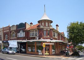
Conservation area shop fronts, Military RoadPopulation: 26,236(2006)[1] Postcode: 2088 Area: 8.7 km² (3.4 sq mi) Location: 8 km (5 mi) north-east of Sydney CBD LGA: Municipality of Mosman State District: North Shore Federal Division: Warringah Suburbs around Mosman: Northbridge Seaforth Clontarf Cremorne Mosman Cremorne Point Mosman is a suburb on the Lower North Shore of Sydney, in the state of New South Wales, Australia. Mosman is located 8 kilometres north-east of the Sydney central business district and is the administrative centre for the local government area of the Municipality of Mosman.
Contents
Localities
In February 1997, a notice was published in the Government Gazette by Mosman Council advising that they had assigned Mosman as the only suburb in the Mosman Local Government Area. However, Mosman Council decided that residents should continue to be allowed to use the following traditional locality names if they wished:[2]
History
Mosman is named after Archibald Mosman (1799–1863) and his twin brother George, who moved onto a 4-acre (16,000 m2) land grant in the area in 1831. They were involved in shipping, and founded a whaling station on a bay in the harbour, which became known as Mosman’s Bay. George subsequently became involved in grazing, but Archibald continued with whaling activities. By 1838, he owned 108 acres (0.44 km2) along the Mosman waterfront.[3]
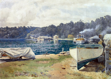
 Arthur Streeton, Mosman's Bay, 1914
Aboriginal culture
Mosman was originally inhabited by the Borogegal tribe.[4] Bungaree (c1775–1830) was a well known Aboriginal who joined British explorers on voyages, including circumnavigating Australia with Matthew Flinders when he was 26. He later became leader of his tribe, was given land at Georges Head, and enjoyed the patronage of Governor Lachlan Macquarie. He greeted newcomers whose ships entered Port Jackson, and became acquainted with Russian and French explorers. His image was painted many times and shown in London, Paris, and Moscow.
European settlement
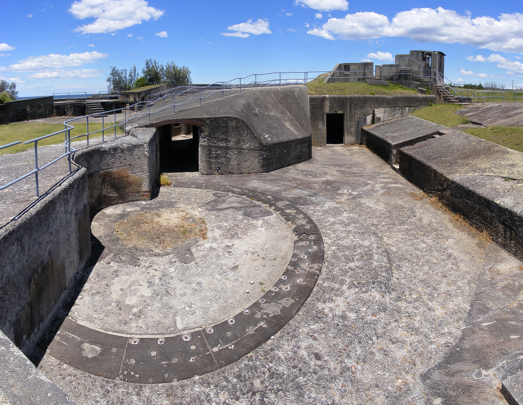
 A gun emplacement at Middle Head Fort
In 1789 HMS Sirius—the flagship of the First Fleet—entered what is now known as Mosman Bay or Great Sirius Cove. Mosman has been the site of important maritime and defence installations for Sydney since 1801, especially when Sydney's Harbour defences were expanded with the construction of Middle Head Fort, Georges Head Battery and Bradleys Head Fortification Complex. In 1871 the Beehive Casemate was constructed into the cliff side on Obelisk Bay.[5]
A Submarine Miners’ Depot was constructed at Chowder Bay (Georges Head) in the 1880s. In 1888 the site was modified for the latest in harbour defences. The site was a strategic position and considered the best place to observe and fire mines which were laid underwater. Minefields were laid across the main shipping channels of Port Jackson from 1876 to 1922 and a base was built at Chowder Bay for the submarine miners (Clifton Gardens). From Georges Head, miners watched for ships entering the harbour. Their job was to explode the mine closest to an approaching enemy ship. Each underwater mine was attached to an electric cable that ran up the cliff to the firing post.[6][7] During a demonstration in 1891, a crowd of several thousand people watched as a fatal accident killed four miners and injured another eight.[8]
 Mosman's Bay by John Mather, 1889
In the 1880s and 1890s, as a result of the enthusiasm for painting en plein air fostered by the Barbizon and Impressionist movements in France, art colonies known as the Sydney artists' camps flourished around the Harbour mainly in the Mosman area.[9] As a result Mosman became known as "Australia's most painted suburb".[10] Notable painters in this community included Julian Ashton, Tom Roberts, Arthur Streeton and John Mather.
In 1942 during the Second World War the Sydney Harbour anti-submarine boom net was constructed on Georges Head and was designed to prevent enemy submarines from entering into Sydney Harbour. The boom net spanned the entire width of Port Jackson and a boom net winch house was located on Liangs Point, Watsons Bay. On the night of 31 May 1942, three Japanese midget submarines attempted to enter Sydney Harbour in what became known as the Attack on Sydney Harbour.[11][12] One of the Japanese midget submarines became entangled in the boom net and after unsuccessful attempts by the crew to free the submarine they detonated charges within the sub, killing themselves and destroying their sub in the process.
 The 1916 Taronga Zoo entrance building
Chowder Bay was used in the late 1820s as an anchorage for visiting American whaling ships.[4] In 1831 Archibald Mosman and John Bell were allotted grants of land in Mosman Bay to establish a whaling station. The only remaining building of the original whaling station is The Barn in Avenue Road. The Barn was a store and sail drying house. It is now the home of the 1st Mosman 1908 Scout Group.
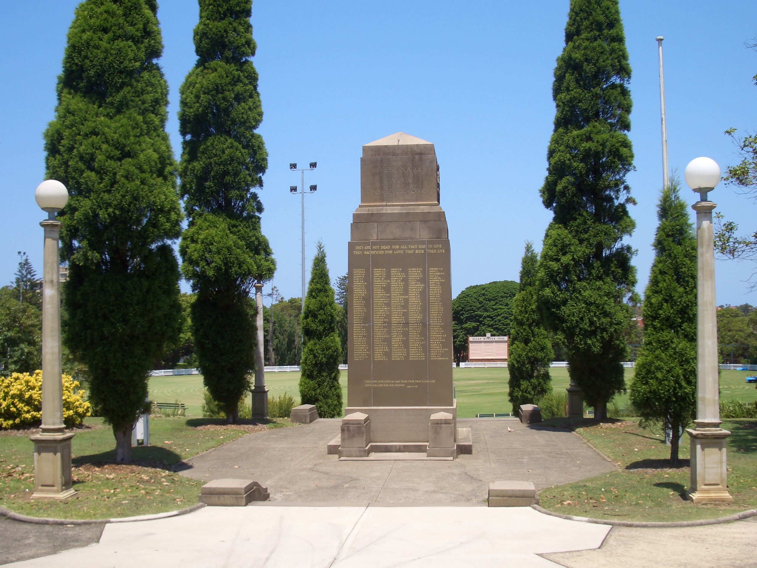
 Mosman War Memorial, designed by Peter Kaad, and Allan Border Oval
A foot track ran from North Sydney to Middle Head in the 1840s. Avenue Road which ran from Mosman Bay to Mosman Junction was constructed in 1860 with Military Road, Middle Head Road, and Bradleys Head Road all constructed ten years later.[4] From the 1870s, land development spread settlement east from Milson's Point, including to the Mosman area, which was boosted with a regular ferry service around the same time.[13] Richard Hayes Harnett Senior purchased Archibald Mosman’s original 108 acres (0.44 km2) in 1859 and in 1878 established a sandstone quarry at Mosman Bay. In 1871, he built a wharf and subsidised a ferry service between Mosman Bay, Neutral Bay, and Circular Quay.[14] He promoted a land development known as the Mosman Bay Estate; when the land was sold, the ferry service was cancelled, much to the annoyance of the new landowners.[15] His son, Richard Harnett Junior, was the first Mayor elected when Mosman became a municipality in 1893 with 1,600 residents, breaking away from the North Sydney municipality.[16] Both men were major influences in Mosman and were responsible for building many roads, a horse drawn bus service and ferry services linking Mosman to the city. Mosman Public School opened in 1880.
At the turn of the century, rows of shops and Federation architecture homes were built. Taronga Park Zoo opened in 1916, moving from a site at Moore Park that had been in use since 1884. Taronga is an Aboriginal word for 'beautiful view'. From the late 1950s, multi-storey flat developments began and became a public concern, leading to controls and restrictions being introduced.
Landmarks
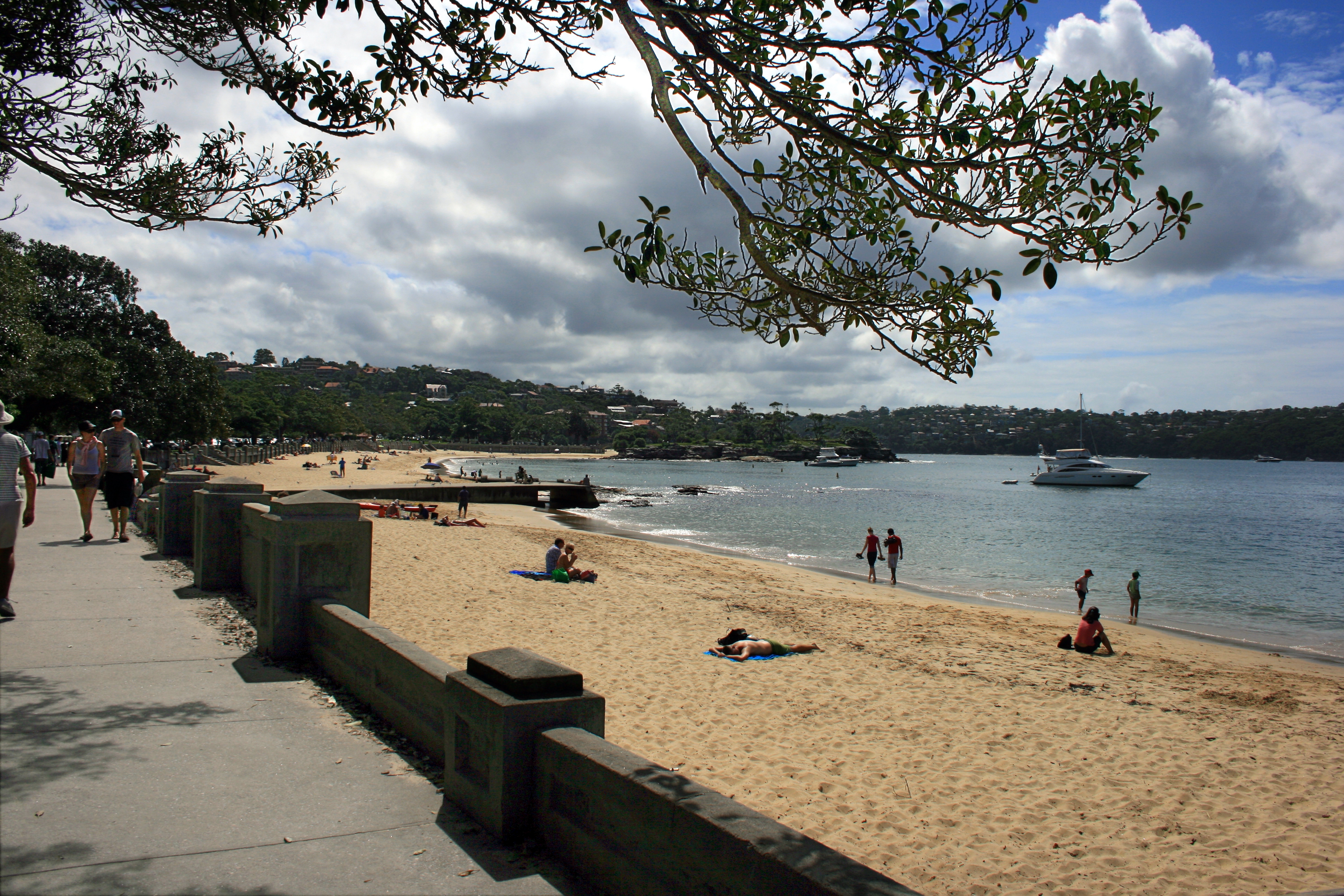
Mosman forms a peninsula between Sydney Harbour and Middle Harbour. It features a number of harbour beaches, including Balmoral, Chinamans, Obelisk Beach and Cobblers Beaches. Other attractions include Taronga Zoo, Bradleys Head and sections of Sydney Harbour National Park.[17] Overlooking the harbour, in Rawson Park, is the Scotland Australia Cairn comprising a stone sourced from every parish in Scotland. It is a memorial to the Scottish pioneers who contributed much to Australia and was a gift from Scotland at the time of the Bicentennial Celebrations in 1988.[18] Highland games are held there, usually the day after St Andrew’s Day celebrations. On the eastern shore of Sirius Cove is the site of Curlew Camp where artists such as Arthur Streeton and Tom Roberts once resided. The Council has recently constructed the Curlew Camp Artists Walk.
Commercial area
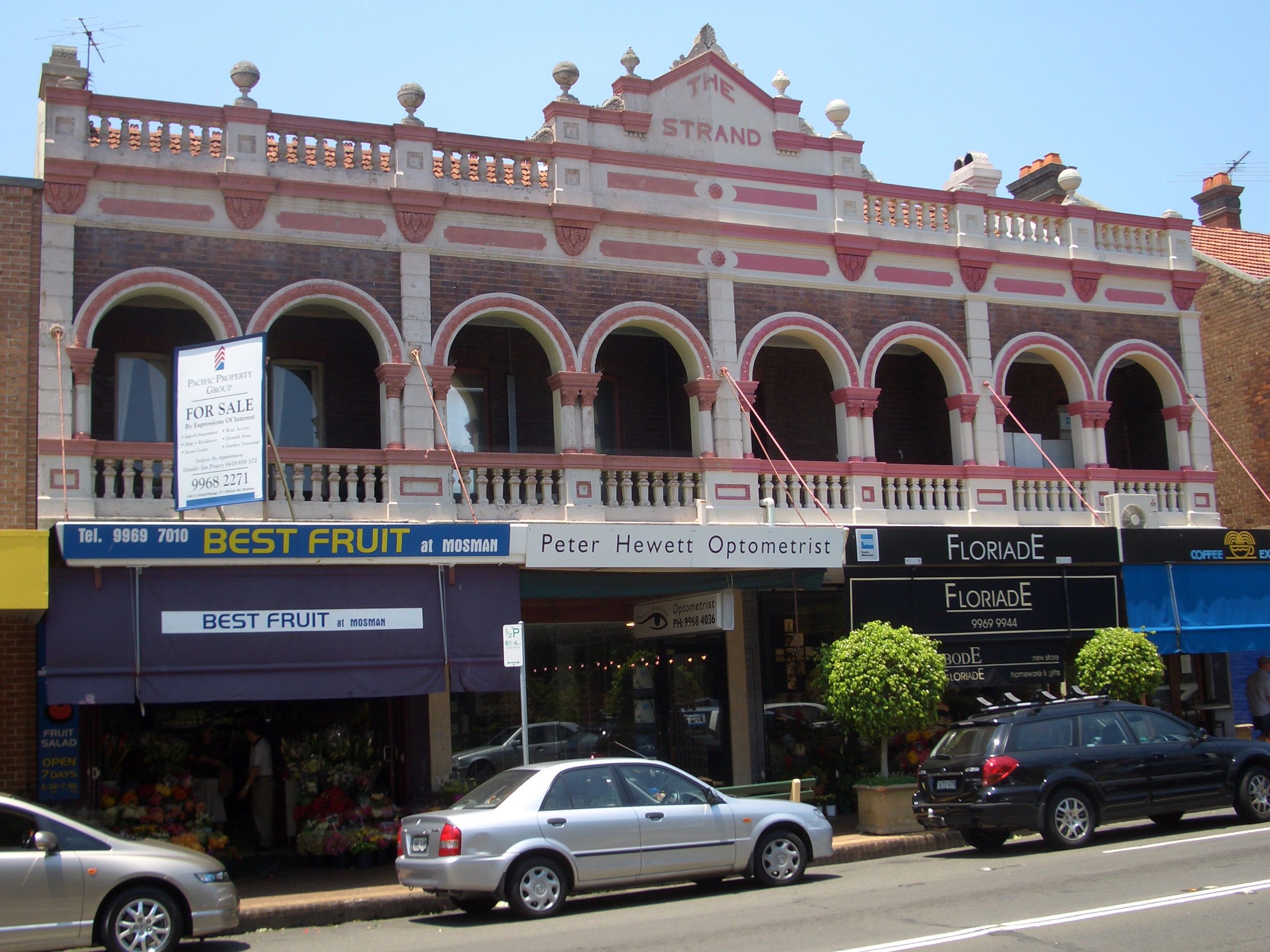
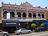 "The Strand" on the conservation area shopping strip.[19]
 Boronia House, built in 1885[6]
Mosman shopping centre is located along Military Road, which features many boutiques, cafes and restaurants. The shopping centre extends from the intersection with Bradley's Head Road and Middle Head Road, continues north up past the intersection with Spit Road at Spit Junction. It continues for some distance along both Spit Road and Military Road and extends down some of the side streets. Mosman Council has identified the early twentieth century shopping strip along Military Road as a conservation area. The awnings along the street were originally column-supported.[19]
A small shopping mall called Bridgepoint is located at Spit Junction. It features a supermarket, grocery shops, bookshop, gift shops, cafés, health practitioners, and offices. Mosman's entertainment spots include the Mosman Hotel located on Military Road and the Buena Vista Hotel located on Middle Head Road.
Houses
Mosman is primarily a residential suburb. Federation era houses predominate but there are also other styles ranging from Californian Bungalow to modern townhouse and apartment buildings.
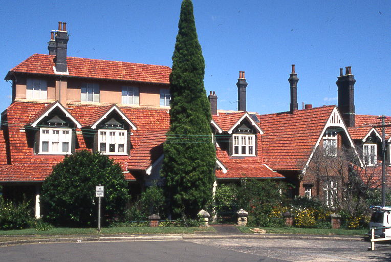
Mosman’s first large home—'The Nest'—was built in 1833.[20] Oswald Bloxsome built 'The Rangers' in 1844—a mansion on 40 acres (160,000 m2) overlooking Mosman Bay. Boronia House, built in 1885 has had a variety of uses including as the former municipal library.[6] Monterey, a large federation house, was built above Mosman Bay and in the 1980s was divided into a number of upmarket units.[citation needed]
 The Manor, Clifton Gardens
The Manor, at a habourside location in Clifton Gardens, is a large mansion loosely in the Federation style. Built circa 1911 by a Mr Bakewell as an eight-room cottage, it grew to over thirty rooms, most of which were lined with beaten copper. It was known locally as Bakewell's Folly.[21] In the 1920s, the Theosophical Society rented and then purchased The Manor, which was regarded as a great "occult forcing-house". It became an important centre for the Society and is still used by them today. The English writer Mary Lutyens, who stayed at The Manor in the 1920s, described it as "a huge and hideous villa."[22]
Education
Schools in Mosman include:
- Mosman High School [23]
- Mosman Public School
- Beauty Point Public School
- Middle Harbour Public School
- Sacred Heart Catholic Primary School
- Blessed Sacrament Catholic Primary School
- Mosman Church of England Preparatory School
- Queenwood School for Girls (four campuses)
Churches
Churches in Mosman include:
- Blessed Sacrament Roman Catholic Church
- Mosman Uniting Church
- Mosman Baptist Church
- Sacred Heart Roman Catholic Church
- St Clement's Anglican Church
- St Luke's Anglican Church
- St Thérèse of the Child Jesus Roman Catholic Church
- Scots Kirk Presbyterian Church
- Sydney Life Church
Sport and recreation
Sporting Clubs serving the Mosman community include:
- Mosman Football Club
- Mosman Rugby Club
- Mosman Cricket Club
- Mosman Rowing Club
Australian Test cricket captains Allan Border and Ian Craig grew up in Mosman and played for the local club.
Culture
- Shakespeare By The Sea (Australia) is a summer outdoor event that is held at Balmoral Beach.
- The Mosman Art Prize is held annually.
- Nancy Phelan's memoir—A Kingdom by the Sea (1969)—vividly recalls Mosman circa 1920.
References
- ^ "2006 Census Community Profile Series : Mosman (State Suburb)". Australian Bureau of Statistics. Accessed 14 October 2009.
- ^ Mosman Municipal Council - Ordinary Meeting Agenda - Meeting Date: 29 November 2005 pg 83.
- ^ The Book of Sydney Suburbs, Compiled by Frances Pollen, Angus & Robertson Publishers, 1990, Published in Australia ISBN 0-207-14495-8, page 181
- ^ a b c "A brief history of Mosman". Mosman Municipal Council. http://www.mosman.nsw.gov.au/mosman/history/from-1788. Retrieved 2007-08-01.
- ^ http://search.informit.com.au/documentSummary;dn=520474193368466;res=IELENG
- ^ a b c Sydney Harbour Federation Trust Sites - Headland Park
- ^ Army - The Soldiers' Newspaper
- ^ http://commons.wikimedia.org/wiki/Image:MiddleGeorgeshedfort0152.JPG
- ^ Robin Tranter, Artists' camps, Dictionary of Sydney, 2008. Accessed 9 May 2011
- ^ John Huxley, Back to the wellspring of inspiration, Sydney Morning Herald, December 7, 2005. Accessed 14 January 2010
- ^ Gill, George Hermon (1968). Royal Australian Navy, 1942–1945, p 65
- ^ Stevens, David (2005). A Critical Vulnerability, p 193
- ^ Prescott, A.M. (1984). Sydney Ferry Fleets. Magill, South Australia: Ronald H. Parsons. ISBN ISBN 0-909418-30-6
- ^ "Hindsight". Mosman Magazine: pp. 26–27. December
- ^ Andrews, Graeme (1982). The Pictorial History of Sydney Ferries. Sydney: AH & AW Reed. pp. 19.. ISBN ISBN 0-589-50386-3.
- ^ Pollen, Frances (1990). The Book of Sydney Suburbs. Australia: Angus & Robertson. pp. 180. ISBN ISBN 0-207-14495-8.
- ^ Sydney and Blue Mountains Bushwalks, Neil Paton (Kangaroo Press) 2004, pp.123-128
- ^ "Isle of Ulva - connection with Scotland Australia Cairn". http://isleofulva.com/history/the-australian-link/.
- ^ a b Fraser, H.; Joyce, R. (1986). The Federation House, Australia's Own Style. Sydney: Lansdowne. pp. 13 and 115. ISBN ISBN 1-86302-126-4.
- ^ Mosman Council: A brief history of Mosman
- ^ The Theosophist, magazine (Theosophical Society) August 1997, pp.460-463
- ^ To Be Young, Mary Lutyens (Corgi Books) 1959, p.153
- ^ Mosman High School–Website, retrieved 9 August 2010
External links
- 2001 Census Information
- Community Profile of the Mosman Local Government Area
- Community Atlas of the Mosman Local Government Area
- History of Mosman from Mosman Council website
- Mosman Memories of Your Street online social history project
- Mosman Voices online oral history project
- Mosman Local
- Mosman Football Club
Coordinates: 33°49′45″S 151°14′39″E / 33.829075°S 151.244090°E
Suburbs and Localities of the Municipality of Mosman · Lower North Shore · Sydney Suburbs Mosman
Localities List of Sydney suburbs Categories:- Suburbs of Sydney


Wikimedia Foundation. 2010.