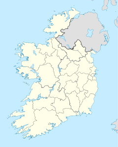
- Cape Clear Island
-
Cape Clear Island Native name: Cléire
Roaring-water BayGeography Location Carbery's Hundred Isles Area 6.7 km2 (2.59 sq mi) Length 5.2 km (3.23 mi) Width 2.4 km (1.49 mi) Highest elevation 160 m (520 ft) Highest point Cnoicín an tSeabhaic Country IrelandProvince Munster County Cork Barony Carbery West Demographics Population 125 (as of 2006) Density 18.6 /km2 (48.2 /sq mi) Additional information The island is a Gaeltacht Clear Island or Cape Clear Island (officially known by its Irish name: Cléire, and sometimes also called Oileán Chléire) lies south west of County Cork in Ireland. It is the southernmost inhabited part of Ireland and has a population of over 100 people. Officially it is a Gaeltacht (Irish speaking area) and most inhabitants speak Irish and English. Its nearest neighbour is Sherkin Island, 2 km east of the island. The island is divided into east and west halves by an isthmus. Ferries sail from the North Harbour to Schull and Baltimore on the mainland. The South Harbour is a popular berth for yachts.
Contents
History
The island is known as the birthplace of Saint Ciarán, for the Dún an Óir fort, and for its birdlife, including Black and Common Guillemots, Cormorants and storm petrels. The island had a population of over 1,052 before the Famine, and the population of Cape Clear is currently less than 1 eighth that figure. The island has a primary school which was built in 1897. In 1998 Irish President Mary McAleese visited it. Every first weekend of September, Cape hosts the Cape Clear Island International Storytelling Festival, which has been running annually since 1994. The festival features professional international storytellers from all over the world.
Wildlife
Seals, basking sharks and dolphins are found in the surrounding water, while sea pinks and honeysuckle are common plants on the land. Cape Clear is home to a lighthouse and a bird observatory. Cape Clear is a prime bird watching destination and in certain times of the year is home to hundreds of species of migratory birds which are attracted to its climate, which is much milder than mainland Ireland's. [1]
Archaeology of Cape Clear
- Boulder Burial, Gort na Lobhar (Gortnalour)
- Burial Ground, Baile Iarthach (Ballyieragh), Cill Leire Forabhain (Comillane); also Children's Burial Ground, Lios O Moine (Lissamona)
- Celtic Art Stone with later cross inscription Celtic Iron Age 600 B.C.–400 A.D., Crathach Thiar (Croha West)
- Church, Baile Iarthach (Ballyieragh) in ruins 1693
- Cross Slab, Lios O Moine (Lissamona), Baile Iarthach (Ballyieragh)
- Cup Mark Stone, Cill Leire Forabhain (Comillane) now in Cape Clear Museum
- Fulach Fiadh (Cooking Pit), Gort na Lobhar (Gortnalour), Cnocan na mBairneach (Knockannamurnagh)
- Holy Well, Cill Leire Forabhain (Comillane), Baile Iarthach (Ballyieragh) visited on St. Kieran's day 5 March
- Medieval post 1200 A.D. O'Driscoll Castle
- Passage Tomb 4000–2200 B.C., Cill Leire Forabhain (Comilane) found 1880
- Promontory fort Celtic Iron Age 600 B.C.–400 A.D. at Baile Iarthach (Ballyieragh), Cnocan na mBairneach (Knockannamurnagh)
- Ringfort, Lios O Moine (Lissamona)
- Signal Tower, Gleann Iarthach (Glen West) burned early 19th century
- Stone Pair, Cill Leire Forabhain (Comillane), Neolithic 4000–2200 B.C.
- Tower House and Bawn, Baile Iarthach (Ballyieragh) O'Driscoll
Townlands
The townlands of the island include:
- Baile Iarthach Theas
- Baile Iarthach Thuaidh
- Cnocán an Choimthigh
- Gleann Iarthach
- Gleann Meánach
- Gleann Oirtheach
- Coinnlín
- Crathach Thiar
- Crathach Thoir
- Cill Leice Fórabhain
- Lios O Móine
- Cnocán na mBairneach
- Gort na Lobhar
- An tArdghort
- Ceathrúna
- Comalán
See also
- Munster Irish
- Carbery's Hundred Isles
References
- The Wild Plants of Sherkin, Cape Clear and adjacent Islands of West Cork, John Akeroyd, editor, Sherkin Island Marine Station 1996 ISBN
- Archaeological Inventory of County Cork, Vol 1 West Cork, Office of Public Works, 1992 ISBN
- Cape Clear Island , Éamon Lankford, 1999 ISBN
External links
Categories:- Islands of County Cork
- Gaeltacht places in County Cork
- Visitor attractions in County Cork
- Gaeltacht towns and villages
Wikimedia Foundation. 2010.


