- Madhya Pradesh
-
Madhya Pradesh — State — 
SealLocation of Madhya Pradesh in India
Coordinates (Bhopal): 22°25′N 72°32′E / 22.42°N 72.54°ECoordinates: 22°25′N 72°32′E / 22.42°N 72.54°E Country  India
IndiaEstablished 1956-11-01 Capital Bhopal Largest city Indore Districts 50 Government – Governor Ram Naresh Yadav – Chief Minister Shivraj Singh Chouhan (BJP) – Parliamentary constituency 29 – High Court Madhya Pradesh High Court Area – Total 308,252 km2 (119,016.8 sq mi) Area rank 2nd Population (2011) – Total 75,697,565 – Rank 6th – Density 245.6/km2 (636/sq mi) Time zone IST (UTC+05:30) ISO 3166 code IN-MP HDI  0.488 (low)
HDI rank 26th (2005) Literacy 76.5% (8th) Official languages Hindi Website mp.gov.in Madhya Pradesh (Hindī: मध्य प्रदेश, pronounced [ˈməd̪ʱjə prəˈd̪eːʃ] (
 listen) "Central Province"; abbreviated MP), often called the Heart of India, is a state in central India. Its capital is Bhopal and Indore is the largest city.
Madhya Pradesh is the second largest state by area and sixth largest state by population. It borders the states of Uttar Pradesh, Chhattisgarh, Maharashtra, Gujarat and Rajasthan.
Contents
History
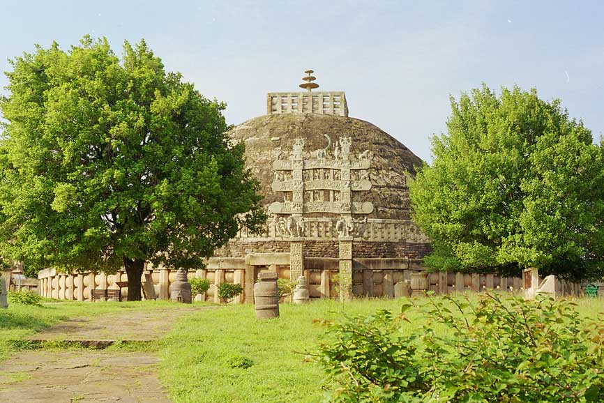
 The Sanchi stupa in Sanchi, Madhya Pradesh built by Emperor Ashoka the Great in the third century BC.
Legend has it that Lord Rama bequeathed the fort to his brother Laxmana, hence the name Bandhavgarh (Bandhavgarh National Park) which means "brother's fort". The Bhimbetka rock shelters in Madhya Pradesh exhibit the earliest traces of human life in India; its stone-age rock paintings are approximately 9,000 years old.
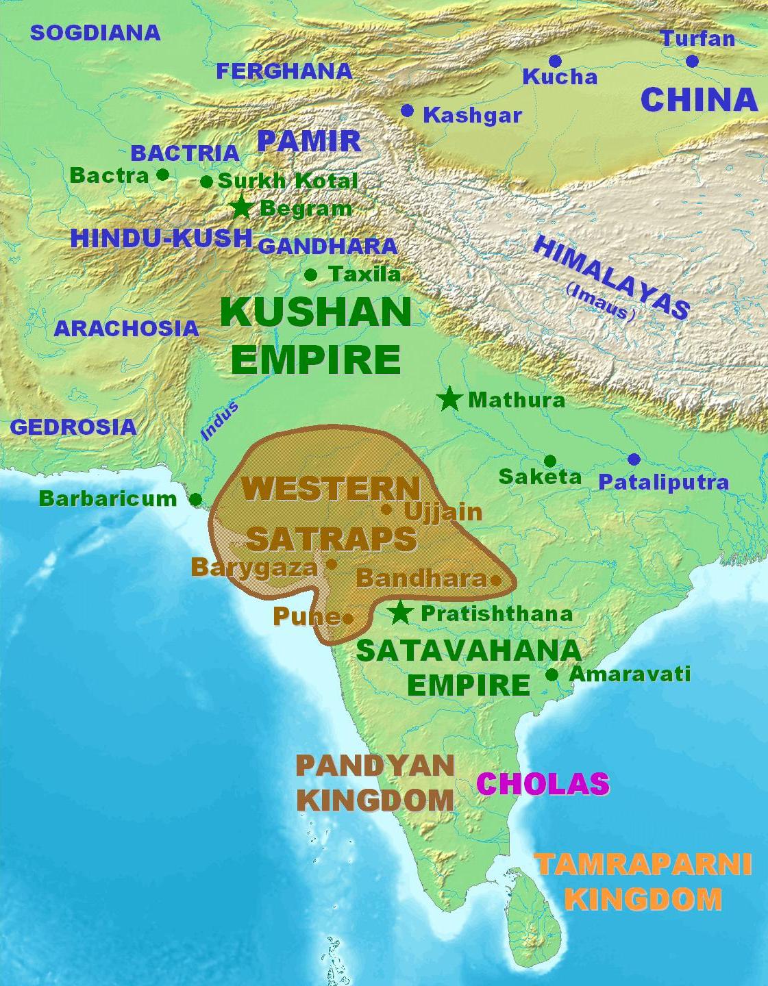
The city of Ujjain (also known as Avanti) arose as a major center in the second wave of Indian urbanization in the sixth century BC, and served as the chief city of the kingdom of Malwa or Avanti. Further east, the kingdom of Chedi lie in Bundelkhand. Chandragupta Maurya united northern India c. 320 BC, establishing the Maurya empire (321 to 185 BC), which included all of modern-day Madhya Pradesh. King Ashoka's wife was said to come from Vidisha- a town north of today's Bhopal. The Maurya empire went into decline after the death of Asoka the Great, and Central India was contested among the Sakas, Kushanas, and local dynasties during the 3rd to 1st centuries BCE. Ujjain emerged as the predominant commercial center of western India from the first century BCE, located on the trade routes between the Ganges plain and India's Arabian Sea ports. It was also an important Hindu and Buddhist center.
The Satavahana dynasty of the northern Deccan and the Saka dynasty of the Western Satraps fought for the control of Madhya Pradesh during the 1st to 3rd centuries CE. Northern India was conquered by the Gupta empire in the 4th and 5th centuries, which became known as India's "classical age". The Vakataka dynasty were the southern neighbors of the Guptas, ruling the northern Deccan plateau from the Arabian Sea to the Bay of Bengal. These empires collapsed towards the end of the 5th century.
Medieval
The attacks of the Hephthalites or White Huns brought about the collapse of the Gupta empire, and India broke up into smaller states. A king Yasodharman of Malwa defeated the Huns in 528, ending their expansion. King Harsha of Thanesar reunited northern India for a few decades before his death in 647. The Medieval period saw the rise of the Rajput clans, including the Paramaras of Malwa and the Chandelas of Bundelkhand. The Paramara king Bhoja (c. 1010–1060) was a brilliant polymath and prolific writer. The Chandelas created the temple city of Khajuraho between c. 950 and c. 1050. Gond kingdoms emerged in Gondwana and Mahakoshal. Northern Madhya Pradesh was conquered by the Muslim Delhi Sultanate in the 13th century. After the collapse of the Delhi Sultanate at the end of the 14th century, independent regional kingdoms reemerged, including the Tomara Rajput kingdom of Gwalior and the Muslim Sultanate of Malwa, with its capital at Mandu. The Malwa Sultanate was conquered by the Sultanate of Gujarat in 1531. Sher Shah Suri, the Afghan king took the reigns of the area in 1540 after defeating Humanyun. Hemu, the Hindu General of Afghans shifted the capital of Afghans from Delhi to Gwalior in 1552. Islam Shah, the son of Sher shah Suri appointed Hemu, as the Prime Minister-cum-Chief of Army of his regime in the Gwalior Fort and Hemu launched several attacks from Gwalior fort on the Afghan rebels. In all Hemu won 22 battles throughout North India in between 1553–56. Hemu also launched an attack on Akbar's forces in Agra and Delhi and defeated his army, thus winning Delhi and established native Vedic Sanskriti oriented 'Hindu Raj' in North India. He was bestowed with the title of 'Vikramaditya' king on his victory in Delhi over Akbar at his 'Rajyabhishake' or coronation ceremony in Purana Quila in Delhi. Hemu lost his life in the Second Battle of Panipat in Nov. 1556 to Akbar, and most of Madhya Pradesh came under Mughal rule during the reign of the emperor Akbar (1556–1605). Gondwana and Mahakoshal remained under the control of Gond kings, who acknowledged Mughal supremacy but enjoyed virtual autonomy. After the death of the Mughal emperor Aurangzeb in 1707 Mughal control began to weaken, and the Marathas began to expand from their base in central Maharashtra. Between 1720 and 1760 the Marathas took control of most of Madhya Pradesh, and Maratha clans were established semi-autonomous states under the nominal control of the Maratha Peshwa. The Holkars of Indore ruled much of Malwa, and the Bhonsles of Nagpur dominated Mahakoshal and Gondwana as well as Vidarbha in Maharashtra. Jhansi was founded by a Maratha general. Bhopal was ruled by a Muslim dynasty descended from Dost Mohammed Khan, an Afghan General in the Mughal army. Maratha expansion was checked at the Third Battle of Panipat in 1761.
Modern
The British were expanding their Indian dominions from bases in Bengal, Bombay, and Madras, and the three Anglo-Maratha Wars were fought between 1775 and 1818. The Third Anglo-Maratha War left the British supreme in India. Most of Madhya Pradesh, including the large states of Indore, Bhopal, Nagpur, Rewa, and dozens of smaller states, became princely states of British India, and the Mahakoshal region became a British province, the Saugor and Nerbudda Territories. In 1853 the British annexed the state of Nagpur, which included southeastern Madhya Pradesh, eastern Maharashtra and most of Chhattisgarh, which were combined with the Saugor and Nerbudda Territories to form the Central Provinces in 1861. The princely states of northern Madhya Pradesh were governed by the Central India Agency.
After Indian independence
Madhya Pradesh was created in 1950 from the former British Central Provinces and Berar and the princely states of Makrai and Chhattisgarh, with Nagpur as the capital of the state. The new states of Madhya Bharat, Vindhya Pradesh, and Bhopal were formed out of the Central India Agency. In 1956, the states of Madhya Bharat, Vindhya Pradesh, and Bhopal were merged into Madhya Pradesh, and the Marathi-speaking southern region Vidarbha, which included Nagpur, was ceded to Bombay state. Bhopal became the new capital of the state. Madhya Pradesh, in its present form, came into existence on 1 November 2000, following its bifurcation to create a new state of Chhattisgarh. The undivided Madhya Pradesh was founded on 1 November 1956. Madhya Pradesh, because of its central location in India, has remained a crucible of historical currents from North, South, East and West.
Government and politics

The constitutional head of the state is the governor, appointed by the President of India. The current governor is Ram Naresh Yadav.
Madhya Pradesh has a 230-seat state Legislative Assembly. The state also sends 40 members to the Parliament of India: 29 are elected to the Lok Sabha (Lower House) and 11 to the Rajya Sabha (Upper House).
The dominant political parties in the state are the Bharatiya Janata Party (BJP) and the Indian National Congress. Unlike many of its neighbours, Madhya Pradesh has largely a two-party system with small or regional parties not having had much success in recent elections.
In the November 2008 state elections, the BJP won an absolute majority of 143 seats, defeating Congress who won just 71 seats. Other parties in the state legislature include the Bahujan Samaj Party with seven seats.
The current chief minister is Shivraj Singh Chouhan, who succeeded Babulal Gaur and Uma Bharti. Before the BJP won in 2003, the longtime Congress Chief Minister was Digvijay Singh. In the 2004 General Election the BJP swept the state by winning 25 of the 29 seats, while the Congress won the remaining four.
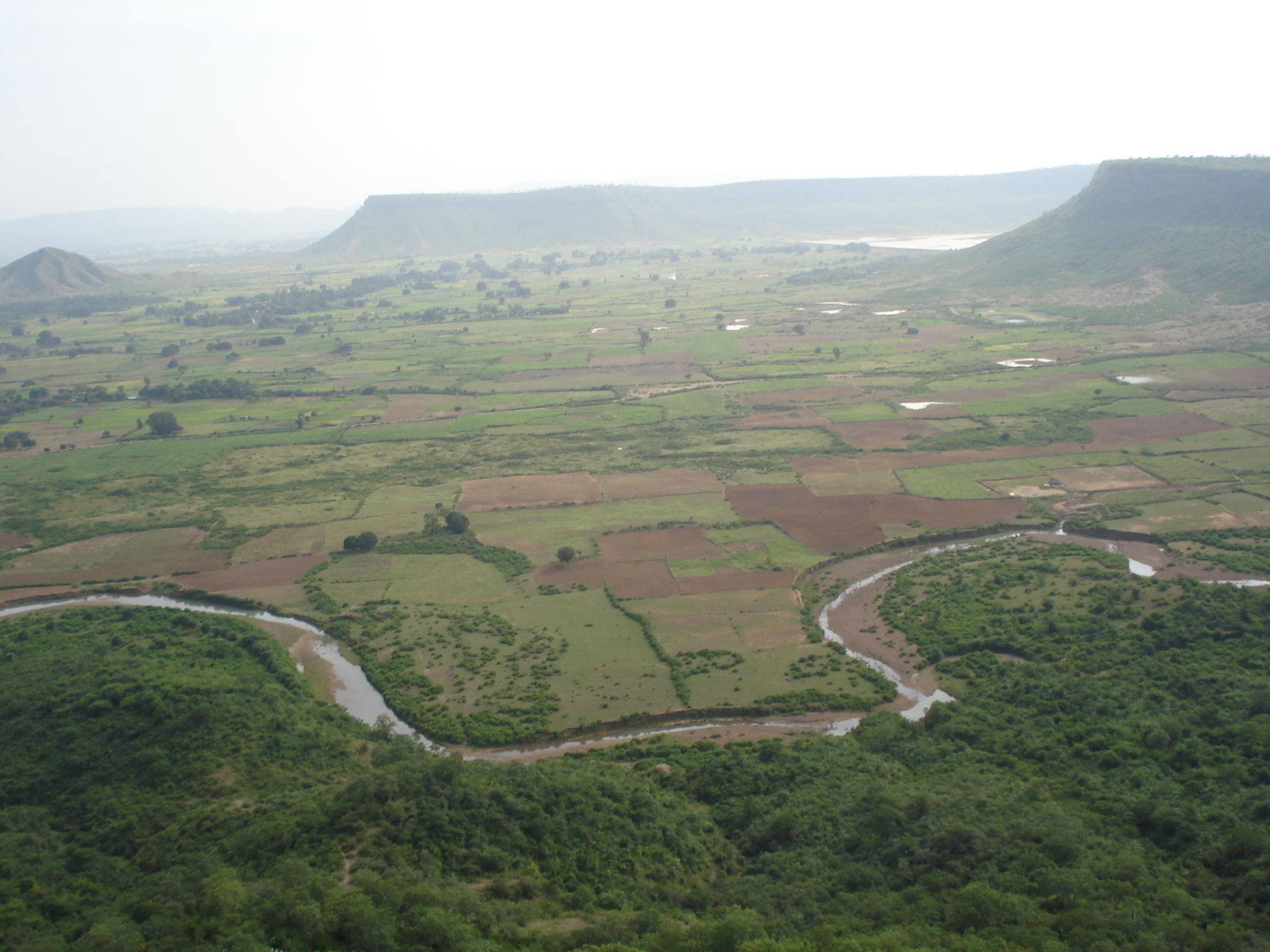
Geography
Madhya Pradesh in Hindi can be translated to Central Province, and it is located in the geographic heart of India. The state straddles the Narmada River, which runs east and west between the Vindhya and Satpura ranges; these ranges and the Narmada are the traditional boundary between the north and south of India. The state is bordered on the west by Gujarat, on the northwest by Rajasthan, on the northeast by Uttar Pradesh, on the east by Chhattisgarh, and on the south by Maharashtra.
Rivers
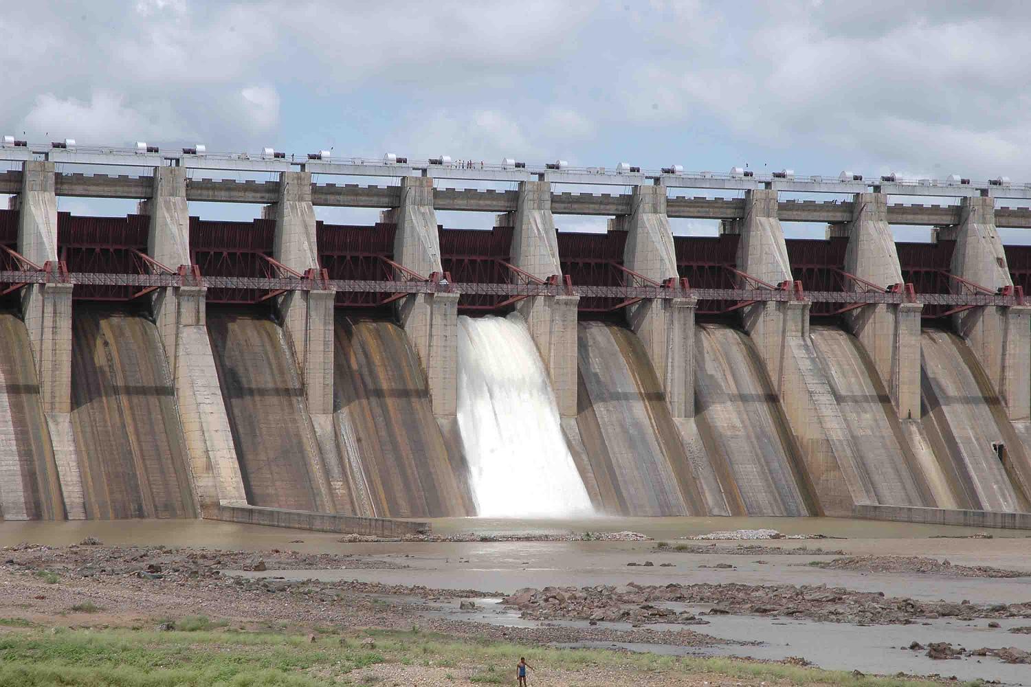
 The Bansagar Dam on Sone River
Madhya Pradesh represents great river basins and the watershed of a number of rivers. Catchments of many rivers of India lie in Madhya Pradesh. The Narmada (originating from Amarkantak) and Tapti (originating from Multai of Betul District) rivers and their basins divide the state in two, with the northern part draining largely into the Ganges basin and the southern part into the Godavari and Mahanadi systems. The Vindhyas form the southern boundary of the Ganges basin, with the western part of the Ganges basin draining into the Yamuna and the eastern part directly into the Ganges itself. All the rivers, which drain into the Ganges, flow from south to north, with the Chambal, Shipra, Kali Sindh, Parbati, Kuno, Sind, Betwa, Dhasan and Ken rivers being the main tributaries of the Yamuna. The land drained by these rivers is agriculturally rich, with the natural vegetation largely consisting of grass and dry deciduous forest types, largely thorny. The eastern part of the Ganges basin consists of the Son, the Tons and the Rihand Rivers, with the Son being the major tributary. This is also the junction point of the Satpura and the Vindhya ranges, with the Maikal Hills and Kaimur Hills being the fulcrum. The forests here are much richer than the thorn forests of the northwestern part of Madhya Pradesh. The Son is of great significance in that it is the largest tributary going into the Ganges on the south bank and arising out of the hills of Madhya Pradesh rather than from the Himalayas. This river and its tributaries contribute the bulk of the monsoon flow into the Ganges, because the north bank tributaries are all snow fed.
The major tributary of the Ganges, the Son, arises in one of the most important watersheds in India, the Maikal hills around Amarkantak. Three of the great rivers of India, Narmada, Mahanadi and Son, are given birth to by these hills. This is also one of the few ranges in the State having a north south configuration. The Mahanadi itself, together with its tributaries such as Hasdeo, Mand and Kharun flows southeast into Orissa and converts that State into a green rice bowl. The upper Mahanadi catchment contains some of the finest forests in the State, ranging from mixed deciduous to teak, bamboo and sal. Just as the Mahanadi flows east from the Maikal hills and the Son flows north, the mighty Narmada charts a westerly course from these very hills. The Narmada flows through a rift valley, with the Vindhyas marching along its northern bank and the Satpuras along the southern. Its tributaries include the Banjar, the Tawa, the Machna, the Denwa and the Sonbhardra rivers. Taken in combination with its parallel sister river, the Tapi, which also flows through a rift valley, the Narmada–Tapi systems carry and enormous volume of water and provide drainage for almost a quarter of the land area of Madhya Pradesh.
The Satpuras (Pansemal), in the Gawilgarh and Mahadeo Hills, also contain a watershed, which is south facing. The Indrawati, the Wainganga, the Wardha, the Pench, the Kanhan and Penganga rivers, discharge an enormous volume of water into the Godavari system. The Godavari is the lifeline of Andhra Pradesh, but the water which feeds it is a gift of the Central India watershed. Some of the finest sub-tropical, semi moist forests in India are to be found in the Godavari basin, mainly in the valley of the Indrawati. There are very few virgin forests left in the country, but very fine examples of these are to be found in Bastar area along the Indrawati and in the Kanger valley in Chhattisgarh.
The importance of Central India watershed was first noted by Captain Forsyth and remarked upon in his book, "The Highlands of Central India", first published in 1889. This is what he has to state in the introductory chapter to his book, "Yet in the very center of India there exists a considerable region to which the term highlands — is strictly applicable; and in which are enormous peaks and ranges, for which the term mountain would, in any other country, be used. Several of the great rivers of India have their first source in this elevated region. And pour their water into the sea on either side of the peninsula – to the north the Son commingling with the Ganges, to the east the Mahanadi, flowing independently to the Bay of Bengal, to the south some of the principal feeders of the Godavari, and to the west the Narmada and the Tapi, Basli Dam Gohad (Bhind) taking parallel courses to the Arabian Sea.
There are many important multi-state irrigation projects in development, including Godavari River Basin Irrigation Projects.
Climate
Madhya Pradesh has a subtropical climate. Like most of north India, it has a hot dry summer(April–June) followed by monsoon rains (July–September) and a cool and relatively dry winter. The average rainfall is about 1,370 mm (53.9 in). It decreases from east to west. The south-eastern districts have the heaviest rainfall, some places receiving as much as 2,150 mm (84.6 in), while the western and north-western districts receive 1,000 mm (39.4 in) or less.
Flora and fauna
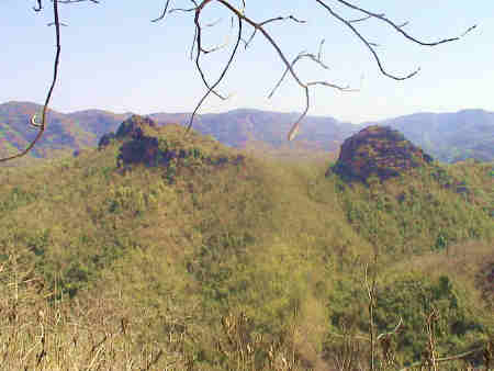
Main article: Flora and fauna of Madhya PradeshForest
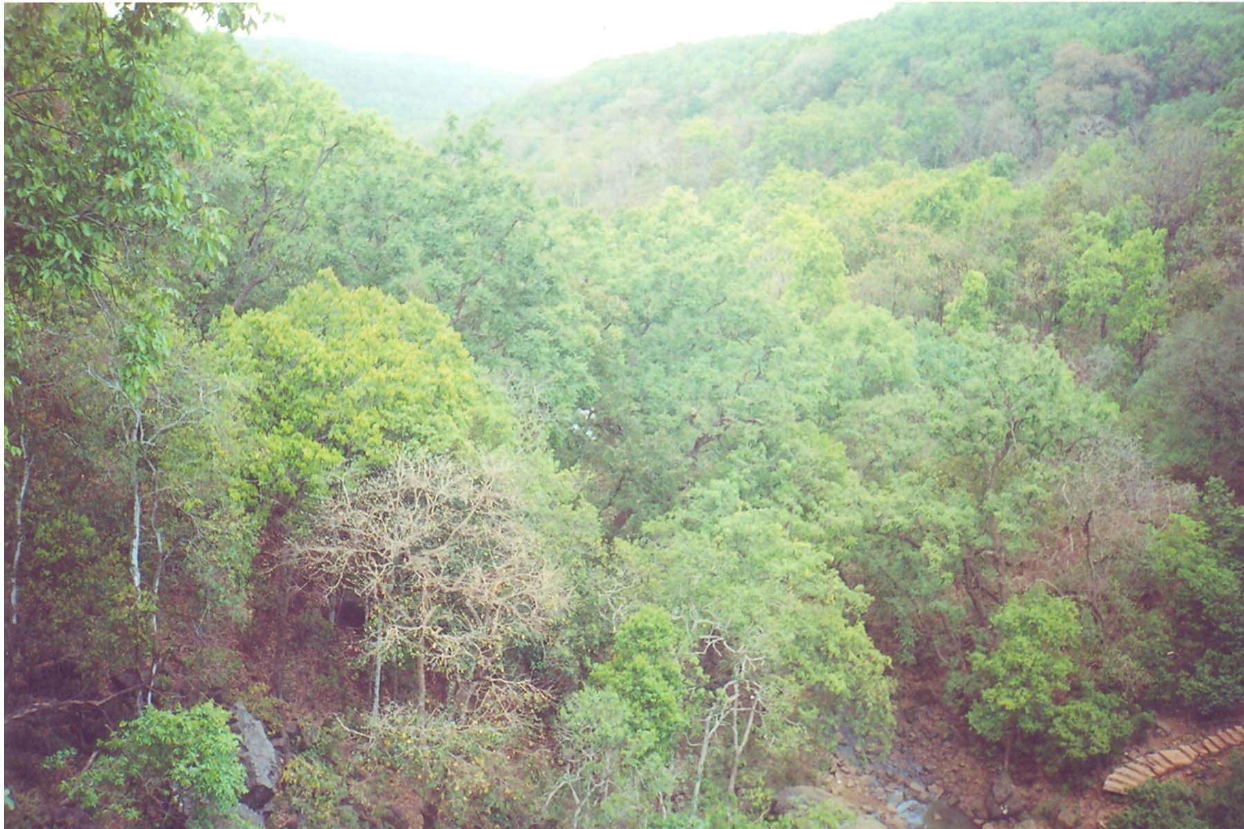
 Mixed forests at Amarkantak
Madhya Pradesh is endowed with rich and diverse forest resources. Lying between lat. 21°04'N and long. 74°02' and 82°49' E, it is a reservoir of biodiversity. The geographical area of the state is 308,144 km2 (118,975 sq mi) which constitutes 9.38% of the land area of the country. The forest area of the state is 95,221 km2 (36,765 sq mi) constituting 31% of the geographical area of the state and 12.44% of the forest area of the country. Legally this area has been classified into "Reserved Forest, Protected Forest and Unclassified Forest", which constitute 61.7%, 37.4% and 0.9% of the forest area respectively. Per capita forest area is 2,400 m2 (0.59 acre) as against the national average of 700 m2 (0.17 acre).
Central, eastern and southern parts of the state are rich, whereas northern and western parts are deficient in forest. Variability in climatic and edaphic conditions brings about significant difference in the forest types of the state. There are four important forest types viz. Tropical Moist, Tropical Dry, Tropical Thorn, Subtropical broadleaved Hill forests. The forest area can also be classified based on the composition of forest and terrain of the area. Based on composition, there are three important forest formations namely teak, sal and miscellaneous forests. Bamboo-bearing areas are widely distributed in the state. To obviate pressure on the natural forests, plantations have been undertaken in forest and non forest areas to supplement the availability of fuel wood, small timber, fodder, etc. MP lost a good amount of forest recently when Chattisgarh was carved out of it, as that region was the richest reserve of forests in MP.
The total growing stock (volume of timber wood) is 50,000,000 m3 valued worth
 2.5 lakh Crores.
National Parks
Madhya Pradesh is home to 9 National Parks, including Bandhavgarh National Park, Kanha National Park, Satpura National Park, Sanjay National Park, Madhav National Park, Van Vihar National Park, Mandla Plant Fossils National Park, Panna National Park, and Pench National Park.
There are also a number of natural preserves, including Amarkantak, Bagh Caves, Balaghat, Bori Natural Reserve, Ken Gharial, Ghatigaon, Kuno Palpur, Narwar, Chambal, Kukdeshwar, Narsinghgarh, Nora Dehi, Pachmarhi, Panpatha, Shikarganj, Patalkot and Tamia.
Biosphere Reserve
Pachmarhi Biosphere Reserve in Satpura Range and Amarkantak biosphere reserve are two of the 17 Biosphere reserves in India.
Economy
Main article: Economy of Madhya PradeshBetween 1999 and 2008, the annualized growth rate was very low 3.5%.[1] According to the India State Hunger Index compiled by the International Food Policy Research Institute, the malnutrition situation in Madhya Pradesh is "extremely alarming", receiving a severity rating between Ethiopia and Chad.[2]
Madhya Pradesh's gross state domestic product for 2004 is estimated at $32 billion in current prices. After partition, the new Madhya Pradesh state produces about 70% of the output of the old Madhya Pradesh state – the rest is produced by Chattisgarh.[citation needed] Between 1980 and 2000 the gross domestic product grew from 77,880 million rupees to 737,150 million rupees.
MFP from the forests, such as Tendu leaves used to roll bidi, Sal seed, teak seed, and lak are major contributors to the rural economy of the state.[citation needed]
Divisions
Districts
Main article: Districts of Madhya PradeshMadhya Pradesh state is made up of 50 districts, which are grouped into 10 divisions: Bhopal, Indore, Jabalpur, Gwalior, Ujjain, Rewa, Sagar, Chambal, Shahdol and Hoshangabad.
Districts: Anuppur, Alirajpur, Ashoknagar, Balaghat, Barwani, Betul, Bhind, Bhopal, Burhanpur, Chhatarpur, Chhindwara, Damoh, Datia, Dewas, Dhar, Dindori, Guna, Gwalior, Harda, Hoshangabad, Indore, Jabalpur, Jhabua, Katni, Khandwa, Khargone, Mandla, Mandsaur, Morena, Narsinghpur, Neemuch, Panna, Raisen, Rajgarh, Ratlam, Rewa, Sagar, Satna, Sehore, Seoni, Shahdol, Shajapur, Sheopur, Shivpuri, Sidhi, Singrauli, Tikamgarh, Ujjain, Umaria, Vidisha.
Agro-climatic zones
Madhya Pradesh is divided into following agro-climatic zones:
- Kaimur Plateau and Satpura Hills
- Vindhyan Plateau (Hills)
- Narmada valley
- Wainganga valley
- Gird (Gwalior) Region
- Bundelkhand Region
- Satpura Plateau (Hills)
- Malwa Plateau
- Nimar Plateau
- Jhabua Hills
The major crops of Madhya Pradesh are wheat, rice, pulses, soy beans, and mustard.[citation needed]
Major cities
rewa Bhopal,ratlam Indore, Jabalpur, Gwalior Sagar and Ujjain are considered the largest and most economically important cities of Madhya Pradesh.
Transport
Madhya Pradesh, being surrounded by land, has both Land and Air transport facilities.
Extensive rail network criss cross the state, with Jabalpur serving as headquarter for West Central Railway Zone of Indian Railways. The state has a total of 20 major railway junctions.
Buses and trains cover most of Madhya Pradesh. Extensive road network is also being developed. Madhya Pradesh leads in nation in implementing Gramin Sadak Nirman Pariyojna, a central government aided programme to provide road networks to villages. Jabalpur, Indore and Bhopal have inter-state bus terminus. More than 2000 bus are conducted in a day from these three cities.
The state has five domestic airports located at Indore, Bhopal, Jabalpur, Gwalior and Khajuraho. Air strips are located at Ujjain, Khandwa and Satna.
Demographics
 Children in Raisen district, Bhil tribe
Population Growth Census Pop. %± 1951 18,615,000 — 1961 23,218,000 24.7% 1971 30,017,000 29.3% 1981 38,169,000 27.2% 1991 48,566,000 27.2% 2001 60,348,000 24.3% 2011 72,598,000 20.3% Source:Census of India[3] Madhya Pradesh is a medley of ethnic groups and tribes, castes and communities. The population of Madhya Pradesh includes indigenous people and migrants from other states. According to census of 2000, 92% followed Hindu religion while others are Muslim (6%), Jain (0.9%), Christians (0.30%), Buddhists (0.30%), and Sikhs (0.20%).[4]. .The scheduled castes and scheduled tribes constitute a significant portion of the population of the State. The scheduled castes are 13.14% while scheduled tribes were 20.63%.[5]
Tribals in Madhya Pradesh include Baiga, Bhariya, Bhils, Gondi people, Kaul, Korku, Malto people, Mariya, and Sahariya.
Tribals
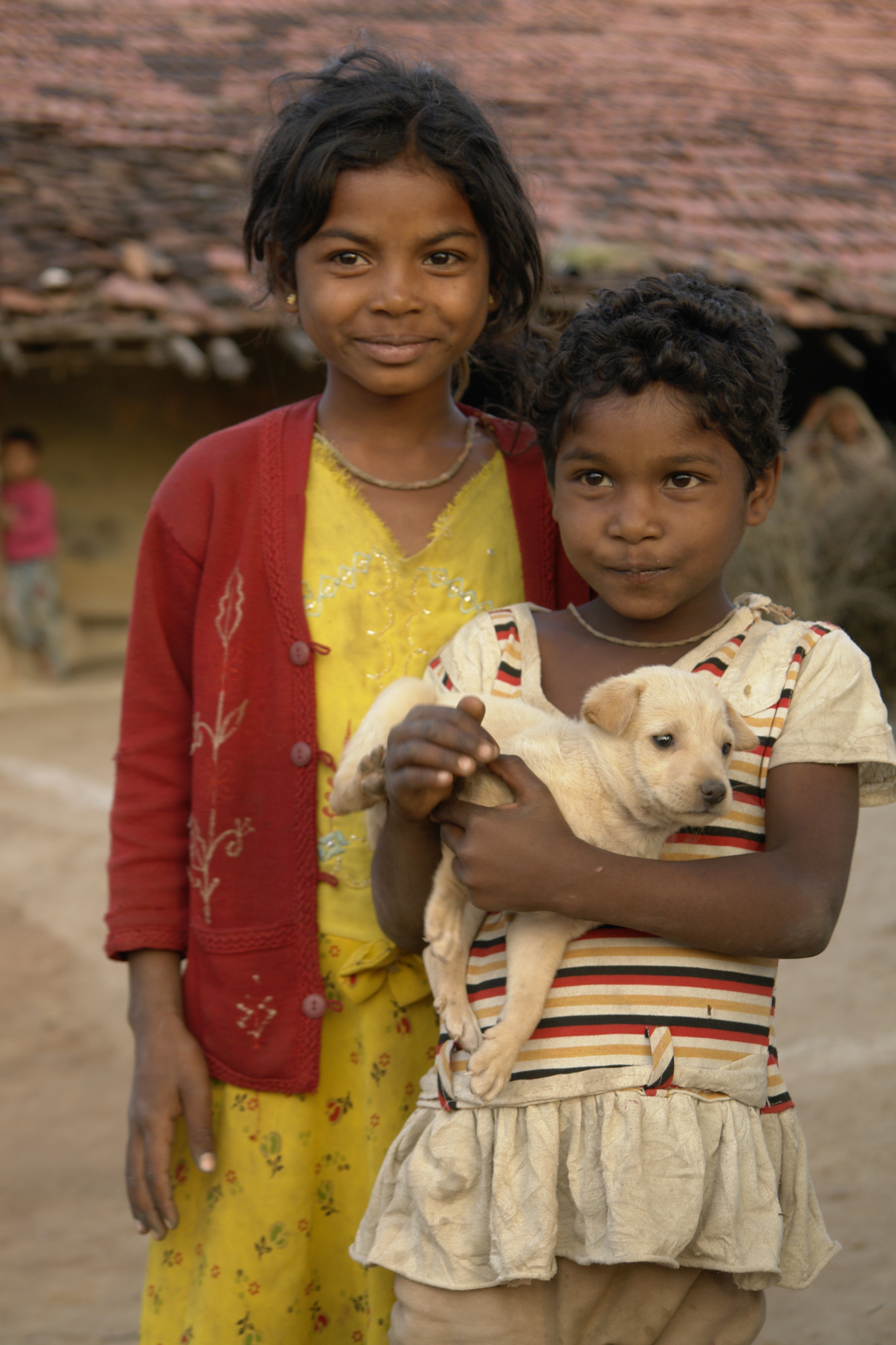
 A family from Baiga tribal, the third largest tribal in the state.Main article: Tribals in Madhya Pradesh
Madhya Pradesh has a substantial Tribal population. The differences in the tribal community, spread over in various parts of the state, is clearly seen not only on the basis of their heredity, lifestyle and cultural traditions, but also from their social, economic structure, religious beliefs and their language and speech. Due to the different linguistic, cultural and geographical environment, and its peculiar complications, the diverse tribal world of Madhya Pradesh has been largely cut-off from the mainstream of development. Veteran social activist and freedom fighter Guru Radha Kishan lived between tribals in East Nimar and learned Korku to work between them to improve the conditions of widespread poverty and exploitations by moneylenders and shrewd traders. Being aware of this primarily cultivators community and their concerns with numerous socio-economic challenges in the day-to-day life he encouraged these innocent people to earn their livelihood through agriculture or even as seasonally employed agricultural labourers so that the community can be in the mainstream of the nation..[6]
The population of Tribals in Madhya Pradesh is 122.33 lakh constituting 20.27% of the total population of Madhya Pradesh (603.85 Lakh), according to the 2001 census. There were 46 recognized Scheduled Tribes and three of them have been identified as "Special Primitive Tribal Groups" in the State.[7]
The main tribal groups in Madhya Pradesh are Gond, Bhil, Baiga, Korku, Bhadia, Halba, Kaul, Mariya, and Sahariya. Dhar, Jhabua and Mandla districts have more than 50 percent tribal population. In Khargone, Chhindwara, Seoni, Sidhi and Shahdol districts 30 to 50 percent population is of tribes. Maximum population is that of Gond tribes.
Languages
The predominant language of the region is Hindi.
In addition to standard Hindi, several regional variants are spoken, which are considered by some to be dialects of Hindi, and by others to be distinct but related languages. Among these languages are Malvi in Malwa, Nimadi in Nimar, Bundeli in Bundelkhand, and Bagheli in Bagelkhand and the southeast. Each of these languages or dialects has dialects of its own. Other languages include Telugu, Bhilodi (Bhili), Gondi, Korku, Kalto (Nahali), and Nihali (Nahali), all spoken by tribal groups. Due to rule of Marathas, Marathi is spoken by a substantial number of people.
In addition, Saraiki and Pashto are spoken by the large number of immigrants from Afghanistan and North-West Frontier Province, Pakistan.
Culture
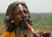 A man playing flute in Orchha, with a white tilak on his forehead, and holy saffron-coloured clothes.
Heritage and architecture
Several cities in Madhya Pradesh are extraordinary for their architecture and or scenic beauty. Three sites in Madhya Pradesh have been declared World Heritage Sites by UNESCO: the Khajuraho Group of Monuments (1986) including Devi Jagadambi temple, Buddhist Monuments at Sanchi (1989) and the Rock Shelters of Bhimbetka (2003). Other architecturally significant or scenic sites include Ajaigarh, Amarkantak, Asirgarh, Bandhavgarh, Bawangaja, Bhopal, Chanderi, Chitrakuta, Dhar, Gwalior, Indore, Burhanpur, Maheshwar, Mandleshwar, Mandu, Omkareshwar, Orchha, Pachmarhi, Shivpuri, Sonagiri, Mandla and Ujjain. MP being very large geographically, and the history being spread over several millennia, developing a comprehensive picture of heritage and architecture is a monumental task.
Music
MP is rich in both classical and Folk Music.
Classical Music
In Hindustani music, a gharānā is a system of social organization linking musicians or dancers by lineage and/or apprenticeship, and by adherence to a particular musical style. A gharana also indicates a comprehensive musicological ideology. This ideology sometimes changes substantially from one gharana to another. It directly affects the thinking, teaching, performance and appreciation of music. Madhya Pradesh has a prominent role in classical music.
Gwalior gharana
The Gwalior Gharana is one of the oldest Khayal Gharanas and one to which most classical Indian musicians can trace the origin of their style. The rise of the Gwalior Gharana started with the reign of the great Mughal emperor Akbar (1542–1605). The favorite singers of this patron of the arts, such as Miyan Tansen, first amongst the vocalists at the court, came from the town of Gwalior. Gwalior has an important role in the journey of music in India, so that every year Tansen Festival is celebrated at the tomb of Tansen in Gwalior.
Dhrupad
Dhrupad (Hindi: ध्रुपद) is a vocal genre in Hindustani classical music, said to be the oldest still in use in that musical tradition.Its name is derived from the words "dhruva" (fixed) and "pada" (words). The term may denote both the verse form of the poetry and the style in which it is sung. Raja Man Singh Tomar The king of Gwalior [during 1486 A.D.-1516 A.D.]was parton of Dhrupad.
Folk Music
Madhya Pradesh(MP) is also rich in Folk music(Lok gayan). In MP some style of folk singing are still alive which are- Faga, Bhartahari, Sanja geet , Bhopa , kal belia, Bhat/bhand/charan, vasdeva, videsia, Kalgi turra, Nirgunia, Alha , Pandwani gayan , Garba Garbi Govalan,
Dance
Main folk dances of MP are Badhai, Rai, Saira, Jawara, Sher, Akhara, Shaitan, baredi , karma, kathi, Sua, Saila, Mauni, Dhimrai, kanara, Bhagoria, Dashera, dadariya, Duldul Ghodi, Lehgi ghodi, Fefriya, Mandlya, danda, Ada-khada, dadel, Matki, birha, Ahirai, pardhauni, Vilma, Dadar, kalsa.
Education

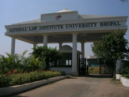
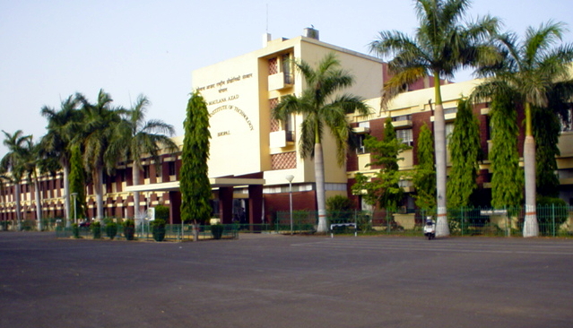
According to the 2001 census, Madhya Pradesh had a literacy rate of 63.74%. The state is home to some of the premier educational and research institutions of India such as the Indian Institute of Technology Indore, Indian Institute of Information Technology and Management, Gwalior, school of planning and architecture, Bhopal, Indian Institute of Management Indore, Indian Institute of Forest Management,, National Law Institute University Bhopal, Maulana Azad National Institute of Technology Bhopal, Madhav Institute of Technology and Science, Gwalior, Indian Institute of Soil Science, Indian Institute of Hotel Management Bhopal, Lakshmibai National Institute of Physical Education (LNIPE) Gwalior, Shri Govindram Seksaria Institute of Technology and Science Indore, Lakshmibai National University of Physical Education (Deemed University),Gwalior, Makhanlal Chaturvedi National University of Journalism & Communication, Bhopal. Madhya Pradesh also has a University of music, Raja Mansingh Tomar Sangeet Vishvavidyalaya, Gwalior. Madhya Pradesh has the second oldest engineering college in India the JEC (Jabalpur Engineering College) and one of the oldest medical colleges in India Netaji Subhash Chandra Bose Medical College, Shri Govindram Seksaria College, Jabalpur. Jabalpur being a British established city has got a number of mission colleges, engineering colleges and schools.
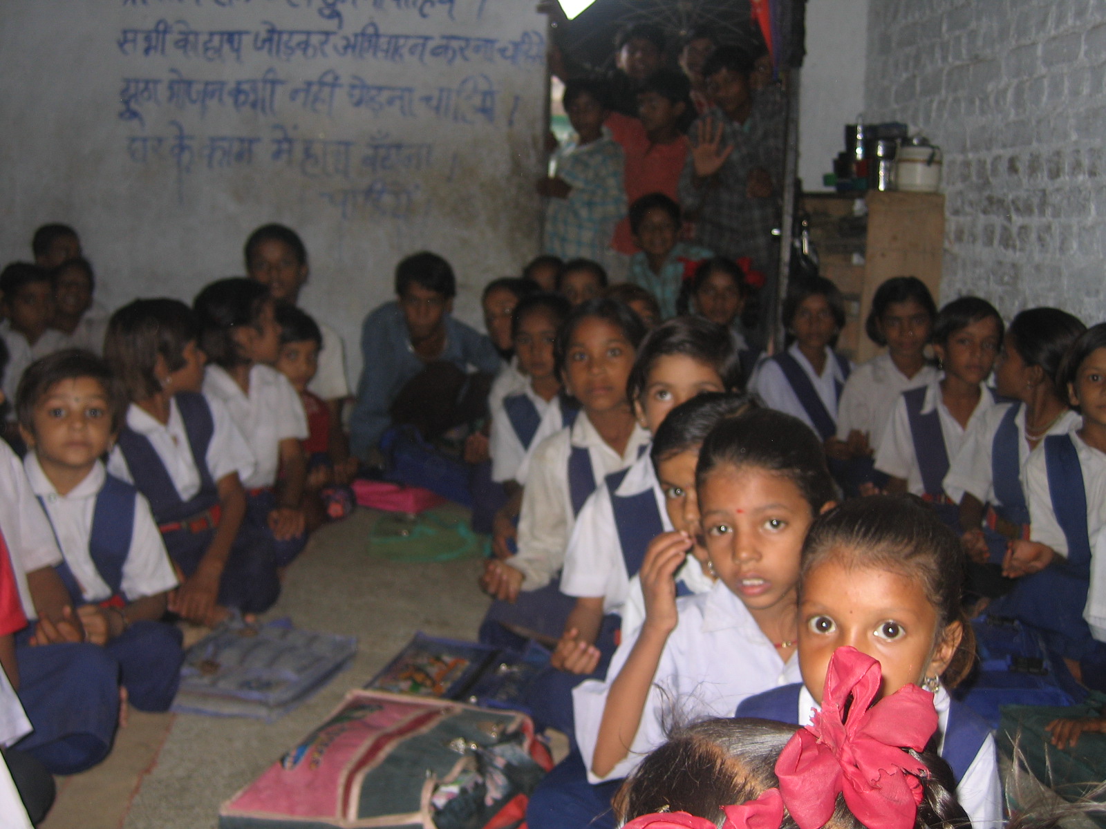
 School children at a primary school in a village in Madhya Pradesh.
There are 500 degree colleges affiliated with one of the universities in the state, viz. Jawaharlal Nehru Agriculture University, Madhya Pradesh Veterinary Sciences University, Madhya Pradesh Medical University, Rajiv Gandhi Technical University, Barkatullah University, Devi Ahilya University, Rani Durgavati University, Vikram University, Jiwaji University Gwalior etc.
The Indian Institute of Management Indore is a state-funded management institute in Indore. Instituted in 1998, IIM Indore is the sixth addition to the prestigious IIM family. Known as "Prabandh Shikhar" or "Peak of Management", the scenic 193 acre (781,000 m²) campus is located atop a small hill on the outskirts of Indore. It is about 20 kilometres from the Railway station and almost 25 Kilometres from the airport. It is among the top ten B-schools of India.
The Mahatma Gandhi Chitrakoot Gramoday VishwavidyalayaThe University receives inspiration for rural development in consonance with the vision of Mahatma Gandhi. The University is mandated to evolve, promote and impart higher education so as to take up emerging challenges for transformation of rural areas. It undertakes academic, research, extension and training programmes for the empowerment of the people with a view to ensure free flow of knowledge, techniques and technologies as a two–way process for betterment of rural life. It provides training facilities to personnel engaged in rural development in collaboration with the state government. The University provides consultancy in all aspects of rural development. The University undertakes monitoring and evaluation of national and state-level development programmes, shares ideas and experiences in rural development work.
The Indian Institute of Forest Management (IIFM) (founded 1982) is an autonomous institution located at Bhopal in Madhya Pradesh, established by the Ministry of Environment and Forests, Government of India with financial assistance from the Swedish International Development Cooperation Agency (SIDA) and course assistance from the Indian Institute of Management Ahmedabad. It is the only Forest Management Institute in India.
The Indian Institute of Science Education and Research, Bhopal (IISERB) is an autonomous institute of higher education for research and education in science established by the federal Ministry of Human Resource Development in 2008. Professor Vinod K Singh is the founder Director of IISER Bhopal.
The Jaypee University of Engineering and Technology, Guna, one of the premier Indian Engineering University is acting as a center of excellence for higher education in field of technology. It is well known for its academics, infrastructure and placements all over India.
Defence Research and Development Establishment, Gwalior (DRDE) is an Indian defense laboratory of the Defence Research and Development Organisation. Located in Gwalior, it is primarily involved in the research and development of detection and protection against toxic chemical and biological agents.
The Indian Institute of Technology, Indore, established in 2009, is part of this mega-project that envisages India as a Global Technology Leader.
Media
Nava Bharat, Raj Express, BPN Times, Nai Duniya, Patrika, Rajsthan Patrika, Dainik Bhaskar, Dainik Jagran and Mahakaushal Samay Chakra are the leading Hindi Newspapers. It is first ever news paper exclusively for Youth of MP, Akbar Times are prominent Hindi newspapers. Various other local newspapers are also published in various cities. In English, Times of India, Hindustan Times, Central Chronicle and Free Press have editions from Bhopal. Urdu journals is common in Bhopal. Nadeem, the oldest Urdu newspaper of the state, is published from Bhopal. Urdu Action and Haq-o-Insaf are also published. Farz, a Sindhi daily is published from Bhopal is the only Sindhi newspaper in State.
The Madhya Pradesh government has gone live with its MP Online portal having urban planner Ashish kumar Chauhan SPA-Bhopal, a joint venture with Tata Consultancy Services. The State has tied up with Bajaj Allianz, Tata Aig and LIC, to enable their customers to payinsurance premiums online. Citizens can also recharge their mobile prepaid accounts online for Airtel, Tata Docomo, Tata Indicom and BSNL Phones. They can also book private tours of state national parks like Kanha and Bandavgarh online. Victims of Bhopal gas tragedy can apply for free medical facilities, state incentives online.[8]
Sports
Cricket is commonly played game. Soccer, basketball, volleyball, cycling, swimming, tracking, badminton, table tennis, lawn tennis are common games. There are two International cricket stadiums in state - Capt Roop singh Stadium, Gwalior and Usha Raje stadium, Indore.
Also some traditional games are played in rural areas:
- Kho kho
- Gulli Danda
- Pittu
MP government has declared Malkhambh is the state game of M.P in 2008.
Various awards in MP to honour the sportspersons are:
- Vikram Award
- Vishwamitra Award
- Eklavya Award
See also
- Flora of Madhya Pradesh
- Flora and fauna of Madhya Pradesh
References
- ^ A special report on India: Ruled by Lakshmi 11 Dec 2008 from The Economist print edition
- ^ "Hunger in India states 'alarming'". BBC. 14 October 2008. http://news.bbc.co.uk/2/hi/south_asia/7669152.stm. Retrieved 12 May 2010.
- ^ "Census Population" (PDF). Census of India. Ministry of Finance India. http://indiabudget.nic.in/es2006-07/chapt2007/tab97.pdf. Retrieved 18 December 2008.
- ^ 2001 Indian Census Data
- ^ Encyclopedia of India and her States, V.Grover and R. Arora(Eds), Vol 6, D&D Publishers, New Delhi, 1996.
- ^ Scheduled Castes & Scheduled Tribe Welfare Department, Government of Madhya Pradesh
- ^ Scheduled Castes & Scheduled Tribe Welfare Department, Government of Madhya Pradesh
- ^ Harsimran Julka (Jun 30, 2010). "All government services to be at your mouse-tip soon". The Times Of India. http://economictimes.indiatimes.com/articleshow/6109024.cms.
Further reading
- Gyanendra Singh. Farm Mechanization in Madhya Pradesh. Bhopal: Central Institute of Agricultural Engineering, 2000.
- Madhya Pradesh (India). The Madhya Pradesh Human Development Report 2002: Using the Power of Democracy for Development. [Bhopal: Govt. of Madhya Pradesh, 2002].
- Guru Radha Kishan Swatantrata Sangraam Senani from Madhya Pradesh: Archives Nehru Memorial Museum and Library, New Delhi.
- Rag, Pankaj. Vintage, Madhya Pradesh: A Collection of Old Photographs. Bhopal: Madhya Pradesh Madhyam jointly with the Directorate of Archaeology, Archives, and Museums, 2005. ISBN 81-902702-7-3
- Parmar, Shyam. Folk Tales of Madhya Pradesh. Folk tales of India series, 12". New Delhi: Sterling Publishers, 1973.
- Rag, Pankaj, and O. P. Misra. Masterpieces of Madhya Pradesh. Bhopal: Directorate of Archaeology, Archives & Museums, Government of Madhya Pradesh, 2005.
- Sampath, M. D., H. V. Trivedi, and Mandan Trivedi. Epigraphs of Madhya Pradesh. New Delhi: Archaeological Survey of India, 2001.
- Sati, Vishwambhar Prasad. Madhya Pradesh, a Geo-Economic Appraisal. Delhi: Abhijeet, 2004. ISBN 81-88683-43-4
- Shah, Shampa, and Aashi Manohar. Tribal Arts and Crafts of Madhya Pradesh. Living traditions of India. Ahmedabad: Mapin Pub./in Association with Vanya Prakashan, Bhopal, 1996. ISBN 0-944142-71-0
- Shrivastava, Divya. The Development of Scheduled Tribes in Madhya Pradesh. New Delhi: Gyan Pub. House, 2000. ISBN 81-212-0698-7
- Singh, R. V. Dairy Co-Operatives and Development: A Study of Tribal Dairy Co-Operatives in Madhya Pradesh. Delhi: Kalpaz Publications, 2006. ISBN 81-7835-331-8
- Chishti, R̥ta Kapur, Martand Singh, and Amba Sanyal. Saris of India: Madhya Pradesh. New Delhi: Wiley Eastern & Amr Vastra Kosh, 1989. ISBN 81-224-0187-2
External links

Rajasthan Uttar Pradesh Gujarat 
Chhattisgarh  Madhya Pradesh

Maharashtra Maharashtra Chhattisgarh Divisions Districts Bhopal · Raisen · Rajgarh · Sehore · Vidisha · Ashoknagar · Shivpuri · Datia · Guna · Gwalior · Morena · Sheopur · Bhind · Alirajpur · Barwani · Burhanpur · Dhar · Indore · Jhabua · Khandwa · Balaghat · Chhindwara · Jabalpur · Katni · Mandla · Narsinghpur · Seoni · Betul · Hoshangabad · Harda · Rewa · Satna · Sidhi · Singrauli · Chhatarpur · Damoh · Panna · Sagar · Tikamgarh · Dindori · Anuppur · Shahdol · Umaria · Dewas · Mandsaur · Neemuch · Ratlam · Shajapur · UjjainMajor cities States and territories of India States 
Union Territories Categories:- Madhya Pradesh
- States and territories established in 1956
- States and territories of India


Wikimedia Foundation. 2010.