- Oymyakon
-
Oymyakon (English)
Оймякон (Russian)
Өймөкөөн (Sakha)- Inhabited locality - 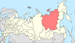
Location of the Sakha (Yakutia) Republic in Russia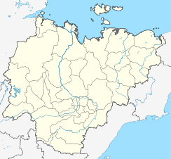
 Location of Oymyakon in the Sakha (Yakutia) Republic
Coordinates: 63°27′39″N 142°47′09″E / 63.46083°N 142.78583°ECoordinates: 63°27′39″N 142°47′09″E / 63.46083°N 142.78583°E Administrative status Country Russia Federal subject Sakha Republic Municipal status Municipal district Oymyakonsky Ulus[citation needed] Statistics Population (2001 est.) 521 inhabitants[citation needed] Time zone VLAST (UTC+11:00)[1] Postal code(s) 678752[citation needed] Dialing code(s) +7 41154[citation needed] Oymyakon (Russian: Оймяко́н, Sakha: Өймөкөөн, Öymököön) is a village (selo) in Oymyakonsky Ulus of the Sakha Republic, Russia, located along the Indigirka River, 30 kilometres (20 mi) northwest of Tomtor on the Kolyma Highway.
Contents
Geography
Oymyakon is located to the east of Yakutia, the population of the village is 521 people. Oymyakon is located at high latitudes and the length of the day varies from 3 hours in December to 21 hours in the summer. The village is at an altitude of approximately 750 m above sea level.
Climate
With an extreme subarctic climate (Köppen climate classification Dfd), Oymyakon is known as one of the candidates for the Northern Pole of Cold, the other being the town of Verkhoyansk. In 1924, a Russian scientist (Sergey Obrychev) registered the lowest temperature −71.2 °C (−96 °F). On February 6, 1933, a temperature of −69.2 °C (−93 °F) was recorded at Oymyakon's weather station.[2] This is the lowest recorded temperature for any permanently inhabited location on Earth. It is also the lowest temperature recorded in the Northern hemisphere.[2] Only Antarctica has recorded lower official temperatures with the lowest being −89.2 °C (−129 °F) near the Russian station of Vostok. But on July 28, 2010 in Oymyakon recorded a highest temperature ever of 34.6 °C (94 °F)[3]. The actual weather station is in a valley between Oymyakon and Tomtor. The station is at 750 metres (2,460 ft) and the surrounding mountains at 1,100 metres (3,610 ft), causing cold air to pool in the valley: in fact, recent studies show that winter temperatures increase with altitude by as much as 10°C (18°F)[4].
Its name in the Sakha language means "non-freezing water"; due to the presence of a natural hot spring nearby[citation needed]. The ground there is permanently frozen (continuous permafrost).
Climate data for Oymyakon Month Jan Feb Mar Apr May Jun Jul Aug Sep Oct Nov Dec Year Record high °C (°F) −16.6
(2.1)−16.2
(2.8)2.0
(35.6)11.7
(53.1)26.2
(79.2)31.1
(88.0)34.6
(94.3)31.4
(88.5)23.7
(74.7)11.0
(51.8)−2.1
(28.2)−6.5
(20.3)34.6
(94.3)Average high °C (°F) −42
(−44)−35.4
(−31.7)−21.8
(−7.2)−3.9
(25.0)8.8
(47.8)19.7
(67.5)22.3
(72.1)18.2
(64.8)8.6
(47.5)−9.6
(14.7)−32.3
(−26.1)−42.2
(−44.0)−8.5 Daily mean °C (°F) −46
(−51)−42
(−44)−32.5
(−26.5)−14
(7)2.4
(36.3)12.2
(54.0)14.4
(57.9)10.2
(50.4)1.8
(35.2)−15.4
(4.3)−36.7
(−34.1)−45.5
(−49.9)−16 Average low °C (°F) −49.8
(−57.6)−47.4
(−53.3)−41.2
(−42.2)−24.3
(−11.7)−5.1
(22.8)3.4
(38.1)5.6
(42.1)2.0
(35.6)−4.5
(23.9)−21.1
(−6.0)−41.1
(−42.0)−49
(−56)−22.7 Record low °C (°F) −65.4
(−85.7)−69.2
(−92.6)−60.6
(−77.1)−46.4
(−51.5)−28.9
(−20.0)−9.7
(14.5)−9.3
(15.3)−17.1
(1.2)−25.3
(−13.5)−47.6
(−53.7)−58.5
(−73.3)−62.8
(−81.0)−69.2
(−92.6)Precipitation mm (inches) 8
(0.31)7
(0.28)5
(0.2)5
(0.2)12
(0.47)34
(1.34)48
(1.89)38
(1.5)22
(0.87)16
(0.63)12
(0.47)8
(0.31)215
(8.46)Avg. precipitation days (≥ 0.1 mm) 12 10 8 5 12 12 12 12 10 11 15 12 131 Sunshine hours 27.9 115.8 223.2 267.0 260.4 267.0 272.8 213.9 141.0 74.4 42.0 3.1 1,908.5 Source no. 1: Погода и Климат[5] Source no. 2: Climate & Temperature (precipitation days and sunshine hours)[6] In the media
Oymyakon has also been featured in at least four television series:
- The episode "The Winter's Tale" of the 1996 PBS weather documentary series Savage Skies.
- Oxford geographer Nick Middleton's television series and accompanying book Going to Extremes, in which he discusses his visit to this village and describes ways in which inhabitants cope with the extreme cold. Middleton describes how Oymyakon lies between two mountain ranges, trapping cold air in between throughout the entire year.[7] In the winter, once every two days, the village's cattle's herd bull was harnessed between the shafts of a sledge with a big water tank on it and led to the spring. The men broke the ice on the spring, let the bull drink its fill, filled the water tank from the spring, and let the bull pull the tanker sledge back into the warm.
- Cameraman Geoff Mackley along with Rachael Wilson and Mark Whetu from New Zealand, made an episode for Discovery Channel series Dangerman. They were accompanied by translator Rob Walker (USA) and Vyacheslav Ipatiev (TourServiceCenter). Geoff rode the water bull to the spring, and spent a night outside in a tent.[8][9]
- The episode "Hot and Cold" in the 2010 BBC series Extreme World features the village.[10]
See also
- Verkhoyansk; the other candidate for the title of "Northern Pole of Cold"
References
- ^ Правительство Российской Федерации. Постановление №725 от 31 августа 2011 г. «О составе территорий, образующих каждую часовую зону, и порядке исчисления времени в часовых зонах, а также о признании утратившими силу отдельных Постановлений Правительства Российской Федерации». Вступил в силу по истечении 7 дней после дня официального опубликования. Опубликован: "Российская Газета", №197, 6 сентября 2011 г. (Government of the Russian Federation. Resolution #725 of August 31, 2011 On the Composition of the Territories Included into Each Time Zone and on the Procedures of Timekeeping in the Time Zones, as Well as on Abrogation of Several Resolutions of the Government of the Russian Federation. Effective as of after 7 days following the day of the official publication).
- ^ a b "Northern Hemisphere: Lowest Temperature". WMO. http://wmo.asu.edu/northern-hemisphere-lowest-temperature. Retrieved 2010-06-19.
- ^ Погода и Климат (раздел Климатический монитор)
- ^ See Response of glaciers in the Suntar-Khayata Range, eastern Siberia
- ^ —Погода и Климат. Retrieved 06 April 2010.
- ^ Oymyakon Climate Guide to the Average Weather & Temperatures with Graphs Elucidating Sunshine and Rainfall Data & Information about Wind Speeds & Humidity. Retrieved 5 November 2011
- ^ [1]
- ^ Travel notes, RamboCam, retrieved February 2010.
- ^ Cold Pole of North, Yakutia Travel, retrieved February 2010.
- ^ http://www.bbc.co.uk/news/world-11840494
External links
- Oymyakon 1996/97 Expedition
- 2008/09 Expedition
- City map Oymyakon
- Video report from SkyNews
- Life in Oymyakon. AskYakutia.com
Further reading
- Middleton, Nick Going to Extremes: Mud, Sweat and Frozen Tears.
- Channel 4 books, 2001, hardcover, ISBN 0-7522-2016-0
- Pan Books - Macmillan UK, 2003, paperback, ISBN 0-330-49384-1.
Categories:- Rural localities in the Sakha Republic


Wikimedia Foundation. 2010.