- Olympos, Karpathos
-
Olympos
Όλυμπος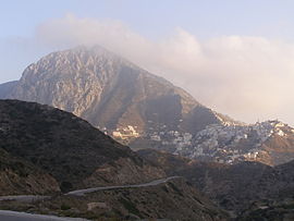
Location 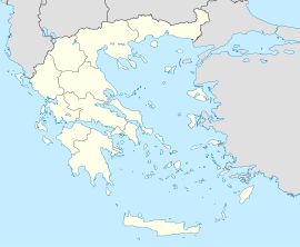
 Olympos
Coordinates 35°44′N 27°11′E / 35.733°N 27.183°ECoordinates: 35°44′N 27°11′E / 35.733°N 27.183°E Location within the Dodecanese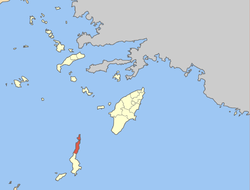
Government Country: Greece Region: South Aegean Regional unit: Karpathos Municipality: Karpathos Population statistics (as of 2001) Municipal unit - Population: 761 - Area: 104.9 km2 (41 sq mi) - Density: 7 /km2 (19 /sq mi) Other Time zone: EET/EEST (UTC+2/3) Olympos (Greek: Όλυμπος) is a village and a former community on the island of Karpathos, in the Dodecanese, Greece. Since the 2011 local government reform it is part of the municipality Karpathos, of which it is a municipal unit.[1] It is located in the northern part of the island. Population 761 (2001). The municipal unit includes Saria Island and the uninhabited islets of Astakída, Atsakidópoúlo, Divoúnia, and Chamilí. The total land area of the community is 104.876 km².
Olympos is also the place of origin of Yannis Philippakis, the frontman of the British band the Foals.
External links
References
- ^ Kallikratis law Greece Ministry of Interior (Greek)
Municipal unit of Karpathos Municipal unit of Olympos OlymposCategories:- Populated places in Karpathos (peripheral unit)
- South Aegean geography stubs


Wikimedia Foundation. 2010.