- Condé-sur-Noireau
-
Condé-sur-Noireau


 Condé-sur-NoireauLocation within Lower Normandy region
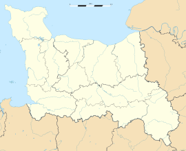 Condé-sur-Noireau
Administration Country France Region Lower Normandy Department Calvados Arrondissement Vire Canton Condé-sur-Noireau Intercommunality Condé Mayor Pascal Allizard
(2008–2014)Statistics Elevation 72–173 m (236–568 ft)
(avg. 84 m/276 ft)Land area1 12.53 km2 (4.84 sq mi) Population2 5,611 (2008) - Density 448 /km2 (1,160 /sq mi) INSEE/Postal code 14174/ 14110 1 French Land Register data, which excludes lakes, ponds, glaciers > 1 km² (0.386 sq mi or 247 acres) and river estuaries. 2 Population without double counting: residents of multiple communes (e.g., students and military personnel) only counted once. Coordinates: 48°51′05″N 0°32′56″W / 48.8513888889°N 0.548888888889°W
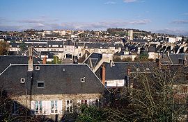
Condé-sur-Noireau is a commune in the Calvados department in the Basse-Normandie region in northwestern France.
It is situated on the Noireau River. In the fifteenth century, the town was occupied by the English, and belonged to Sir John Fastolf of Caister Castle in Norfolk (1380-1459). It was from here that the Spanish mercenary Francois de Surienne launched an attack on Fougeres in Brittany, which triggered the invasion of English Normandy by Charles VII of France, and the end of the Hundred Years' War.
Contents
Population
Historical population of Condé-sur-Noireau 1793 1800 1806 1821 1831 1836 1841 1846 1851 1856 4327 3700 3925 5436 5562 6449 5976 6355 6368 6969 1861 1866 1872 1876 1881 1886 1891 1896 1901 1906 7234 6643 6871 7350 7279 7252 6764 6663 6591 6247 1911 1921 1926 1931 1936 1946 1954 1962 1968 1975 5604 5357 4937 4852 4800 3358 4277 6231 6568 7287 1982 1990 1999 2008 7098 6309 5820 5611 Twin towns
- Ross-on-Wye, UK since 1978.
- Poggio Rusco,Italy since 2000.
See also
- Condé sur Ifs
- Condé sur Seulles
- Communes of the Calvados department
References
- Stephen Cooper, The Real Falstaff, Sir John Fastolf and the Hundred Years War, (Pen & Sword, 2010)
Categories:- Communes of Calvados
- Calvados geography stubs


Wikimedia Foundation. 2010.