- Cresserons
-
Cresserons


 CresseronsLocation within Lower Normandy region
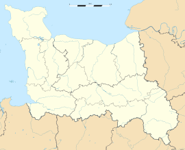 Cresserons
Administration Country France Region Lower Normandy Department Calvados Arrondissement Caen Canton Douvres-la-Délivrande Intercommunality Cœur de Nacre Mayor Patrick Lhermine
(2008–2014)Statistics Elevation 17–59 m (56–194 ft)
(avg. 30 m/98 ft)Land area1 3.59 km2 (1.39 sq mi) Population2 1,231 (2008) - Density 343 /km2 (890 /sq mi) INSEE/Postal code 14197/ 14440 1 French Land Register data, which excludes lakes, ponds, glaciers > 1 km² (0.386 sq mi or 247 acres) and river estuaries. 2 Population without double counting: residents of multiple communes (e.g., students and military personnel) only counted once. Coordinates: 49°17′19″N 0°21′12″W / 49.2886111111°N 0.353333333333°W
Cresserons is a commune in the Calvados department in the Basse-Normandie region in northwestern France.
Cresserons is located just south of the beaches of Normandy. During the Battle of Normandy in World War II, British troops arrived there and a battle was fought on 7 June 1944.
Population
Historical population of Cresserons 1793 1800 1806 1821 1831 1836 1841 1846 1851 1856 578 428 614 630 641 655 605 617 624 641 1861 1866 1872 1876 1881 1886 1891 1896 1901 1906 628 601 566 531 503 500 482 450 450 470 1911 1921 1926 1931 1936 1946 1954 1962 1968 1975 420 357 347 310 365 373 420 405 393 435 1982 1990 1999 2008 785 953 1202 1231 See also
References
Categories:- Communes of Calvados
- Calvados geography stubs


Wikimedia Foundation. 2010.