- Westchester County, New York
-
"Westchester County" redirects here. For the eponymous ship, see USS Westchester County (LST-1167).
Westchester County, New York 
Flag
Logo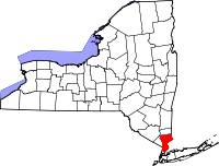
Location in the state of New York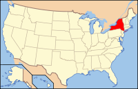
New York's location in the U.S.Founded 1683 Seat White Plains Largest city Yonkers Area
- Total
- Land
- Water
500 sq mi (1,295 km²)
433 sq mi (1,121 km²)
67 sq mi (174 km²), 13.45%Population
- (2010)
- Density
949,113
2,193/sq mi (846.6/km²)Congressional districts 17th, 18th, 19th Website www.westchestergov.com Westchester County is a county located in the U.S. state of New York. Westchester covers an area of 450 square miles (1,200 km2) and has a population of 949,113 according to the 2010 Census, residing in 45 municipalities. It was named after the city of Chester in England, and the county seat is White Plains.
The county's location puts New York City and Long Island Sound to its south, Putnam County on the north, Connecticut on the east, Rockland County on the west. Westchester became the first large scale suburban area in the world to develop. Its significance as a suburb derived mostly from the upper-middle class development of entire communities in the late 19th century, and the rapid population growth that occurred as a result.[1]
According to 2006 HUD data, the median income for a household of one person in the county was $75,427 and the median income for a family of four was $96,500.[2][3] Westchester County ranks number two (number one being New York County) for wealthiest counties in New York State and the seventh wealthiest county nationally. Westchester County has long been associated with "old money" and some of the country's wealthiest families for generations, along with other places such as Greenwich, Connecticut, and Long Island's Gold Coast and Five Towns.
History
Original inhabitants
At the time of European contact in the 16th and 17th centuries, the Native American inhabitants of what would become Westchester County were part of one of the Algonquian peoples whose name for themselves was Lenape ("the people"). The region inhabited by the Lenape—called by them Lenapehoking—consisted of the area around and between the Delaware and lower to middle Hudson Rivers. Throughout the region were spoken two related languages (part of the Algonquian language family and related to Mahican) collectively known as the Delaware languages: Unami and Munsee. Munsee was spoken by the inhabitants of what is today known as Westchester County as well as those from Manhattan island. Some ethnographers of the past, lacking valid contemporary sources, simply referred to the various tribes of the area as Munsee speakers, or, even more generally, as Lenni Lenape (the "true people").
Fortunately title deeds given to European settlers have turned out to be able to supply considerable information about the sub-tribes in the region and their locations. The "Manhattans" occupied the island upon which New York City was built, as well as land in southern Westchester now covered by the city of Yonkers. The Weckquaesgeek occupied land along the Hudson River and the central portion of the county where the modern settlements of Dobbs Ferry, Tarrytown and White Plains can be found. The Siwanoy lived along the coast of Long Island Sound where Pelham, New Rochelle, Larchmont, Mamaroneck and Rye now stand. The northern portions of the county were occupied by smaller tribes such as the Tankiteke, Kitchawank and Saint Sik. In the Lenape worldview, however, since they all spoke more or less the same mother tongue, they all were the very opposite of "foreigners" to each other (although that did not prevent in-fighting any more than it does among other related but competitive tribes such as the Scandinavians or the various speakers of Romance languages).
Colonial Westchester
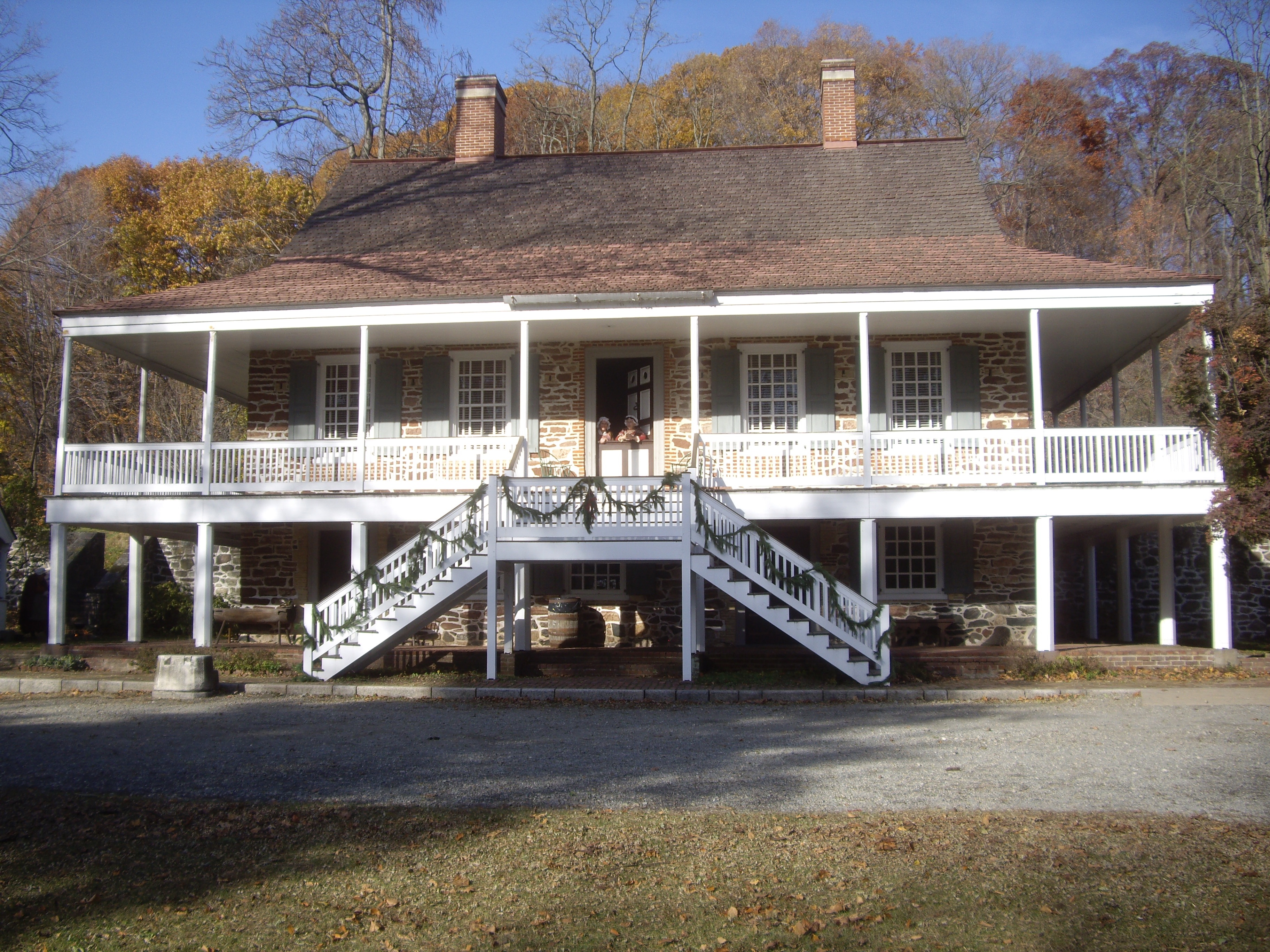
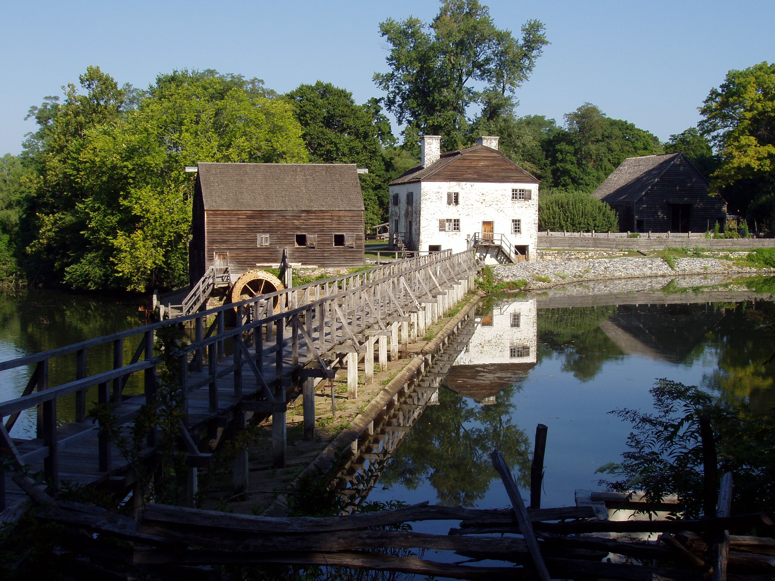
 Philipsburg Manor House
The first Europeans to explore Westchester were Giovanni da Verrazzano in 1524 and Henry Hudson in 1609. The first European settlers were sponsored by the Dutch West India Company in the 1620s and 1630s. English settlers arrived from New England in the 1640s.By 1664, the Dutch lost control of the County to the English and large tracts of Westchester land were established as manors or patents. Manors were held by a single proprietor, while patents were held by groups of associates. The lords of the manors and patents leased land to tenant farmers and provided many essential services to the tenants. Westchester County was an original county of the Province of New York, one of twelve created by an act of the New York General Assembly in 1683. At the time, it also included the present Bronx County, which constituted the original Town of Westchester (whose center was around the area today known as Westchester Square, in the Bronx) and portions of three other towns: Yonkers, Eastchester, and Pelham.
During the colonial period, life in Westchester was quite primitive. Roads were few and in poor condition. Transportation was heavily dependent on water routes. Nearly everything settlers consumed was raised or made on their farms. They bartered wood, cattle and food for items that they could not produce themselves. Colonial churches not only served as religious centers but also played an important social and political role.
Although the economy was still primarily agricultural, farmers began to supplement income through cottage industries - shoe making and furniture crafting. These industries led to heavier use of local roads; heavier use necessitated road improvements which encouraged increased travel. Taverns providing accommodations for travelers were established and ferries were launched. By 1775, Westchester was the richest and most populous County in the colony of New York.
Revolutionary transition
During the American Revolutionary War, Westchester County saw more fighting and suffering than any other area in the country. The Revolution was in some ways a civil war, as families were often divided between patriot and loyalist sympathies. After the battles of Pelham and White Plains in 1776, the main American headquarters was at Continental Village, north of Peekskill in Putnam County. The British were headquartered in New York City. Westchester was the "Neutral Ground" between the two camps and the countryside was pillaged by both sides.
Although the Revolution devastated the County, recovery after the war was rapid. The large landowners in Westchester were mostly Loyalists, and after the war their lands were confiscated by the state and sold. Many local farmers were able to buy the lands they had previously farmed as tenants. In 1788, five years after the end of the Revolutionary War, the County was officially divided into 20 towns. In 1798, the first federal census recorded a population of 24,000 centered in northern Westchester.
Early infrastructure improvements
 1867 map of Westchester
In 1800, the first commercial toll road, the Westchester Turnpike, which ran through Pelham and New Rochelle, was chartered. Other toll roads including the Croton (Somerstown) Turnpike were later established. During this same period, steamboats began to appear on the Hudson River. Expansion of transportation options encouraged economic expansion. Larger industries were gradually established such as iron foundries in Peekskill and Port Chester, brickyards in Verplank and Croton, marble quarries in Ossining and Tuckahoe.
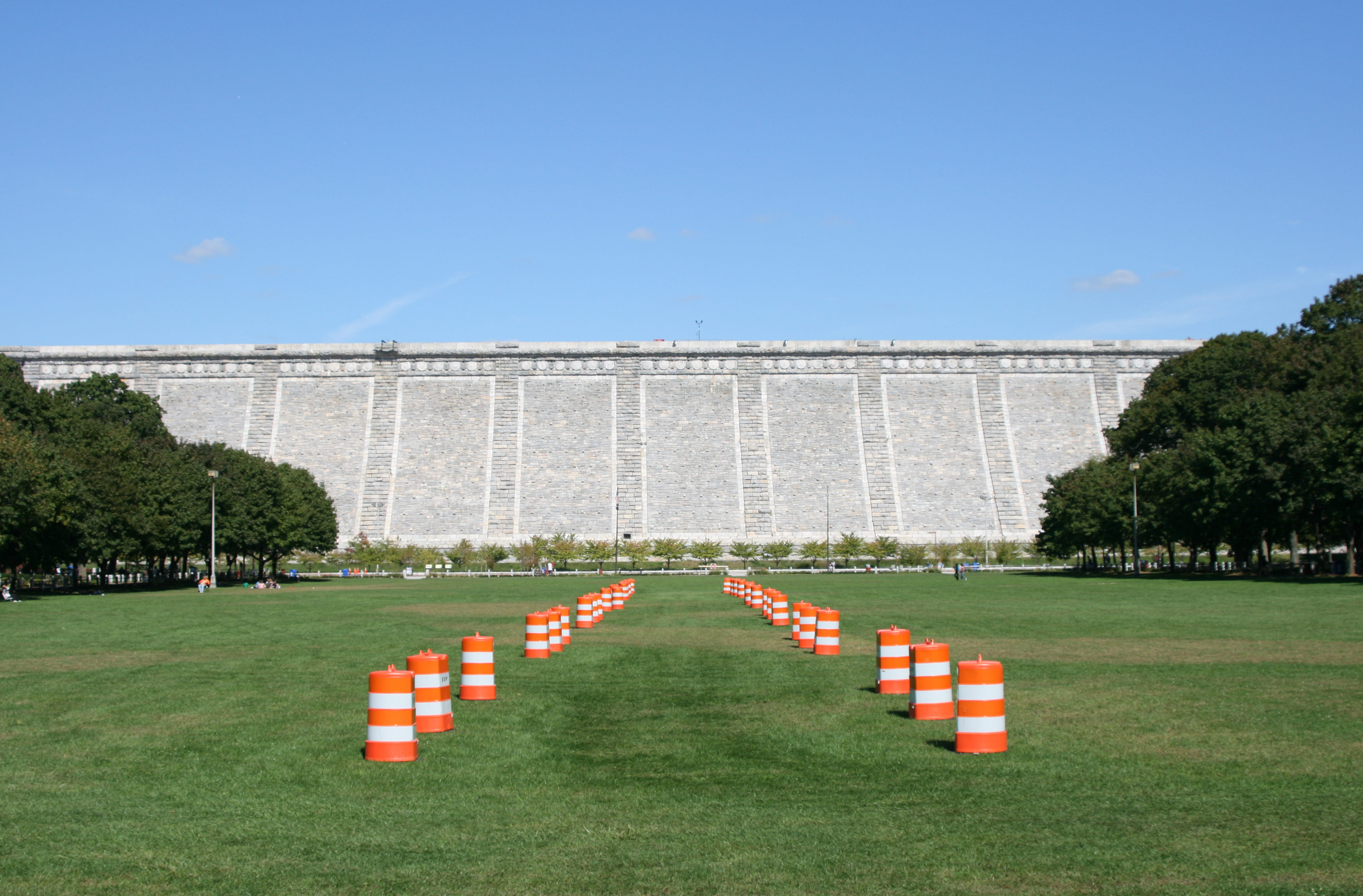
Two developments in the first half of the 19th century - the construction of the first Croton Dam and Aqueduct and the coming of the railroad - had enormous impact on the growth of both Westchester and New York City. Construction of the Croton Dam and Aqueduct began in 1837 and was completed in 1842. The aqueduct carried water 41 miles (66 km) from Croton to two reservoirs in Manhattan to be distributed to the city. Now a National Historic Landmark, the Croton Aqueduct is considered one of the great engineering achievements of the 19th century.
In the 1840s, the railroads came to Westchester. In 1844, the New York and Harlem Railroad reached White Plains. The Hudson River Railroad line was completed to Peekskill in 1849. That same year, the New York and New Haven Railroad opened its route through eastern Westchester. The railroads often determined whether a town grew or declined, and they contributed to a population shift from northern to southern Westchester. By 1860, the total County population was 99,000 and the largest city was Yonkers. Many small downtowns, centered around a railroad station, flourished.
Post-Civil War
 Yonkers Civil War monument
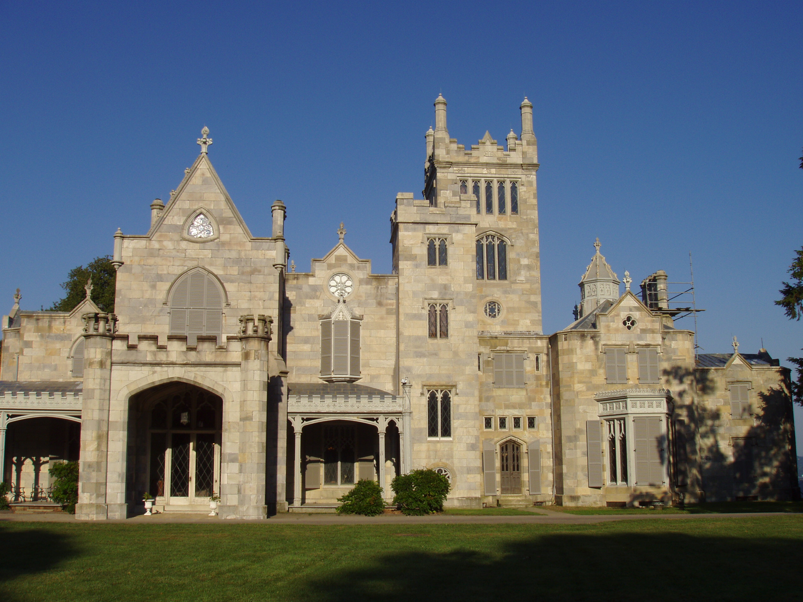
The period following the American Civil War brought vast fortunes to a new class of entrepreneurs in the New York area, and many built large estates in Westchester. Several magnificent mansions of this era are preserved and open to the public. Among them are Lyndhurst in Tarrytown, Kykuit in Pocantico Hills, the Jay Heritage Center in Rye, Caramoor in Katonah and Glenview in Yonkers.
Expansion of the New York City water supply system also impacted local development, creating new dams, bridges and roads. The flooding of thousands of acres for reservoirs created considerable dislocations in many towns north of White Plains. The building of the New Croton Dam and its reservoir, for instance, resulted in the relocation of the hamlet of Katonah to higher ground. In North Salem the hamlet of Purdys was moved when five percent of the town was inundated, including hundreds of prime acres of dairy land.
During the last half of the 19th century, Westchester's transportation system and labor force attracted a manufacturing base, particularly along the Hudson River and Nepperhan Creek. Pills and patent medicines were manufactured in Ossining; greenhouses in Irvington; beer in Dobbs Ferry; sugar, paving material and conduit in Hastings; and in Yonkers, elevators and carpets.
In 1874, the western portion of the present Bronx County, consisting of the then towns of Kingsbridge, West Farms, and Morrisania, was transferred to New York County, and in 1895 the remainder of the present Bronx County, consisting of the Town of Westchester and portions of the towns of Eastchester and Pelham, was transferred to New York County. By that time, the portion of the town of Eastchester immediately north of the transferred portion had seceded from the town of Eastchester (1892) to become the City of Mount Vernon so that the Town of Eastchester had no border with New York City. In January 1914, those parts of the then New York County which had been annexed from Westchester County were constituted as Bronx County.[4]
Twentieth century
During the 20th century, the primarily rural character of Westchester would yield to the suburban county known today. Between the County's railroad network and the proliferation of the automobile in the early 20th century, working in New York City and living in the country became possible for the middle class. In 1907 the Bronx River Commission was established to acquire the necessary lands to eliminate nuisance conditions along the river's banks and improve its water quality through a joint undertaking between New York City and Westchester County. The Commission's efforts led to the creation of the Bronx River Parkway Reservation, completed in 1925, and the first modern, multi-lane limited-access roadway in North America. The success of the Bronx River Parkway Reservation encouraged the County government to develop its outstanding parks system, preserving great tracts of open space.
Playland in Rye, a National Historic Landmark, opened to the public in 1928, was the first totally planned amusement park in the country. It continues to be operated by Westchester County. The development of Westchester's parks and parkway systems supported existing residential communities and encouraged the establishment of new ones. New homes were constructed on former estates and farms. The parkways were a boon for commuters and transformed the development pattern of Westchester. New businesses appeared in response to expanded markets; White Plains, with branches of many New York City stores, became the County's central shopping center. With the need for new homes for new families following World War II, multistory apartment houses appeared in the urbanized areas of the County, while the market for single family houses continued to expand. By 1950 the total County population was 625,816.
Major interstate highways were constructed in Westchester during the 1950s and 60s. The establishment of these roadways, along with the construction of the Tappan Zee Bridge, encouraged many major corporations, such as PepsiCo, General Foods, Ciba-Geigy and IBM to establish headquarters in Westchester. They accomplishe this by assembling large tracts of property to construct office facilities, which were often designed by world-famous architects and enhanced by extensive landscape.
Today it is one of the most affluent counties in the country, home to many of New York City's most desirable suburban communities. It is a haven for commuters, whether traveling by car or by the Metro-North Commuter Railroad.
National Historic Sites
St. Paul's Church in Mt. Vernon was designated a National Historic Site in 1942. The original church, a wooden structure known as Church of Eastchester, was built in 1695. The present-day stone church was completed in 1764, and its name was changed to St. Paul's in 1795.
The church property, which is operated by the National Park Service, includes a cemetery with burial stones dating to 1704 and the remnants of a village green that was the site of what came to be known as the "Great Election" of 1733.[5] The publisher of the New York Journal, John Peter Zenger, wrote an account of the election and was arrested and tried for seditious libel. His acquittal established the legal precedent for "freedom of the press," which was later incorporated as a basic freedom in the U.S. Bill of Rights.
Horace Greeley's house stands in Chappaqua. Horace Greeley was most famous for his newspaper, The New York Tribune , which ran late into the 19th century. Greeley got a mere sixty votes in the electoral college when he ran for president against Ulysses S. Grant and died shortly thereafter from severe illnesses and broken spirits. His home and the grounds which have not been subdivided are run by the Town of New Castle Historical Society and is open for guided and self-guided tours.
One of the Founding Fathers native to New York State, John Jay, grew up in Rye, New York and returned there to rest among his many descendants. America's first Chief Justice of the Supreme Court served in every branch of US government and his boyhood home is now a National Historic Landmark, open to the public. It is managed by the Jay Heritage Center. The buildings on this historic site, including the 1838 Peter Augustus Jay House built by Jay's eldest son, are being restored for educational programs in American History, Architecture and Environmental Stewardship.
The Thomas Paine Cottage in New Rochelle, New York, was the home from 1802 to 1806 of Thomas Paine, author of Common Sense and Revolutionary War hero. It was declared a National Historic Landmark on November 28, 1972.
Geography
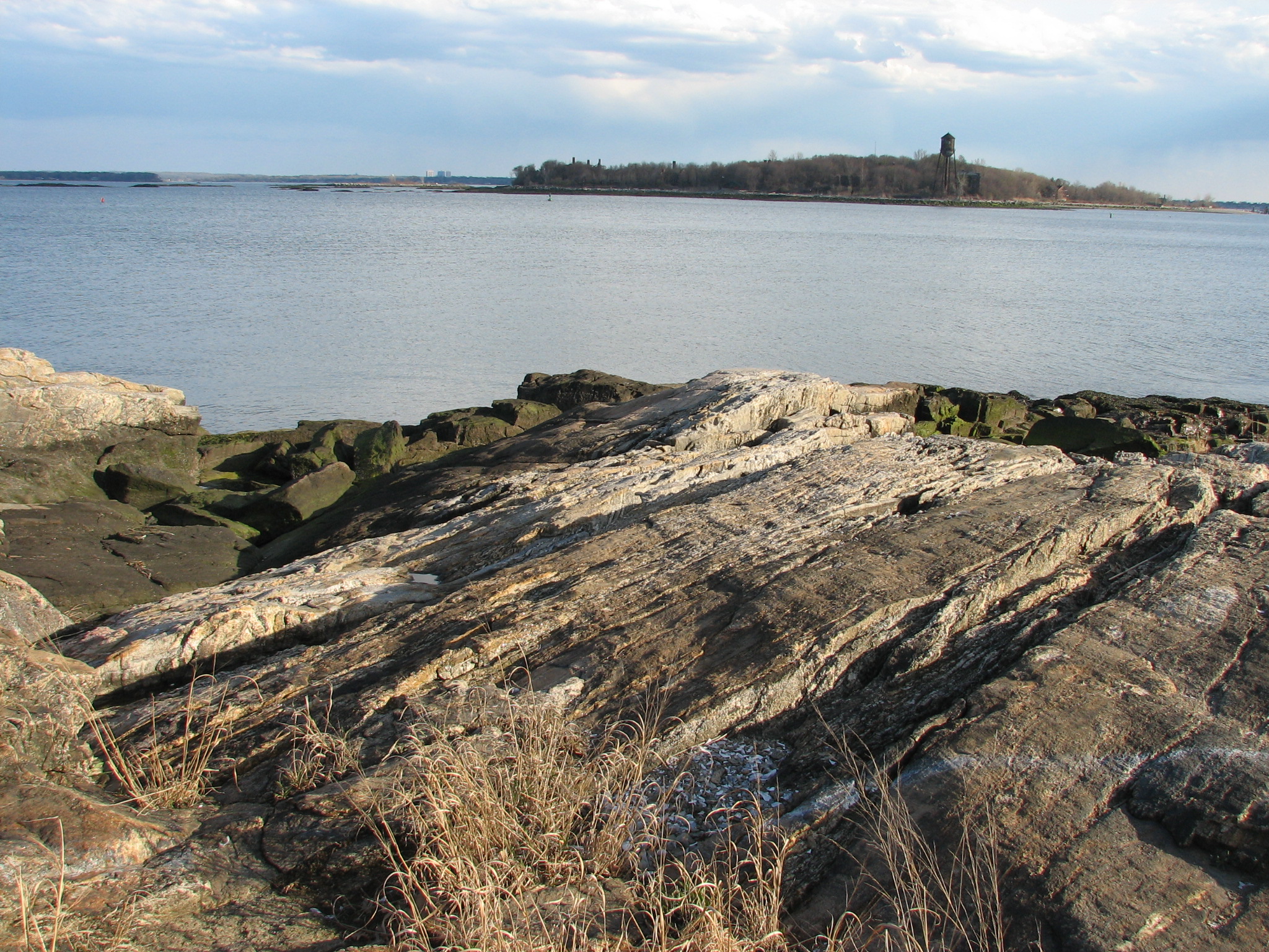
 Davids' Island
Westchester County is located at the southeastern tip of New York State. According to the U.S. Census Bureau, the county has a total area of 500 square miles (1,300 km2), of which 433 square miles (1,100 km2) is land and 67 square miles (170 km2) (13.45%), water. The County shares its northern boundary with Putnam County and its southern boundary with New York City. It is bordered on the west side by the Hudson River and on the east side by Long Island Sound and Fairfield County, Connecticut.
The closest point on the southern border of Westchester is just under 11 miles (18 km) from Columbus Circle in Manhattan (the customary point for measuring distances from New York City), where Pelham Manor meets Pelham Bay Park in the Bronx. At over 2,700 acres (11 km2), Pelham Bay Park is the largest of New York City's parks, forming a substantial 'buffer' between suburban Westchester and urban Bronx County.
Southern Westchester's Long Island Sound shore is generally rocky. Tidal mud flats, marshes and wetlands, as well as several natural and artificially-maintained sand beaches are interspersed on the coast. Public waterfront access is limited by residential and other development, although municipal and County owned parks provide access to beaches, nature preserves and passive and active waterfront recreational facilities. Several large harbors lie along the shore including Milton Harbor in Rye, Mamaroneck Harbor, Larchmont Harbor and Echo Bay, and the Upper and Lower harbors in New Rochelle. A number of islands can be found offshore from New Rochelle. The uses of these islands vary: Davids' Island, the former location of the U.S. Army’s Fort Slocum, is currently unoccupied but is slated for use as passive parkland; Glen Island is a County park for passive and active recreation; Huckleberry Island is largely undeveloped and has one of the largest rookeries for some shore bird species in western Long Island Sound; Columbia Island was the former site of CBS television broadcast antennas and is currently unoccupied; Echo Island is used by a private yacht club; Execution Rocks is the site of a 19th century lighthouse listed on the National Register of Historic Places; Pea Island is owned by Huguenot Yacht Club but remains undeveloped; Goose Island is undeveloped; Clifford, Harrison and Tank Islands are part of a nature preserve and city park;and Oak and Pine Islands are used as private residences.
The widest section across the Hudson River, at 3.6 miles (6 km), is found between the Westchester and Rockland County shorelines immediately north of Croton Point in Croton-on-Hudson. In Colonial times, this area was called the Tappan Zee or Sea. The Hudson River is tidal and brackish through Westchester and contains a small number of estuarine marshes. Two bridges span the Hudson in Westchester; the Bear Mountain Bridge crosses at Cortlandt and the Tappan Zee Bridge at Tarrytown. Municipal, County and state-owned parks provide access to waterfront landmarks and sites, including Croton Point in Croton, Kingsland Point in Sleepy Hollow and JFK Memorial Marina in Yonkers.
The Hudson River waterfront in Westchester is in the midst of a renaissance, converting from primarily industrial uses to mixed residential, commercial, retail, and recreational uses. This transformation is most notable in Yonkers, Hastings-on-Hudson, Dobbs Ferry, Irvington, Tarrytown, Sleepy Hollow, Ossining, and Peekskill, where redevelopment projects are in various stages of design and construction. In 2004, Westchester County embarked on a project to create a Hudson RiverWalk of 50 miles (80 km) which will provide public access between New York City and Putnam County along or close to the river. RiverWalk will weave through the Hudson River communities and provide access and linkages to recreational, cultural, and historic resources as well as community business centers.
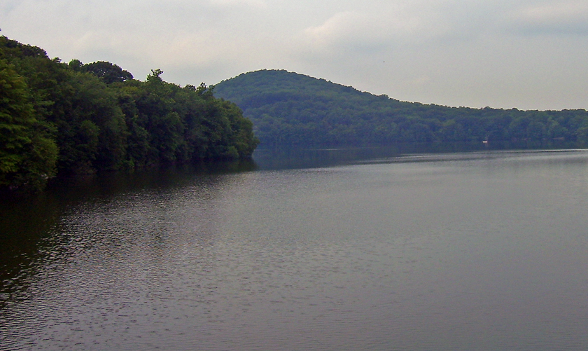
 New Croton Reservoir
 Kensico Dam
The County's interior generally is more hilly north of Interstate 287, which bisects the County. The highest elevation in the county is a U.S. Coast and Geodetic Survey benchmark known as "Bailey" at 980 feet (300 m) above sea level in Mountain Lakes Park near the Connecticut state line. The lowest elevation is sea level, along both the Hudson and Long Island Sound.
The County is divided into six primary drainage basins or watersheds, which are the Lower Long Island Sound, Upper Long Island Sound, Bronx River, Upper Hudson River, Lower Hudson River and Croton River basins. Within these primary drainage basins are approximately 60 smaller basins, or subwatersheds. The principal streams draining the southern part of the County include Beaver Swamp Brook, Blind Brook, Bronx River, Hutchinson River, Mamaroneck River, Saw Mill River, Sheldrake River, Stephenson Brook and Tibbetts Brook. The primary streams draining the central part of the County include Byram River, Kisco River, Mianus River, Mill River, Pocantico River and Silvermine River. The principal streams draining the northern part of the County include Dickey Brook, Furnace Brook, Hallocks Mill Brook, Hunter Brook, Muscoot River, Peekskill Hollow Brook, and Titicus River. The County contains several major reservoirs for public drinking water supply: The Croton system and the Kensico Reservoir are important components of the New York City water supply system. The system is a series of interconnected reservoirs and lakes in northern Westchester and Putnam Counties that provides 10% of New York City’s water under normal conditions and up to 30% of the in-City consumption in times of drought. The components of the system include the New Croton Reservoir in Cortlandt, Yorktown, Somers and Bedford; the Cross River Reservoir contained largely in Bedford; Titicus Reservoir in North Salem; Amawalk Reservoir in Somers; and the Muscoot Reservoir in Somers, Lewisboro and Bedford. The Kensico Reservoir is located in Mount Pleasant, Harrison and North Castle; and Byram Lake Reservoir in North Castle and Bedford. A number of other smaller reservoirs exist throughout the County.
Officially, the Westchester County Department of Planning divides the county into North, Central and South sub-regions.[6]
Cities, towns and villages
 Yonkers City LibraryMain article: Cities, towns and villages in Westchester County
Westchester County has six cities, 19 towns and 20 villages. Any land area in the county that is not contained in one of the cities is in a town. A town may have zero, one or multiple villages. A village can be located in more than one town, as two of Westchester's villages are.
Adjacent counties
Westchester is considered to be a prime suburb of New York
- Putnam County, New York—north
- Fairfield County, Connecticut—east
- Bergen County, New Jersey—southwest, water boundary only, across the Hudson River
- Rockland County, New York—west, water boundary only, across the Hudson River, with bridge access at the Tappan Zee Bridge and Bear Mountain Bridge
- Nassau County, New York—southeast, water boundary only, across the Long Island Sound
- Bronx County, New York (The Bronx)—south
- Orange County, New York—northwest, water boundary only, across the Hudson River
Climate
The climate of Westchester County is much colder than that of the city. Sometimes temperatures are as much as 15 degrees Fahrenheit colder than those of the city. Winters are cold throughout the county and summers are hot inland but rather cool towards the coast. Rainfall is plentiful and in some areas reaches over 45 inches. Snowfall is much more common in Westchester than in the city. With the exception of the southwest of the county, snowfall is often between 40 and 60 inches - even by the coast. In January, less dense areas have a low of 16-18 and a high of 30-34 while dense areas like Yonkers or White plains have a low of 20-25 and a high of 35-40. In the summer, this effect is much milder. Coastal areas (Mamaroneck, New Rochelle, Rye, Portchester) will have highs 80-83 and lows 62-66 while inland highs will be 84-86 and lows will be 60-66. Wind is heavy, especially by the coast.
Government
Westchester County Government is headed by County Executive Rob Astorino (R). The district attorney is Janet DiFiore (D). The county clerk is Timothy C. Idoni (D).
Board of Legislators
Main article: Westchester County Board of LegislatorsThe Westchester County Board of Legislators is the legislative, policy-making branch of Westchester County. The County Board has seventeen members. The current board chair is Kenneth W. Jenkins (D).[7]
Politics
Presidential elections results Year Republican Democrat 2008 35.8% 147,824 63.4% 261,810 2004 40.3% 159,628 58.1% 229,849 2000 37.5% 139,278 58.6% 218,010 1996 35.9% 123,719 56.9% 196,310 1992 40.1% 151,990 48.6% 184,300 1988 53.4% 197,956 45.8% 169,860 1984 58.7% 160,225 41.1% 229,005 1980 54.4% 198,552 35.6% 130,136 1976 54.3% 208,527 45.1% 173,153 1972 62.8% 262,901 36.9% 154,412 1968 50.3% 201,652 43.4% 173,954 1964 37.9% 149,052 62.0% 243,723 Although the county historically leaned Republican, it swung Democratic in the early 1990s – much like other New York City suburbs. In the most recent national elections, Westchester voters tended to be far more Democratic than national average. In fact, Westchester, after New York City and Albany County, has produced the biggest margins for statewide Democrats in recent years. Democratic voters are mainly concentrated in the southern and central parts of the county. More than 63% of Westchester County voters voted for Barack Obama in the 2008 presidential race, the seventh-highest percentage of any New York county, behind four New York City boroughs and Albany and Tompkins counties. Currently, two of the three U.S. congressional representatives from Westchester County are Democrats.
However, Westchester County is less Democratic in state and local elections. For instance, it voted for George Pataki by a margin of 23.07% against African-American candidate, Carl McCall in the gubernatorial race of 2002, and by 26.22% in 1998. Pataki hails from Westchester, where he previously served as mayor of Peekskill prior to being elected governor. Nita Lowey and Eliot Engel, both of whom are Democrats, represent most of the rest of the county (Engel's district also includes parts of the Bronx and Rockland County, and Lowey's also reaches into Rockland County) in Congress. Westchester's third representative is Republican Nan Hayworth, who was elected in 2010, defeating Democratic incumbent John Hall. Hayworth's district includes most of northern Westchester County. Former County Executive Andrew Spano is just the second Democrat to hold the post in at least a half-century. In 2006, county legislator Andrea Stewart-Cousins defeated 20 year incumbent Nicholas Spano (unrelated to Andrew) for a seat in the New York State Senate in a rematch of the 2004 race, which she lost by only 18 votes. Assembly Member Mike Spano (brother of Nicholas) switched parties in July 2007 to become a Democrat. Current district attorney Janet DiFiore also switched parties from Republican to Democratic in August 2007. In 2009, Republican Rob Astorino ousted three-term county executive Andy Spano, who had the endorsement of the New York Conservative Party, winning in a landslide. Astorino became the first Republican county executive since Andrew O'Rourke, who left the post after the 1997 election.
Westchester County was the home of former vice-president Nelson Rockefeller, who occupied the Kykuit mansion of the Rockefeller family 3,400-acre (14 km2) estate after the death of John D. Rockefeller, Jr.; it is situated near the town of Pocantico Hills.
The county is also home to the former President Bill Clinton and Secretary of State Hillary Rodham Clinton, who live in Chappaqua. Former First Lady Barbara Bush grew up in Rye.
Emergency services
Westchester County has a wide array of emergency services and is the home to 58 fire departments, 42 ambulance services, two Haz-Mat teams, a volunteer technical rescue team, a fire academy and a fire investigations unit. Each department has career, volunteer or a combination of career and volunteer personnel. Westchester County Department of Emergency Services operates the main dispatching system for EMS and fire departments referred to as 60-control located in Valhalla. The department also provides numerous support services for the various agencies throughout the county.
The "Career Chief's Association", a cooperative of the career fire departments also operates a "Special Operations Task Force" consisting of six squad companies that can be rapidly assembled for a major hazarous materials incident, CBRNE event, collapse or confined space rescue, or other incident requiring a large number of haz-mat or rescue technicians. Over 700 firefighters, police officers and EMS providers were trained to be part of this effort and serve over half the population of Westchester County including Yonkers, Mount Vernon, New Rochelle, White Plains, Scarsdale, Eastchester, and the Fairview, Hartsdale, and Greenville Fire Departments in the Town of Greenburgh.
Law enforcement
Main article: Law enforcement in Westchester CountyThere are currently 42 local police agencies located in Westchester County. As well as other County, State, Private and Federal law enforcement agencies responsible for protecting Westchester County, these agencies frequently work with one another and other agencies located in the surrounding counties and states as well as the New York State Police and the NYPD.
Demographics
Historical populations Census Pop. %± 1790 23,978 — 1800 27,428 14.4% 1810 30,272 10.4% 1820 32,638 7.8% 1830 36,456 11.7% 1840 48,686 33.5% 1850 58,263 19.7% 1860 99,497 70.8% 1870 131,348 32.0% 1880 108,988 −17.0% 1890 146,772 34.7% 1900 184,257 25.5% 1910 283,055 53.6% 1920 344,436 21.7% 1930 520,947 51.2% 1940 573,558 10.1% 1950 625,816 9.1% 1960 808,891 29.3% 1970 894,404 10.6% 1980 866,599 −3.1% 1990 874,866 1.0% 2000 923,459 5.6% 2010 949,113 2.8% [8][9][10] In 2000, there were 349,445 housing units at an average density of 807 per square mile (312/km²). The racial makeup of the county was 71.35% White, 14.20% African American, 0.25% Native American, 4.48% Asian, 0.04% Pacific Islander, 6.63% from other races, and 3.05% from two or more races. Hispanic or Latino of any race were 15.61% of the population. 64.1% were Whites of non-Hispanic origin. 71.7% spoke English, 14.4% Spanish, 3.5% Italian, 1.1% Portuguese and 1.1% French as their first language.
By 2006, the population was 68.12% White, 13.91% African-Americans, 5.58% Asian, 0.16% Native American and 12.23% of other or mixed race. 18.54% of the population was Latino or Hispanic of any race.
There were 337,142 households of which 34.00% had children under the age of 18 living with them, 53.90% were married couples living together, 12.20% had a female householder with no husband present, and 30.20% were non-families. 25.70% of all households were made up of individuals and 10.30% had someone living alone who was 65 years of age or older. The average household size was 2.67 and the average family size was 3.21.
Age distribution was 25.00% under the age of 18, 7.20% from 18 to 24, 30.40% from 25 to 44, 23.50% from 45 to 64, and 14.00% who were 65 years of age or older. The median age was 38 years. For every 100 females there were 91.70 males. For every 100 females age 18 and over, there were 87.30 males.
According to 2006 HUD data, the median income for a household of one person in the county was $67,555 and the median income for a family of four was $96,500.
According to census data, the per capita income for the county in 1999 was $36,726. The Bureau of Economic Analysis lists Westchester in 2004 with the per capita income of $58,952, the eighth highest in the country.[2] The Census Bureau reports that 6.40% of families and 8.7% (2003) of the population were below the poverty line, including 26.53% of those under age 18 and 7.60% of those age 65 or over.
The largest census reviewed area in Westchester County is the City of Yonkers, New York's fourth-largest city, with a population of almost 200,000. The smallest is the community of Scotts Corners in the town of Pound Ridge with a population of 624.
Westchester County Department of Planning - Tomorrow's Communistructure
The Westchester County Department of Planning serves as the repository for all Westchester-related census data. Under former County Executive Andrew Spano's directive, the department launched Westchester 2025, [1] a web-based update of its county-wide comprehensive planning policies. This interactive planning resource integrates the Plan's elements with new sections on three-dimensional visualization, community overviews, regional partnerships, as well as planning tools and interactive forums for public comment.
Part of Westchester 2025 focuses on the need to improve regional connectivity, including both physical infrastructure (roads, trains, sewers, etc.) and communication capabilities (wider bandwidths, GIS technology, etc.) to keep pace with the global economy and reduce environmental impacts. This new infrastructure model for the 21st century, Tomorrow's Communistructure, will require a complete paradigm shift in the way the community views and defines its critical infrastructure in the future.
Transportation
 Tappan Zee Bridge From Tarrytown, NY
 Bee-Line bus in Port Chester, NY.
 Arrivals and Departures at Grand Central Terminal
Westchester County is served by Interstate 87 (the New York State Thruway), Interstate 95, Interstate 287 and Interstate 684. Parkways in the county include the Bronx River Parkway, the Cross County Parkway, the Hutchinson River Parkway, the Saw Mill River Parkway, the Sprain Brook Parkway and the Taconic State Parkway. The Tappan Zee Bridge connects Tarrytown to Rockland County across the Hudson River. The Bear Mountain Bridge crosses the Hudson from Cortlandt to Orange County. The combination of these numerous highways, proximity to New York City, and the county's large population all lead to substantial traffic enforcement and very busy local courts.
The development corridors in the county have defined sections and follow transportation corridors. The main north-south corridors are, from west to east, the U.S. Route 9/Albany Post Rd/Broadway Corridor along the Hudson River from Yonkers in the South to Peekskill/Cortlandt in the North. The Saw Mill River Parkway Corridor traverses the county in a north-eastern path, beginning in Yonkers, and terminating at I-684 in Bedford, mostly following the path of the Putnam Branch of the New York Central Railroad, which was abandoned in March 1970 (and which has largely been replaced by a paved path known as the South County and North County Trailways). The Sprain Brook Parkway traverses the county's midsection from a point in Yonkers where it breaks off from the Bronx River Parkway until Hawthorne about 15 miles (24 km) north where it merges with the Taconic State Parkway and continues until I-90 near Albany. The Hutchinson River Parkway lines the eastern county, from the Bronx (terminating at the Long Island crossing—the Whitestone Bridge) until the Connecticut state line in Greenwich, where it becomes the Merritt Parkway. I-684 begins at a junction with the Hutchinson River Parkway and I-287 in Harrison, and continues north into Putnam County (with a brief stretch in Greenwich, Connecticut) through Bedford and North Salem. The eastern most corridor is the I-95/New England Thruway which traverses the county on the Long Island Sound, from the Pelhams through the Town of Rye and into Connecticut. The East-West corridors are the Cross County Parkway, which traverses the southern county from Yonkers in the west through New Rochelle in the east, terminating at the Hutchinson River Parkway. The Cross Westchester Expressway/I-287 is the mid-county corridor spanning from the Tappan-Zee Bridge in Tarrytown to the west to I-95/New England Thruway in the east. The northern-most corridor is that approximating the US-202 route from Cortlandt, and the Bear Mountain Bridge, to Lewisboro and the Connecticut border. But unlike the more southerly corridors, US-202 is for the most part not a limited-access highway and has frequent traffic lights.
Robert Moses and others once proposed a bridge connecting Westchester with Nassau County, most likely using I-287 to do so. Public opposition was fierce, and the New York state government abandoned the plan.
Commuter train service in Westchester is provided by Metro-North Railroad (operated by the Metropolitan Transportation Authority). Metro-North operates three lines in the county; west to east, they are the Hudson, the Harlem and the New Haven lines, each of which stops in the Bronx between Westchester and Manhattan. Amtrak serves Croton-Harmon, New Rochelle and Yonkers. There are proposals for a cross-county rail line to connect all three lines and provide easier access to Stamford, Connecticut.
NY Waterway also operates a ferry service between Haverstraw in Rockland County and Ossining.
Bus service is provided by the Bee-Line Bus System (operated by the Westchester County Department of Transportation) both within Westchester and to Manhattan (BxM4C). The MTA Bus Company also runs the BxM3 to and from Getty Square in Yonkers to Midtown Manhattan.
Westchester County Airport is adjacent to White Plains.
Media In Westchester
There are quite a few county-wide media outlets, including:
- Westchester Magazine, an upscale lifestyle magazine focusing on Westchester County and its environs.
- The Journal News, a daily newspaper, owned by Gannett Company, Inc.. WCBS-TV operates a news-bureau in conjunction with The Journal News.
- The White Plains Times Local news coverage of White Plains and surrounding Westchester County.
- The Hudson Independent, a monthly newspaper serving Tarrytown, Sleepy Hollow and Irvington.
- InTown Westchester, a monthly lifestyle magazine published by The Journal News and Gannett.
- The Westchester County Business Journal, a weekly newspaper published by Westfair Communications Inc..
- The Westchester WAG a magazine of local people, events and lifestyles.
- News 12 Westchester, a cable TV news station owned by Cablevision.
- WFAS-FM[2] (103.9 FM), a radio station focusing on Westchester.
- White Plains CitizeNet Reporter a news site local people, events and information.
- White Plains Week Weekly 30-minute news broadcast on what is happening in White Plains.
- WXPK (107.1 FM), or The Peak, owned by Pamal Broadcasting.
- WVIP[3] (93.5 FM), a radio station broadcasting from New Rochelle. Varied programming includes news, education and music.
- RNN (Regional News Network), a news station
- Pluma Libre News, a Hispanic newspaper serving Westchester County and part of Rockland County.
- WHUD[4] (100.7 FM), located in Peekskill, focuses on the Hudson Valley and bills itself as "The Hudson Valley's news and information station".
- Westchester.com, a community newspaper covering Westchester County news and events.
- Elsolnews.com, a community Spanish newspaper covering Westchester County news and events.
- Westchester Guardian
Education
Main article: Education in Westchester CountyWestchester County contains 48 public school districts,[11] 118 private college-preparatory and parochial schools, and 14 colleges and universities.
Libraries
Main article: Westchester Library SystemWestchester County is served by the Westchester Library System which was established in 1958. The system comprises 38 public libraries.
Historic and cultural attractions
 Scenic spillway at the New Croton Reservoir, in Croton-on-Hudson
- Bronx River Parkway
- Caramoor Center for Music and the Arts
- Croton Gorge Park
- Elephant Hotel in Somers
- Emelin Theatre, Mamaroneck, New York
- Ferncliff Cemetery, Hartsdale
- Hudson River Museum, Yonkers
- Irvington Town Hall Theater, Irvington, New York
- Jacob Burns Film Center, Pleasantville
- Jacob Purdy House, White Plains
- 1838 Peter Augustus Jay House, owned and managed by the Jay Heritage Center, Rye
- Jay Property, Rye owned by Westchester County, New York State and Jay Heritage Center
- Katonah Museum of Art, Katonah
- Leland Castle, New Rochelle
- Donald M. Kendall Sculpture Gardens, PepsiCo, Inc., Purchase
- Kykuit, Rockefeller family estate, Pocantico Hills, New York
- Lyndhurst, Tarrytown, New York
- Neuberger Museum of Art, Purchase College, Purchase
- Old Croton Aqueduct and the Old Croton Trail

- Paramount Center for the Arts, Peekskill
- Philipsburg Manor House, historic site, Sleepy Hollow
- Philipse Manor Hall State Historic Site, Yonkers
- Picture House Regional Film Center, Pelham
- Playland, Rye, New York
- The Performing Arts Center at Purchase College, Purchase
- Sing Sing Prison, Ossining
- The Square House Museum, Rye
- Sunnyside, Tarrytown, New York
- Tarrytown Music Hall, Tarrytown
- Teatown Lake Reservation, Ossining
- Thomas Paine Cottage, New Rochelle
- Thomas Paine National Historical Association, New Rochelle
- The Timothy Knapp House, Rye
- Union Church, Pocantico Hills
- Westchester Jazz Orchestra, Chappaqua
- Westchester Philharmonic Orchestra, White Plains
- Xavier's School for Gifted Youngsters, North Salem
- Yonkers Raceway, Yonkers
Geology
The rocks, which compose the Island of Manhattan in New York City and underlie the county of Westchester, are chiefly gneiss and mica-schist, with layers of dolmitic marble and serpentine.
See also
- List of counties in New York
- National Register of Historic Places listings in Westchester County, New York
- USS Westchester County (LST-1167)
Notes
- ^ Westchester: The American Suburb, Robert Pannetta;foreword, vii
- ^ a b "CA1-3 per capita personal income". Regional Economic Accounts. Bureau of Economic Analysis. April 2007. doi:7. http://www.bea.gov/regional/reis/drill.cfm?selTable=CA1-3&selLineCode=30&selYears=2007&rformat=display&areatype=36000&selSort=1. Retrieved 2009-10-26.
- ^ Westchester County, New York - Income in the Past 12 Months (In 2006 Inflation-Adjusted Dollars)
- ^ On the start of business for Bronx County: Bronx County In Motion. New Officials All Find Work to Do on Their First Day. The New York Times, January 3, 1914 (PDF retrieved on January 30, 2011)
- ^ "St. Paul's Church: History & Culture". National Park Service. http://home.nps.gov/sapa/historyculture/index.htm. Retrieved 2009-03-21.
- ^ Westchester County Sub-Regions
- ^ "Westchester County Board of Legislators". http://www.westchesterlegislators.com/
- ^ http://www.census.gov/population/www/censusdata/cencounts/files/ny190090.txt
- ^ http://factfinder2.census.gov
- ^ http://mapserver.lib.virginia.edu/
- ^ "Westchester County School Districts". Westchester County Data Book. Westchester County Department of Planning. Archived from the original on 2007-04-02. http://web.archive.org/web/20070402010858/http://www.westchestergov.com/ed/district.htm. Retrieved 2007-04-26.
External links
- Westchester County official website
- The Westchester County Department of Public Safety
- Westchester County at the Open Directory Project
- Hudson Valley Directory

Orange County Putnam County Fairfield County, Connecticut Rockland County 
 Westchester County, New York

Bergen County, New Jersey Bronx County
(The Bronx)Long Island Sound  State of New York
Topics - Administrative divisions
- Bibliography
- Congressional districts
- Constitution
- Demographics
- Economy
- Education
- Elections
- Geography
- Government
- History
- Symbols
- People
- Politics
- Transportation
- Visitor Attractions
Regions - Adirondack Mountains
- Allegheny Plateau
- Capital District
- Catskill Mountains
- Central Region (formerly Central-Leatherstocking)
- Central New York
- Champlain Valley
- City of New York
- Finger Lakes
- Holland Purchase
- Hudson Highlands
- Hudson Valley
- Long Island
- Mohawk Valley
- New York Metro
- Niagara Frontier
- North Country
- Ridge and Valley
- Saint Lawrence Seaway
- Shawangunks
- Ski country
- Southern Tier
- Southtowns
- Tech Valley
- Thousand Islands
- Upstate
- Western
Metro areas - Albany / Schenectady / Troy
- Binghamton
- Buffalo / Niagara Falls
- Elmira / Corning
- Glens Falls
- Ithaca
- Jamestown
- Newburgh / Middletown
- New York City
- Poughkeepsie
- Rochester
- Syracuse
- Utica / Rome
Counties - Albany
- Allegany
- Bronx
- Broome
- Cattaraugus
- Cayuga
- Chautauqua
- Chemung
- Chenango
- Clinton
- Columbia
- Cortland
- Delaware
- Dutchess
- Erie
- Essex
- Franklin
- Fulton
- Genesee
- Greene
- Hamilton
- Herkimer
- Jefferson
- Kings
- Lewis
- Livingston
- Madison
- Monroe
- Montgomery
- Nassau
- New York
- Niagara
- Oneida
- Onondaga
- Ontario
- Orange
- Orleans
- Oswego
- Otsego
- Putnam
- Queens
- Rensselaer
- Richmond
- Rockland
- Saint Lawrence
- Saratoga
- Schenectady
- Schoharie
- Schuyler
- Seneca
- Steuben
- Suffolk
- Sullivan
- Tioga
- Tompkins
- Ulster
- Warren
- Washington
- Wayne
- Westchester
- Wyoming
- Yates
New York-Newark-Bridgeport Combined Statistical Area Counties 
Major city Cities and towns
100k–999kBridgeport • Elizabeth • Huntington • Jersey City • New Haven • Newark • Paterson • Stamford • Waterbury • YonkersCities and towns
25k–99kBayonne • Branford • Cheshire • Clifton • Danbury • East Haven • East Orange • Englewood • Fairfield • Garfield • Greenwich • Hackensack • Hamden • Hoboken • Howell, New Jersey Kearny • Long Beach • Long Branch • Meriden • Middletown • Milford • Mount Vernon • Naugatuck • New Brunswick • New Milford • New Rochelle • Newburgh • Newtown • Norwalk • Passaic • Perth Amboy • Plainfield • Poughkeepsie • Rahway • Shelton • Stratford • Torrington • Trenton • Trumbull • Union City • Wallingford • West Haven • Westfield • Westport • White PlainsCities and towns
10k–25kAnsonia • Asbury Park • Beacon • Bethel • Brookfield • Darien • Derby • Dover • Guildford • Guttenberg • Harrison (NJ) • Harrison (NY) • Kingston • Linden • Madison • Monroe • Morristown • New Canaan • New Fairfield • North Branford • North Haven • Orange • Plymouth • Peekskill • Ridgefield • Rye • Scarsdale • Secaucus • Seymour • Southbury • Summit • Watertown • West New York • Weston • Wilton • Winchester • WolcottSub-regions Central Jersey • Greater Danbury • Greater New Haven • Greater Waterbury • Hudson Valley • Litchfield Hills • Long Island • North Jersey • Southwestern ConnecticutCoordinates: 41°09′04.57″N 73°45′25.76″W / 41.1512694°N 73.7571556°W
Categories:- New York counties
- Westchester County, New York
- 1683 establishments
- Long Island Sound
- Rockefeller family
- United States places with Orthodox Jewish communities


Wikimedia Foundation. 2010.