Dranesville, Virginia

Dranesville, Virginia
Dranesville
—  Unincorporated community  —
Dranesville is located in Virginia
Dranesville
Location within the Commonwealth of Virginia
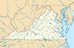
Coordinates: 39°0′2″N 77°20′45″W / 39.00056°N 77.34583°W / 39.00056; -77.34583Coordinates: 39°0′2″N 77°20′45″W / 39.00056°N 77.34583°W / 39.00056; -77.34583
Country United States
State Virginia
County Fairfax
Time zone Eastern (EST) (UTC-5)
 – Summer (DST) EDT (UTC-4)
ZIP codes
FIPS code
GNIS feature ID

Dranesville is an unincorporated community in Fairfax County, Virginia, USA. Dranesville is located on the Leesburg Pike (State Route 7) at its intersection with Georgetown Pike. The Census Bureau defines Dranesville as a census-designated place (CDP) with a population of 11,921 as of 2010.[1] The town is named for Washington Drane, a settler who moved there from the District of Columbia in 1810 and began the operation of Drane's Tavern.

References

See also

External links


Wikimedia Foundation. 2010.

Игры ⚽ Поможем сделать НИР

Look at other dictionaries:

  • Virginia State Route 193 — Infobox road state=VA type= route=193 alternate name=Georgetown Pike length mi=11.79 length ref=PDFlink| [http://www.virginiadot.org/info/resources/AADT 029 Fairfax 2005.pdf 2005 Virginia Department of Transportation Jurisdiction Report Daily… …   Wikipedia

  • Virginia State Route 228 — Infobox road state=VA type= route=228 length mi=4.53 length ref=PDFlink| [http://www.virginiadot.org/info/resources/AADT 029 Fairfax 2005.pdf 2005 Virginia Department of Transportation Jurisdiction Report Daily Traffic Volume Estimates Fairfax… …   Wikipedia

  • Battle of Dranesville — Infobox Military Conflict conflict=Battle of Dranesville caption= Battle of Dranesville partof=the American Civil War date=December 20, 1861 place=Fairfax County, Virginia result=Union victory combatant1= flagicon|USA|1861 United States (Union)… …   Wikipedia

  • Second Dranesville — Infobox Military Conflict conflict = Second Dranesville caption = partof = the American Civil War date = February 22, 1864 place = Loudoun County, Virginia result = Confederate Victory combatant1 = flagicon|USA|1861 United States (Union)… …   Wikipedia

  • National Register of Historic Places listings in Fairfax County, Virginia — Map of all coordinates from Google Map of all coordinates from Bing …   Wikipedia

  • 43rd Battalion Virginia Cavalry — 43rd Battalion of Virginia Cavalry Flag of Virginia Active June 10, 1863 to April 21, 1865 Country …   Wikipedia

  • List of Registered Historic Places in Virginia, Counties D-G — List of Registered Historic Places in Virginia, Counties D–G: NOTOC :: Virginia NRHP date for lists =Danville (independent city)= * Dan River Inc. Riverside Division Historic District * Danville Historic District * Danville Municipal Building *… …   Wikipedia

  • Cooktown, Virginia — Cooktown   Unincorporated community   …   Wikipedia

  • Northern Virginia — Reston, an internationally known planned community,[1] seen from the Dulles Toll Road. Northern Virginia consists of several counties and independent cities in the Commonwealth of Virginia, in a widespread region generally radiating sout …   Wikipedia

  • Fairfax, Virginia — This article is about the independent city of Fairfax, Virginia. For the surrounding unincorporated area of Fairfax County, see Fairfax County, Virginia. Fairfax   Independent city   City of Fairfax …   Wikipedia

Share the article and excerpts

Direct link
Do a right-click on the link above
and select “Copy Link”