- Nahariya Railway Station
-
נהריה
Nahariya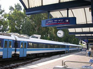
Station statistics Address 2 HaGaaton Blvd, Nahariya[1]
IsraelCoordinates 33°00′19″N 35°05′56″E / 33.00528°N 35.09889°ECoordinates: 33°00′19″N 35°05′56″E / 33.00528°N 35.09889°E Connections Central Bus Station Platforms Side platforms Tracks 2 Parking 50 pay spaces[1] Bicycle facilities 12 spaces[1] Other information Opened 1945 Rebuilt 2001 Accessible 
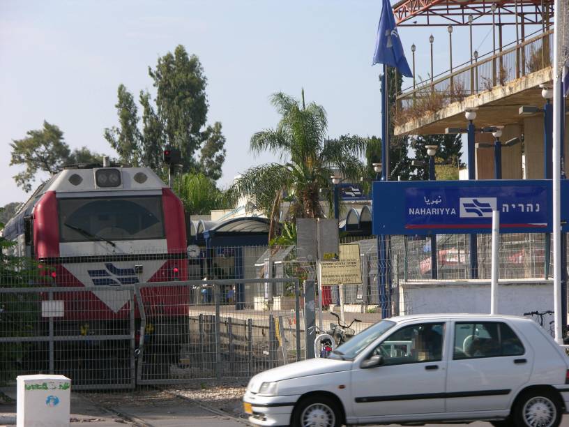
 End of active tracks at Nahariya
Nahariya Railway Station (Hebrew: תחנת רכבת נהריה, Takhanat Rakevet Nahariya) is a train station serving the city of Nahariya and the surrounding towns and villages of the Western Galilee region. It is the northern-most passenger station in Israel and is currently the terminus of the North-South coastal line.[2]
The station is located on Ga'aton Boulevard (Hebrew: שדרות הגעתון, Sderot HaGe'aton),[1] Nahariya's main street along the Ga'aton River, near the main entrance to the city from the coastal highway (
 Highway 4) and across the street from the city's central bus station.
Contents
History
The first regular passenger service at the station began during the British Mandate of Palestine, on July 1, 1945. The station was then serving the Haifa – Beirut line. The service was then suspended during Israel's War of Independence (1947-1949), and resumed on June 1950 with 2 daily passenger trains to Haifa and back. This passenger service was again discontinued two years later but was finally reinstated in 1958. The railway connection to Beirut via Rosh HaNikra was never resumed after the end of the British Mandate.[3]
On September 9, 2001 the Nahariya Railway Station was the scene of a suicide bombing. The terror attack was executed, for the first time in the current conflict, by an Arab-Israeli who was sent by Hamas and detonated himself on the crowded platform, killing 3 Israelis and injuring 94.[4]
Train service to the station was completely suspended, for the first time since 1952, on July 13, 2006, the day after the 2006 Israel-Lebanon conflict began, due to the Hezbollah rocket attacks on Nahariya.[5] It was restored 33 days later, on August 15, a day after the ceasefire went into effect.[6]
Design
The station underwent a complete reconstruction in the summer of 2001, which included an update to the present passenger station format of Israel Railways as well as the erection of a second platform, a modern station hall, a tunnel connecting the two platforms.[3]
It now consist of two side platforms with two parallel rail tracks running between them, the small station hall is located to the west of the rail tracks and a pedestrian tunnel connects the two platforms beneath the rail tracks. Because the station is a terminus for all arriving trains there is no directional designation for the platforms.
An additional platform will be built in 2012, to accommodate increased train service at the station after the completion of the double tracking of the coastal railway between Akko (Acre) and Nahariya (the last remaining single-track portion of Israel Railways' main line).
Train service
Nahariya Railway Station is a station on the main North-South coastal line of Israel Railways (Nahariya – Haifa – Tel Aviv – Be'er Sheva Inter-City Service). The station is situated to the north of Acre Railway Station and is the most northern of all the stations.[2]
Public transport connections
Nahariya Railway Station is well connected to all parts of the city and the region via Nahariya Central Bus Station, located just across the street. The central bus station also provides supplementary medium-distance bus service to destination reachable by train as well.
City bus services are operated by Nativ Express and include 8 bus lines which connect the railway station to every neighborhood in Nahariya.[8] Regional bus services are also operated by Native Express and include 19 bus lines which reach many of the towns and villages in the region.[8] Medium-distance bus services are provided by Egged, these lines are supplementary to the train service and provide a link to Akko, the Krayot and Haifa, as well as to the villages in between.[9]
Sherut Taxis (share taxis) stop on the main highway (
Highway 4), just outside the station and also provide supplementary connection to Akko, the Krayot and Haifa.References
- ^ a b c d Israel Railways - Nahariyya (English)
- ^ a b Israel Railways' official network map
- ^ a b Nahariya station on the RailnewsIL website (Hebrew)
- ^ Jerusalem Post's coverage of the terror attack on Nahariya's Railway Station
- ^ YNET News coverage of the Israel-Lebanon conflict
- ^ YNET News coverage at the end of the Israel-Lebanon conflict (Hebrew)
- ^ Israel Railways' official timetable (as of 30/12/06)
- ^ a b Nativ Express official timetable (Hebrew)
- ^ Egged official timetable
External links
Previous station Israel Railways Next station Terminus Nahariya – Haifa – Tel Aviv – Ben-Gurion Airport – Modi'in
Inter-City ServiceTowards: Modi'in Central
Akko (Acre)Terminus Nahariya – Haifa – Tel Aviv – Be'er Sheva
Inter-City ServiceTowards: Be'er Sheva Center
Akko (Acre)Categories:- Railway stations in Israel
- Nahariya

Wikimedia Foundation. 2010.