- Scotstown
Infobox Irish Place
name = Scotstown
gaeilge = An Bhoth, Baile an Scotaigh
crest
motto =
map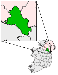
pin coords = left: 40px; top: 40px
north coord = 54.283333| west coord = 7.066667 | irish grid =
area = | elevation = 72 meters, 236 feet
province =Ulster
county =County Monaghan
population = | town pop = 250 [ [http://www.cso.ie/census/documents/2006_prelim_table01.pdf From Census 2006 Preliminary Report - Table 1] ] Male: 121Female: 129
census yr = 2006
web = |Scotstown (Irish place name|Baile an Scotaigh and also An Bhoth|) is a village in the north of
County Monaghan , in theRepublic of Ireland . Scotstown is located in theparish ofTydavnet , along the River Blackwater, Scotstown being the village closest to the river's source. Scotstown is centered in thetownland of Bough, but extends into Carrowhatta, Teraverty, Drumdesco and Stracrunnion townlands.A couple of theories exist around the origin of the English name, either deriving from the fact that a lot of Scots were located there during the
Ulster Plantation , or it may have been named after a local landowner, George Scott in the 1660s. Older documents, including Thom's Irish Almanac of 1862 [http://www.libraryireland.com/articles/MonaghanCountyDirectoryThom1862/index.php From Thom's Irish Almanac - Monaghan Directory] alternate between referencing the village as Scottstown and Scotstown, that suggest the latter as the source of the name. George Scott is also attributed with giving his name to another Monaghan village,Scotshouse .With regard to the Irish Gaelic names, the traditional name of "An Bhoth" comes from the
townland of Bough, where the village is centered, with the likely meaning of tent or hut [http://www.libraryireland.com/plnm/ From Irish Local Names explained - by P. W. Joyce] , suggesting humble origins for the village. This is the name appearing on signs as you enter the village. OnOrdnance Survey maps and road signs, the village also carries the name "Baile an Scotaigh", which literally means 'town of the Scots'. This is a comparatively rare occurrence of the Irish Gaelic form being a translation of the English form (and in this case, possibly, an erroneous one), as opposed to the Irish form being the original. Locals, to the extent they use the Irish form at all, favour the name "An Bhoth".History
A
crannog in the local Hollywood lake was the headquarters of Patrick Mac Art Moyle MacMahon. In 1591, Lord Deputy Fitzwilliam broke up the MacMahon lordship in Monaghan when "The MacMahon", hereditary leader of the sept, resisted the imposition of an Englishsheriff ; he was hanged and his lordship divided. Patrick Mac Art Moyle MacMahon became one of the independent leaders of the divided MacMahon lordship. The MacMahons generally fought amongst themselves during most of the Nine Years War (1594-1603), and Patrick Mac Art Moyle MacMahon, along with other MacMahon leaders, ultimately surrendered to Baron Mountjoy in 1601. Although the MacMahon's retained most of their land after the war, unable to raise taxes they would eventually give up their land as payment for those taxes.A
Catholic church was built in the neighbouringtownland of Drumdesco in 1785 (rebuilt in the 1820s), referred to locally as UrbleshannyChapel , but officially dedicated toSt Mary . Church registers go back to 1835 for births and 1825 for marriages. It is one of the three catholic churches in the Parish of Tydavnet. St. Mary's has an adjoiningcemetery with graves dating back to the late 18th century. Urbleshanny chapel served as apro-cathedral for the Catholic Diocese of Clogher from 1801 to 1824, while Dr. James Murphy was bishop. At the time it was noted to have no ceiling, no boards on the floor, and only partially fitted with pews. A tradition in Urbleshanny after weddings was to hold a race for a bottle of whiskey, and there is still a place near the chapel called Whiskey Hollow were these races were said to have taken place. AnotherPresbyterian cemetery exists close to the village center, but is no longer in use.The village
national school is also called Urbleshanny and is located in Carrowhatta. Urbleshanny National School is thought to be the earliest Catholic school in theDiocese of Clogher , having been set up in 1791, just after thepenal laws were repealed.In the 18th and 19th centuries, the lowlands surrounding Scotstown were favored by the landed classes, and as a consequence, they have left some ornamental woodland behind, including Hollywood and Mullaghmore.
During the 18th century, Scotstown developed as a small market center and by the 1830s, Scotstown was known to have a thriving fair, which centred on the
village green , and the green is still an open space today. Records show that traders came to sell calico, printed and course linens, stockings, socks, combs, brushes, cutlery and other hardware. Also in the 18th century, Scotstown served as a depot for quarried stones coming from a number of locations in theSliabh Beagh mountains.It is on record in 1938 as having a
blacksmith . Scotstown also had aRoyal Irish Constabulary (RIC) barracks, with probably 4 officers stationed here. Electric power first arrived in Scotstown in 1948.In the 1970s and 80s, Scotstown and the rural community around were known for having a number of active members of the Provisional IRA. One of these,
Seamus McElwain was killed close toRoslea in 1986, and his funeral at Urbleshanny chapel was a significant media event, drawing an estimated 3000 people to the village.Sport
Scotstown has a
Gaelic Athletic Association (GAA) football club, which has had some success in the past, and is currently ranked 3rd in towns winning theUlster Senior Club Football Championship . It's last victory however, was back in 1989.Seán McCague a native of Scotstown, was also GAA president from 2000-2003.Today
Today, Scotstown has two furniture manufacturers, providing the most significant employment source directly within the village. It also has 3
Public Houses , a small grocery shop/post office , apharmacy and several other small retail outlets.In October, Scotstown also hosts a traditional music festival, [http://www.anbhoth.ie Scoil Cheoil na Botha] , which features workshops, concerts and sessions.
Each summer, the Tydavnet Parish Show is held near Scotstown.
Places of interest
*Just outside Scotstown, is the Hollywood recreational area, centred around a lake. A local voluntary committee purchased the lake and surrounds in 1969 and since then have developed the park with the support of various funding agencies, private donations and Monaghan County Council. The lake itself is stocked with
bream ,rudd (which locals call roach),perch and pike.
*A number of marked mountain trails are maintained in the nearbySliabh Beagh area. A tourism center and hotel have been opened inCorlat as a staging point for these walks.
*A commemorative "famine stone", marking the location wherepotato blight was first noticed in County Monaghan, can be seen in the nearby townland ofSheskin .References
External links
* [http://maps.google.com/maps?f=q&hl=en&geocode=&q=Scotstown,+Monaghan,+County+Monaghan,+Ireland&sll=38.123671,-122.529008&sspn=0.012221,0.019827&ie=UTF8&cd=1&mpnum=0&ll=54.278055,-7.069702&spn=2.322158,5.075684&t=k&z=8&iwloc=addr&om=1 Satellite View of Scotstown from Google]
* [http://www.knockatallon.com/walking.htm Sliabh Beagh Walks]
* [http://www.knockatallon.com/index.htm Sliabh Beagh Tourism Center]
* [http://www.anbhoth.ie Scoil Cheoil na Botha]
* [http://uk.youtube.com/watch?v=fSDfT6w7PgU Rally School Video]
* [http://uk.youtube.com/ScoilCheoilnaBotha Video from Cheoil na Botha]
Wikimedia Foundation. 2010.