- Pennsylvania Avenue
-
For other uses, see Pennsylvania Avenue (disambiguation).
Pennsylvania Avenue 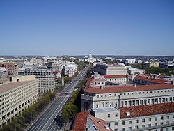
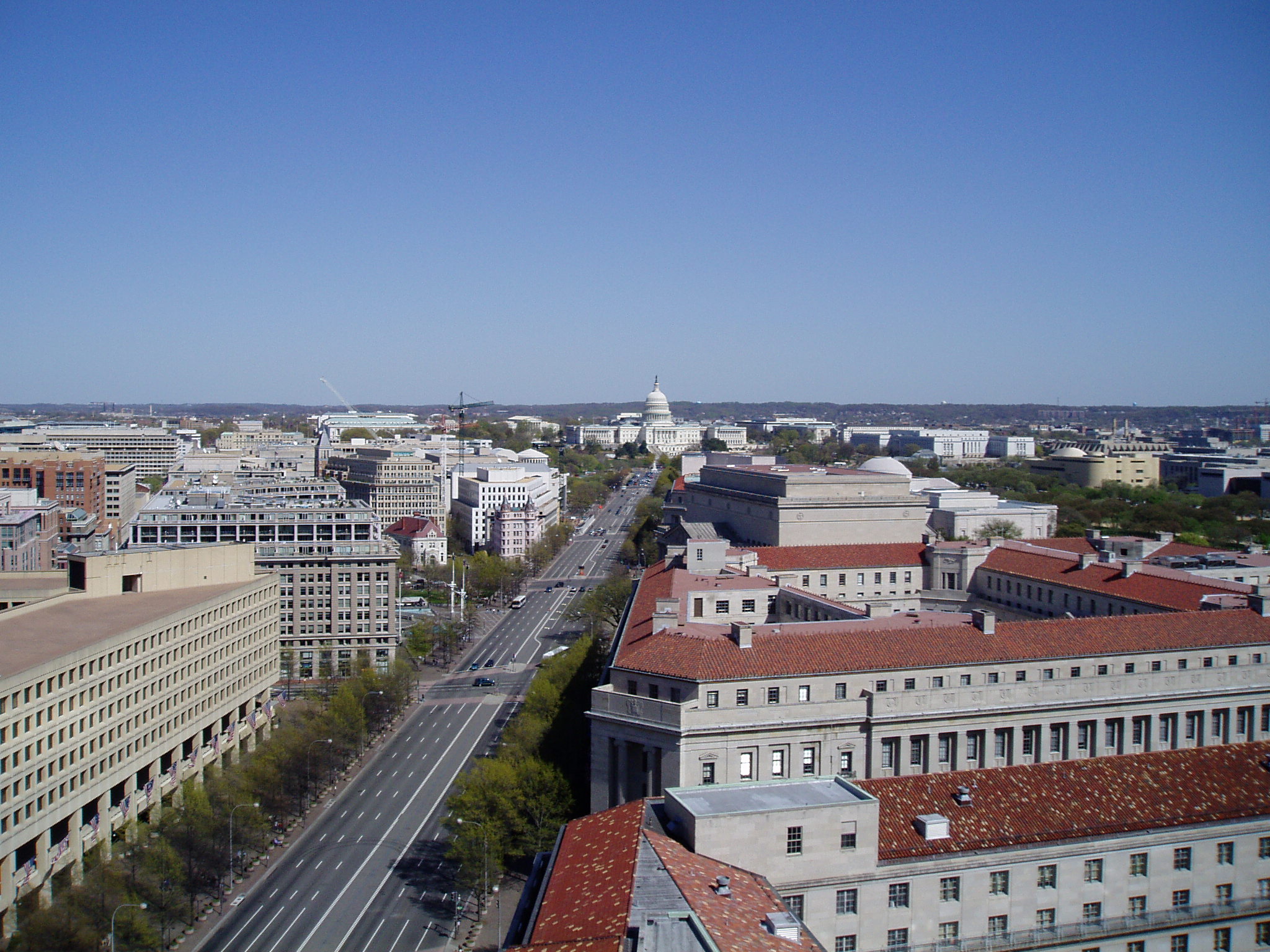
Looking southeast down Pennsylvania Avenue, NW towards the United States Capitol seen here from the Old Post Office Pavilion.Length: 35.1 mi (56.5 km) Location: Washington, D.C.
Prince George's County, MarylandCoordinates: 38°53′37″N 77°01′26″W / 38.893738°N 77.0239019°W Pennsylvania Avenue is a street in Washington, D.C. that joins the White House and the United States Capitol. Called "America's Main Street",[1] it is the location of official parades and processions, as well as protest marches. Moreover, Pennsylvania Avenue is an important commuter route and is part of the National Highway System.
Contents
Route
 Pennsylvania Avenue NW street sign near The White House
The avenue runs for a total of 5.8 miles (9.3 km) inside Washington, but the 1.2 miles (1.9 km) of Pennsylvania Avenue from the White House to the United States Capitol building is considered the most important. It continues within the city for 3.5 miles (5.6 km), from the southeast corner of the Capitol grounds through the Capitol Hill neighborhood, and over the Anacostia River on the John Philip Sousa Bridge. Crossing the entire width of Prince George's County, Maryland, it ends 14.5 miles (23.3 km) from the DC line at its junction with MD Route 408 at Waysons Corner near the Patuxent River, for a total length of 20.3 miles (32.7 km). At this point, as a limited-access highway, it becomes Southern Maryland Boulevard. In addition to its street name, in Maryland it is designated as Maryland Route 4. Northwest of the White House, Pennsylvania Avenue runs for 1.4 miles (2.3 km) to its end at M Street NW in Georgetown.
History
11th & Pennsylvania Avenue, NW - Washington, D.C.Intersection of 11th Street and Pennsylvania Avenue, NW in 1921 Laid out by Pierre Charles L'Enfantierre Pennsylvania Avenue was one of the earliest streets constructed in the Federal City.L'Enfant identified himself as "Peter Charles L'Enfant" during most of his life, while residing in the United States. He wrote this name on his "Plan of the city intended for the permanent seat of the government of t(he) United States ...." (Washington, D.C.) and on other legal documents. However, during the early 1900s, a French ambassador to the U.S., Jean Jules Jusserand, popularized the use of L'Enfant's birth name, "Pierre Charles L'Enfant". (Reference: Bowling, Kenneth R (2002). Peter Charles L'Enfant: vision, honor, and male friendship in the early American Republic. George Washington University, Washington, D.C. ISBN 978-0-9727611-0-9). The United States Code states in 40 U.S.C. § 3309: "(a) In General.—The purposes of this chapter shall be carried out in the District of Columbia as nearly as may be practicable in harmony with the plan of Peter Charles L'Enfant." The National Park Service identifies L'Enfant as "Major Peter Charles L'Enfant" and as "Major Pierre (Peter) Charles L'Enfant" on its website.</ref> The first reference to the street as Pennsylvania Avenue comes in a 1791 letter from Thomas Jefferson. One theory is that the street was named for Pennsylvania as consolation for moving the capital from Philadelphia.[2] Both Jefferson and George Washington considered the avenue an important feature of the new capital. After inspecting L'Enfant's plan, President Washington referred to the thoroughfare as a "Grand Avenue". Jefferson concurred, and while the "grand avenue" was little more than a wide dirt road ridiculed as "The Great Serbonian Bog", he planted it with rows of fast-growing Lombardy poplars. From 1862 to 1962, streetcars ran the length of the avenue from Georgetown to the Anacostia River.
Although Pennsylvania Avenue extends six miles (10 km) within Washington, D.C., the expanse between the White House and the Capitol constitutes the ceremonial heart of the nation. Washington called this stretch "most magnificent & most convenient", and it has served the country well. At one time Pennsylvania Avenue provided an unobstructed view between the White House and the Capitol. The construction of an expansion to the Treasury Building blocked this view, and supposedly President Andrew Jackson did this on purpose. Relations between the president and Congress were strained, and Jackson did not want to see the Capitol out his window,[3] though in reality the Treasury Building was simply built on what was cheap government land.
 A 1942 photo of a DC 4 shield.
Ever since an impromptu procession formed around Jefferson's second inauguration, every United States president except Ronald Reagan has paraded down the Avenue after taking the oath of office (Reagan paraded up the avenue for his first inauguration, in 1981, but not for the second in 1985 because of freezing temperatures which high winds made dangerous). From William Henry Harrison to Gerald Ford, the funeral corteges of seven of the eight presidents who died in office and two former presidents followed this route. Franklin Roosevelt was the only president who died in office whose cortege did not follow this route. Lyndon B. Johnson and Ford were the former presidents whose funeral cortege followed this route. For LBJ, it was along the route from the Capitol to the National City Christian Church, where he worshipped often, because the funeral was held there. Ford's went up Pennsylvania Avenue because it paused at the White House en route to the Washington National Cathedral, where the funeral was held. Abraham Lincoln's funeral cortege solemnly proceeded along Pennsylvania Avenue in 1865; only weeks later the end of the American Civil War was celebrated when the Army of the Potomac paraded more joyously along the avenue.
 Looking southeast down Pennsylvania Avenue towards the Old Post Office Pavilion and United States Capitol.
As well as being the scene of official functions, Pennsylvania Avenue is the traditional parade and protest route of ordinary citizens. During the depression of the 1890s, for example, Jacob Coxey marched 500 supporters down Pennsylvania Avenue to the Capitol to demand federal aid for the unemployed. Similarly, on the eve of Woodrow Wilson's 1913 inauguration, Alice Paul masterminded a parade highlighting the women's suffrage movement. In July 1932, a contingent of the Bonus Expeditionary Force carried flags up Pennsylvania Avenue to the White House where they planned to form picket lines. Pennsylvania Avenue also has served as a background for more lighthearted celebrations, including a series of day- and nighttime Shriner's parades in the 1920s and 1930s.
 Crossroads of K Street and Pennsylvania Avenue in the Foggy Bottom neighborhood
At one point in the mid-20th century, Pennsylvania Avenue was designated DC 4, an extension of Maryland Route 4 that reached at least the east side of the White House.[4]
On September 30, 1965, portions of the avenue and surrounding area were designated the Pennsylvania Avenue National Historic Site. The National Park Service administers this area which includes the United States Navy Memorial, Old Post Office Tower, and Pershing Park.[2]
Congress created the Pennsylvania Avenue Development Corporation (PADC) on October 27, 1972 to rehabilitate the street between the Capitol and the White House, an area seen as blighted. The new organization was given the mandate of developing Pennsylvania Avenue "in a manner suitable to its ceremonial, physical, and historic relationship to the legislative and executive branches of the Federal Government".[2]
Security measures
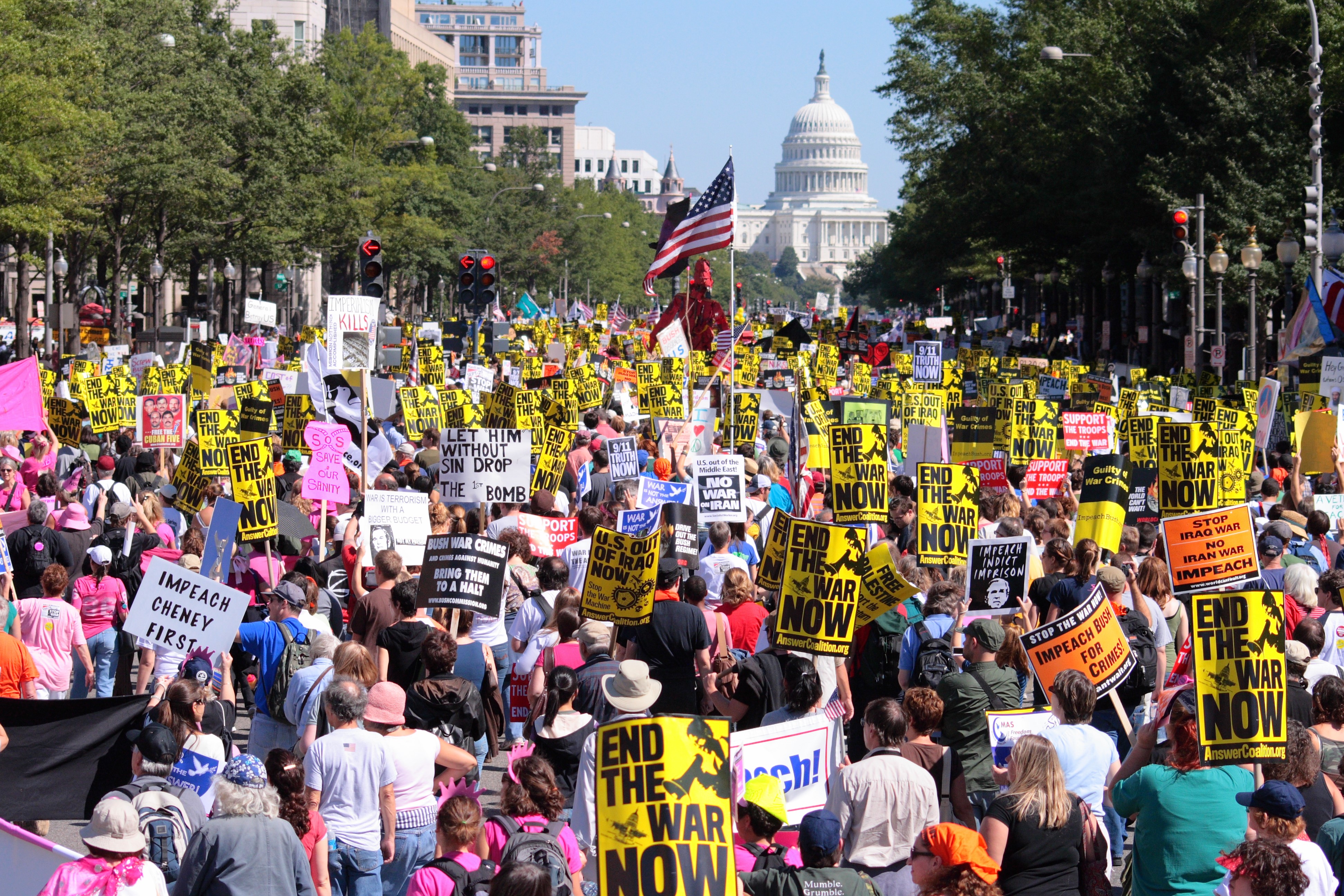
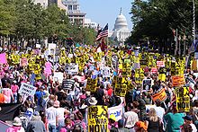 Protesters marching down Pennsylvania Avenue during the September 15, 2007 anti-war protest.
After the Oklahoma City bombing in 1995, the Secret Service closed the portion of Pennsylvania Avenue in front of the White House to all vehicular traffic. Pedestrian and bicycle traffic, however, was still permitted on the sidewalk. After 9/11 this policy was made permanent. Near the White House traffic is redirected to H Street or Constitution Avenue, both of which eventually link back with Pennsylvania Avenue. Plans drafted by District officials after the September 11th attacks call for Pennsylvania Avenue downtown being used as a dividing line for any mass evacuation of the city. People north of the avenue would be directed north while those south of the avenue would be directed south. No vehicles would be allowed to cross the avenue.[citation needed]
In 2002, the National Capital Planning Commission invited several prominent landscape architects to submit proposals for the redesign of Pennsylvania Avenue at the White House, with the intention that the security measures would be woven into an overall plan for the precinct and a more welcoming public space might be created. The winning entry by Michael Van Valkenburgh Associates, Inc., Landscape Architects proposed a very simple approach to planting, paving and the integration of security measures. Construction was completed in 2004.[5]
Sites of interest
East→
- John Philip Sousa Bridge
- Barney Circle
- United States Capitol
- Peace Monument
- National Gallery of Art, East Building
- John Marshall Park
- Canadian Embassy
- Newseum
- Federal Trade Commission
- National Archives Building
- United States Navy Memorial
- J. Edgar Hoover Building (FBI headquarters)
- Robert F. Kennedy Department of Justice Building (Department of Justice headquarters)
- Old Post Office Pavilion
- Ronald Reagan Building
 The White House is at 1600 Pennsylvania Avenue.
- John A. Wilson Building
- Freedom Plaza
- Pershing Park
- Department of the Treasury headquarters
- White House
- Lafayette Park
- Blair House
- Renwick Gallery
- World Bank
- Mexican Embassy
- The George Washington University
- International Finance Corporation
- Washington Circle
- Spanish Embassy
- Rock Creek Park
- Georgetown
←West
The National Theatre and Warner Theatre use Pennsylvania Avenue mailing addresses, although the theaters are nearby on E Street and 13th Street respectively.
Transit service
Pennsylvania Avenue is served by multiple buses, and several rail lines intersect it.
Metrobus
The following Metrobus routes travel along the street (listed from west to east):
- 36 (Branch Ave. to Independence Ave., then 7th St. NW to 15th St. NW, then Eye St. NW to M St. NW)
- 32 (Minnesota Ave. to Independence Ave., then 7th St. NW to 15th St. NW, then Eye St. NW to M St. NW)
- 38B (Eye St. NW to M St. NW)
- 31, D5 (Washington Circle to M St. NW)
- 39 (Limited stop service from Southern Ave. to Independence Ave., then 7th St. NW to 15th St. NW, then Eye St. NW to Washington Circle)
- 37 (Limited stop service from 7th St. NW to 15th St. NW)
- P6 (4th St. NW to 11th St. NW)
- 54 (6th St. NW to 11th St. NW)
- P1, P2 (4th St. NW to 9th St. NW)
- N22 (8th St. SE to Independence Ave.)
- M5 (Minnesota Ave. to North Carolina Ave.)
- K11 (Early weekend morning service from Forestville Rd. to Walters La., then Shadyside Ave. to Potomac Ave.)
- M6 (Alabama Ave. to Potomac Ave.)
- J13 (Early Saturday morning service eastbound only from Forestville Rd. to Old Marlboro Pike, then both directions from 38th St. SE to Potomac Ave.)
- B2, V7, V8, V9 (Minnesota Ave. to Potomac Ave.)
- V12 (Brooks Dr. to Shadyside Ave.)
- K12 (Forestville Rd. to Walters La.)
- J11 (Presidential Pkwy. to Forestville Rd.)
- J12 (Eastbound only from Forestville Rd. to Old Marlboro Pike)
DC Circulator
The DC Circulator travels along the street:
- East-West line (20th St. NW to M St. NW)
MTA Commuter Bus
The following MTA Maryland Commuter Bus routes travel along the street:
- 904 (Anacostia Freeway to Independence Ave., then 7th St. NW to 11th St. NW)
- 905 (7th St. NW to 11th St. NW)
TheBus
The following routes of TheBus serve Pennsylvania Ave. in Prince George's County:
- 24 (Old Silver Hill Rd. to Brooks Dr.)
- 20 (Marlboro Pike to Donnell Dr.)
Washington Metro
The following Washington Metro stations have entrances located near Pennsylvania Avenue:
- Potomac Avenue
- Eastern Market
- Archives
- Federal Triangle
- Foggy Bottom–GWU
References
- ^ Pennsylvania Avenue, National Historic Site. National Park Service.
- ^ a b c "Pennsylvania Avenue National Historic Site and Old Post Office Building". Washington, DC: A National Register of Historic Places Travel Itinerary. National Park Service. http://www.nps.gov/history/NR/travel/wash/dc41.htm. Retrieved 2009-01-21.
- ^ "FAQs: Main Treasury Building". United States Department of the Treasury. http://www.ustreas.gov/education/faq/treasury/building.shtml.
- ^ Maps on us-highways.com, including a 1946 DC map showing DC 4
- ^ Fernandez, Manny (November 10, 2004). "America's Main Street Revisited; Pennsylvania Ave. Reopened to Pedestrians". Washington Post: p. A01. http://pqasb.pqarchiver.com/washingtonpost/access/733273771.html?dids=733273771:733273771&FMT=ABS&FMTS=ABS:FT&date=Nov+10%2C+2004&author=Manny+Fernandez&pub=The+Washington+Post&edition=&startpage=A.01&desc=America%27s+Main+Street+Revisited%3B+Pennsylvania+Ave.+Reopened+to+Pedestrians.
External links
- Pennsylvania Avenue restoration project
- National Park Service
- Allen, Henry, and Andrew Cutraro. The Two Sides of America's Boulevard. The Washington Post Magazine. 2007-12-23. Retrieved 2007-12-23.
- The Library of Congress American Memory project
Streets and highways of Washington, D.C. Streets 7th St. • 14th St. NW/SW • 16th St. NW • 18th St. NW • E. Capitol St. • N. Capitol St. • S. Capitol St. • H St. • Jackson Place • K St. • M St. • Madison Place • U St.Avenues,
Roads & DrivesBenning Rd. • Canal Rd. • Connecticut Ave. • Constitution Ave. • Eastern Ave. • Florida Ave. • Georgia Ave. • Independence Ave. • Klingle Road • Maine Ave. • Martin Luther King, Jr. Ave.• Massachusetts Ave. • New Hampshire Ave. • New York Ave. • Ohio Dr. • Pennsylvania Ave. • Rhode Island Ave. • Southern Ave. • Virginia Ave. • Wisconsin Ave.Circles Anna J. Cooper Circle • Barney Circle • Benjamin Banneker Circle • Columbus Circle • Dupont Circle • Garfield Circle • Grant Circle • Logan Circle • Observatory Circle • Peace Circle • Pinehurst Circle • Randle Circle • Scott Circle • Sheridan Circle • Sherman Circle • Tenley Circle • Thomas Circle • Ward Circle • Washington Circle • Westmoreland CircleHighways Coordinates: 38°53′37″N 77°01′26″W / 38.893738°N 77.0239019°W
Categories:- Streets in Washington, D.C.
- Historic districts in Washington, D.C.


Wikimedia Foundation. 2010.