- Crigglestone
-
Coordinates: 53°38′38″N 1°31′21″W / 53.644004°N 1.522586°W
Crigglestone 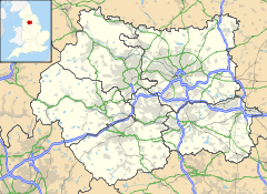
 Crigglestone
Crigglestone shown within West YorkshirePopulation 9,189 OS grid reference SE316164 Parish Crigglestone Metropolitan borough City of Wakefield Metropolitan county West Yorkshire Region Yorkshire and the Humber Country England Sovereign state United Kingdom Post town WAKEFIELD Postcode district WF4 Dialling code 01924 Police West Yorkshire Fire West Yorkshire Ambulance Yorkshire EU Parliament Yorkshire and the Humber UK Parliament Wakefield List of places: UK • England • Yorkshire Crigglestone is a village and civil parish in the City of Wakefield in West Yorkshire, England. It is recorded as "Crigeston" (along with neighbouring "Orberie") in the Domesday Book. In 1941, there was a disaster at Crigglestone Colliery; 22 men died underground. The site of the colliery is now an industrial estate.
See also
References
External links
Categories:- Villages in West Yorkshire
- Geography of Wakefield
- Civil parishes in West Yorkshire
- West Yorkshire geography stubs

Wikimedia Foundation. 2010.